River Lagan
Videos
Page
The River Lagan is a major river in Northern Ireland which runs 53.5 mi (86.1 km) from the Slieve Croob mountain in County Down to Belfast where it enters Belfast Lough, an inlet of the Irish Sea. The Lagan forms much of the border between County Antrim and County Down in the east of Ulster. It rises as a tiny, fast-moving stream near to the summit of Slieve Croob; Transmitter Road runs nearby. It runs to Belfast through Dromara, Donaghcloney and Dromore. On the lower slopes of the mountain, it combines with a branch from Legananny Mountain, just opposite Slieve Croob. The river then turns east to Magheralin into a broad plain between the plateaus of Antrim and Down.

River Lagan at Lanyon Place, Belfast

River Lagan and the Waterfront Hall, Belfast, October 2009
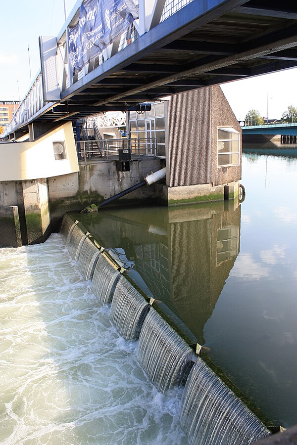
Lagan Weir, Belfast, October 2009

The old Lagan Navigational Canal (disused) at Broadwater, near Aghalee. (The disused canal used to be part of the River Lagan, but no longer. This gives the canal its name.)
County Down
Videos
Page
County Down is one of the six counties of Northern Ireland, one of the nine counties of Ulster and one of the traditional thirty-two counties of Ireland. It covers an area of 961 sq mi (2,490 km2) and has a population of 552,261. It borders County Antrim to the north, the Irish Sea to the east, County Armagh to the west, and County Louth across Carlingford Lough to the southwest.

Mourne Mountains

King John's Castle on Carlingford Lough.

A steam train on the Downpatrick and County Down Railway travelling through the Ulster drumlin belt near Downpatrick.