Rogers Pass (British Columbia)
Videos
Page
Rogers Pass is a high mountain pass through the Selkirk Mountains of British Columbia, but the term also includes the approaches used by the Canadian Pacific Railway (CP) and the Trans-Canada Highway. In the heart of Glacier National Park, this National Historic Site has been a tourist destination since 1886.

Snow shed construction, Rogers Pass, 1887.
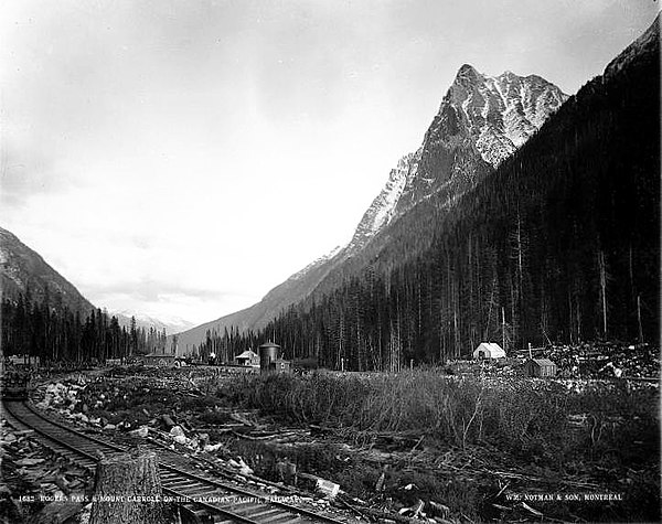
Mt. Macdonald (formerly Mt. Carroll), eastern slope, northeast from summit, 1887. Water tower and 2nd station in centre.
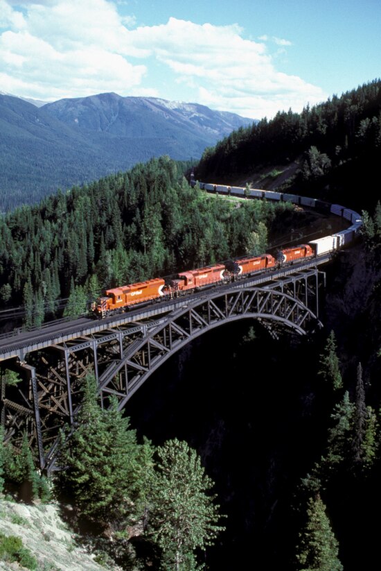
CP freight train, Stoney Creek Bridge, 1988.
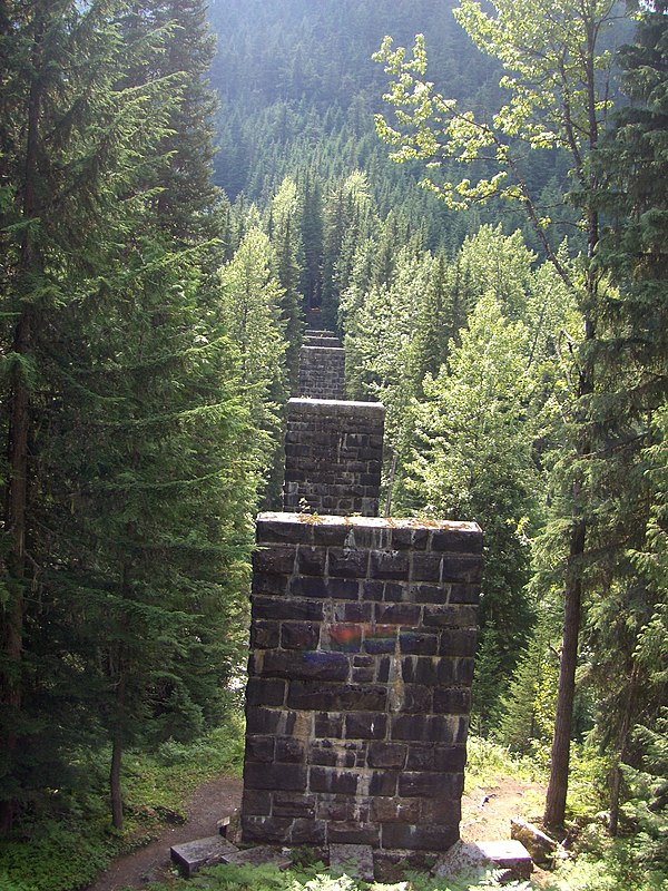
Pillars for lower loop viaduct (south of highway), Rogers Pass, 2007.
Selkirk Mountains
Videos
Page
The Selkirk Mountains are a mountain range spanning the northern portion of the Idaho Panhandle, eastern Washington, and southeastern British Columbia which are part of a larger grouping of mountains, the Columbia Mountains. They begin at Mica Peak and Krell Hill near Spokane and extend approximately 320 km north from the border to Kinbasket Lake, at the now-deserted location of the onetime fur company post, Boat Encampment. The range is bounded on its west, northeast and at its northern extremity by the Columbia River, or the reservoir lakes now filling most of that river's course. From the Columbia's confluence with the Beaver River, they are bounded on their east by the Purcell Trench, which contains the Beaver River, Duncan River, Duncan Lake, Kootenay Lake and the Kootenay River. The Selkirks are distinct from, and geologically older than, the Rocky Mountains. The neighboring Monashee and Purcell Mountains, and sometimes including the Cariboo Mountains to the northwest, are also part of the larger grouping of mountains known as the Columbia Mountains. A scenic highway loop, the International Selkirk Loop, encircles the southern portions of the mountain range.

USGS surveyors on Scotchman Peak in 1900
Mt. Fox and Mt. Dawson from Asulkan Pass, British Columbia, c. 1902