Sabah
Videos
Page
Sabah is a state of Malaysia located on the northern portion of Borneo, in the region of East Malaysia. Sabah has land borders with the Malaysian state of Sarawak to the southwest and Indonesia's North Kalimantan province to the south. The Federal Territory of Labuan is an island just off Sabah's west coast. Sabah shares maritime borders with Vietnam to the west and the Philippines to the north and east. Kota Kinabalu is the state capital and the economic centre of the state, and the seat of the Sabah State government. Other major towns in Sabah include Sandakan and Tawau. The 2020 census recorded a population of 3,418,785 in the state. It has an equatorial climate with tropical rainforests, abundant with animal and plant species. The state has long mountain ranges on the west side which forms part of the Crocker Range National Park. Kinabatangan River, the second longest river in Malaysia runs through Sabah. The highest point of Sabah, Mount Kinabalu is also the highest point of Malaysia.
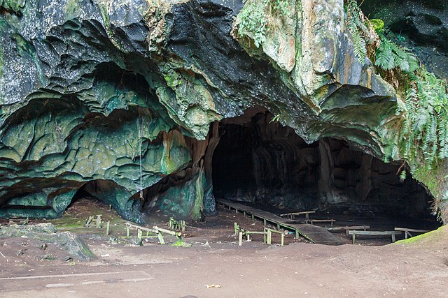
Entrance to the Madai Cave
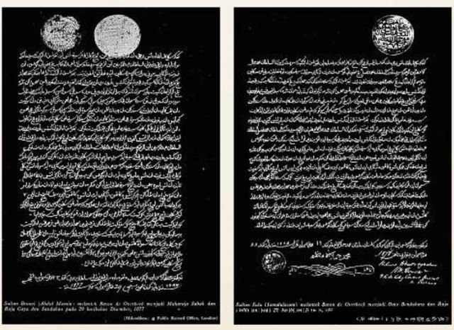
Left: The first concession treaty was signed by Sultan Abdul Momin of Brunei on 29 December 1877. Right: The second concession treaty was signed by Sultan Jamal ul-Azam of Sulu on 22 January 1878.

Japanese civilians and soldiers prior to their embarkation to Jesselton after their surrender to the Australian Imperial Force (AIF) in Tawau on 21 October 1945.
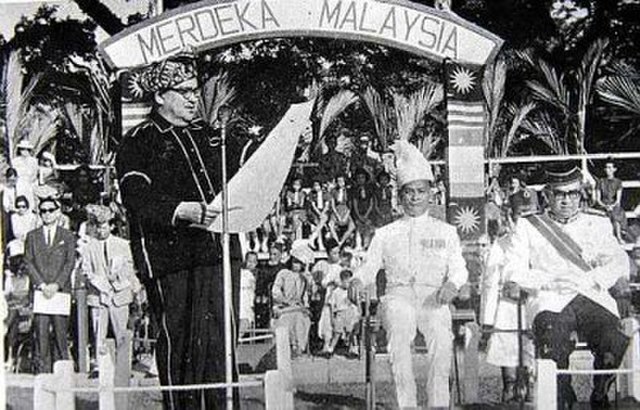
Donald Stephens (left) declaring the forming of the Federation of Malaysia at Merdeka Square, Jesselton on 16 September 1963. Together with him was the then Deputy Prime Minister of Malaysia Tun Abdul Razak (right) and Mustapha Harun (second right).
States and federal territories of Malaysia
Videos
Page
The states and federal territories of Malaysia are the principal administrative divisions of Malaysia. Malaysia is a federation of 13 states (Negeri) and 3 federal territories.

Malaysia and its states' flags at Putra Square, Putrajaya
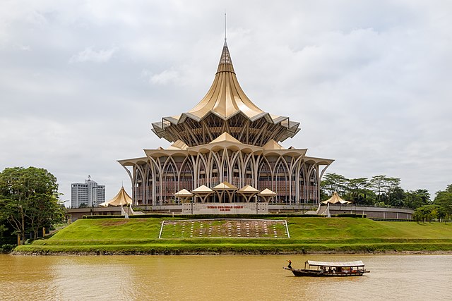
The building hosting the Sarawak State Legislative Assembly