San Gabriel Mountains
Videos
Page
The San Gabriel Mountains comprise a mountain range located in northern Los Angeles County and western San Bernardino County, California, United States. The mountain range is part of the Transverse Ranges and lies between the Los Angeles Basin and the Mojave Desert, with Interstate 5 to the west and Interstate 15 to the east. The range lies in, and is surrounded by, the Angeles and San Bernardino National Forests, with the San Andreas Fault as its northern border.
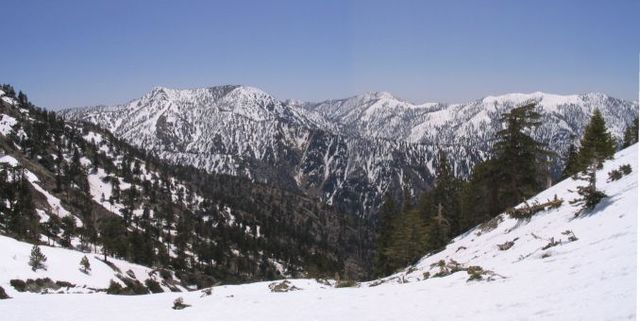
Summits in the eastern San Gabriel Mountains, Angeles National Forest, San Bernardino County, California. The main peaks are: Telegraph Peak 8,985 feet (2,739 m) (left), Cucamonga Peak, 8,859 feet (2,700 m) (center), and Ontario Peak 8,693 feet (2,650 m) (center right), as seen from Baldy Bowl on Mount Baldy.
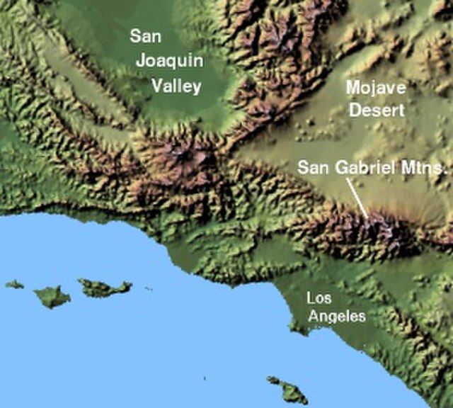
Image: Wpdms shdrlfi 020l san gabriel mountains

East Fork San Gabriel River canyon, looking west.

Mount Harwood, from Devils Backbone
Los Angeles County, California
Videos
Page
Los Angeles County, officially the County of Los Angeles, and sometimes abbreviated as L.A. County, is the most populous county in the United States, with 9,861,224 residents estimated in 2022. Its population is greater than that of 40 individual U.S. states. Comprising 88 incorporated cities and many unincorporated areas within a total area of 4,083 square miles (10,570 km2), it is home to more than a quarter of Californians and is one of the most ethnically diverse U.S. counties. The county's seat, Los Angeles, is the second most populous city in the United States and the most populous city in California, with 3,822,238 residents estimated in 2022. It is also known for being the home of the American film and television industry, a distinction it has held since the early 20th century which has given the county global prominence.
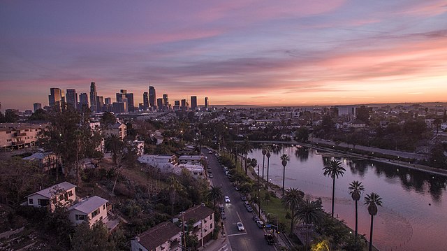
Image: 20190616154621!Echo Park Lake with Downtown Los Angeles Skyline

Image: Venice, California Beach

Image: Rodeo Drive Beverly Hills
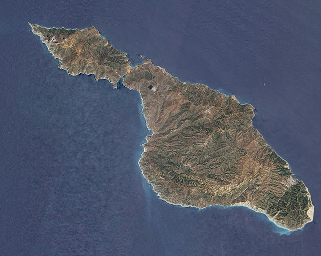
Image: Santa Catalina NASA EO