Scarborough Shoal
Videos
Page
Scarborough Shoal, also known as Bajo de Masinloc, Huangyan Island, Minzhu Jiao and Panatag Shoal, are two skerries (rocks) located between Macclesfield Bank to the west and Luzon to the east. Luzon is 220 kilometres (119 nmi) away and the nearest landmass. The atoll is a disputed territory claimed by the Republic of the Philippines through the 1734 Velarde map, while the People's Republic of China and the Republic of China (Taiwan) claim it through the disputed nine-dash line. The atoll's status is often discussed in conjunction with other territorial disputes in the South China Sea such as those involving the Spratly Islands, and the 2012 Scarborough Shoal standoff. It was administered by the Philippines as part of its Zambales province, until 2012, when a standoff was initiated by China through the use of warships against fishing boats, resulting in effective capture by the Chinese maritime forces.
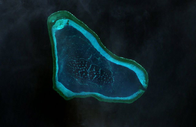
Landsat 7 image of Scarborough Shoal in 2000
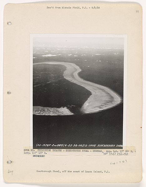
Aerial view of Scarborough Shoal (1938)
Masinloc
Videos
Page
Masinloc, officially the Municipality of Masinloc, is a 1st class municipality in the province of Zambales, Philippines. According to the 2020 census, it has a population of 54,529 people.

San Andrés Church