Sha Tin District
Videos
Page
Sha Tin District is one of the 18 districts of Hong Kong. As one of the 9 districts located in the New Territories, it covers the areas of Sha Tin, Tai Wai, Ma On Shan, Fo Tan, Siu Lek Yuen, Kwun Yam Shan and Ma Liu Shui. The district is the most populous district in Hong Kong, with a population of 659,794 as per 2016 by-census, having a larger population than many states or dependencies including Iceland, Malta, Montenegro and Brunei.

Day view of the Sha Tin District skyline

Sha Tin and Shing Mun River

Wu Kai Sha

Residential, commercial and industrial buildings with numerous village type developments has been built along the two sides of the Shing Mun River since the early stage of development of Shatin.
New Territories
Videos
Page
The New Territories is one of the three main regions of Hong Kong, alongside Hong Kong Island and the Kowloon Peninsula. It makes up 86.2% of Hong Kong's territory, and contains around half of the population of Hong Kong. Historically, it is the region described in the Convention for the Extension of Hong Kong Territory. According to that treaty, the territories comprise the mainland area north of Boundary Street on the Kowloon Peninsula and south of the Sham Chun River, as well as over 200 outlying islands, including Lantau Island, Lamma Island, Cheung Chau, and Peng Chau in the territory of Hong Kong.

Butterfly Bay in New Territories
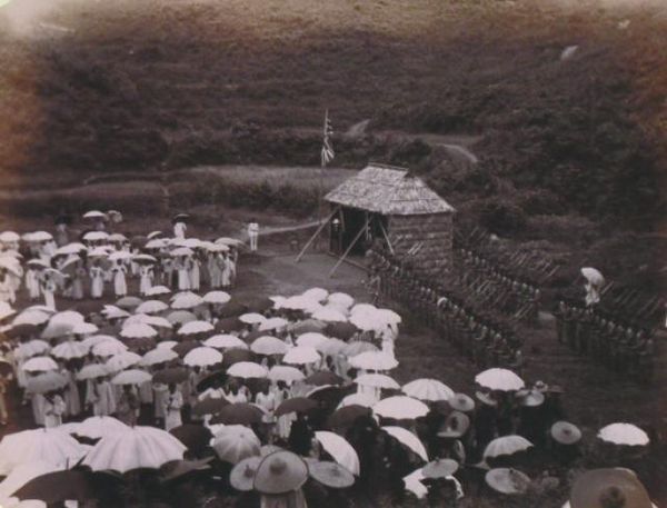
The British ceremony in Tai Po, 1899, assuming control of the New Territories