St. Clair County, Michigan
Videos
Page
St. Clair County is a county located in the U.S. state of Michigan and bordering the west bank of the St. Clair River. As of the 2020 census, the population was 160,383. It is the 13th-most populous county in the state. The county seat is Port Huron, located at the north end of the St. Clair River at Lake Huron. The county was created September 10, 1820, and its government was organized in 1821. It is located northeast of Detroit. It is considered by the State of Michigan to be a part of The Thumb, a peninsula that is surrounded by Lake Huron in the east-central area of the state. This area is sometimes dubbed the Blue Water Area.
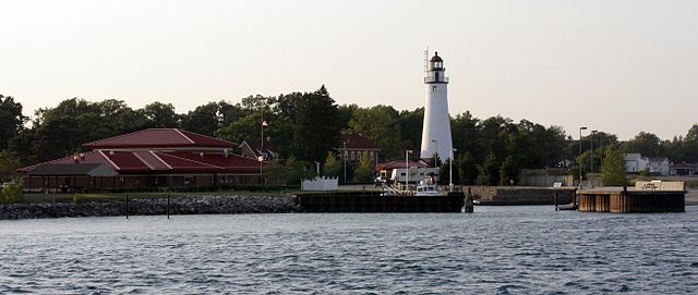
Fort Gratiot Light
St. Clair River
Videos
Page
The St. Clair River is a 40.5-mile-long (65.2 km) river in central North America which flows from Lake Huron into Lake St. Clair, forming part of the international boundary between Canada and the United States and between the Canadian province of Ontario and the U.S. state of Michigan. The river is a significant component in the Great Lakes Waterway, whose shipping channels permit cargo vessels to travel between the upper and lower Great Lakes.
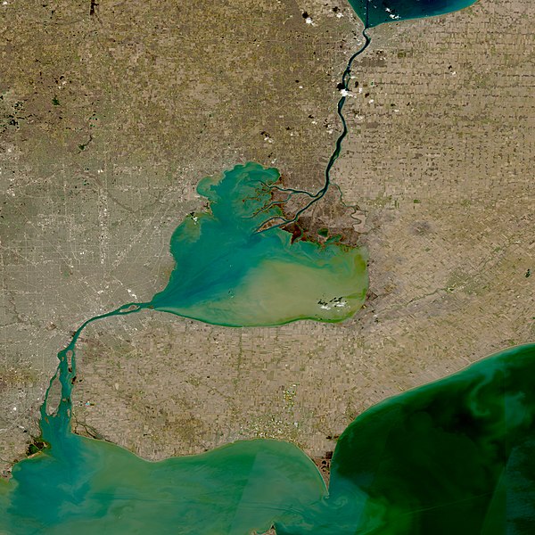
Sentinel-2 satellite photo, showing Lake Saint Clair (center), as well as St. Clair River connecting it to Lake Huron (to the North) and Detroit River connecting it to Lake Erie (to the South)
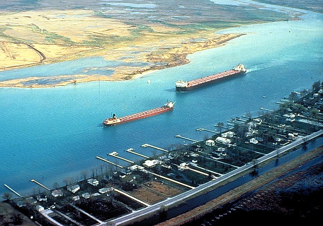
Great Lakes freighters navigating on the lower St. Clair River. View is from the U.S. side, looking across to Canada.

Head of river looking into Lake Huron, showing the twin Blue Water Bridge

Canadian freighter Algorail downbound in the St. Clair River