Suisun Bay
Videos
Page
Suisun Bay is a shallow tidal estuary in Northern California. It lies at the confluence of the Sacramento River and San Joaquin River, forming the entrance to the Sacramento–San Joaquin River Delta, an inverted river delta. To the west, Suisun Bay is drained by the Carquinez Strait, which connects to San Pablo Bay, a northern extension of San Francisco Bay. Grizzly Bay forms a northern extension of Suisun Bay. Suisun Bay is between Contra Costa County to the south and Solano County to the north.

Aerial photo of the Suisun Bay, looking east at the Benicia-Martinez Bridges. Benicia is on the left, Martinez to the right.

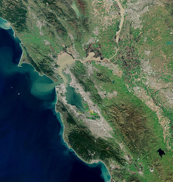
San Pablo Bay with Suisun Bay at upper right.

Another view of the "Ghost Fleet", also known as the "Moth Ball Fleet".
San Francisco Bay
Videos
Page
San Francisco Bay is a large tidal estuary in the U.S. state of California, and gives its name to the San Francisco Bay Area. It is dominated by the cities of San Francisco, San Jose, and Oakland.
San Francisco Bay

Aerial panorama of the northern Bay, the Bay Bridge, Golden Gate, and Marin Headlands on a clear morning. November 2014 photo by Doc Searls.

Panorama of San Francisco Bay, and the city skyline seen from Marin County in the Golden Gate National Recreation Area

Population density and low elevation coastal zones in San Francisco Bay (2010). The San Francisco Bay is especially vulnerable to sea level rise.