Summerston
Videos
Page
Summerston is a residential area of Glasgow, Scotland. With most of the housing constructed in the 1970s, it is situated in the far north of the city and is considered to be part of the larger Maryhill district, but has a different postcode; other nearby neighbourhoods are Gilshochill to the south and Cadder to the south-east. With open farmland to the north-east, Summerston is separated from the southern parts of the town of Bearsden to the north-west by the River Kelvin and a golf course.
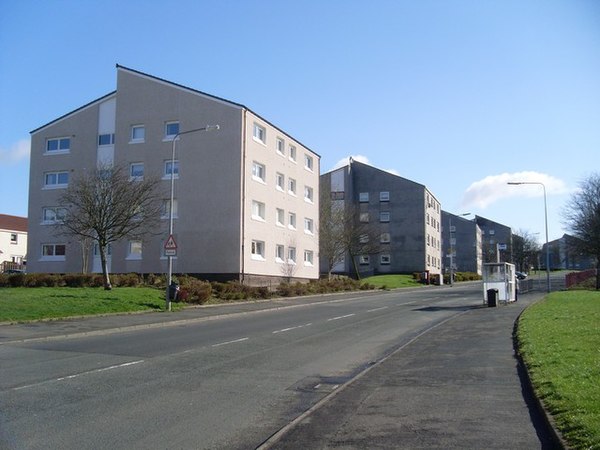
Apartment blocks on Arrochar Street

John Paul Academy

Summerston Cottages
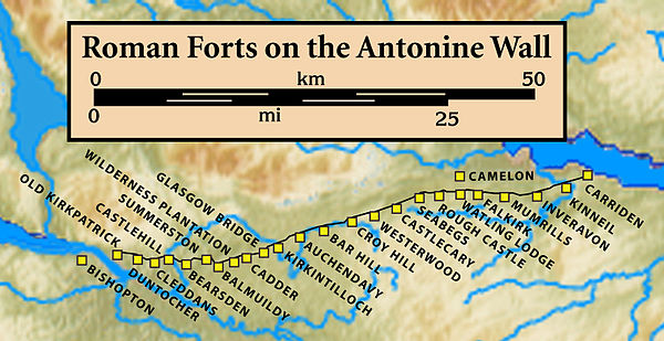
Forts and Fortlets associated with the Antonine Wall from west to east: Bishopton, Old Kilpatrick, Duntocher, Cleddans, Castlehill, Bearsden, Summerston, Balmuildy, Wilderness Plantation, Cadder, Glasgow Bridge, Kirkintilloch, Auchendavy, Bar Hill, Croy Hill, Westerwood, Castlecary, Seabegs, Rough Castle, Camelon, Watling Lodge, Falkirk, Mumrills, Inveravon, Kinneil, Carriden
Maryhill
Videos
Page
Maryhill is an area in the north-west of Glasgow in Scotland. A former independent burgh and the heart of an eponymous local authority ward, its territory is bisected by Maryhill Road, part of the A81 road which runs for a distance of roughly three miles between Glasgow city centre and the suburban town of Bearsden.
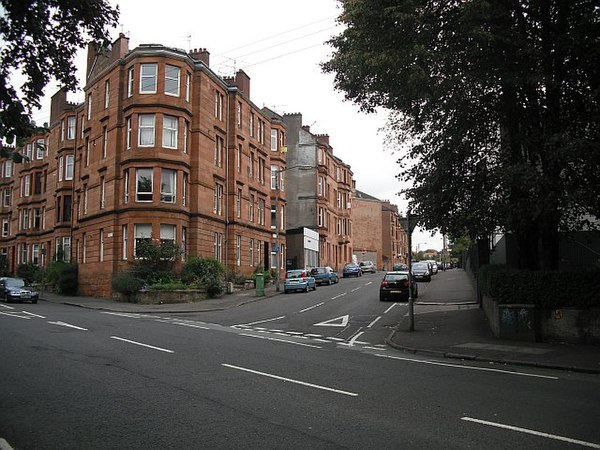
Shakespeare Street

Firhill Stadium during a Scottish Premiership football match (2013)

A branch of the Forth and Clyde Canal runs south from Gilshochill in Maryhill through Ruchill to Port Dundas: Ruchill Church stands beside the canal.

Maryhill Burgh Halls