Sunshine Coast, Queensland
Videos
Page
The Sunshine Coast is a peri-urban region in South East Queensland, Australia. It is the district defined in 1967 as "the area contained in the Shires of Landsborough, Maroochy and Noosa, but excluding Bribie Island". Located 100 km (62 mi) north of the centre of Brisbane in South East Queensland, on the Coral Sea coastline, its urban area spans approximately 60 km (37 mi) of coastline and hinterland from Pelican Waters to Tewantin.
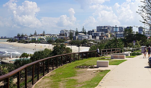
Image: Kings Beach, Caloundra (1) (cropped)

Image: Maroochydore seen across South Maroochy River, Queensland 01 (cropped)
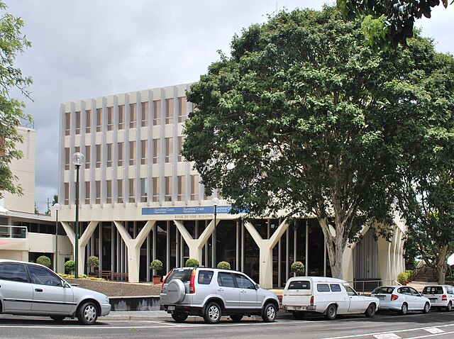
Image: Nambour Sunshine Coast Council Offices

Image: Mooloolaba Esplanade at Mooloolaba, Queensland
South East Queensland
Videos
Page
South East Queensland (SEQ) is a bio-geographical, metropolitan, political and administrative region of the state of Queensland in Australia, with a population of approximately 3.8 million people out of the state's population of 5.1 million. The area covered by South East Queensland varies, depending on the definition of the region, though it tends to include Queensland's three largest cities: the capital city Brisbane; the Gold Coast; and the Sunshine Coast. Its most common use is for political purposes, and covers 35,248 square kilometres (13,609 sq mi) and incorporates 11 local government areas, extending 240 kilometres (150 mi) from Noosa in the north to the Gold Coast and New South Wales border in the south, and 140 kilometres (87 mi) west to Toowoomba. It is the third largest urban area in Australia by population.

Queensland's first railway linked Grandchester to Ipswich, 1865
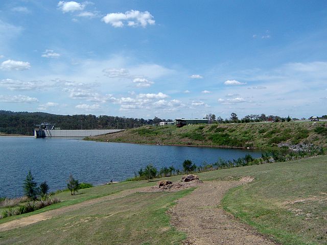
Wyaralong Dam was opened in 2011

South-East Queensland from the Landsat 7 satellite
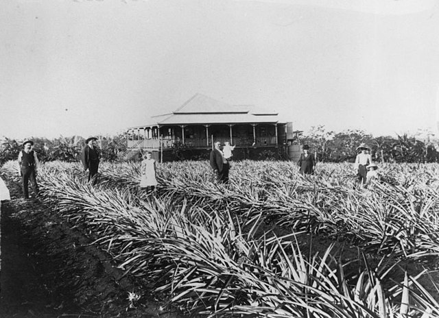
Pineapple plantation at Cleveland, 1907