Thalassery
Videos
Page
Thalassery, formerly Tellicherry, is a municipality and commercial city on the Malabar Coast in Kannur district in the state of Kerala, India, bordered by the districts of Mahe, Kozhikode, Wayanad, Kasaragod and Kodagu (Karnataka). Thalassery municipality has a population of just under 100,000 as of 2011 census. Thalassery Heritage City has an area of 23.98 square kilometres (9.26 sq mi). Thalassery has an altitude ranging from 2.5 to 30 metres above mean sea-level.
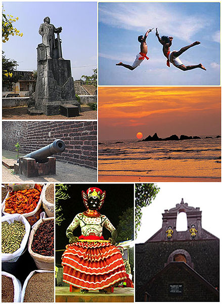
Clockwise from top: Statue of Hermann Gundert, Kalaripayattu, Muzhappilangad Beach, Tellicherry Fort, Theyyam, Thalassery spice market, a cannon inside St. Angelo Fort, Thalassery Pier

Tellicherry Pepper- A Black pepper variety. This is a produce of Terre Exotique, France
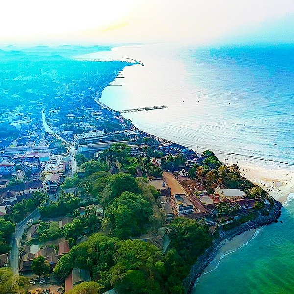
Aerial view of Tellicherry Coastal area
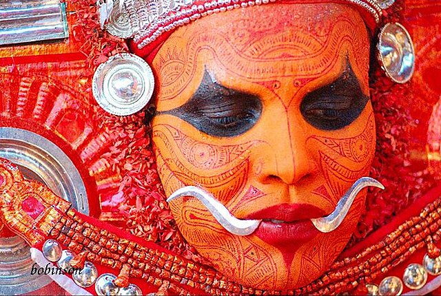
"Mukathezhuthu"-The face painting of Theyyam, the religious ritual art form in Thalassery
Kannur district
Videos
Page
Kannur is one of the 14 districts along the west coast in the state of Kerala, India. The city of Kannur is the district headquarters and gives the district its name. The old name, Cannanore, is the anglicized form of the Malayalam name "Kannur". Kannur district is bounded by Kasaragod District to the north, Kozhikode district to the south, Mahé district to the southwest and Wayanad District to the southeast. To the east, the district is bounded by the Western Ghats, which forms the border with the state of Karnataka. The Arabian Sea lies to the west. Paithalmala is the highest point in Kannur District (1,372m). Enclosed within the southern part of the district is the Mahé district of the Union Territory of Puducherry. The district was established in 1957.

Image: Vpra floating park boat walking path
Image: Ptb kannur

Image: Chatti pathiri

Image: St. Angelo Fort, Kannur