Treasure Island, San Francisco
Videos
Page
Treasure Island is an artificial island in the San Francisco Bay, and a neighborhood in the City and County of San Francisco. Built in 1936–37 for the 1939 Golden Gate International Exposition, the island was named by Clyde Milner Vandeburg, part of the Fair's public relation team. Its World's Fair site is a California Historical Landmark. Buildings there have been listed on the National Register of Historic Places, and the historical Naval Station Treasure Island, an auxiliary air facility, are designated in the Geographic Names Information System. Treasure Island is connected to Yerba Buena Island, another auxiliary island of San Francisco, by a causeway, creating access to Interstate 80.

Treasure Island is "5,520 feet long by 3,410 feet wide" and has the Treasure Island Marina on the south near Yerba Buena Island (bottom)

Headquarters Building at US Naval Station Treasure Island
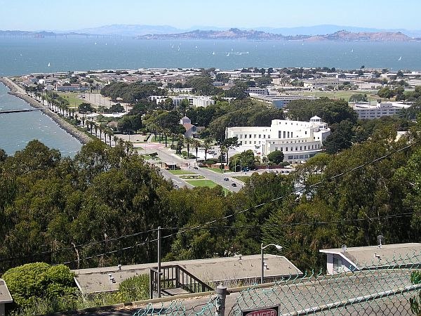
Treasure Island beyond Yerba Buena Island's rooftops and trees, which obscure the causeway and marina. The large curved white building (right of center) is the Administration Building (Building 1) which housed the island's museum 1976–97 (the museum association's offices returned in 2008.)
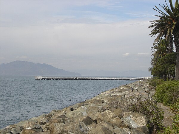
Looking north towards the Marin Headlands from the western shore.
San Francisco Bay
Videos
Page
San Francisco Bay is a large tidal estuary in the U.S. state of California, and gives its name to the San Francisco Bay Area. It is dominated by the cities of San Francisco, San Jose, and Oakland.
San Francisco Bay

Aerial panorama of the northern Bay, the Bay Bridge, Golden Gate, and Marin Headlands on a clear morning. November 2014 photo by Doc Searls.

Panorama of San Francisco Bay, and the city skyline seen from Marin County in the Golden Gate National Recreation Area

Population density and low elevation coastal zones in San Francisco Bay (2010). The San Francisco Bay is especially vulnerable to sea level rise.