Typhoon Karen
Videos
Page
Typhoon Karen was the most powerful tropical cyclone to strike the island of Guam, and has been regarded as one of the most destructive events in the island's history. It was first identified as a tropical disturbance on November 6, 1962, well to the southeast of Truk. Over the following two days, the system tracked generally northward and quickly intensified. Karen became a tropical storm late on November 7, and within two days it explosively intensified into a Category 5-equivalent super typhoon on the Saffir–Simpson scale. Turning westward, the typhoon maintained its intensity and struck Guam with winds of 280 km/h (170 mph) on November 11. Once clear of the island, it strengthened slightly and reached its peak intensity on November 13 with winds of 295 km/h (183 mph) and a barometric pressure of 894 mb. The storm then gradually turned northward as it weakened, brushing the Ryukyu Islands on November 15, before moving east-northeastward over the open waters of the Pacific. Karen continued to weaken and transitioned into an extratropical cyclone on November 17 before losing its identity the following day between Alaska and Hawaii.
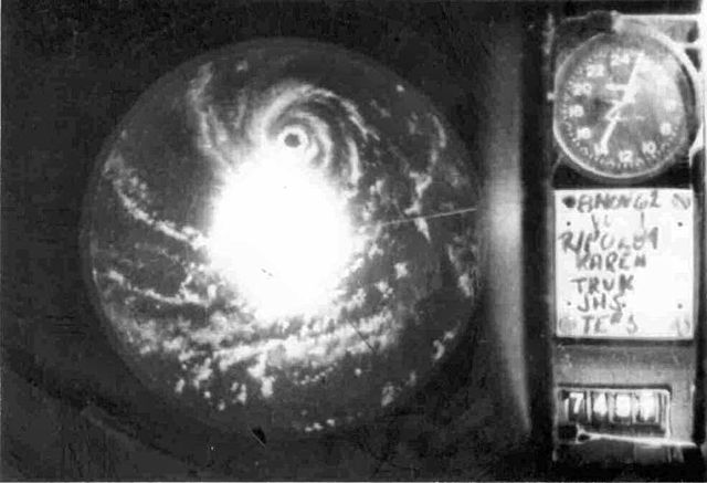
Radar image of Typhoon Karen on November 8 as it was rapidly intensifying
A week after the storm, coastal areas devastated by the typhoon were seemingly untouched.

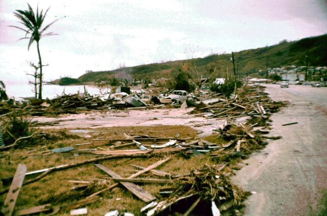
Two tugboats were torn from their moorings in Apra Harbor and washed ashore during the typhoon.
Guam
Videos
Page
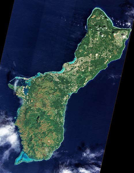
Guam is an organized, unincorporated territory of the United States in the Micronesia subregion of the western Pacific Ocean. Guam's capital is Hagåtña, and the most populous village is Dededo. It is the westernmost point and territory of the United States, reckoned from the geographic center of the U.S. In Oceania, Guam is the largest and southernmost of the Mariana Islands and the largest island in Micronesia.

Reception of the Manila Galleon by the Chamorro in the Ladrones Islands, c. 1590 Boxer Codex
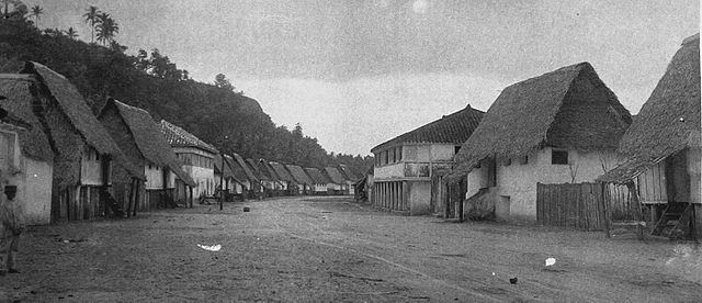
The main street of Hagåtña c. 1899–1900

U.S. Marines walk through the ruins of Hagåtña, July 1944.
A photograph of Guam from space captured by NASA's now decommissioned Earth observation satellite, Earth Observing-1 (EO-1), December 2011