U-shaped valley
Videos
Page
U-shaped valleys, also called trough valleys or glacial troughs, are formed by the process of glaciation. They are characteristic of mountain glaciation in particular. They have a characteristic U shape in cross-section, with steep, straight sides and a flat or rounded bottom. Glaciated valleys are formed when a glacier travels across and down a slope, carving the valley by the action of scouring. When the ice recedes or thaws, the valley remains, often littered with small boulders that were transported within the ice, called glacial till or glacial erratic.
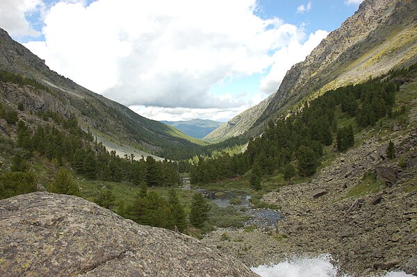
A glaciated valley in the Altai Mountains showing the characteristic U shape.
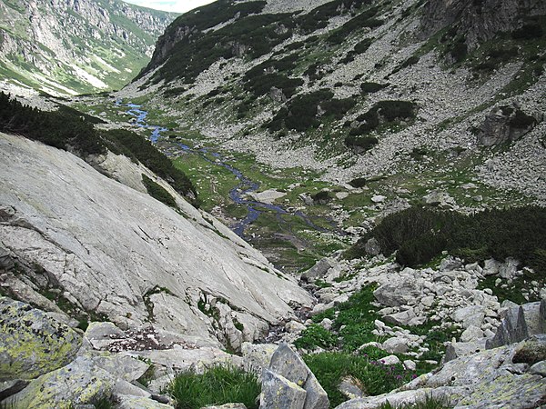
Malyovitsa U-shaped valley, Rila Mountain, Bulgaria

U-shaped valley in Leh valley, Ladakh, NW Indian Himalaya. The glacier visible at the head of the valley is the last remnant of the formerly much more extensive glacier which carved it.

U-shaped valley with lake in Myklebustdalen, Nordfjord, Sogn og Fjordane, Norway.
Rila
Videos
Page
Rila is the highest mountain range of Bulgaria, the Balkan Peninsula and Southeast Europe. It is situated in southwestern Bulgaria and forms part of the Rila–Rhodope Massif. The highest summit is Musala at an elevation of 2,925 m which makes Rila the sixth highest mountain range in Europe after the Caucasus, the Alps, Sierra Nevada, the Pyrenees and Mount Etna, and the highest one between the Alps and the Caucasus. It spans a territory of 2,629 km2 with an average elevation of 1487 m. The mountain is believed to have been named after the river of the same name, which comes from the Old Bulgarian verb "рыти" meaning "to grub".

Strashnoto ezero (The Dreadful Lake)
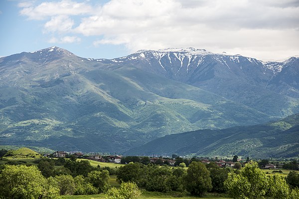
A view to Rila

A view from Musala

The cirque of the Marichini Lakes