U.S. Route 1 or U.S. Highway 1 (US 1) is a major north–south United States Numbered Highway that serves the East Coast of the United States. It runs 2,370 miles (3,810 km) from Key West, Florida, north to Fort Kent, Maine, at the Canadian border, making it the longest north–south road in the United States. US 1 is generally paralleled by Interstate 95 (I-95), though US 1 is significantly farther west and inland between Jacksonville, Florida, and Petersburg, Virginia, while I-95 is closer to the coastline. In contrast, US 1 in Maine is much closer to the coast than I-95, which runs farther inland than US 1. The route connects most of the major cities of the East Coast from the Southeastern United States to New England, including Miami, Jacksonville, Augusta, Raleigh, Richmond, Washington, D.C., Baltimore, Philadelphia, Newark, New York City, New Haven, Providence, Boston, and Portland.
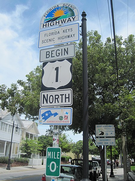
Mile 0, Key West, Florida
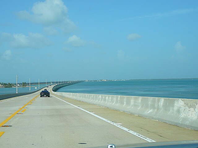
US 1 crossing Moser Channel along the Overseas Highway, Florida Keys
US 1 along Biscayne Boulevard in downtown Miami, Florida
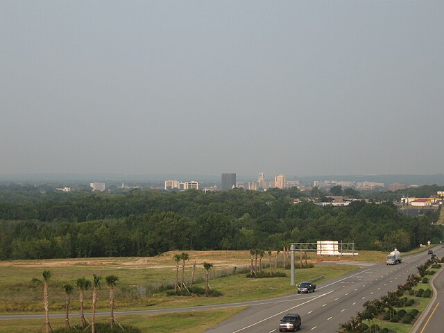
Skyline of Augusta, Georgia, as seen from US 1 in North Augusta near I-520
United States Numbered Highway System
The United States Numbered Highway System is an integrated network of roads and highways numbered within a nationwide grid in the contiguous United States. As the designation and numbering of these highways were coordinated among the states, they are sometimes called Federal Highways, but the roadways were built and have always been maintained by state or local governments since their initial designation in 1926.
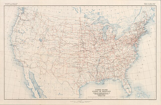
The "final" U.S. Highway plan as approved November 11, 1926
This sign, photographed in 1941 on US 99 between Seattle, Washington, and Portland, Oregon, illustrates one rationale for a federal highway system: national defense.