U.S. Route 40 in Maryland
Videos
Page
U.S. Route 40 in the U.S. state of Maryland runs from Garrett County in Western Maryland to Cecil County in the state's northeastern corner. With a total length of 221 miles (356 km), it is the longest numbered highway in Maryland. Almost half of the road overlaps or parallels with Interstate 68 (I-68) or I-70, while the old alignment is generally known as US 40 Alternate, US 40 Scenic, or Maryland Route 144. West of Baltimore, in the Piedmont and
Appalachian Mountains / Blue Ridge region of the Western Maryland panhandle of the small state, the portions where it does not overlap an Interstate highway are mostly two-lane roads. The portion northeast of Baltimore going toward Wilmington in northern Delaware and Philadelphia in southeastern Pennsylvania is a four-lane divided highway, known as the Pulaski Highway. This section crosses the Susquehanna River at the north end of the Chesapeake Bay on the Thomas J. Hatem Memorial Bridge.

US 40 eastbound past the Pennsylvania state line in Garrett County
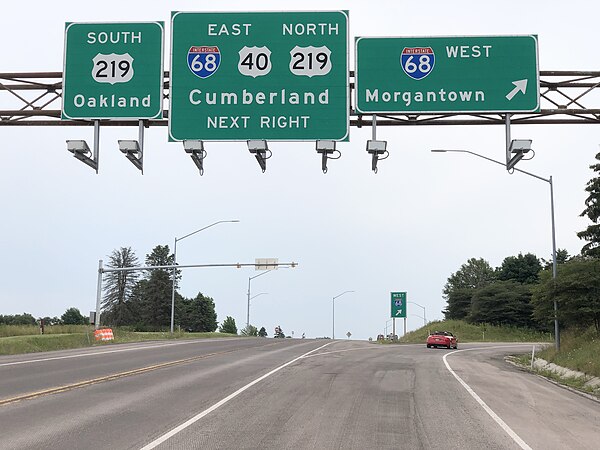
US 40 eastbound at I-68 and US 219 in Keysers Ridge
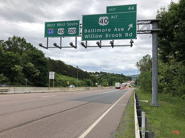
I-68/US 40/US 220 concurrency in Cumberland

A 340-foot (100 m) deep cut in Sideling Hill makes room for the I-68/US 40 roadway
Garrett County, Maryland
Videos
Page
Garrett County is the westernmost county of the U.S. state of Maryland completely within the Appalachian Mountains. As of the 2020 census, the population was 28,806, making it the third-least populous county in Maryland. Its county seat is Oakland. The county was named for John Work Garrett (1820–1884), president of the Baltimore and Ohio Railroad. Created from Allegany County in 1872, it was the last county to be formed in the state.

Garrett County Courthouse in December 2013

Forest in Swallow Falls State Park

I-68/US 40 eastbound and US 219 northbound at MD 495 in Garrett County