U.S. Route 64 in North Carolina
Videos
Page
U.S. Route 64 (US 64) is the longest numbered route in the U.S. state of North Carolina, running 604 miles (972 km) from the Tennessee state line to the Outer Banks. The route passes through the westernmost municipality in the state, Murphy, and one of the most easternmost municipalities, Manteo, making US 64 a symbolic representation of the phrase "from Murphy to Manteo" which is used to refer to the expanse of the state. The highway is a major east–west route through the central and eastern portion of the state.

US 64 near Siler City

Knightdale Bypass (I-87/US 64/US 264) bridge over the Neuse River

Exit 419 diagrammatic guide sign
Outer Banks
Videos
Page
The Outer Banks are a 200 mi (320 km) string of barrier islands and spits off the coast of North Carolina and southeastern Virginia, on the east coast of the United States. They line most of the North Carolina coastline, separating Currituck Sound, Albemarle Sound, and Pamlico Sound from the Atlantic Ocean. A major tourist destination, the Outer Banks are known for their wide expanse of open beachfront and the Cape Hatteras National Seashore. The seashore and surrounding ecosystem are important biodiversity zones, including beach grasses and shrubland that help maintain the form of the land.
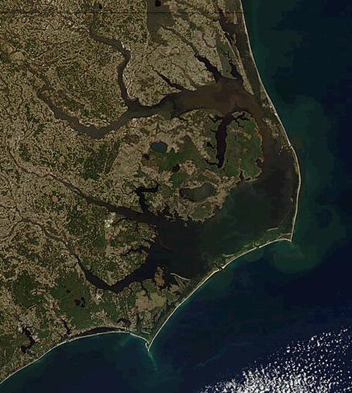
The Outer Banks, separating the Atlantic Ocean (east) from Currituck and Albemarle Sounds (north) and Pamlico Sound (south)

View from the International Space Station in 2019 (north is in the lower left of the photo)
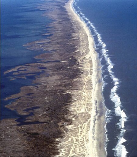
Aerial view of Outer banks (looking north), with sound on the left and ocean on the right

Graveyard of the Atlantic Museum, Hatteras, North Carolina, June 2007