U.S. Route 6 in Massachusetts
Videos
Page
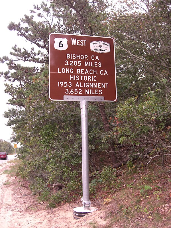
U.S. Route 6 (US 6) in Massachusetts is a 117.952-mile-long (189.825 km) portion of the cross-country route connecting Providence, Rhode Island, to Fall River, New Bedford, and Cape Cod. In the Fall River and New Bedford areas, US 6 parallels Interstate 195 (I-195). On Cape Cod, US 6 is a highway interconnecting the towns of the area. The freeway section in this area is also known as the Mid-Cape Highway. The highway is also alternatively signed as the "Grand Army of the Republic Highway".
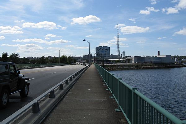
Looking westbound entering New Bedford

Looking southbound entering Eastham
US 6's westbound facing terminus in Provincetown. This sign was erected in mid-2010
New Bedford, Massachusetts
Videos
Page
New Bedford is a city in Bristol County, Massachusetts, United States. It is located on the Acushnet River in what is known as the South Coast region. Up through the 17th century, the area was the territory of the Wampanoag Native American people. English colonists bought the land on which New Bedford would later be built from the Wampanoag in 1652, and the original colonial settlement that would later become the city was founded by English Quakers in the late 17th century. The town of New Bedford itself was officially incorporated in 1787.

New Bedford Harbor

William Allen Wall's 1842 depiction of Wampanoag people meeting Bartholomew Gosnold and his crew upon their arrival in New Bedford in 1602

Lowering Boats by Clifford Warren Ashley, held at the New Bedford Whaling Museum.

The New Bedford waterfront in 1867.