Victorian Alps
Videos
Page
The Victorian Alps, also known locally as the High Country, is a large mountain system in the southeastern Australian state of Victoria. Occupying the majority of eastern Victoria, it is the southwestern half of the Australian Alps, the tallest portion of the Great Dividing Range. The Yarra and Dandenong Ranges, both sources of rivers and drinking waters for Melbourne, are branches of the Victorian Alps.

Mount Feathertop and the Razorback
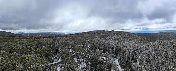
Aerial panorama of Mount Donna Buang. Flurry of snow in early spring. Shot on 9 September 2023.

View of Mount Buffalo from Mount Hotham, in summer.

Mount Hotham in winter
Victoria (state)
Videos
Page
Victoria is a state in southeastern Australia. It is the second-smallest state, with a land area of 227,444 km2 (87,817 sq mi); the second-most-populated state, with a population of over 6.7 million; and the most densely populated state in Australia. Victoria is bordered by New South Wales to the north and South Australia to the west and is bounded by the Bass Strait to the south, the Great Australian Bight portion of the Southern Ocean to the southwest, and the Tasman Sea to the southeast. The state encompasses a range of climates and geographical features from its temperate coastal and central regions to the Victorian Alps in the northeast and the semi-arid northwest.
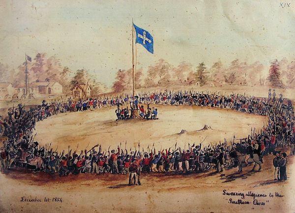
Swearing Allegiance to the Southern Cross at the Eureka Stockade on 1 December 1854 – watercolour by Charles Doudiet

Island Archway on the Great Ocean Road in Victoria, Australia

Aireys Inlet
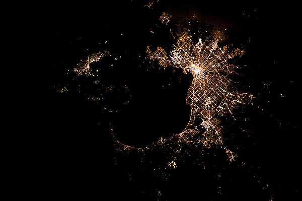
Greater Melbourne at night from the International Space Station