Vidarbha
Videos
Page
Vidarbha is a geographical region in the east of the Indian state of Maharashtra and a proposed state of western India, comprising the state's Amravati and Nagpur divisions. Amravati Division's former name is Berar. It occupies 31.6% of the total area and holds 21.3% of the total population of Maharashtra. It borders the state of Madhya Pradesh to the north, Chhattisgarh to the east, Telangana to the south and Marathwada and Uttar Maharashtra regions of Maharashtra to the west. Situated in central India. The largest city in Vidarbha is Nagpur followed by Amravati, Akola, Chandrapur and Gondia. A majority of Vidarbha residents speak Varhadi and Zadi dialects of Marathi.

Coin of the Vidarbhas of the Deccan. Uncertain ruler. (1st century BCE) Obv Linear cross with each arm terminating in pellet-in-annulet. Rev Tree in railing.

Coin of King Jagadeva of the Paramaras of Vidarbha, 12th–13th centuries CE.
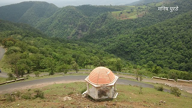
Chikhaldara is the only hill station in Vidharbha

Wainganga river near Bhandara district
Maharashtra
Videos
Page
Maharashtra is a state in the western peninsular region of India occupying a substantial portion of the Deccan Plateau. It is bordered by the Arabian Sea to the west, the Indian states of Karnataka and Goa to the south, Telangana to the southeast and Chhattisgarh to the east, Gujarat and Madhya Pradesh to the north, and the Indian union territory of Dadra and Nagar Haveli and Daman and Diu to the northwest. Maharashtra is the second-most populous state in India.
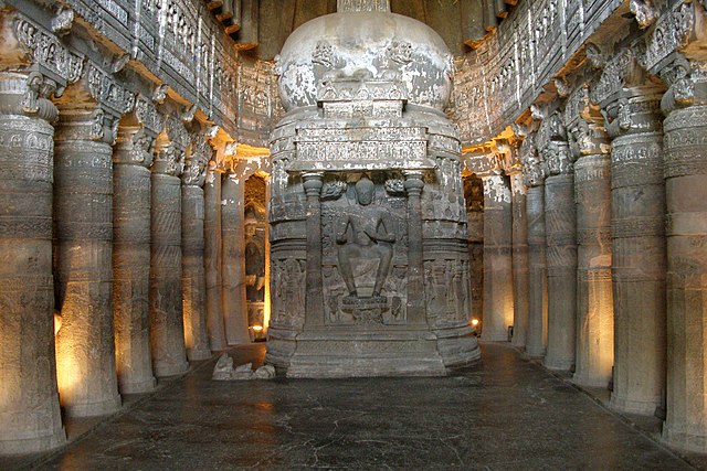
Image: Ajanta Caves, India, Ajanta chaitya (stupa) worship hall, Cave 26

Image: Ellora Caves, India, Religious shrines in Kailash Kailasa Temple

Image: Mahabaleshwar Pratapgad 023
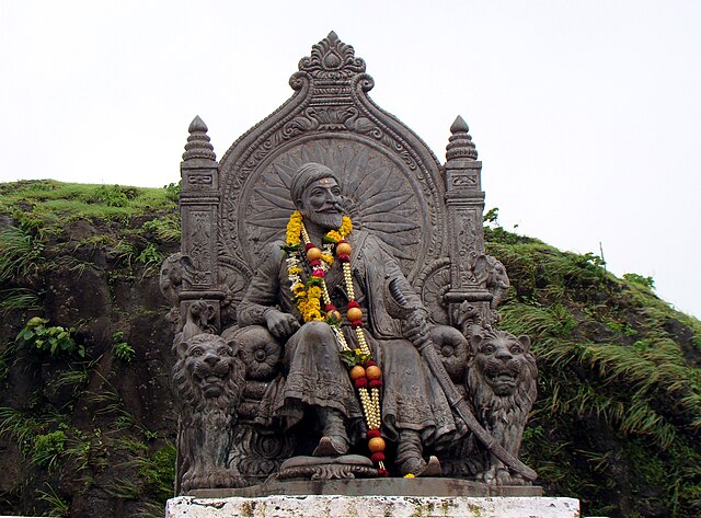
Image: Shivaji Maharaj Raigad 2