Visibility
Videos
Page
In meteorology, visibility is the measure of the distance at which an object or light can be clearly discerned. It depends on the transparency of the surrounding air and as such, it is unchanging no matter the ambient light level or time of day. It is reported within surface weather observations and METAR code either in meters or statute miles, depending upon the country. Visibility affects all forms of traffic: roads, railways, sailing and aviation.
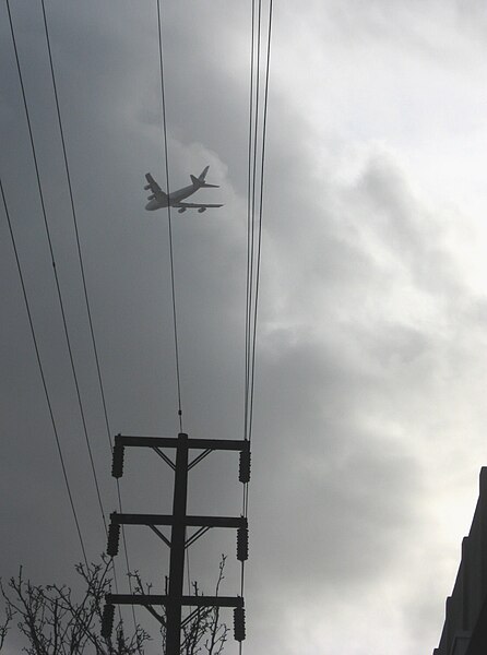
Airplane flying into clouds on descent for landing

Foggy morning road
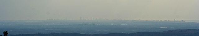
On clear days, Tel Aviv's skyline is visible from the Carmel mountains, 80 km north
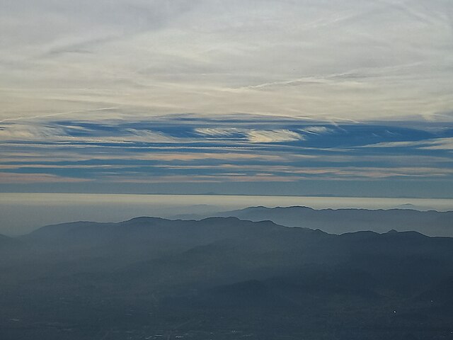
From the summit of Mount Summano (1296 m Vicenza Italy), it is possible to see (dark blue sky line) the Tuscan-Emilian Apennines and Mount Cimone (2165 m Modena Italy) in good visibility. The distance is about 180 km. Note the fog present throughout the Po Valley in the lower layers.
Surface weather observation
Videos
Page
Surface weather observations are the fundamental data used for safety as well as climatological reasons to forecast weather and issue warnings worldwide. They can be taken manually, by a weather observer, by computer through the use of automated weather stations, or in a hybrid scheme using weather observers to augment the otherwise automated weather station. The ICAO defines the International Standard Atmosphere (ISA), which is the model of the standard variation of pressure, temperature, density, and viscosity with altitude in the Earth's atmosphere, and is used to reduce a station pressure to sea level pressure. Airport observations can be transmitted worldwide through the use of the METAR observing code. Personal weather stations taking automated observations can transmit their data to the United States mesonet through the Citizen Weather Observer Program (CWOP), the UK Met Office through their Weather Observations Website (WOW), or internationally through the Weather Underground Internet site. A thirty-year average of a location's weather observations is traditionally used to determine the station's climate. In the US a network of Cooperative Observers make a daily record of summary weather and sometimes water level information.

Weather station at Mildura Airport, Victoria, Australia.
ASOS sensors, located at Salinas, California