Wakhan Corridor
Videos
Page
The Wakhan Corridor is a narrow strip of territory located within the Badakhshan province of Afghanistan. This corridor stretches eastward, connecting Afghanistan to Xinjiang, China. It also separates the Gorno-Badakhshan Autonomous Region of Tajikistan in the north from northern Pakistan in the south. This high mountain valley serves as the source of both the Panj and Pamir rivers, which converge to form the larger Amu River. For countless centuries, a vital trade route has traversed this valley, facilitating the movement of travelers to and from East, South, and Central Asia.

Wakhan Corridor

Floodplains in the Wakhan Corridor
Badakhshan Province
Videos
Page
Badakhshan Province is one of the 34 provinces of Afghanistan, located in the northeastern part of the country. It is bordered by Tajikistan's Gorno-Badakhshan in the north and the Pakistani regions of Lower and Upper Chitral and Gilgit-Baltistan in the southeast. It also has a 91-kilometer (57-mile) border with China in the east.

Image: Badakhshan province of Afghanistan
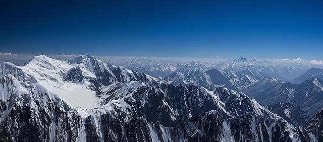
Image: Naw shakh
Noshaq (or Nowshak) (Dari: نوشاخ) is the second highest independent peak of the Hindu Kush Range after Tirich Mir (7,492 m (24,580 ft)). It lies on the border between Pakistan and Badakhshan Province in Afghanistan. The north and west sides of the mountain are in Afghanistan, and the southern and eastern sides are in Pakistan. Noshaq is Afghanistan's highest mountain and is in the northeastern corner of the country along the Durand line (which marks the border with Pakistan). It is the westernmost 7000m peak in the world.

Classic lazurite specimen from Sar-e-Sang district