Walcheren
Videos
Page
Walcheren is a region and former island in the Dutch province of Zeeland at the mouth of the Scheldt estuary. It lies between the Eastern Scheldt in the north and the Western Scheldt in the south and is roughly the shape of a rhombus. The two sides facing the North Sea consist of dunes and the rest of its coastline is made up of dykes. Middelburg, the provincial capital, lies at Walcheren's centre. Vlissingen, 9 kilometres (5.6 mi) to the south, is the main harbour and the third municipality is Veere.

Campveer Tower in Veere, built in 1500
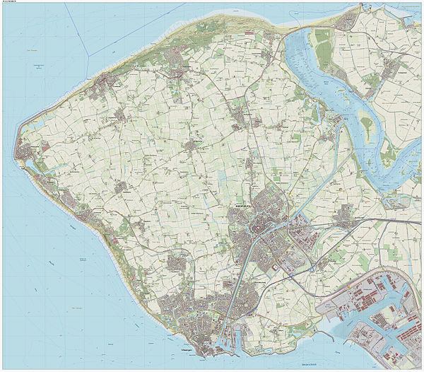
Image: Walcheren natuur Open Topo
Zeeland
Videos
Page
Zeeland is the westernmost and least populous province of the Netherlands. The province, located in the southwest of the country, borders North Brabant to the east, South Holland to the north, as well as the country of Belgium to the south and west. It consists of a number of islands and peninsulas and a strip bordering the Flemish provinces of East and West Flanders. Its capital is Middelburg with a population of 48,544 as of November 2019, although the largest municipality in Zeeland is Terneuzen. Zeeland has two seaports: Vlissingen and Terneuzen. Its area is 2,933 square kilometres (1,132 sq mi), of which 1,154 square kilometres (446 sq mi) is water; it had a population of about 391,000 as of January 2023.
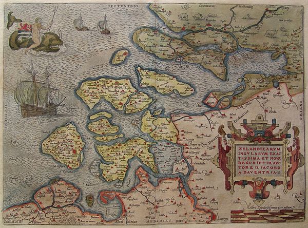
The County of Zeeland in 1580

North Sea flood of 1953 in a town in Zuid-Beveland
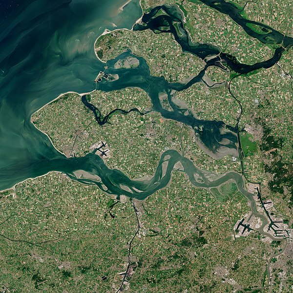
Satellite image of Zeeland

The States of Zeeland are located in a former abbey in Middelburg.