Wall of the Ferme générale
Videos
Page
The Wall of the Ferme générale was one of the several city walls of Paris built between the early Middle Ages and the mid 19th century. Built between 1784 and 1791, the 24 km wall crossed the districts of the Place de l'Étoile, Batignolles, Pigalle, Belleville, Nation, the Place d'Italie, Denfert-Rochereau, Montparnasse and the Trocadéro, roughly following the route now traced by line 2 and line 6 of the Paris Métro. The wall was demolished in the early 1860s, although elements of some of its gates remain.
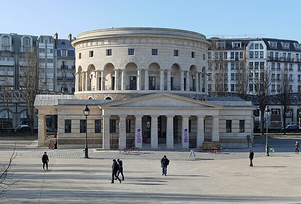
Claude Nicolas Ledoux's Rotonde de la Villette at Place de Stalingrad

One of the two customs houses at the barrière d'Enfer, now Place Denfert-Rochereau

Rotunda in the parc Monceau, Barrière de Chartres

Barrière du Trône near the Place de la Nation
Place Charles de Gaulle
Videos
Page
The Place Charles de Gaulle, historically known as the Place de l'Étoile, is a large road junction in Paris, France, the meeting point of twelve straight avenues including the Champs-Élysées. It was renamed in 1970, following the death of President Charles de Gaulle. It is still often referred to by its original name; the nearby Métro and RER station retains the designation Charles de Gaulle–Étoile. Paris's Axe historique cuts through the Arc de Triomphe, which stands at the centre of the Place Charles de Gaulle.

View of the Place Charles de Gaulle from the Avenue d'Iéna
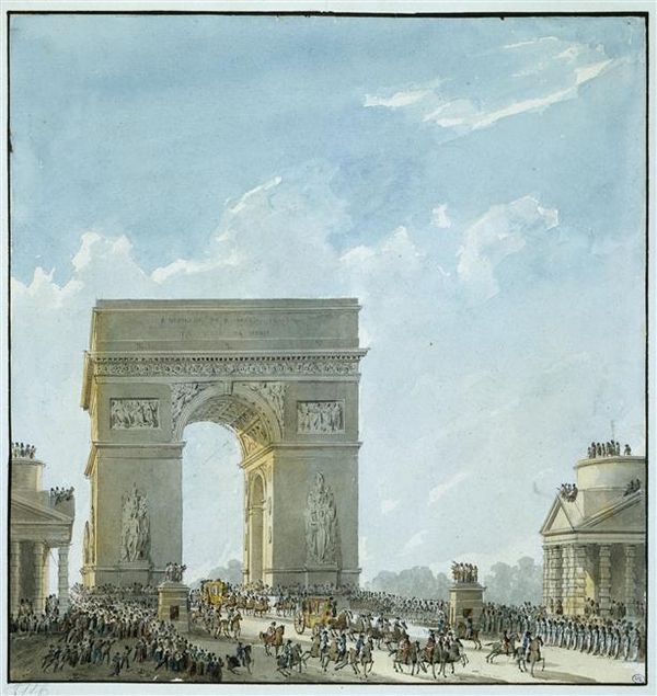
The Barrière de l'Étoile buildings in front of a wooden mock-up of the Arc de Triomphe in 1810.

The Place de l'Étoile, c. 1920.

The Place de l'Étoile was renamed the Place Charles de Gaulle in 1970.