Washington State Route 504
Videos
Page
State Route 504 is a state highway in southwestern Washington state in the United States. It travels 52 miles (84 km) along the North Fork Toutle River to the Mount St. Helens area, serving as the main access to the Mount St. Helens National Volcanic Monument. The highway begins at an interchange with Interstate 5 (I-5) and SR 411 in Castle Rock and terminates at the Johnston Ridge Observatory near Spirit Lake.
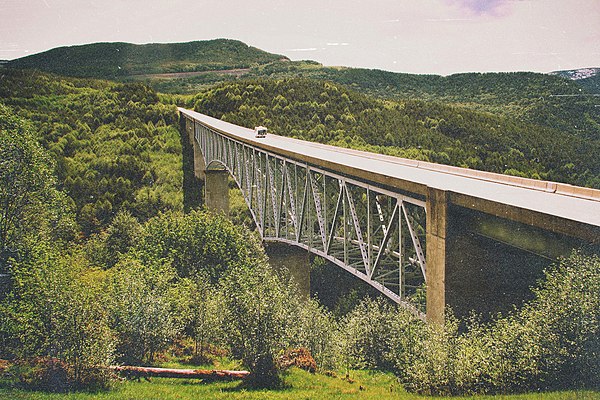
The Hoffstadt Creek Bridge on SR 504, located near the Toutle River Sediment Dam
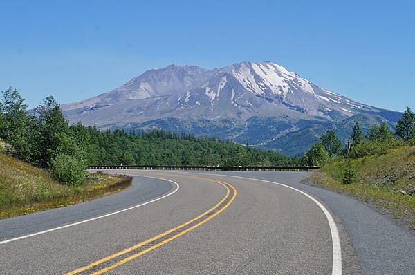
A curve on SR 504 as it approaches Mount St. Helens from the northwest
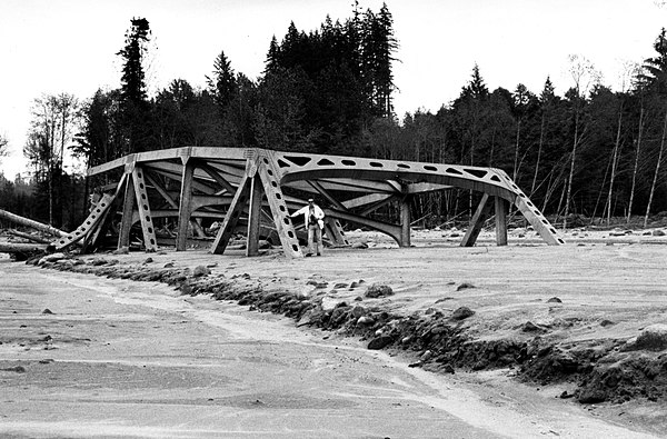
A truss bridge carrying SR 504 over the North Fork Toutle River that was destroyed by the May 1980 eruption's lahar

A section of SR 504 near Coal Bank buried under a lahar deposit
Mount St. Helens
Videos
Page
Mount St. Helens is an active stratovolcano located in Skamania County, Washington, in the Pacific Northwest region of the United States. It lies 52 miles (83 km) northeast of Portland, Oregon, and 98 miles (158 km) south of Seattle. Mount St. Helens takes its English name from that of the British diplomat Alleyne Fitzherbert, 1st Baron St Helens, a friend of explorer George Vancouver who surveyed the area in the late 18th century. The volcano is part of the Cascade Volcanic Arc, a segment of the Pacific Ring of Fire.

3,000 ft (0.9 km) high steam plume on May 19, 1982, two years after the 1980 major eruption

Mount St. Helens pictured the day before the 1980 eruption, which removed much of the northern face of the mountain, leaving a large crater

East Dome on the east flank of Mount St. Helens in 2013.

The symmetrical appearance of St. Helens prior to the 1980 eruption earned it the nickname "Mount Fuji of America". The once-familiar shape was formed out of the Kalama and Goat Rocks eruptive periods.