1.
United Kingdom
–
The United Kingdom of Great Britain and Northern Ireland, commonly known as the United Kingdom or Britain, is a sovereign country in western Europe. Lying off the north-western coast of the European mainland, the United Kingdom includes the island of Great Britain, Northern Ireland is the only part of the United Kingdom that shares a land border with another sovereign state—the Republic of Ireland. The Irish Sea lies between Great Britain and Ireland, with an area of 242,500 square kilometres, the United Kingdom is the 78th-largest sovereign state in the world and the 11th-largest in Europe. It is also the 21st-most populous country, with an estimated 65.1 million inhabitants, together, this makes it the fourth-most densely populated country in the European Union. The United Kingdom is a monarchy with a parliamentary system of governance. The monarch is Queen Elizabeth II, who has reigned since 6 February 1952, other major urban areas in the United Kingdom include the regions of Birmingham, Leeds, Glasgow, Liverpool and Manchester. The United Kingdom consists of four countries—England, Scotland, Wales, the last three have devolved administrations, each with varying powers, based in their capitals, Edinburgh, Cardiff and Belfast, respectively. The relationships among the countries of the UK have changed over time, Wales was annexed by the Kingdom of England under the Laws in Wales Acts 1535 and 1542. A treaty between England and Scotland resulted in 1707 in a unified Kingdom of Great Britain, which merged in 1801 with the Kingdom of Ireland to form the United Kingdom of Great Britain and Ireland. Five-sixths of Ireland seceded from the UK in 1922, leaving the present formulation of the United Kingdom of Great Britain, there are fourteen British Overseas Territories. These are the remnants of the British Empire which, at its height in the 1920s, British influence can be observed in the language, culture and legal systems of many of its former colonies. The United Kingdom is a country and has the worlds fifth-largest economy by nominal GDP. The UK is considered to have an economy and is categorised as very high in the Human Development Index. It was the worlds first industrialised country and the worlds foremost power during the 19th, the UK remains a great power with considerable economic, cultural, military, scientific and political influence internationally. It is a nuclear weapons state and its military expenditure ranks fourth or fifth in the world. The UK has been a permanent member of the United Nations Security Council since its first session in 1946 and it has been a leading member state of the EU and its predecessor, the European Economic Community, since 1973. However, on 23 June 2016, a referendum on the UKs membership of the EU resulted in a decision to leave. The Acts of Union 1800 united the Kingdom of Great Britain, Scotland, Wales and Northern Ireland have devolved self-government
2.
Army Reserve (United Kingdom)
–
The Army Reserve is the active-duty volunteer reserve force and integrated element of the British Army. Most Volunteer infantry units had unique identities, but lost these in the reorganisation, only one infantry unit, the London Regiment, has maintained a separate identity. Reservists in the past also served as constables or bailiffs, even holding positions of civic duty as overseer of their parish, the more modern Yeomen of the 18th century were cavalry-based units, which were often used to suppress riots. Several units that are now part of the Army Reserve bear the title militia, after the Second World War, for example, the Army Reserve - or Territorial Army as it was known then - was not demobilised until 1947. All Army Reserve personnel have their jobs protected to a limited extent by law should they be compulsorily mobilised. There is, however, no protection against discrimination in employment for membership of the Army Reserve in the normal course of events. As part of the process, remaining units of militia were converted to the Special Reserve. The TF was formed on 1 April 1908 and contained fourteen infantry divisions and it had an overall strength of approximately 269,000. The individual units that made up each division or brigade were administered by County Associations, the other members of the association consisted of military members, representative members and co-opted members. Associations took over any property vested in the volunteers or yeomanry under their administration, each regiment or battalion had a Regular Army officer attached as full-time adjutant. In August 1914, after the outbreak of the First World War, territorial units were given the option of serving in France and, by 25 August, in excess of seventy battalions had volunteered. This question over the availability of territorial divisions for service was one of Lord Kitcheners motivations for raising the New Army separately. The first fully Territorial division to join the fighting on the Western Front was the 46th Division in March 1915, with divisions later serving in Gallipoli and elsewhere. As the war progressed, and casualties mounted, the character of territorial units was diluted by the inclusion of conscript. Following the Armistice all units of the Territorial Force were gradually disbanded, New recruiting started in early 1920, and the Territorial Force was reconstituted on 7 February 1920. On 1 October 1920, the Territorial Force was renamed the Territorial Army, the 1st Line divisions were reconstituted in that year. However, the composition of the divisions was altered, with a reduction in the number of infantry battalions required, there was also a reduced need for cavalry, and of the 55 yeomanry regiments, only the 14 most senior retained their horses. The remaining yeomanry were converted to artillery or armoured car units or disbanded, the amalgamation of 40 pairs of infantry battalions was announced in October 1921
3.
Liverpool Blitz
–
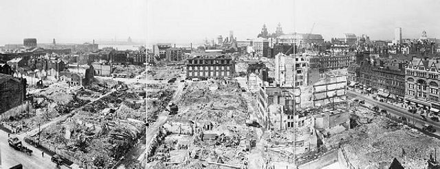
The Liverpool Blitz was the heavy and sustained bombing of the British city of Liverpool and its surrounding area, during the Second World War by the German Luftwaffe. The government was concerned to hide from the Germans just how much damage had been inflicted upon the docks, around 4,000 people were killed in the Merseyside area during the Blitz. This death toll was only to London, which suffered 30,000 deaths by the end of the war. Liverpool, Bootle and the Wallasey Pool complex were strategically very important locations during the Second World War. The large port had for years been the United Kingdoms main link with North America. Liverpool was the end of a Transatlantic chain of supplies from North America. The evacuation of children at the start of the war, in September 1939, was a measure to save the population of urban or military areas from German aerial bombing. The evacuations were organised by Liverpool Corporation and though some children were transported to smaller towns nearby, many went to areas in North Wales. The first major air raid on Liverpool took place in August 1940 and this assault continued over the next three nights, then regularly for the rest of the year. There were 50 raids on the city during this three-month period, some of these were minor, comprising a few aircraft, and lasting a few minutes, with others comprising up to 300 aircraft and lasting over ten hours. On 18 September,22 inmates at Walton Gaol were killed when high-explosive bombs demolished a wing of the prison,28 November saw a heavy raid on the city, and the most serious single incident, when a hit on an air-raid shelter in Durning Road caused 166 fatalities. Winston Churchill described it as the single worst incident of the war, the air assault in 1940 came to a peak with the Christmas blitz, a three-night bombardment towards the end of December. A series of heavy raids took place in December 1940, referred to as the Christmas blitz, on 21 December another hit on a shelter killed 74 people. The bombing decreased in severity after the new year, may 1941 saw a renewal of the air assault on the region, a seven-night bombardment that devastated the city. The first bomb landed upon Seacombe, Wallasey, Wirral, at 22,15 on 1 May, the peak of the bombing occurred from 1 –7 May 1941. It involved 681 Luftwaffe bombers,2,315 high explosive bombs and 119 other explosives such as incendiaries were dropped, the raids put 69 out of 144 cargo berths out of action and inflicted 2,895 casualties and left many more homeless. Another landed on the front steps without exploding but incendiaries destroyed equipment in the yard at the west end. One incident on 3 May involved the SS Malakand, a ship carrying munitions which was berthed in the Huskisson Dock, although its eventual explosion is often attributed to a burning barrage balloon, this fire was put out
4.
Normandy landings
–
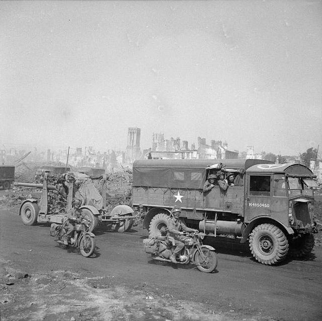
The Normandy landings were the landing operations on Tuesday,6 June 1944 of the Allied invasion of Normandy in Operation Overlord during World War II. The largest seaborne invasion in history, the operation began the liberation of German-occupied northwestern Europe from Nazi control, planning for the operation began in 1943. Adolf Hitler placed German Field Marshal Erwin Rommel in command of German forces, the amphibious landings were preceded by extensive aerial and naval bombardment and an airborne assault—the landing of 24,000 American, British, and Canadian airborne troops shortly after midnight. Allied infantry and armoured divisions began landing on the coast of France at 06,30, the target 50-mile stretch of the Normandy coast was divided into five sectors, Utah, Omaha, Gold, Juno, and Sword. Strong winds blew the landing craft east of their positions, particularly at Utah. Casualties were heaviest at Omaha, with its high cliffs, at Gold, Juno, and Sword, several fortified towns were cleared in house-to-house fighting, and two major gun emplacements at Gold were disabled, using specialised tanks. The Allies failed to any of their goals on the first day. Carentan, St. Lô, and Bayeux remained in German hands, and Caen, German casualties on D-Day have been estimated at 4,000 to 9,000 men. Allied casualties were at least 10,000, with 4,414 confirmed dead, museums, memorials, and war cemeteries in the area now host many visitors each year. Between 27 May and 4 June 1940, over 338,000 troops of the British Expeditionary Force, after the German Army invaded the Soviet Union in June 1941, the Soviet leader Joseph Stalin began pressing his allies for the creation of a second front in western Europe. In late May 1942 the Soviet Union and the United States made a joint announcement that a. full understanding was reached with regard to the urgent tasks of creating a front in Europe in 1942. Instead of a return to France, the Western Allies staged offensives in the Mediterranean Theatre of Operations. By mid-1943 the campaign in North Africa had been won, the Allies then launched the invasion of Sicily in July 1943, and subsequently invaded Italy in September the same year. By then, Soviet forces were on the offensive and had won a victory at the Battle of Stalingrad. The decision to undertake a cross-channel invasion within the year was taken at the Trident Conference in Washington in May 1943. Initial planning was constrained by the number of landing craft, most of which were already committed in the Mediterranean. At the Tehran Conference in November 1943, Roosevelt and Churchill promised Stalin that they would open the second front in May 1944. Four sites were considered for the landings, Brittany, the Cotentin Peninsula, Normandy, as Brittany and Cotentin are peninsulas, it would have been possible for the Germans to cut off the Allied advance at a relatively narrow isthmus, so these sites were rejected
5.
Operation Overlord
–
Operation Overlord was the code name for the Battle of Normandy, the Allied operation that launched the successful invasion of German-occupied Western Europe during World War II. The operation was launched on 6 June 1944 with the Normandy landings, a 1, 200-plane airborne assault preceded an amphibious assault involving more than 5,000 vessels. Nearly 160,000 troops crossed the English Channel on 6 June, the decision to undertake a cross-channel invasion in 1944 was taken at the Trident Conference in Washington in May 1943. The coast of Normandy was chosen as the site of the invasion, with the Americans assigned to land at sectors codenamed Utah and Omaha, the British at Sword and Gold, and the Canadians at Juno. In the months leading up to the invasion, the Allies conducted a military deception, Operation Bodyguard. This misled the Germans as to the date and location of the main Allied landings, Adolf Hitler placed German Field Marshal Erwin Rommel in charge of developing fortifications all along the Atlantic Wall in anticipation of an invasion. A failed counterattack by German forces on 8 August left 50,000 soldiers of the 7th Army trapped in the Falaise pocket, the Allies launched an invasion of southern France on 15 August, and the Liberation of Paris followed on 25 August. German forces retreated across the Seine on 30 August 1944, marking the close of Operation Overlord, in June 1940, Germanys leader Adolf Hitler had triumphed in what he called the most famous victory in history—the fall of France. The defending British Expeditionary Force, trapped along the northern coast of France, was able to evacuate over 338,000 troops to England in the Dunkirk evacuation. After the Germans invaded the Soviet Union in June 1941, Soviet leader Joseph Stalin began pressing for the creation of a front in Western Europe. Two tentative plans code-named Operation Roundup and Operation Sledgehammer were put forward for 1942–43, instead, the Allies launched the invasion of French North Africa in November 1942, the invasion of Sicily in July 1943, and invaded Italy in September. These operations provided the troops with valuable experience in amphibious warfare, the decision to undertake a cross-channel invasion within the next year was taken at the Trident Conference in Washington in May 1943. Churchill favoured making the main Allied thrust into Germany from the Mediterranean theatre, but was over-ruled by his American allies, British Lieutenant-General Frederick E. Morgan was appointed Chief of Staff, Supreme Allied Commander, to begin detailed planning. The initial plans were constrained by the number of landing craft, most of which were already committed in the Mediterranean. In part because of lessons learned in the Dieppe Raid of 19 August 1942, the failure at Dieppe also highlighted the need for adequate artillery and air support, particularly close air support, and specialised ships able to travel extremely close to shore. Morgan considered four sites for the landings, Brittany, the Cotentin Peninsula, Normandy, as Brittany and Cotentin are peninsulas, it would have been possible for the Germans to cut off the Allied advance at a relatively narrow isthmus, so these sites were rejected. The Pas de Calais is the closest point in continental Europe to Britain and was the location of sites for V-1 and V-2 rockets. The Germans considered it to be the most likely initial landing zone, Normandy was hence chosen as the landing site
6.
British Army
–
The British Army is the principal land warfare force of the United Kingdom. As of 2017 the British Army comprises just over 80,000 trained Regular, or full-time, personnel and just over 26,500 trained Reserve, or part-time personnel. Therefore, the UK Parliament approves the continued existence of the Army by passing an Armed Forces Act at least once every five years, day to day the Army comes under administration of the Ministry of Defence and is commanded by the Chief of the General Staff. Repeatedly emerging victorious from these decisive wars allowed Britain to influence world events with its policies and establish itself as one of the leading military. In 1660 the English, Scottish and Irish monarchies were restored under Charles II, Charles favoured the foundation of a new army under royal control and began work towards its establishment by August 1660. The Royal Scots Army and the Irish Army were financed by the Parliament of Scotland, the order of seniority of the most senior line regiments in the British Army is based on the order of seniority in the English army. At that time there was only one English regiment of dragoons, after William and Marys accession to the throne, England involved itself in the War of the Grand Alliance, primarily to prevent a French invasion restoring Marys father, James II. Spain, in the two centuries, had been the dominant global power, and the chief threat to Englands early transatlantic ambitions. The territorial ambitions of the French, however, led to the War of the Spanish Succession and the Napoleonic Wars. From the time of the end of the Seven Years War in 1763, Great Britain was the naval power. As had its predecessor, the English Army, the British Army fought the Kingdoms of Spain, France, and the Netherlands for supremacy in North America and the West Indies. With native and provincial assistance, the Army conquered New France in the North American theatre of the Seven Years War, the British Army suffered defeat in the American War of Independence, losing the Thirteen Colonies but holding on to Canada. The British Army was heavily involved in the Napoleonic Wars and served in campaigns across Europe. The war between the British and the First French Empire of Napoleon Bonaparte stretched around the world and at its peak, in 1813, the regular army contained over 250,000 men. A Coalition of Anglo-Dutch and Prussian Armies under the Duke of Wellington, the English had been involved, both politically and militarily, in Ireland since being given the Lordship of Ireland by the Pope in 1171. The campaign of the English republican Protector, Oliver Cromwell, involved uncompromising treatment of the Irish towns that had supported the Royalists during the English Civil War, the English Army stayed in Ireland primarily to suppress numerous Irish revolts and campaigns for independence. Having learnt from their experience in America, the British government sought a political solution, the British Army found itself fighting Irish rebels, both Protestant and Catholic, primarily in Ulster and Leinster in the 1798 rebellion. The Haldane Reforms of 1907 formally created the Territorial Force as the Armys volunteer reserve component by merging and reorganising the Volunteer Force, Militia, Great Britains dominance of the world had been challenged by numerous other powers, in the 20th century, most notably Germany
7.
Royal Artillery
–
The Royal Regiment of Artillery, commonly referred to as the Royal Artillery, is the artillery arm of the British Army. Despite its name Royal Regiment of Artillery it actually consists of 13 Regular Regiments and 5 Reserve Regiments, the introduction of artillery into the English army came as early as the Battle of Crécy in 1346. Henry VIII made the armys artillery semi-permanent in the sixteenth century, before the 18th century, artillery traynes were raised by royal warrant for specific campaigns and disbanded again when they were over. On 26 May 1716, however, by warrant of George I two regular companies of field artillery, each 100 men strong, were raised at Woolwich. The title Royal Artillery was first used in 1720, in 1741 the Royal Military Academy was formed in the Royal Arsenal at Woolwich to provide training for RA and Royal Engineers officers. The regiment expanded rapidly and, by 1757, had 24 companies divided into two battalions, as well as a company formed in 1741. During 1748, the presidential artilleries of Bengal, Madras and Bombay were formed,1756 saw the creation of the Royal Irish Regiment of Artillery. In 1762 the Royal Artillery Band was formed at Minden, by 1771 there were 32 companies in four battalions, as well as two invalid companies comprising older and unfit men employed in garrison duties. During 1782, the regiment moved to the Royal Artillery Barracks on Woolwich Common, in January 1793, two troops of Royal Horse Artillery were raised to provide fire support for the cavalry, augmented by two more in November 1793. The Royal Irish Artillery was absorbed into the RA in 1801, during 1805, the Royal Military Academy moved to Woolwich Common. In 1819, the Rotunda was given to the regiment by the Prince Regent to celebrate end of the Napoleonic Wars, in 1832, the regimental motto, Ubique Quo Fas Et Gloria Ducunt, was granted. The motto signified that the regiment had seen action in all the conflicts of the British Army. The regiment was under the control of the Board of Ordnance until the board was abolished in 1855, thereafter the regiment came under the War Office along with the rest of the army. The School of Gunnery established at Shoeburyness, Essex in 1859, the third group continued to be titled simply Royal Artillery, and was responsible for ammunition storage and supply. Which branch a gunner belonged to was indicated by metal shoulder titles, the RFA and RHA also dressed as mounted men, whereas the RGA dressed like foot soldiers. In 1920 the rank of Bombardier was instituted in the Royal Artillery, the three sections effectively functioned as separate corps. This arrangement lasted until 1924, when the three amalgamated once more to one regiment. In 1938, RA Brigades were renamed Regiments, during the World War II there were over 1 million men serving in 960 gunner regiments
8.
World War II
–
World War II, also known as the Second World War, was a global war that lasted from 1939 to 1945, although related conflicts began earlier. It involved the vast majority of the worlds countries—including all of the great powers—eventually forming two opposing alliances, the Allies and the Axis. It was the most widespread war in history, and directly involved more than 100 million people from over 30 countries. Marked by mass deaths of civilians, including the Holocaust and the bombing of industrial and population centres. These made World War II the deadliest conflict in human history, from late 1939 to early 1941, in a series of campaigns and treaties, Germany conquered or controlled much of continental Europe, and formed the Axis alliance with Italy and Japan. Under the Molotov–Ribbentrop Pact of August 1939, Germany and the Soviet Union partitioned and annexed territories of their European neighbours, Poland, Finland, Romania and the Baltic states. In December 1941, Japan attacked the United States and European colonies in the Pacific Ocean, and quickly conquered much of the Western Pacific. The Axis advance halted in 1942 when Japan lost the critical Battle of Midway, near Hawaii, in 1944, the Western Allies invaded German-occupied France, while the Soviet Union regained all of its territorial losses and invaded Germany and its allies. During 1944 and 1945 the Japanese suffered major reverses in mainland Asia in South Central China and Burma, while the Allies crippled the Japanese Navy, thus ended the war in Asia, cementing the total victory of the Allies. World War II altered the political alignment and social structure of the world, the United Nations was established to foster international co-operation and prevent future conflicts. The victorious great powers—the United States, the Soviet Union, China, the United Kingdom, the Soviet Union and the United States emerged as rival superpowers, setting the stage for the Cold War, which lasted for the next 46 years. Meanwhile, the influence of European great powers waned, while the decolonisation of Asia, most countries whose industries had been damaged moved towards economic recovery. Political integration, especially in Europe, emerged as an effort to end pre-war enmities, the start of the war in Europe is generally held to be 1 September 1939, beginning with the German invasion of Poland, Britain and France declared war on Germany two days later. The dates for the beginning of war in the Pacific include the start of the Second Sino-Japanese War on 7 July 1937, or even the Japanese invasion of Manchuria on 19 September 1931. Others follow the British historian A. J. P. Taylor, who held that the Sino-Japanese War and war in Europe and its colonies occurred simultaneously and this article uses the conventional dating. Other starting dates sometimes used for World War II include the Italian invasion of Abyssinia on 3 October 1935. The British historian Antony Beevor views the beginning of World War II as the Battles of Khalkhin Gol fought between Japan and the forces of Mongolia and the Soviet Union from May to September 1939, the exact date of the wars end is also not universally agreed upon. It was generally accepted at the time that the war ended with the armistice of 14 August 1945, rather than the formal surrender of Japan
9.
Western Front (World War II)
–
The Western Front of the European theatre of World War II encompassed Denmark, Norway, Luxembourg, Belgium, the Netherlands, the United Kingdom, France, Italy, and Germany. World War II military engagements in Southern Europe and elsewhere are generally considered under separate headings, the Western Front was marked by two phases of large-scale combat operations. The second phase consisted of ground combat, which began in June 1944 with the Allied landings in Normandy. The Phoney War was a phase of World War II marked by a few military operations in Continental Europe in the months following the German invasion of Poland. Although the great powers of Europe had declared war on one another, neither side had yet committed to launching a significant attack and this was also the period in which The United Kingdom and France did not supply significant aid to Poland, despite their pledged alliance. While most of the German Army was fighting against Poland, a much smaller German force manned the Siegfried Line, there were only some local, minor skirmishes. The British Royal Air Force dropped propaganda leaflets on Germany and the first Canadian troops stepped ashore in Britain, while Western Europe was in a strange calm for seven months. In their hurry to re-arm, Britain and France had both begun to buy large numbers of weapons manufacturers in the United States at the outbreak of hostilities. The non-belligerent United States, contributed to the Western Allies by discounted sales of military equipment, German efforts to interdict the Allies trans-Atlantic trade at sea ignited the Battle of the Atlantic. However, when the Allies made a counter-landing in Norway following the German invasion, the Kriegsmarine, nonetheless, suffered very heavy losses during the two-months of fighting required to seize all of mainland Norway. In May 1940, the Germans launched the Battle of France, the Western Allies soon collapsed under the onslaught of the so-called blitzkrieg strategy. The majority of the British and elements of the French forces escaped at Dunkirk, with the fighting ended, the Germans began to consider ways of resolving the question of how to deal with Britain. If the British refused to agree to a treaty, one option was to invade. However, Nazi Germanys Kriegsmarine, had suffered losses in Norway. With the Luftwaffe unable to defeat the RAF in the Battle of Britain and these were built in anticipation of an Allied invasion of France. Because of the massive logistical obstacles a cross-channel invasion would face, on 19 August 1942, the Allies began the Dieppe Raid, an attack on Dieppe, France. Most of the troops were Canadian, with some British contingents, the raid was a disaster, almost two-thirds of the attacking force became casualties. However, much was learned as a result of the operation – these lessons would be put to use in the subsequent invasion
10.
Belgium
–
Belgium, officially the Kingdom of Belgium, is a sovereign state in Western Europe bordered by France, the Netherlands, Germany, Luxembourg, and the North Sea. It is a small, densely populated country which covers an area of 30,528 square kilometres and has a population of about 11 million people. Additionally, there is a group of German-speakers who live in the East Cantons located around the High Fens area. Historically, Belgium, the Netherlands and Luxembourg were known as the Low Countries, the region was called Belgica in Latin, after the Roman province of Gallia Belgica. From the end of the Middle Ages until the 17th century, today, Belgium is a federal constitutional monarchy with a parliamentary system of governance. It is divided into three regions and three communities, that exist next to each other and its two largest regions are the Dutch-speaking region of Flanders in the north and the French-speaking southern region of Wallonia. The Brussels-Capital Region is a bilingual enclave within the Flemish Region. A German-speaking Community exists in eastern Wallonia, Belgiums linguistic diversity and related political conflicts are reflected in its political history and complex system of governance, made up of six different governments. Upon its independence, declared in 1830, Belgium participated in the Industrial Revolution and, during the course of the 20th century, possessed a number of colonies in Africa. This continuing antagonism has led to several far-reaching reforms, resulting in a transition from a unitary to a federal arrangement during the period from 1970 to 1993. Belgium is also a member of the Eurozone, NATO, OECD and WTO. Its capital, Brussels, hosts several of the EUs official seats as well as the headquarters of major international organizations such as NATO. Belgium is also a part of the Schengen Area, Belgium is a developed country, with an advanced high-income economy and is categorized as very high in the Human Development Index. A gradual immigration by Germanic Frankish tribes during the 5th century brought the area under the rule of the Merovingian kings, a gradual shift of power during the 8th century led the kingdom of the Franks to evolve into the Carolingian Empire. Many of these fiefdoms were united in the Burgundian Netherlands of the 14th and 15th centuries, the Eighty Years War divided the Low Countries into the northern United Provinces and the Southern Netherlands. The latter were ruled successively by the Spanish and the Austrian Habsburgs and this was the theatre of most Franco-Spanish and Franco-Austrian wars during the 17th and 18th centuries. The reunification of the Low Countries as the United Kingdom of the Netherlands occurred at the dissolution of the First French Empire in 1815, although the franchise was initially restricted, universal suffrage for men was introduced after the general strike of 1893 and for women in 1949. The main political parties of the 19th century were the Catholic Party, French was originally the single official language adopted by the nobility and the bourgeoisie
11.
V-1 flying bomb
–
The V-1 was developed at Peenemünde Army Research Center by the Nazi German Luftwaffe during the Second World War. During initial development it was known by the codename Cherry Stone, the first V-1 was launched at London on 13 June 1944), one week after the successful Allied landings in Europe. After this, the V-1s were directed at the port of Antwerp and other targets in Belgium, the attacks stopped only a month before the war in Europe ended, when the last launch site in the Low Countries was overrun on 29 March 1945. On 9 November 1939, a proposal for an aircraft carrying a payload of 1,000 kg over a distance of 500 km was forwarded to the RLM. On 31 May, Rudolf Bree of the RLM commented that he saw no chance that the projectile could be deployed in combat conditions, as the proposed remote-control system was seen as a design weakness. Heinrich Koppenberg, the director of Argus, met with Ernst Udet on 6 January 1941 to try to convince him that the development should be continued, despite this, Gosslau was convinced that the basic idea was sound and proceeded to simplify the design. On 22 January 1942, Lusser took up a position with the Fieseler aircraft company and he met with Koppenberg on 27 February and was informed of Gosslaus project. Gosslaus design used two engines, Lusser improved the design to use a single engine. A final proposal for the project was submitted to the Technical Office of the RLM on 5 June and the project was renamed Fi 103, as Fieseler was to be the chief contractor. By 30 August, Fieseler had completed the first fuselage, and the first flight of the Fi 103 V7 took place on 10 December, the V-1 was named by The Reich journalist Hans Schwarz Van Berkl in June 1944 with Hitlers approval. The V-1 was designed under the codename Kirschkern by Lusser and Gosslau, with a fuselage constructed mainly of welded sheet steel, the simple, Argus-built pulsejet engine pulsed 50 times per second, and the characteristic buzzing sound gave rise to the colloquial names buzz bomb or doodlebug. It was known briefly in Germany as Maikäfer and Krähe, ignition of the Argus pulsejet was accomplished using an automotive type spark plug located about 76 cm behind the intake shutters, with current supplied from a portable starting unit. The Argus As 014 could operate at zero airspeed because of the nature of its intake shutters, ramp-launch velocity for an operational V-1 was 580 km/h as it left the end of the launch ramp. Beginning in January 1941, the V-1s pulsejet engine was tested on a variety of craft, including automobiles. The unsuccessful prototype was a version of a Sprengboot, in which a boat loaded with explosives was steered towards a target ship, the Tornado was assembled from surplus seaplane hulls connected in catamaran fashion with a small pilot cabin on the crossbeams. The Tornado prototype was a noisy underperformer and was abandoned in favour of conventional piston engined craft. The engine made its first flight aboard a Gotha Go 145 on 30 April 1941, the V-1 guidance system used a simple autopilot developed by Askania in Berlin to regulate altitude and airspeed. A weighted pendulum system provided fore-and-aft attitude measurement to control pitch, operating power for the gyroscope platform and the flight-control actuators was provided by two large spherical compressed air tanks that also pressurized the fuel tank
12.
Oswestry
–
Oswestry, one of the UKs oldest border settlements, is the largest market town and civil parish in Shropshire, England, close to the Welsh border. It is at the junction of the A5, A483, the town was the administrative headquarters of the Borough of Oswestry until that was abolished under local government reorganisation with effect from 1 April 2009. Oswestry is the third largest town in Shropshire, following Telford, the 2011 Census recorded the population of the civil parish as 17,105 and the urban area as 16,660. The town is five miles from the Welsh border, and has a mixed Welsh and English heritage and it is the home of the Shropshire libraries Welsh Collection. Oswestry is the largest settlement within the Oswestry Uplands, a natural area. It has also known as, or recorded in historical documents as, Album Monasterium, Blancminster, Blankmouster, Blancmustier, Croes Oswallt, Oswaldestre. The site is also named Caer Ogyrfan or The City of Gogyrfan, the Battle of Maserfield is thought to have been fought there in 642, between the Anglo-Saxon kings Penda of Mercia and Oswald of Northumbria. Oswald was killed in battle and was dismembered, according to legend, one of his arms was carried to an ash tree by a raven. Thus it is believed that the name of the site is derived from a reference to Oswalds Tree, the spring, Oswalds Well, is supposed to have originated where the bird dropped the arm from the tree. Offas Dyke runs nearby to the west, the Domesday Book records a castle being built by Rainald, a Norman Sheriff of Shropshire, Loeuvre – see Oswestry Castle. Alans duties to the Crown included supervision of the Welsh border and he also founded Sporle Priory in Norfolk. He married Ada or Adeline, daughter of Ernulf de Hesdin and their eldest son William FitzAlan was made High Sheriff of Shropshire by King Stephen in 1137. He married a niece of Robert of Gloucester, the town has many Welsh language street and place names and the towns name in Welsh is Croesoswallt, meaning Oswalds Cross. It eventually became known as Oswalds Tree in English, from which its current English name is probably derived, the town changed hands between the English and the Welsh a number of times during the Middle Ages. In 1149 the castle was captured by Madog ap Maredudd during The Anarchy, occasionally in the 13th century it is referred to in official records as Blancmuster or Blancmostre, meaning White Minster. The castle was reduced to a pile of rocks during the English Civil War, in 1190 the town was granted the right to hold a market each Wednesday. With the weekly influx of Welsh farmers the townsfolk were often bilingual, after the foot and mouth outbreak in the late 1960s the animal market was moved out of the town centre. In the 1990s, a statue of a shepherd and sheep was installed in the square as a memorial to the history of the market site
13.
Arborfield
–
Arborfield is a village in Berkshire about 4.5 miles south-east of Reading, about 4 miles west of Wokingham. It is about 0.6 miles west of the village of Arborfield Cross. Arborfield Hall was the home of Sir John Conroy, Controller of the Household of the Duchess of Kent, the village is on the A327 road linking Reading with Farnborough. Arborfield is in the parish of Arborfield and Newland, which is in the district of Wokingham unitary authority. The present Church of England parish church of Saint Bartholomew is a Gothic Revival building designed by J Picton, the new building replaces an older St Bartholomews church that had been built in the 13th century and altered probably early in the 18th century. These have now been lost and the ruins have greatly deteriorated. The army garrison has its own church, a 20th-century building dedicated to Saint Eligius. Arborfield is also known for the School of Electronic Engineering where the British Army train their electronic engineers for Radar, Telecommunications, Arborfield Garrison is about 1 mile the other side of Arborfield Cross and which is mostly in the civil parish of Barkham. A History of the County of Berkshire, Volume 3
14.
Military Cross
–
The Military Cross is the third-level military decoration awarded to officers and other ranks of the British Armed Forces, and used to be awarded to officers of other Commonwealth countries. The MC is granted in recognition of an act or acts of gallantry during active operations against the enemy on land to all members. In 1979, the Queen approved a proposal that a number of awards, including the Military Cross, the award was created on 28 December 1914 for commissioned officers of the substantive rank of Captain or below and for Warrant Officers. In August 1916, Bars were awarded to the MC in recognition of the performance of acts of gallantry meriting the award. In 1931 the award was extended to Majors and also to members of the Royal Air Force for actions on the ground, the MC now serves as the third-level award for gallantry on land for all ranks of the British Armed Forces. 46 mm max height,44 mm max width, ornamental silver cross with straight arms terminating in broad finials, suspended from plain suspension bar. Obverse decorated with crowns, with the Royal Cypher in centre. Reverse is plain, but from 1938 the name of the recipient, the ribbon width is 32 mm and consists of three equal vertical moire stripes of white, purple, and white. During World War I, Acting Captain Francis Wallington of the Royal Field Artillery was the first person to be awarded the MC, during World War II Captain Sam Manekshaw, Indian Army, was leading a counter-offensive operation against the invading Japanese Army in Burma. During the course of the offensive, he was hit by a burst of machine-gun fire, Major General D. T. Cowan spotted Manekshaw holding on to life and was aware of his valour in face of stiff resistance from the Japanese. Fearing the worst, Major General Cowan quickly pinned his own Military Cross ribbon on to Manekshaw saying, the first posthumous Military Cross was that awarded to Captain Herbert Westmacott, Grenadier Guards for gallantry in Northern Ireland during the period 1 February 1980 to 30 April 1980. The first woman to be awarded the Military Cross was Private Michelle Norris of the Royal Army Medical Corps, Norris was awarded her medal personally by Queen Elizabeth II on 21 March 2007 as the result of her actions in Iraq on 11 June 2006. Able Seaman Kate Nesbitt, second woman, first in the Royal Navy, sergeant Michael Lockett MC was the first holder of the MC to be killed in action since World War II. Database of Australian Awardees at the Australian Government Honours website Search recommendations for the Military Cross on The UK National Archives website, the Kings Own Royal Regiment Museum, Military Cross
15.
World War I
–
World War I, also known as the First World War, the Great War, or the War to End All Wars, was a global war originating in Europe that lasted from 28 July 1914 to 11 November 1918. More than 70 million military personnel, including 60 million Europeans, were mobilised in one of the largest wars in history and it was one of the deadliest conflicts in history, and paved the way for major political changes, including revolutions in many of the nations involved. The war drew in all the worlds great powers, assembled in two opposing alliances, the Allies versus the Central Powers of Germany and Austria-Hungary. These alliances were reorganised and expanded as more nations entered the war, Italy, Japan, the trigger for the war was the assassination of Archduke Franz Ferdinand of Austria, heir to the throne of Austria-Hungary, by Yugoslav nationalist Gavrilo Princip in Sarajevo on 28 June 1914. This set off a crisis when Austria-Hungary delivered an ultimatum to the Kingdom of Serbia. Within weeks, the powers were at war and the conflict soon spread around the world. On 25 July Russia began mobilisation and on 28 July, the Austro-Hungarians declared war on Serbia, Germany presented an ultimatum to Russia to demobilise, and when this was refused, declared war on Russia on 1 August. Germany then invaded neutral Belgium and Luxembourg before moving towards France, after the German march on Paris was halted, what became known as the Western Front settled into a battle of attrition, with a trench line that changed little until 1917. On the Eastern Front, the Russian army was successful against the Austro-Hungarians, in November 1914, the Ottoman Empire joined the Central Powers, opening fronts in the Caucasus, Mesopotamia and the Sinai. In 1915, Italy joined the Allies and Bulgaria joined the Central Powers, Romania joined the Allies in 1916, after a stunning German offensive along the Western Front in the spring of 1918, the Allies rallied and drove back the Germans in a series of successful offensives. By the end of the war or soon after, the German Empire, Russian Empire, Austro-Hungarian Empire, national borders were redrawn, with several independent nations restored or created, and Germanys colonies were parceled out among the victors. During the Paris Peace Conference of 1919, the Big Four imposed their terms in a series of treaties, the League of Nations was formed with the aim of preventing any repetition of such a conflict. This effort failed, and economic depression, renewed nationalism, weakened successor states, and feelings of humiliation eventually contributed to World War II. From the time of its start until the approach of World War II, at the time, it was also sometimes called the war to end war or the war to end all wars due to its then-unparalleled scale and devastation. In Canada, Macleans magazine in October 1914 wrote, Some wars name themselves, during the interwar period, the war was most often called the World War and the Great War in English-speaking countries. Will become the first world war in the sense of the word. These began in 1815, with the Holy Alliance between Prussia, Russia, and Austria, when Germany was united in 1871, Prussia became part of the new German nation. Soon after, in October 1873, German Chancellor Otto von Bismarck negotiated the League of the Three Emperors between the monarchs of Austria-Hungary, Russia and Germany
16.
33rd (Western) Anti-Aircraft Brigade
–
The 33rd Anti-Aircraft Brigade was an air defence formation of Anti-Aircraft Command of the Territorial Army, part of the British Army, formed shortly before the outbreak of World War II. It defended Merseyside and West Lancashire during The Blitz, AA Command took over all TA air defences in 1939. AA Command mobilised in August 1939, and its units were already at their war stations on the outbreak of war on 3 September 1939,59 AA Brigade was itself placed in suspended animation on 31 October 1955 and formally disbanded on 31 December 1957. A new 33rd AA Bde was formed on 1 November 1955 at Shepherds Bush, London and it had no links with Western Command or Merseyside. This brigade was reorganised on 1 May 1961, becoming 33 Artillery Brigade in 56th Division, litchfield, The Territorial Artillery 1908–1988, Nottingham, Sherwood Press,1992, ISBN 0-9508205-2-0. Routledge, History of the Royal Regiment of Artillery, Anti-Aircraft Artillery 1914–55, London, Royal Artillery Institution/Brasseys,1994, British Army units from 1945 on British Military History Orders of Battle at Patriot Files The Royal Artillery 1939–45 Graham Watson, The Territorial Army 1947
17.
Liverpool
–
Liverpool is a major city and metropolitan borough in North West England.24 million people in 2011. Liverpool historically lay within the ancient hundred of West Derby in the south west of the county of Lancashire and it became a borough from 1207 and a city from 1880. In 1889 it became a county borough independent of Lancashire, Liverpool sits on the eastern side of the Mersey Estuary and its growth as a major port is paralleled by the expansion of the city throughout the Industrial Revolution. Along with general cargo, freight, raw materials such as coal and cotton, the city was also directly involved in the Atlantic slave trade. Liverpool was home to both the Cunard and White Star Line, and was the port of registry of the ocean liner RMS Titanic and others such as the RMS Lusitania, Queen Mary, and Olympic. The city celebrated its 800th anniversary in 2007, and it held the European Capital of Culture title together with Stavanger, Norway, several areas of Liverpool city centre were granted World Heritage Site status by UNESCO in 2004. The Liverpool Maritime Mercantile City includes the Pier Head, Albert Dock, tourism forms a significant part of the citys economy. Liverpool is also the home of two Premier League football clubs, Liverpool and Everton, matches between the two being known as the Merseyside derby, the world-famous Grand National horse race takes place annually at Aintree Racecourse on the outskirts of the city. The city is home to the oldest Black African community in the country. Natives of Liverpool are referred to as Liverpudlians and colloquially as Scousers, a reference to scouse, the word Scouse has also become synonymous with the Liverpool accent and dialect. Pool is a place name element in England from the Brythonic word for a pond, inlet, or pit, cognate with the modern Welsh. The derivation of the first element remains uncertain, with the Welsh word Llif as the most plausible relative and this etymology is supported by its similarity to that of the archaic Welsh name for Liverpool Llynlleifiad. Other origins of the name have suggested, including elverpool. The name appeared in 1190 as Liuerpul, and it may be that the place appearing as Leyrpole, in a record of 1418. King Johns letters patent of 1207 announced the foundation of the borough of Liverpool, the original street plan of Liverpool is said to have been designed by King John near the same time it was granted a royal charter, making it a borough. The original seven streets were laid out in an H shape, Bank Street, Castle Street, Chapel Street, Dale Street, Juggler Street, Moor Street, in the 17th century there was slow progress in trade and population growth. Battles for the town were waged during the English Civil War, in 1699 Liverpool was made a parish by Act of Parliament, that same year its first slave ship, Liverpool Merchant, set sail for Africa. Since Roman times, the city of Chester on the River Dee had been the regions principal port on the Irish Sea
18.
QF 3.7-inch AA gun
–
The QF3. 7-inch AA was Britains primary heavy anti-aircraft gun during World War II. It was roughly the equivalent of the German 88 mm FlaK and American 90 mm and it was used throughout World War II in all theatres except the Eastern Front. The gun was produced in six variants, two versions and in considerable numbers. The Mk VI ordnance used only with a fixed mounting gave vastly increased performance and it remained in use after the war until AA guns were replaced by guided missiles, notably the Thunderbird, in the late 1950s. During World War I, anti-aircraft guns and anti-aircraft gunnery developed rapidly, the British Army eventually adopted the QF 3-inch 20 cwt as the most commonly used type. Shortly before the end of the war a new QF3.6 inch gun was accepted for service, after the war, all anti-aircraft guns except the three-inch gun were scrapped. However, the war had shown the possibilities and potential for air attack, the British had used AA guns in most theatres in daylight, as well as against night attacks at home. They had also formed an AA Experimental Section during the war, after an immediate post war hiatus, the army re-established peacetime anti-aircraft units in 1922. In 1925 the RAF established a new command, Air Defence of Great Britain, in 1924–5 the war office published the two-volume Textbook of Anti-Aircraft Gunnery. First, aimed fire was the method and this was enabled by predicting gun data from visually tracking the target with continuous height. Second, that the target would maintain a course, speed. Heavy anti-aircraft units were to engage targets up to 24,000 feet, mechanical, as opposed to igniferous, time fuzes were required because the speed of powder burning varied with height so fuze length was not a simple function of time of flight. Automated fire ensured a constant rate of fire made it easier to predict where each shell should be individually aimed. The three-inch AA guns were modified accordingly, in 1928 the general characteristics for a new HAA gun were agreed, a bore of 3.7 inches firing 25 lb shells with a ceiling of 28,000 feet. In 1934, Vickers Armstrong produced a mock-up and proceeded to develop prototypes of the weapon, the weight specification was exceeded, the muzzle velocity not achieved and the mechanical time fuze, No. 206, was some years from production. The igniferous No.199 had to be used and its running time limited the effective ceiling. Gun production started the following year, on 1 January 1938, the British air defences had only 180 anti-aircraft guns larger than 50 mm and most of these were the older 3-inch guns
19.
QF 3-inch 20 cwt
–
The QF3 inch 20 cwt anti-aircraft gun became the standard anti-aircraft gun used in the home defence of the United Kingdom against German airships and bombers and on the Western Front in World War I. It was also common on British warships in World War I,20 cwt referred to the weight of the barrel and breech, to differentiate it from other 3 inch guns. The gun was based on a prewar Vickers naval 3-inch QF gun with modifications specified by the War Office in 1914 and these included the introduction of a vertical sliding breech-block to allow semi-automatic operation. When the gun recoiled and ran forward after firing, the motion also opened the breech, ejected the empty cartridge case and held the breech open ready to reload, when the gunner loaded the next round, the block closed and the gun fired. The early 12. 5-pound shrapnel shell at 2,500 ft/s caused excessive wear and was unstable in flight. The 1916 16-pound shell at 2,000 ft/s proved ballistically superior and was suited to a high explosive filling. The Mark I* had different rifling, the Mark II lost the semi-automatic action. Routledge quotes a rate of fire of 16-18 rounds per minute and this would appear to be the effective rate of fire found to be sustainable in action. 8 more Mks followed between the World Wars, by 1934 the rocking-bar deflection sights had been replaced by Magslip receiver dials which received input from the Predictor, with the layers matching pointers instead of tracking the target. Predictor No.1 was supplemented from 1937 by Predictor No,2, based on a US Sperry AAA Computer M3A3. This was faster and could track targets at 400 mph at heights of 25,000 ft, the 3 inch 20 cwt gun was superseded by the QF3.7 inch AA gun from 1938 onwards, but numbers of various Marks remained in service throughout World War II. In Naval use it was being replaced in the 1920s by the QF4 inch Mk V on HA mounting, Britain entered World War I with no anti-aircraft artillery. When war broke out and Germany occupied Belgium and North-east France, as a result, a search for suitable anti-aircraft guns began. It was from then onwards operated by Royal Garrison Artillery crews, with drivers, however, the Mobile Anti-Aircraft Brigade based at Kenwood Barracks in London, continued to be manned by the RNVR, although under the operational control of the Army. The 3 inch 20 cwt with its powerful and stable in flight 16 lb shell and fairly high altitude was well suited to defending the United Kingdom against high-altitude Zeppelins and bombers. The 16 pound shell took 9.2 seconds to reach 5,000 ft at 25° from horizontal,13.7 seconds to reach 10,000 ft at 40°,18.8 seconds to reach 15,000 at 55°. This means that the gun team had to calculate where the target would be 9 –18 seconds ahead, determine the deflection and set the fuze length, load, aim. British time fuzes, required for airburst shooting, were powder burning, however, the powder burning rate changed as air pressure reduced, making them erratic for the new vertical shooting
20.
Gateacre
–
Gateacre is an affluent suburb of Liverpool, England, about 6 miles from the city centre. It is bordered by Childwall, Woolton and Belle Vale, Gateacre can trace its roots back to at least the 12th century, although it was not until the mid-seventeenth century that the name was first used to refer to the area. It remained a rural village until the nineteenth century, when it began to grow rapidly as new transport links. Gateacre was officially adsorbed into Liverpool in 1913, however it was not until the period that it became part of citys metropolitan area. In the 1950s and 1960s, large housing developments occurred in and around Gateacre, while a new comprehensive school. In 1969, in order to protect the historic buildings, Gateacre was declared a conservation area. The name Gateacre was first used in the century to refer to the area that had previously been part of the townships of Little. The origin of the name is not fully known, although there are two theories on where it may have come from. The first explanation suggests that the name may derive from gata - meaning path or the way in Middle English - to the field of Much Woolton. An alternative suggestion is that the name may have developed from the Anglo-Saxon term gāt-æcer, the origins of modern-day Gateacre date back to at least the 12th century, to the historic townships of Much Woolton and Little Woolton. Much Woolton was centred on the village of Woolton, with Little Woolton covering an almost entirely rural area adjacent to it. The area that would later become Gateacre was situated on the boundary between the two townships, the present day Halewood Road and Grange Lane approximately sit on the path of a former packhorse trail, which went from Hale to West Derby. The ownership of the land changed numerous times over the several hundred years. There are records of buildings and tenants on the land, although it wasnt until the mid 16th century that Gateacre was referred to. The oldest surviving buildings in Gateacre are Grange Lodge, which dates to the late 17th century, and the Unitarian Chapel, although Gateacre remained a mainly rural area until the nineteenth century, maps from the eighteenth century do show the crossroads in the centre of the Village. Numerous luxury villas and rural cottages were constructed during this time, using sandstone and brick from the quarry in Woolton. Gateacre only really began to grow as a village in the nineteenth century, employment opportunities in the area began to expand beyond agriculture, with the opening of the Gateacre Brewery in the mid-nineteenth century and a local telephone exchange in 1889. Gateacre railway station opened in 1879, on the Cheshire Lines Committees North Liverpool Extension Line
21.
Woolton
–
Woolton, originally Much Woolton, is an affluent suburb of Liverpool, England and a Liverpool City Council Ward. It is located in the south of the city, bordered by Gateacre, Hunts Cross, Allerton, at the 2011 Census the population was recorded as 12,921. Originally a separate village, it was incorporated into the City of Liverpool in 1913, the area was referred to as Uluentune in the Domesday Book, with the name translating as farm of Wulfa. Shortly after the Domesday survey, which was completed in 1086, Woolton became part of the Barony of Halton and these Knights Hospitallers held land in Woolton for over 350 years, until it was confiscated from them in 1559 by Queen Elizabeth I. The manorial rights to Woolton passed from Queen Elizabeth to James I who sold them to William Stanley, Woolton then passed to Isaac Green, and through his daughter to her son Bamber Gascoyne of Childwall, and is now owned by the Marquess of Salisbury. Woolton is a middle class suburb. Housing is primarily semi-detached and detached, although some well-preserved terraces survive in Woolton Village, public houses in the area include The White Horse, The Cobden, The Victoria, The Grapes and The Elephant. Many Beatles landmarks can be found in Woolton, including Mendips, another one of Wooltons claims to fame is that John Lennon and Paul McCartney first met at St. Peters garden fete on 6 July 1957. The elected councillors for Woolton are Cllrs Mark Norris, Colin McAlley, bob Paisley, the legendary Liverpool F. C. manager from 1974 to 1983, was buried in the churchyard of St Peters after his death in February 1996. The old congregational church is now a home at the junction of Quarry Street South. Mendips St. Liverpool South Parkway, one and a half miles to the west of Woolton, serves the lines in addition to Crewe. Bus services provide connections with Liverpool John Lennon Airport, the city centre, neighbouring districts and the broader Liverpool area. C
22.
Croxteth Hall
–
Croxteth Hall in Croxteth, Liverpool, is the former country estate and ancestral home of the Molyneux family, the Earls of Sefton. After the death of the 7th and last Earl in 1972 the estate passed to Liverpool City Council, the remaining grounds, Croxteth Park, were at one time a hunting chase of the Molyneux family and are now open to the public. The hall is recorded in the National Heritage List for England as a designated Grade II* listed building, the original house was built in about 1575, and has been expanded in several stages in Tudor, Georgian, and Queen Anne styles. The principal front, the west façade, was built in 1702, Queen Victoria, Prince Albert, and their children stayed at Croxteth Hall on 9 October 1851 before visiting Liverpool the following day during torrential rain. However, the visit started fine with 700 members of the local gentry being entertained in the Hall grounds, the Hall and its outbuilding are a Grade II* Listed Building, as are 3 of the outbuildings, another 15 buildings on the estate are Grade II. The Molyneux family lived at the Hall from the 16th century until 1972 and his American-born widow Josephine, Countess of Sefton – once a close friend of the Duchess of Windsor and nicknamed Foxy for her abundant auburn hair – continued to spend some time at Croxteth. She became the last member of the Molyneux family to reside in the hall, when the last Earl died in 1972, a worldwide search was made for an heir to the title but without success. The estate also contains the historic Hall itself, open to the public for a fee, as well as a maintained Victorian walled garden. The walled garden is home to what remains of the Liverpool Botanics and this is one of the oldest horticultural collections in Britain, founded by William Roscoe in 1802. Liverpool was once world-famous for its orchids as the collection is composed mainly of wild collected species rather than the more usual garden hybrids. In March 2013, it was announced that a £400,000 programme would be undertaken to restore the damaged Queen Anne wing which was gutted by fire in 1952, the park is listed at Grade II. It also contains Mull Wood, which is part of the 85 hectares Croxteth Local Nature Reserve, in partnership with Lancashire Wildlife Trust, the reserve was doubled in size. This allows people access to the reserve areas and include new habitats within the reserve. One of the improvements to Mull Wood is the sowing of a Wildflower Meadow, Myerscough College operate their Liverpool campus from part of the Hall, at which they teach 350 full-time students. See Myerscough College Liverpool Homepage The Friends of Croxteth Hall and Country Park support the work of Liverpools major stately home, the Friends hold a variety of fun events to raise funds. Among the things they have paid for are benches, plants, equipment, the kennels in Croxteth Hall Lane were built in the 1870s and are a Grade II listed building. They were designed by the Chester architect John Douglas for the 4th Earl of Sefton, the kennels are built in red brick with a patterned roof of blue and green slates. The building is in one storey and has three bays, the two bays consist of the kennels and the bay on the right is higher with a steeper half-hipped roof
23.
Parachute mine
–
A parachute mine is a naval mine dropped from an aircraft by parachute. They were mostly used in the Second World War by the Luftwaffe, frequently, they were dropped on land targets. These mines were attached to parachutes to act as blast bombs, during the Second World War, the Luftwaffe used a number of different kinds of parachute mine. The Luftmine A and Luftmine B weighed 500 kg and 1,000 kg respectively, the LMA was 5 ft 8 in in length and the LMB8 ft 8 in. After the parachute opened, the mine would descend at around 40 miles per hour, if it came down on land, a clockwork mechanism would detonate the mine 25 seconds after impact. If the mine landed in water it would sink to the bottom, if the depth was greater than 8 feet, water pressure and the dissolving of a water–soluble plug would deactivate the clockwork time-detonator, and activate an anti-shipping detonator. These were initially magnetic detonators but later, acoustic or magnetic/acoustic detonators could be fitted, the Luftwaffe began dropping these mines in British waters in November 1939, using Heinkel He 115 seaplanes and Heinkel He 111 land–based bombers. They were first used against land targets on 16 September 1940 in the stages of the Blitz. The Luftwaffe also used the 1,000 kg Bombenmine and this was fitted with a tail made from Bakelite which broke up on impact. It had a cell beneath a cover which detonated the bomb if exposed to light to counteract the work of bomb disposal units. The RAF initially used naval mines, but replaced them with purpose-made blockbuster bombs, al Bowlly was killed by a parachute mine which exploded outside his flat in Jermyn Street, London during the Blitz on 17 April 1941
24.
River Mersey
–
The River Mersey /ˈmɜːrzi/ is a river in the north west of England. Its name is derived from the Anglo-Saxon language and translates as boundary river, the river may have been the border between the ancient kingdoms of Mercia and Northumbria and for centuries it formed part of the boundary between the historic counties of Lancashire and Cheshire. The start of the Mersey is at the confluence of the River Tame and it flows westwards through the suburban areas of south Manchester, then into the Manchester Ship Canal at Irlam, becoming a part of the canal and maintaining the canals water levels. After 4 miles the river exits the canal flowing towards Warrington where the river widens before it then narrows as it passes between the towns of Runcorn and Widnes. From Runcorn the river widens into an estuary, which is 3 miles wide at its widest point near Ellesmere Port. The course of the then heads north as the estuary narrows between Liverpool and Birkenhead on the Wirral Peninsula to the west and empties into Liverpool Bay. In total the river flows 70.33 miles, a railway tunnel between Birkenhead and Liverpool as part of the Mersey Railway opened in 1886. Two road tunnels pass under the estuary from Liverpool, the Queensway Tunnel opened in 1934 connecting the city to Birkenhead, the Silver Jubilee Bridge completed in 1961, crosses between Runcorn and Widnes, adjacent to the Runcorn Railway Bridge which opened in 1868. Water quality in the Mersey was severely affected by industrialisation, and in 1985, in 2009 it was announced that the river is cleaner than at any time since the industrial revolution and is now considered one of the cleanest in the UK. The Mersey Valley Countryside Warden Service manages local nature reserves such as Chorlton Ees, the river gave its name to Merseybeat, developed by bands from Liverpool, notably the Beatles. In 1965 it was the subject of the hit single Ferry Cross the Mersey by Gerry. Its name is derived from the Anglo-Saxon mǣres, of a boundary and ēa, the Mersey was possibly the border river between Mercia and Northumbria. Its Welsh name is Afon Merswy, and it has given the alternative etymology of Celtic môr-afon meaning sea river. The Mersey is formed from three tributaries, the River Etherow, the River Goyt and the River Tame, the modern accepted start of the Mersey is at the confluence of the Tame and Goyt, in central Stockport, Greater Manchester. The 1784 John Stockdale map shows the River Mersey extending to Mottram, in the west of Stockport it flows at the base of a cliff below the road called Brinksway before reaching flat country. The old course of the Mersey has been obliterated by the canal past Hollins Green to Rixton although the old river bed can be seen outside Irlam, the river is tidal from Howley Weir in Warrington, although high spring tides often top the weir. Before construction of the canal, work to improve navigation included Woolston New Cut, bypassing a meander, and Howley Lock for craft to avoid the weir. The island formed between the weir and the lock is known locally as Monkey Island, west of Warrington the river widens, and then narrows as it passes through the Runcorn Gap between the towns of Runcorn and Widnes, in Halton
25.
Battle of Britain
–
The Battle of Britain was a military campaign of the Second World War, when the Royal Air Force defended the United Kingdom against the German Air Force attacks from the end of June 1940. It is described as the first major campaign fought entirely by air forces, the primary objective of the Nazi German forces was to compel Britain to agree to a negotiated peace settlement. In July 1940, the air and sea blockade began with the Luftwaffe mainly targeting coastal shipping convoys, ports and shipping centres, such as Portsmouth. On 16 July Hitler ordered the preparation of Operation Sea Lion as an amphibious and airborne assault on Britain. Nazi Germany was unable to sustain daylight raids, but their continued night bombing operations on Britain became known as the Blitz. Its first Chief of the Air Staff Hugh Trenchard was among the military strategists in the 1920s like Giulio Douhet who saw air warfare as a new way to overcome the stalemate of trench warfare, interception was near impossible with fighter planes no faster than bombers. Their view was that the bomber will always get through, Germany was forbidden military air forces by the 1919 Treaty of Versailles, but developed aircrew training in civilian and sport flying. In 1926 the secret Lipetsk fighter-pilot school began operating, a winter 1933–34 war game indicated a need for fighters and anti-aircraft protection as well as bombers. On 1 March 1935 the Luftwaffe was formally announced, with Walther Wever as Chief of Staff, the list excluded bombing civilians to destroy homes or undermine morale, as that was considered a waste of strategic effort, but the doctrine allowed revenge attacks if German civilians were bombed. A revised edition was issued in 1940, and the central principle of Luftwaffe doctrine was that destruction of enemy armed forces was of primary importance. In the Spanish Civil War, the Luftwaffe in the Condor Legion tried out air fighting tactics, wolfram von Richthofen become an exponent of air power providing ground support to other services. The difficulty of hitting targets prompted Ernst Udet to require that all new bombers had to be dive bombers. Priority was given to producing large numbers of aeroplanes. The speed with which German forces defeated most of the armies in Norway in early 1940 created a significant political crisis in Britain. In early May 1940, the Norway Debate questioned the fitness for office of the British Prime Minister Neville Chamberlain, on 10 May, the same day Winston Churchill became British Prime Minister, the Germans initiated the Battle of France with an aggressive invasion of French territory. The Germans were so convinced of an imminent armistice that they began constructing street decorations for the parades of victorious troops. Instead, Churchill used his skilful rhetoric to harden public opinion against capitulation, the Battle of Britain has the unusual distinction that it gained its name before being fought. In secret conference on 23 May 1939 Hitler set out his rather contradictory strategy that an attack on Poland was essential, if this is impossible, then it will be better to attack in the West and to settle Poland at the same time with a surprise attack
26.
Birkenhead
–
Birkenhead /ˌbɜːrkənˈhɛd/ is a town within the Metropolitan Borough of Wirral in Merseyside, England. Historically in Cheshire, it is on the Wirral Peninsula, along the west bank of the River Mersey, the Birkenhead Urban Area defined as the contiguous built-up area along the eastern side of the Wirral had a total population of 325,264 in the 2011 Census. In the 2011 census, the Parliamentary constituency of Birkenhead had a population of 88,818, the Birkenhead and Tranmere electoral ward, covering a much smaller area, had a population of 15,879. The recorded history of Birkenhead began with the establishment of Birkenhead Priory, during the 19th century Birkenhead expanded greatly, becoming a town as a consequence of the Industrial Revolution, with Birkenhead Park and Hamilton Square being examples of the era. Around the same time, Birkenhead gained the first street tramway in Britain, later, the Mersey Railway connected Birkenhead and Liverpool, with the worlds first tunnel beneath a tidal estuary. Birkenhead is perhaps best known for the shipbuilding of Cammell Laird, in the second half of the 20th century, the town suffered a significant period of decline, with containerisation causing a reduction in port activity. During the first half of the 21st century, the Wirral Waters development is planned to regenerate much of the dockland. The name Birkenhead probably means headland overgrown with birch, from the Old English bircen meaning birch tree, the name is not derived from the Birket, a stream which enters the Mersey between Birkenhead and Seacombe. The Birket is a name which was introduced by Ordnance Survey. The earliest records state that the Mersey ferry began operating from Birkenhead in 1150, the priory was visited in 1275 and 1277 by Edward I. In a royal charter of 13 April 1330, Edward III granted the priory further rights, distanced from the Industrial Revolution in Liverpool by the physical barrier of the River Mersey, Birkenhead retained its agricultural status until the advent of steam ferry services. In 1817 a steam ferry service started from Liverpool to Tranmere and in 1822 the paddle steamer, Royal Mail, an iron works was initially established by William Laird in 1824 and was joined by his son John Laird in 1828. The business eventually became Cammell Laird, merchant vessels were also built such as RMS Mauretania and RMS Windsor Castle. The Mersey Railway tunnel opened in 1886, providing direct access to Liverpool. In September 1932 thousands of unemployed people protested in a series of demonstrations organised by the branch of the National Unemployed Workers Movement. After three days of rioting, police were brought in from elsewhere to help quell the rioters, in addition to the ferries and the railway, the Queensway road tunnel opened in 1934 and gave rapid access to Liverpool. This opened up the Wirral Peninsula for development, and prompted further growth of Birkenhead as an industrial centre. Bolstered by migration from rural Cheshire, southern Ireland and Wales, formerly a township in Bidston Parish of the Wirral Hundred, Birkenhead was incorporated as a municipal borough in 1877, and became a county borough with the passing of the Local Government Act 1888
27.
War Office
–
The name War Office is also given to the former home of the department, the War Office building located at the junction of Horse Guards Avenue and Whitehall in central London. During August 2013 it was announced that the former War Office building would be sold on the open market. The War Office developed from the Council of War, an ad hoc grouping of the King and his military commanders which managed the Kingdom of Englands frequent wars. It was equivalent to the Admiralty, responsible for the Royal Navy, and the Air Ministry, the department had several London homes until it settled at Horse Guards in Whitehall during 1722, where it was to remain until 1858. The first War Office Secretary at War is usually said to have been William Blathwayt and it was, however, a fairly minor government job which dealt with the minutiae of administration rather than grand strategy. Issues of strategic policy during wartime were managed by the Northern and Southern Departments, from 1704 to 1855, the job of Secretary was possessed by a minister of the second rank, although he was occasionally part of the Cabinet. Many of his responsibilities were transferred to the Secretary of State for War after the creation of more senior post during 1794. The job of Secretary at War was merged with that of the Secretary of State for War during 1855, during 1855 the Board of Ordnance was abolished as a result of its perceived poor performance during the Crimean War. This powerful independent body, dating from the 15th century, had directed by the Master-General of the Ordnance. The disastrous campaigns of the Crimean War resulted in the consolidation of all duties during 1855 as subordinate to the Secretary of State for War. He was not, however, solely responsible for the Army and this was reduced in theory by the reforms introduced by Edward Cardwell during 1870, which subordinated the Commander-in-Chief to the Secretary for War. His resistance to reform caused military efficiency to lag well behind that of Britains rivals, the management of the War Office was hampered by persistent disputes between the civilian and military parts of the organisation. The government of H. H. Asquith attempted to resolve this during the First World War by appointing Lord Kitchener as Secretary for War, making him the first, however, this was thought unsatisfactory, during his tenure, the Imperial General Staff was virtually dismantled. Its role was replaced effectively by the Committee of Imperial Defence, the War Office decreased greatly in importance after the First World War, a fact illustrated by the drastic reductions of its staff numbers during the inter-war period. On 1 April 1920, it employed 7,434 civilian staff and its responsibilities and funding were also reduced. During 1936, the government of Stanley Baldwin appointed a Minister for Co-ordination of Defence, when Winston Churchill became Prime Minister during 1940, he bypassed the War Office altogether and appointed himself Minister of Defence. Clement Attlee continued this arrangement when he came to power during 1945, during 1964, the present form of the Ministry of Defence was established, unifying the War Office, Admiralty, and Air Ministry. The records of the War Office are kept by The National Archives with the code WO and it contains about 1,000 rooms across seven floors, linked by 2½ miles of corridors
28.
Cornwall
–
Cornwall is a ceremonial county and unitary authority area of England within the United Kingdom. It is bordered to the north and west by the Celtic Sea, to the south by the English Channel, Cornwall has a population of 551,700 and covers an area of 3,563 km2. Cornwall forms the westernmost part of the south-west peninsula of the island of Great Britain, and this area was first inhabited in the Palaeolithic and Mesolithic periods. It continued to be occupied by Neolithic and then Bronze Age peoples, there is little evidence that Roman rule was effective west of Exeter and few Roman remains have been found. In the mid-19th century, however, the tin and copper mines entered a period of decline, subsequently, china clay extraction became more important and metal mining had virtually ended by the 1990s. Traditionally, fishing and agriculture were the important sectors of the economy. Railways led to a growth of tourism in the 20th century, however, the area is noted for its wild moorland landscapes, its long and varied coastline, its attractive villages, its many place-names derived from the Cornish language, and its very mild climate. Extensive stretches of Cornwalls coastline, and Bodmin Moor, are protected as an Area of Outstanding Natural Beauty, Cornwall is the homeland of the Cornish people and is recognised as one of the Celtic nations, retaining a distinct cultural identity that reflects its history. Some people question the present constitutional status of Cornwall, and a nationalist movement seeks greater autonomy within the United Kingdom in the form of a devolved legislative Cornish Assembly. On 24 April 2014 it was announced that Cornish people will be granted minority status under the European Framework Convention for the Protection of National Minorities. The modern English name Cornwall derives from the concatenation of two ancient demonyms from different linguistic traditions, Corn- records the native Brythonic tribe, the Cornovii. The Celtic word kernou is cognate with the English word horn. -wall derives from the Old English exonym walh, the Ravenna Cosmography first mentions a city named Purocoronavis in the locality. This is thought to be a rendering of Duro-cornov-ium, meaning fort of the Cornovii. The exact location of Durocornovium is disputed, with Tintagel and Carn Brea suggested as possible sites, in later times, Cornwall was known to the Anglo-Saxons as West Wales to distinguish it from North Wales. The name appears in the Anglo-Saxon Chronicle in 891 as On Corn walum, in the Domesday Book it was referred to as Cornualia and in c.1198 as Cornwal. Other names for the county include a latinisation of the name as Cornubia, the present human history of Cornwall begins with the reoccupation of Britain after the last Ice Age. The area now known as Cornwall was first inhabited in the Palaeolithic and Mesolithic periods and it continued to be occupied by Neolithic and then Bronze Age people. The Common Brittonic spoken at the time developed into several distinct tongues
29.
St Ives, Cornwall
–
St Ives is a seaside town, civil parish and port in Cornwall, England. The town lies north of Penzance and west of Camborne on the coast of the Celtic Sea, in former times it was commercially dependent on fishing. St Ives was incorporated by Royal Charter in 1639, St Ives has become renowned for its number of artists. It was named best seaside town of 2007 by The Guardian newspaper and it should not be confused with St Ive, a village and civil parish in southwest Cornwall. The origin of St Ives is attributed in legend to the arrival of the Irish saint Ia of Cornwall, the parish church bears her name, and St Ives derives from it. The Sloop Inn, which lies on the wharf was a pub for many centuries and is dated to circa 1312. The town was the site of a particularly notable atrocity during the Prayer Book Rebellion of 1549, the English provost marshal, Anthony Kingston, came to St Ives and invited the portreeve, John Payne, to lunch at an inn. He asked the portreeve to have the gallows erected during the course of the lunch, afterwards the portreeve and the Provost Marshal walked down to the gallows, the Provost Marshal then ordered the portreeve to mount the gallows. The portreeve was then hanged for being a busy rebel, the seal of St Ives is Argent, an ivy branch overspreading the whole field Vert, with the legend Sigillum Burgi St. Ives in Com. During the Spanish Armada of 1597 two Spanish ships, a bark and a pinnace had made their way to St Ives to seek shelter from the storm which had dispersed the Spanish fleet. They were captured by the English warship Warpsite of Sir Walter Raleigh leaking from the same storm, the information given by the prisoners was vital on learning the Armadas objectives. From medieval times fishing was important at St Ives, it was the most important fishing port on the north coast, the pier was built by John Smeaton in 1767–70 but has been lengthened at a later date. The octagonal lookout with a cupola belongs to Smeatons design, in the decade 1747–1756 the total number of pilchards dispatched from the four principal Cornish ports of Falmouth, Fowey, Penzance, and St Ives averaged 30,000 hogsheads annually. Much greater catches were achieved in 1790 and 1796, in 1847 the exports of pilchards from Cornwall amounted to 40,883 hogsheads or 122 million fish while the greatest number ever taken in one seine was 5,600 hogsheads at St Ives in 1868. A. K. Hamilton Jenkin describes how the St Ives fisherman strictly observed Sunday as a day of rest, St Ives was a very busy fishing port and seining was the usual method of fishing. Seining was carried out by a set of three boats of different sizes, the largest two carrying seine nets of different sizes, the total number of crew was seventeen or eighteen. However this came to an end in 1924, the bulk of the catch was exported to Italy, for example, in 1830,6400 hogsheads were sent to Mediterranean ports. From 1829 to 1838, the average for this trade was 9000 hogsheads
30.
Truro
–
Truro is a city and civil parish in Cornwall, England, United Kingdom. Truro is Cornwalls county town and only city, its centre for administration, leisure and it is the most southern city in mainland Great Britain. People from Truro are known as Truronians, Truro grew as a centre of trade from its port and then as a stannary town for the tin mining industry. The citys cathedral was completed in 1910, places of interest include the Royal Cornwall Museum, the Hall for Cornwall and Cornwalls Courts of Justice. The origin of Truros name is debated and it is said to be derived from the Cornish tri-veru meaning three rivers, but references such as the Oxford Dictionary of English Place Names reject this theory. The tru part might mean three, though this is doubtful, an expert on Cornish place-names, Oliver Padel, in his book A Popular Dictionary of Cornish Place-names, wrote that the three rivers meaning is possible. Alternatively the name may derive from *tre-uro or similar, i. e. the settlement on the river *uro, the earliest records and archaeological findings of a permanent settlement in the Truro area originate from Norman times. The town grew in the shadow of the castle and was awarded borough status to further economic activity, the castle has long since gone. Richard de Lucy fought in Cornwall under Count Alan of Brittany after leaving Falaise late in 1138, the small adulterine castle at Truro, Cornwall, later known as “Castellum de Guelon” was probably built by him between 1139-1140. He styled himself Richard de Lucy, de Trivereu, the castle later passed to Reginald FitzRoy, an illegitimate son of Henry I, when he was invested by King Stephen as the first Earl of Cornwall. Reginald married Mabel FitzRichard, daughter of William FitzRichard, a landholder in Cornwall. The 75-foot diameter castle was in ruins by 1270 and the motte levelled in 1840 and it is today the site of the Crown Court. Reginald FitzRoy confirmed c1170 in a charter to the burgesses of Truro the privileges which had been granted by Richard de Lucy, Richard held ten Knights Fees in Cornwall prior to 1135 and at his death a third of his considerable total holding remained in Cornwall. The Black Death arrived, and with it a trade recession, resulting in an exodus of the population. Trade gradually returned and the town became prosperous during the Tudor period, self-governance was awarded in 1589 when a new charter was granted by Elizabeth I, which gave Truro an elected mayor and control over the port of Falmouth. During the Civil War in the 17th century, Truro raised a force to fight for the king. Defeat by the Parliamentary troops came in 1646 and the mint was moved to Exeter, later in the century Falmouth was awarded its own charter giving it rights to its harbour, starting a long rivalry between the two towns. The dispute was settled in 1709 with control of the River Fal divided between Truro and Falmouth, Truro prospered greatly during the 18th and 19th centuries
31.
Penzance
–
Penzance is a town, civil parish and port in Cornwall, in England, United Kingdom. It is well known for being the most westerly town in Cornwall and is about 75 miles west of Plymouth and 300 miles west-southwest of London. The civil parish includes the town of Newlyn and the villages of Mousehole, Paul, Gulval, granted various royal charters from 1512 onwards and incorporated in 1614, it has a population of 21,200. There are no early documents mentioning an actual dedication to St Anthony which seems to depend entirely on tradition, until the 1930s this history was also reflected in the choice of symbol for the town, the severed holy head of St John the Baptist. It can still be seen on the civic regalia of the Mayor of Penzance, about 400 prehistoric stone axes, known as Group 1 axes and made from greenstone, have been found all over Britain, which from petrological analysis appear to come from west Cornwall. Although the quarry has not been identified, it has suggested that the Gear. A significant amount of trade is indicated as many have been elsewhere in Britain. The earliest evidence of settlement in Penzance is from the Bronze Age, the defensive earthwork known as Lescudjack Castle is not excavated, but almost certainly belongs to the Iron Age. A single rampart encloses three acres of hilltop, and would have dominated the approach to the area from the east, there are no signs of the additional ramparts reported by William Hals in about 1730, and the site is now surrounded by housing with allotments. Until recently, there was evidence for anything but an early and short Roman occupation of Cornwall. In August 1899 two coins of Vespasian were found in an ancient trench in Penzance Cemetery, the coins were eight feet below ground together with some cow bones, and are now in the Penlee House Museum. A1934 find from the Alverton area is described as a ″coin of the reign of Constantine the Great″, a 30 mm sestertius was found on a building site in or around Penzance about ten years previously, and was presented to the Royal Institution of Cornwall. The Hundred of Penwith had its ancient centre at Connerton, now buried beneath the sands of Gwithian Towans at Gwithian, a Hundred was a Saxon administrative unit which was sub-divided into tithings. The Manor of Alverton, with an area of 64 Cornish acres, the manor included Penzance as well as parts of Madron, Paul, St Buryan and Sancreed. Although Penzance is not mentioned in the document the Domesday Book. Domesday records that in 1066 the Manor of Alwarton was owned by Alward who was dispossessed by Robert, Count of Mortain, the name Alward and tun, a personal name combined with a town or settlement suffix, indicate Saxon land ownership. In around 1800 the chapel was converted to a fish cellar, a carving in Ludgvan granite thought to be of St Anthony was removed in about 1830 and was used in the wall of a pig sty which was further vandalised in 1850 when a stranger. Taking fancy to the countenance and rough hands, they were broken off
32.
Luftwaffe
–
The Luftwaffe was the aerial warfare branch of the combined German Wehrmacht military forces during World War II. During the interwar period, German pilots were trained secretly in violation of the treaty at Lipetsk Air Base, with the rise of the Nazi Party and the repudiation of the Versailles Treaty, the Luftwaffe was officially established on 26 February 1935. The Condor Legion, a Luftwaffe detachment sent to aid Nationalist forces in the Spanish Civil War, provided the force with a testing ground for new doctrines. By the summer of 1939, the Luftwaffe had twenty-eight Geschwaders, during World War II, German pilots claimed roughly 70,000 aerial victories, while over 75,000 Luftwaffe aircraft were destroyed or significantly damaged. Of these, nearly 40,000 were lost entirely, the Luftwaffe proved instrumental in the German victories across Poland and Western Europe in 1939 and 1940. From 1942, Allied bombing campaigns gradually destroyed the Luftwaffes fighter arm, in addition to its service in the West, the Luftwaffe operated over the Soviet Union, North Africa and Southern Europe. In January 1945, during the stages of the Battle of the Bulge, the Luftwaffe made a last-ditch effort to win air superiority. After the defeat of Germany, the Luftwaffe was disbanded in 1946, the Luftwaffe had only two commanders-in-chief throughout its history, Hermann Göring and later Generalfeldmarschall Robert Ritter von Greim. Throughout the war, the force was responsible for war crimes, one of the forerunners of the Luftwaffe, the Imperial German Army Air Service, was founded in 1910 with the name Die Fliegertruppen des deutschen Kaiserreiches, most often shortened to Fliegertruppe. It was renamed Luftstreitkräfte on 8 October 1916, after the defeat of Germany, the service was dissolved on 8 May 1920 under the conditions of the Treaty of Versailles, which also mandated the destruction of all German military aircraft. Since the Treaty of Versailles forbade Germany to have an air force, to train its pilots on the latest combat aircraft, Germany solicited the help of its future enemy, the Soviet Union, which was also isolated in Europe. This base was known as 4th squadron of the 40th wing of the Red Army. Hundreds of Luftwaffe pilots and technical personnel visited, studied and were trained at Soviet air force schools in locations in Central Russia. The first steps towards the Luftwaffes formation were undertaken just months after Adolf Hitler came to power, in April 1933 the Reichsluftfahrtministerium was established. Görings control over all aspects of aviation became absolute, on 25 March 1933 the Deutschen Luftsportverband absorbed all private and national organizations, while retaining its sports title. On 15 May 1933, all military organizations in the RLM were merged, forming the Luftwaffe. The |Nationalsozialistisches Fliegerkorps was formed in 1937 to give pre-military flying training to male youths, military-age members of the NSFK were drafted to the Luftwaffe. As all such prior NSFK members were also Nazi Party members, the absence of Göring in planning and production matters was fortunate
33.
Focke-Wulf Fw 190
–
The Focke-Wulf Fw 190 Würger is a German single-seat, single-engine fighter aircraft designed by Kurt Tank in the late 1930s and widely used during World War II. Along with its counterpart, the Messerschmitt Bf 109, the Fw 190 became the backbone of the Luftwaffes Jagdwaffe. The Fw 190A started flying operationally over France in August 1941, and quickly proved superior in all but turn radius to the Royal Air Forces main front-line fighter, V, especially at low and medium altitudes. The 190 maintained superiority over Allied fighters until the introduction of the improved Spitfire Mk, in the opinion of German pilots who flew both the Bf 109 and the Fw 190, the latter provided increased firepower and, at low to medium altitude, manoeuvrability. The Fw 190A series performance decreased at high altitudes, which reduced its effectiveness as a high-altitude interceptor, problems with the turbocharger installations on the -B and -C subtypes meant only the D model would see service, entering service in September 1944. While these long nose versions gave them parity with Allied opponents, the Fw 190 was well-liked by its pilots. Some of the Luftwaffes most successful fighter aces claimed a great many of their kills while flying it, including Otto Kittel, Walter Nowotny, between 1934 and 1935 the German Ministry of Aviation ran a contest to produce a modern fighter for the rearming Luftwaffe. Kurt Tank entered the parasol-winged Fw 159 into the contest, against the Arado Ar 80, Heinkel He 112, the Fw 159 was hopelessly outclassed, and was soon eliminated from the competition along with the Ar 80. The He 112 and Bf 109 were generally similar in design, on 12 March 1936 the 109 was declared the winner. Kurt Tank responded with a number of designs, most based around a liquid-cooled inline engine, however, it was not until a design was presented using the air-cooled, 14-cylinder BMW139 radial engine that the Ministry of Aviations interest was aroused. As this design used an engine, it would not compete with the inline-powered Bf 109 for engines. This was not the case for competing designs like the Heinkel He 100 or twin-engined Focke-Wulf Fw 187, after the war, Tank denied a rumour that he had to fight a battle with the Ministry to convince them of the radial engines merits. Tank was not convinced of this, having witnessed the use of radial engines by the U. S. Navy. The hottest points on any air-cooled engine are the cylinder heads, in order to provide sufficient air to cool the engine, airflow had to be maximized at this outer edge. This was normally accomplished by leaving the majority of the front face of the open to the air. During the late 1920s, NACA led development of an improvement by placing an airfoil-shaped ring around the outside of the cylinder heads. The shaping accelerated the air as it entered the front of the cowl, increasing the total airflow, Tank introduced a further refinement to this basic concept. He suggested placing most of the components on the propeller
34.
Land's End
–
Lands End is a headland and holiday complex in western Cornwall, England. It is the most westerly point of mainland Cornwall and England, is within the Penwith peninsula and is eight miles west-south-west of Penzance at the western end of the A30 road. The actual Land’s End or Peal Point, is a modest headland compared with nearby headlands such as Pedn-men-dhu overlooking Sennen Cove and Pordenack, the present hotel and tourist complex is at Carn Kez,200 m south of the actual Land’s End. Lands End has a particular resonance because it is used to suggest distance. Lands End to the northernmost point of England is a distance of 556 miles by road, there are two varieties of granite represented at Lands End. Adjacent to the hotel the granite is coarse-grained with large phenocrysts of orthoclase, the granite dates to 268–275 million years ago of the Permian period. The contact zone between the Lands End granite pluton and the altered ″country rocks″ is nearby and the Longships Lighthouse, Lands End is a popular venue for rock climbers. The area around Lands End has been designated part of an Important Plant Area, by the organisation Plantlife, tourists have been visiting Land’s End for over two hundred years. In 1878 people left Penzance by horse-drawn vehicles from outside the Queens and Union hotels and travelled via St Buryan and Treen, there was a short stop to look at Porthcurno and the Eastern Telegraph Company followed by refreshments at the First and Last Inn in Sennen. They then headed for Land’s End, often on foot or horse, because of the uneven, over one hundred people could be at Lands End at any one time. At Carn Kez, the First and Last Inn owned a house which looked after the horses while visitors roamed the cliffs. The house at Carn Kez eventually developed into the present hotel, the earliest part of the house was damaged by the Luftwaffe when a plane returning from a raid on Cardiff jettisoned its remaining bombs. A number of local fisherman were injured or killed, in the build-up to D-Day American troops were billeted in the hotel leaving the building in a bad state. In 1987, Peter de Savary outbid the National Trust to purchase Land’s End for almost £7 million from David Goldstone and he had two new buildings erected and much of the present theme park development was instigated by him. He sold both Lands End and John o Groats to businessman Graham Ferguson Lacey in 1991, the current owners purchased Land’s End in 1996 and formed a company named Heritage Great Britain PLC. Attractions at the park include childrens playgrounds and recorded music. Twice a week in August, Lands End hosts Magic in the Skies, within the complex is the Lands End Hotel. In May 2012, Lands End received worldwide publicity as the point of the 2012 Summer Olympics torch relay
35.
Hertford
–
Hertford is the county town of Hertfordshire, England, and is also a civil parish in the East Hertfordshire district of the county. Forming a civil parish, the 2011 census put the population of Hertford at about 26,000, the earliest reference to the town appears in the Ecclesiastical History of the English People, written by Bede in 731 AD, which refers to Herutford. Herut is the Old English spelling of hart, meaning a fully mature stag, the Domesday Book of 1086 gives a spelling of Hertforde. Hertford has been the county town of Hertfordshire since Saxon times when it was governed by the kings reeves, by the 13th century, the reeves had been replaced by a bailiff, elected by the burgesses. Charters of 1554 and 1589 established a council of eleven chief burgesses. Another charter of 1605 changed the title to mayor. In 1835, Hertford became a Municipal Corporation, the ratepayers elected twelve councillors, since 1974, Hertford has been within the East Hertfordshire district of Hertfordshire. The headquarters of Hertfordshire County Council is at County Hall in Hertford. East Herts District Councils offices almost adjoin County Hall, and there is also a Hertford Town Council based at Hertford Castle. Hertford is at the confluence of four valleys, the Rib, Beane and Mimram join the River Lea at Hertford to flow south toward the Thames as the Lee Navigation. The town centre still has its medieval layout with many timber-framed buildings hidden under later frontages, Hertford suffers from traffic problems despite the existence of the 1960s A414 bypass called Gascoyne Way which passes close to the town centre. Plans have long existed to connect the A10 with the A414, nevertheless, the town retains very much a country-town feel, despite lying only 19.2 miles north of Central London. This is aided by its proximity to towns such as Harlow, Bishops Stortford. Possibly the first mention of the town was in 673 A. D. the first synod of a number of the bishops in England was held either in Hertford or at Hartford and it was called by Theodore of Tarsus, decisions included the calculation of the date of Easter. In 912 AD, Edward the Elder built two burhs close by the ford over the River Lea as a defence against Danish incursions, by the time of the Domesday Book, Hertford had two churches, two markets and three mills. The Normans began work on Hertford Castle, and Hertford Priory was founded by Ralph de Limesy, king Henry II rebuilt the castle in stone, but in 1216, during the First Barons War, it was besieged and captured after 25 days by Prince Louis of France. The castle was visited by English royalty and in 1358, Queen Isabella, wife of Edward II. The priory was dissolved in 1536 and subsequently demolished and in 1563, Hertford grew and prospered as a market and county town, communication was improved by the construction of the Lea Navigation Canal in 1767 and the arrival of the railway in 1843. A fair amount of employment in the town is centred on County Hall, Wallfields and McMullens Brewery, many residents commute to work in London
36.
Royal Corps of Signals
–
The Royal Corps of Signals is one of the combat support arms of the British Army. Signals units are among the first into action, providing the battlefield communications, colloquially referred to by some as Siggies, Royal Signals units provide the full telecommunications infrastructure for the Army wherever they operate in the world. The Corps has its own engineers, logistics experts and systems operators to run radio, in 1870, C Telegraph Troop, Royal Engineers, was founded under Captain Montague Lambert. By 1871, C Troop had expanded in size from 2 officers and 133 other ranks to 5 officers and 245 other ranks, in 1879, C Troop first saw action during the Anglo-Zulu War. Signalling was the responsibility of the Telegraph Battalion until 1908, when the Royal Engineers Signal Service was formed, as such it provided communications during the First World War. It was about time that motorcycle despatch riders and wireless sets were introduced into service. A Royal Warrant for the creation of a Corps of Signals was signed by the Secretary of State for War, Winston Churchill, six weeks later, King George V conferred the title Royal Corps of Signals. Before the Second World War, Royal Signals recruits were required to be at least 5 feet 2 inches tall and they initially enlisted for eight years with the colours and a further four years with the reserve. They trained at the Signal Training Centre at Catterick Camp, all personnel were taught to ride. Throughout the Second World War, members of the Royal Corps of Signals had served in every theatre of war, by the end of the war the strength of the Corps was 8,518 officers and 142,472 other ranks. In the immediate period, the Corps played a full and active part in numerous campaigns, including Palestine, Indonesia-Malaysia confrontation, Malaya. Soldiers from the Royal Signals delivered communications in the Falklands War, the first Gulf War, Bosnia, Kosovo, Sierra Leone, East Timor and they are currently deployed in Cyprus and Afghanistan. In late 2012, 2nd Signal Brigade disbanded, the future structure of the Royal Signals will change under Army 2020. Other ranks are trained both as soldiers and tradesmen. Their basic military training is delivered at the Army Training Regiment at Winchester before undergoing trade training at 11th Signal Regiment. Whilst SSgts are generally regarded as being Regimental Duty, this roster does not start until WO2, the Corps wears a blue and white tactical recognition flash. This is worn horizontally on the arm with the blue half charging forward. Airborne elements of the Royal Signals wear a Drop Zone flash on the arm of their combat jacket
37.
Royal Electrical and Mechanical Engineers
–
The Corps of Royal Electrical and Mechanical Engineers is a corps of the British Army that maintains the equipment that the British Army utilises. Pursuant to the recommendation of a committee William Beveridge chaired, the Corps of Royal Electrical and Mechanical Engineers was formed on the 1st October 1942, such a major re-organisation was too complex to be carried out quickly and completely in the middle of a world war. Therefore the changeover was undertaken in two phases, at the same time a number of individual tradesmen were transferred into REME from other corps. The new corps was responsible for repairing the technical equipment of all arms with certain major exceptions. REME did not yet undertake, Those repairs which were carried out by tradesmen who were driver/mechanics or fitters in regiments. Repairs of RASC-operated vehicles, which remained the responsibility of the RASC, repairs of RE specialist equipment, which remained the responsibility of the RE. In 1949, it was decided that REME Phase II should be implemented, the main changes were, The transfer to REME of most of the unit repair responsibilities of other arms. The provision of Light Aid Detachments for certain units that had not possessed them under the old organisation, the provision of new REME workshops to carry out field repairs in RASC transport companies. Maintenance of vessels of the RASC fleet whilst in port was given to the fleet repair branch and this organisation was also responsible for arranging and overseeing ship refits. After some interim designs, the badge of the Corps was formalised in June 1943 for use as the cap-badge, collar-badge, and on the buttons. It consisted of an oval Royally Crowned laurel wreath, on the wreath were four small shields at the compass points, within the wreath was a pair of calipers. Examples of these early badges can be found at the REME Museum, in 1947 the Horse and Lightning was adopted as the cap badge. The final change occurred in 1953 when the Queens crown replaced the Kings crown, at the end of the war, the Allies occupied the major German industrial centres to decide their fate. The Volkswagen factory at Wolfsburg became part of the British Zone in June 1945 and No.30 Workshop Control Unit, REME and they operated under the overall direction of Colonel Michael McEvoy at Rhine Army Headquarters, Bad Oeynhausen. Uniquely, he had experience of the KdF Wagen in his career as a motor racing engineer. Whilst attending the Berlin Motor Show in 1939 he was able to test drive one, after visiting the Volkswagen factory he had the idea of trying to get Volkswagen back into production to provide light transport for the occupying forces. The British Army, Red Cross and essential German services were short of light vehicles. If the factory could provide them, there would be no cost to the British taxpayer, to do this a good manager with technical experience would be needed
38.
Blandford Camp
–
Blandford Camp is a military base comprising some 390 hectares of downland lying 2 miles north-east of Blandford Forum in the county of Dorset in southern England. Significant areas of the camp are Sites of Special Scientific Interest, a number of other telecommunications-related units, such as the MOD Land Systems Reference Centre, are also housed on the site. Over the years, however, the camp has been home to Royal Navy, Royal Air Force, Army and joint-Service units, the site has also been used as a road racing circuit. There are numerous sites within the camp boundaries, but the first recorded use of the site was as a racecourse. Race meetings began in the late 16th century and an annual race week was held until the end of the 19th century. It is thought that the area has been used by military forces for many centuries, in addition, in 1724 a troop of the Hussars were stationed in the area for anti-smuggling duties. In 1806, an Admiralty Shutter Telegraph Station was built near the racecourse on the now known as Telegraph Clump. The Blandford station was a link in the used to convey messages from the Admiralty in London to the Naval Dockyard at Plymouth. The signal station was closed in 1816 after the end of the Napoleonic Wars, with the outbreak of the First World War a large number of Royal Naval reservists were called for full-time service, in excess of the numbers required to man ships. It was therefore decided that a Royal Naval Division would be formed to augment the army divisions, after its initial action in the front line in Belgium, the Division returned to the UK and established a base depot and training camp at Blandford. A German prisoner of war camp was set up alongside it. The RN Division had battalions named after the naval officers Drake, Nelson, Benbow, Hawke, Hood, Howe, Anson and Collingwood. Instruction on trench construction and trench warfare was carried out within the camp area, the men of the Division left Blandford Camp to embark on the ill-fated Gallipoli operation. At the end of 1919, however, the camp was closed, by the end of 1920 the site had been returned to agricultural use. There are still a few huts from the 1939 camp remaining, the camp then became a Battle Training Camp, staffed by a cadre of officers and NCOs who organised the training of the units who passed through the camp. Each unit spent a month carrying out training prior to being sent to a combat area such as North Africa. The hospitals started receiving patients about two weeks after D-Day and many were brought from the area via the wartime airfield at Tarrant Rushton. The hospitals were often working at capacity and receiving as many as 500 casualties during one night
39.
Beach groups
–
During the Second World War, the Allies realised the need for the landing zone of an amphibious assault to be organised for the efficient passage of follow on forces. The equivalent U. S. units were called beach battalions, after the Operation Torch landings, the need for a beach organisation became apparent for the larger planned operations. Beach Groups were formed in the UK and began to train in Scotland, in the Mediterranean, the equivalent organisations were called Beach Bricks and were formed in Egypt and trained at Kabrit. Move stores from ships holds and craft to dumps in the maintenance areas. Develop and organise the beaches and beach area in regard to defence, movement and administration, including the evacuation of all casualties. The removal to the UK of casualties, prisoners of war, the creation of dumps to hold petrol, ammunition and rations that were being landed. Assembly areas for the personnel and their vehicles. The Navy provided Royal Navy Beach Commandos and a unit. The complement of a Beach group or brick was up to 3000 men, unloading landing craft according to priority. Providing salvage parties to recover damaged landing craft, stores and equipment, the men wore army battledress with navy headgear. Nine beach commandos were formed for Operation Overlord, designated F, J, L, P, Q, R, S, T and W, the Royal Navy Beach Signals units were to provide communications between the beach and the offshore forces. Included in the units were men from the army and R. A. F, the infantry component was intended to be a fighting force if any pockets of resistance remained on the beach immediately after the landings. As well as the treatment and dispatch of casualties back to Britain, the Military Police were to be used to control the flow of traffic on the beach and to guard and document the prisoners of war collected in the initial stages and brought back to the beach. The RASC was responsible for the transport and distribution of the supplies needed by the troops, the REME was tasked with keeping the beaches clear of disabled vehicles, including the removal of stranded landing craft. Repairable vehicles were repaired in place or at a vehicle park, the men used normal and specialised recovery vehicles for the task, such as the BARV. The precise mix and number of units depended of the perceived need of each location, from spring 1942, on the formation of the beach commandos, training was begun at Ardentinny, with amphibious training on Loch Long. R. A. F. units and other formations destined for the groups were trained at Gailes Camp near Irvine. Units formed in the Mediterranean trained at Kibrit on the Great Bitter Lake on the Suez Canal, formed in the UK, it sailed to Sicily with the 1st Canadian Infantry Division, landing on 10 July 1943
40.
Ramsgate
–
Ramsgate is a seaside town in the district of Thanet in east Kent, England. It was one of the great English seaside towns of the 19th century, in 2001 it had a population of around 40,000. Ramsgate’s main attraction is its coastline, and its industries are tourism. The town has one of the largest marinas on the English south coast, Ramsgate began as a fishing and farming hamlet. The Christian missionary St Augustine, sent by Pope Gregory the Great, the town is home to the Shrine of St Augustine. The earliest reference to the town is in the Kent Hundred Rolls of 1274-5, the names Ramisgate and Raunsgate appear in the parish of St. Laurence records circa 1290. These are all derived from late Anglo-Saxon ‘Hremmes’ from earlier ‘Hræfnes’ and ‘geat’, in 1357, the area became known as Ramesgate. Ramsgate was a member of the Confederation of Cinque Ports, under the Limb of Sandwich, the construction of Ramsgate Harbour began in 1749 and was completed in about 1850. The harbour has the distinction of being the only Royal Harbour in the United Kingdom, because of its proximity to mainland Europe, Ramsgate was a chief embarkation point both during the Napoleonic Wars and for the Dunkirk evacuation in 1940. Etc. not forgetting its bracing climate. The streets of Ramsgate are well paved or macadamed and brilliantly lighted with gas. The architect A W Pugin and his sons lived in Ramsgate and built several important buildings there, including St Augustines Church, The Grange, St Augustines Abbey, the artist Vincent Van Gogh moved to Ramsgate in April 1876, at age 23. He boarded at 11 Spencer Square, which is identified by a blue plaque and he obtained work as a teacher at a local school in Royal Road, where he received his post. In one of his letters to his brother Theo, he described his surroundings, There’s a harbour full of all kinds of ships, and further out one sees the sea in its natural state, and that’s beautiful. In 1901, a tram service, one of the few inter-urban tramways in Britain, was introduced on the Isle of Thanet. The towns of Ramsgate, Margate and Broadstairs were linked by 11 miles of track, in 1915–1916, early aircraft began to use the open farmland at Manston as a site for emergency landings. The location near the Kent coast gave Manston some advantages over the previously established aerodromes. During the First World War, Ramsgate was the target of bombing raids by Zeppelin airships, by 1917 the Royal Flying Corps was well established and taking an active part in the defence of Britain. As RAF Manston, the played a important role in the Second World War
41.
Pembrokeshire
–
Pembrokeshire is a county in the south west of Wales. It borders Carmarthenshire to the east and Ceredigion to the north east, Pembrokeshire County Councils headquarters are in the county town of Haverfordwest. Over the years Pembrokeshires beaches have received many International Blue Flag Awards, Green Coast Awards. In 2011 it had 39 beaches recommended by the Marine Conservation Society, industry is nowadays focused on agriculture and tourism, but historically mining and fishing were important activities. The county has a geography and a complex history. Pembrokeshires population was 122,400 at the 2011 census, an increase of 7. 2% from the 2001 figure of 114,131, Pembrokeshire is bordered by the sea on three sides, and by the counties of Ceredigion to the north east and Carmarthenshire to the east. Other towns include Pembroke, Pembroke Dock, Milford Haven, Fishguard, Tenby, Saundersfoot, Narberth, Neyland, St Davids, in the west of the county, is the United Kingdoms smallest city with a population of 2,000. Saundersfoot is the biggest village in Pembrokeshire with a population of well over 2,500, see List of places in Pembrokeshire for a comprehensive list of settlements in Pembrokeshire. The countys coastline includes internationally important seabird breeding sites and numerous bays, Pembrokeshire contains a predominantly coastal park, Pembrokeshire Coast National Park, which includes a 186-mile walking trail, the Pembrokeshire Coast Path. A large estuary and natural harbour at Milford Haven cuts deeply into the coast, this inlet is formed by the confluence of the Western Cleddau, the Eastern Cleddau, and rivers Cresswell and Carew. The estuary is bridged by the large Cleddau Bridge which carries the A477 between Neyland and Pembroke Dock, upstream bridges span the Cleddau at Haverfordwest and Canaston Bridge, large bays are Newport Bay, Fishguard Bay, St Brides Bay and a portion of Carmarthen Bay. There are several islands off the Pembrokeshire coast, the largest of which are Ramsey Island, Grassholm Island, Skomer Island. Pembrokeshires diverse range of features was a key factor in the establishment of the Pembrokeshire Coast National Park. Younger rocks have been lost by subsequent geological processes, the land on which Pembrokeshire is today was established approximately 60 million years ago by a combination of uplift and falling sea levels. The sea cliffs and inland tors that are now a feature of the county were those that were resistant to weathering that has taken place since. The landscape was subject to change as a result of the ice ages over the last several thousand years. About 20,000 years ago the Irish Sea ice sheet deposited areas of clays, while Pembrokeshire is not a seismically active area, two periods of activity were noted in the 19th century. In 1873 there was a shock in the west of the county
42.
Whitby
–
Whitby is a seaside town, port and civil parish in the Borough of Scarborough and English county of North Yorkshire. It is located within the boundaries of the North Riding of Yorkshire. Situated on the east coast of Yorkshire at the mouth of the River Esk, Whitby has a maritime, mineral. Its East Cliff is home to the ruins of Whitby Abbey, where Cædmon, the fishing port developed during the Middle Ages, supporting important herring and whaling fleets, and was where Captain Cook learned seamanship. Tourism started in Whitby during the Georgian period and developed further on the arrival of the railway in 1839, Jet and alum were mined locally. Whitby Jet, which was mined by the Romans and Victorians, the earliest record of a permanent settlement is in 656, when as Streanœhealh it was the place where Oswy, the Christian king of Northumbria, founded the first abbey, under the abbess Hilda. The Synod of Whitby was held there in 664, in 867, the monastery was destroyed by Viking raiders. Another monastery was founded in 1078 and it was in this period that the town gained its current name, Whitby. The abbey ruin at the top of the East Cliff is the towns oldest and most prominent landmark, other significant features include the swing bridge, which crosses the River Esk and the harbour, which is sheltered by the grade II listed East and West piers. The towns maritime heritage is commemorated by statues of Captain Cook and William Scoresby, the town also has a strong literary tradition and has featured in literary works, television and cinema, most famously in Bram Stokers novel Dracula. As a result, tourism and some forms of fishing remain the mainstay of its economy and it is the closest port to a proposed wind farm development in the North Sea,47 miles from York and 22 miles from Middlesbrough. According to the 2011 UK census, the town had a population of 13,213, Whitby was called Streanæshalc, Streneshalc, Streoneshalch, Streoneshalh, and Streunes-Alae in Lindissi in records of the 7th and 8th centuries. Prestebi, meaning the habitation of priests in Old Norse, is an 11th century name and its name was recorded as Hwitebi and Witebi, meaning the white settlement in Old Norse, in the 12th century, Whitebi in the 13th century and Qwiteby in the 14th century. A monastery was founded at Streanœhealh in AD657 by King Oswiu or Oswy of Northumbria, as an act of thanksgiving, after defeating Penda, at its foundation, the abbey was an Anglo-Saxon double monastery for men and women. Its first abbess, the royal princess Hild, was venerated as a saint. The abbey became a centre of learning and here Cædmon the cowherd was miraculously transformed into a poet whose poetry is an example of Anglo-Saxon literature. The abbey became the royal nunnery of the kingdom of Deira. The Synod of Whitby, in 664, established the Roman date of Easter in Northumbria at the expense of the Celtic one, the monastery was destroyed between 867 and 870 in a series of raids by Vikings from Denmark under their leaders Ingwar and Ubba