1.
Transportation in Edmonton
–
The metropolitan area covers over 9,418 km2. This has resulted in a heavily private transportation-oriented transportation network typical of any city of its size in North America. The Edmonton Transit System is the public transportation agency, covering most parts of the city. The smaller city of Fort Saskatchewan contracts out bus services there to ETS, in 1978, Edmonton became the first city with a population of under one million to operate a light rail transit system in North America. The LRT currently runs on two lines - the Capital Line and the Metro Line - extending 24.3 km, the system runs from Clareview Station in northeast Edmonton, across the North Saskatchewan River, to Century Park in the south, and northwest from downtown to NAIT. Of the 18 stations on the network, six are underground running through the downtown core, the ETS operates a fleet of well over 960 buses across the city with 180 regular routes. Edmonton was one of two cities in Canada that operated a bus system until service was discontinued in May 2009. The ETS also operates a system for disabled people called DATS. Commuter service to Edmontons suburbs is provided by Strathcona County Transit, Edmonton is connected to British Columbia and Saskatchewan via the Yellowhead Highway, and to Calgary and Red Deer via the Queen Elizabeth II Highway. Anthony Henday Drive is a 78 km ring road encircling the City of Edmonton completed on October 1,2016, in a clockwise direction, the 78 km of free-flowing road spans from the Yellowhead Trail /Meridian Street in the east to Manning Drive Highway 15 in the northeast. The southeast leg from Calgary Trail/Gateway Boulevard to Highway 14 opened on October 23,2007, the northwest leg of Anthony Henday Drive from Yellowhead Trail in the west to Manning Drive in the northeast opened on November 1,2011. West of Queens Avenue, the avenues also switched, although, unlike the streets and this led to a confusing situation with avenues becoming streets despite no change in direction. For example, MacKenzie Avenue became Boyle Street west of Queens Avenue, the city of Strathcona had adopted a grid and quadrant system before its amalgamation with Edmonton, with the city being centred on Main Street and Whyte Avenue. This street system was similar to that of present-day Calgarys system, having NW, NE, SW, strathconas grid/quadrant system was abandoned in 1914. In 1914, following amalgamation with Strathcona, Edmonton adopted a new numbering system. The centre of the city, Jasper Avenue and 101 Street, was set as the starting point, Jasper Avenue was one of the few streets that was not assigned a number. The other avenues were numbered as if Jasper Avenue had been 101 Avenue, Avenues run east and west, streets run north and south. Avenue numbers increase to the north, street numbers increase to the west, when a street lies between two numbered streets, letters are appended as suffixes
2.
Edmonton
–
Edmonton /ˈɛdməntən/ is the capital city of the Canadian province of Alberta. Edmonton is on the North Saskatchewan River and is the centre of the Edmonton Capital Region, the city anchors the north end of what Statistics Canada defines as the Calgary–Edmonton Corridor. The city had a population of 932,546 in 2016, making it Albertas second-largest city, also in 2016, Edmonton had a metropolitan population of 1,321,426, making it the sixth-largest census metropolitan area in Canada. Edmonton is North Americas northernmost city with a population over one million. A resident of Edmonton is known as an Edmontonian, Edmontons historic growth has been facilitated through the absorption of five adjacent urban municipalities and a series of annexations ending in 1982. Known as the Gateway to the North, the city is a point for large-scale oil sands projects occurring in northern Alberta. Edmonton is a cultural, governmental and educational centre and it hosts a year-round slate of festivals, reflected in the nickname Canadas Festival City. It is home to North Americas largest mall, West Edmonton Mall, in 1754, Anthony Henday, an explorer for the Hudsons Bay Company, may have been the first European to enter the Edmonton area. By 1795, Fort Edmonton was established on the north bank as a major trading post for the Hudsons Bay Company. The new forts name was suggested by John Peter Pruden after Edmonton, London, the home town of both the HBC deputy governor Sir James Winter Lake, and Pruden. In 1876, Treaty 6, which includes what is now Edmonton, was signed between the Aboriginal peoples in Canada and Queen Victoria as Queen of Canada, as part of the Numbered Treaties of Canada. The agreement includes the Plains and Woods Cree, Assiniboine, and other governments of First Nations at Fort Carlton, Fort Pitt. The area covered by the treaty represents most of the area of the current provinces of Saskatchewan. The arrival of the CPR and the C&E Railway helped bring settlers and entrepreneurs from eastern Canada, Europe, U. S. the Edmonton areas fertile soil and cheap land attracted settlers, further establishing Edmonton as a major regional commercial and agricultural centre. Some people participating in the Klondike Gold Rush passed through South Edmonton/Strathcona in 1897, in November 1905, the Canadian Northern Railway arrived in Edmonton, accelerating growth. During the early 1900s, Edmontons rapid growth led to speculation in real estate, in 1912, Edmonton amalgamated with the City of Strathcona, south of the North Saskatchewan River, as a result, the city extended south of the North Saskatchewan River for the first time. Just prior to World War I, the boom ended, many impoverished families moved to subsistence farms outside the city, while others fled to greener pastures in other provinces. Recruitment to the Canadian army during the war contributed to the drop in population
3.
Anthony Henday Drive
–
Anthony Henday Drive is a 77-kilometre freeway that encircles Edmonton, Alberta, Canada. It is a heavily travelled commuter and truck route, with the southwest quadrant serving as a portion of the CANAMEX Corridor linking Canada to the United States. Henday is one of the busiest roads in Western Canada, carrying over 105,000 vehicles per day near West Edmonton Mall, rush hour congestion is common in southwest Edmonton where traffic levels have outpaced Alberta Transportation estimates by a significant margin due to rapid suburban development. It continues east past 97 Street to Manning Drive, then south across the North Saskatchewan River a second time, entering Strathcona County, it again crosses Yellowhead Trail before passing Sherwood Park and Whitemud Drive. Continuing south to Highway 14, the road re-enters southeast Edmonton, the freeway was named after 18th century explorer Anthony Henday, one of the first European men to explore central Alberta. Its designation of 216 is derived from its bypass linkages to Edmontons two major crossroads, Highways 2 and 16. Constructed over 26 years at a cost of $4.3 billion, planning of the ring began in the 1950s, followed by design work and initial land acquisition in the 1970s, and construction of the first expressway segment beginning in 1990. Plans for Henday were developed in tandem with Stoney Trail, a freeway around Calgary. The majority of Capital Region residents reside within the approximate 20-kilometre diameter of the ring, by physical size, Edmonton is larger than both Toronto and Montreal, but has a relatively low population density. Some have argued that the freeway is a significant contributor to urban sprawl in the region, the city also lacks a free-flowing north–south route, further increasing traffic levels on Anthony Henday Drive. The roads travels primarily through suburban areas in the south and west of the city. The highest number of lanes is seven, between Aurum Road and 153 Avenue in northeast Edmonton. The entire road is paved with asphalt, except for an experimental 14.4 km concrete segment in southwest Edmonton, Alberta Transportation intended for the section to have lower long-term maintenance costs, but only six years after construction it required significant repairs. Concrete was not considered for subsequent sections of the road, Alberta Transportation considers the starting point of Anthony Henday Drive to be at Calgary Trail / Gateway Boulevard in south Edmonton, with mileage increasing clockwise around the ring. At this major interchange, two lanes of the freeway are joined by two lanes from northbound Gateway Boulevard and a third from southbound Calgary Trail. All five lanes merge into two over a distance, creating congestion in the afternoon rush hour. Two westbound lanes continue across Blackmud Creek past 111 Street to 119 Street, curving slightly to the southwest through the suburbs of south Edmonton, Henday crosses Whitemud Creek to an interchange at Rabbit Hill Road. Veering back to the northwest, the freeway passes beneath Terwillegar Drive before descending to cross the North Saskatchewan River on twin 360-metre bridges, West of the river, the four lane freeway passes Maskêkosihk Trail and Cameron Heights Drive on its way to Lessard Road and Callingwood Road
4.
23 Avenue, Edmonton
–
23 Avenue NW is a major arterial road in south Edmonton. It runs through several neighbourhoods including Mill Woods and The Meadows, and commercial areas including South Edmonton Common, in mid-2007 construction of an interchange started at the intersection with Calgary Trail / Gateway Boulevard, expected to be completed in 2011. This is considered Edmontons busiest intersection, construction has also been planned to extend 119 Street and the LRT past 23 Avenue, no dates have been set yet for either to begin. Because Edmonton has adapted a quadrant system, the suffix NW is sometimes added to addresses, main Site City of Edmonton Pictures and Models
5.
Whitemud Drive
–
The portion of Whitemud Drive from 170 Street and 75 Street forms part of the Edmonton inner ring road. The road is preceded by the segment of Highway 628 from Stony Plain. It also passes under a Canadian Pacific rail line before 99 Street, the last recent at-grade intersection to be upgraded to an interchange was 17 Street. The overpass has two open in each direction. The construction was completed in 2013, as a result, Whitemud Drive now has no traffic signals between the western and eastern junctions with Anthony Henday Drive
6.
Southgate station (Edmonton)
–
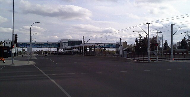
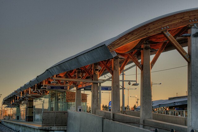
Southgate Station is an LRT station on the Capital Line in Edmonton, Alberta. It is a station located next to the Southgate Centre shopping mall. The station was opened on April 24,2010, with regular service commencing on April 25,2010. Southgate Station is located between South Campus/Fort Edmonton Park Station and Century Park Station and it provides an important transit connection between southwest Edmonton neighbourhoods, the University of Alberta and downtown Edmonton. The station has a 123 metre long centre loading platform that can accommodate two trains at the time, one on each side of the platform. The platform is nine metres wide. It also has a separated pedestrian overpass connecting the station to Southgate Centre and the Southgate Transit Centre to the east. The transit centre features two twenty-foot brick boots, titled Immense Mode, an art piece by Dawn Detarando. It is connected to the station by a pedestrian overpass which also crosses to the west side of 111 Street. The following bus routes serve the centre, Media related to Southgate LRT Station
7.
Arterial road
–
An arterial road or arterial thoroughfare is a high-capacity urban road. The primary function of a road is to deliver traffic from collector roads to freeways or expressways. As such, many arteries are limited-access roads, or feature restrictions on private access, though the design of arterial roads varies from country to country, city to city, and even within cities, they share a number of common design characteristics. For example, in cities, arteries are arranged in concentric circles or in a grid. Many jurisdictions also classify arterial roads as either principal or minor, in traffic engineering hierarchy, an arterial road delivers traffic between collector roads and freeways. For new arterial roads, intersections are often reduced to increase traffic flow, in California, arterial roads are usually spaced every half mile, and have intersecting collector and streets. The Traffic Engineering Handbook describes Arterials as being either principal or minor, both classes serve to carry longer-distance flows between important centers of activity. Arterials are laid out as the backbone of a network and should be designed to afford the highest level of service, as is practical. The construction and development of roads is achieved through two methods. By far the most common is the upgrading of an existing right-of-way during subdivision development, when existing structures prohibit the widening of an existing road however, bypasses are often constructed. Because of the placement and general continuity of arterial road corridors, sewers, water mains, conduits, in North America, traffic signals are used at most intersections. In Europe, large roundabouts are more commonly seen at the busier junctions, speed limits are typically between 30 and 50 mph, depending on the density of use of the surrounding development. In school zones, speeds may be reduced, likewise, in sparsely developed or rural areas. The width of arterial roads can range from four lanes to ten or more, some are divided at the center, while others share a common center lane, such as a contraflow lane or central turning lane. As with other types, environmental consequences derive from arterial roadways, including air pollution generation, noise pollution
8.
Alberta
–
Alberta is a western province of Canada. With an estimated population of 4,196,457 as of July 1,2015, it is Canadas fourth-most populous province and its area is about 660,000 square kilometres. Alberta and its neighbour Saskatchewan were districts of the Northwest Territories until they were established as provinces on September 1,1905, the premier has been Rachel Notley since May 2015. Alberta is bounded by the provinces of British Columbia to the west and Saskatchewan to the east, the Northwest Territories to the north, and the U. S. state of Montana to the south. Alberta is one of three Canadian provinces and territories to only a single U. S. state and one of only two landlocked provinces. About 290 km south of the capital is Calgary, the largest city in Alberta, Calgary and Edmonton centre Albertas two census metropolitan areas, both of which have populations exceeding one million, while the province has 16 census agglomerations. Tourist destinations in the province include Banff, Canmore, Drumheller, Jasper, Alberta is named after Princess Louise Caroline Alberta, the fourth daughter of Victoria, Queen of Canada, and Albert, Prince Consort. Princess Louise was the wife of John Campbell, Marquess of Lorne, Lake Louise and Mount Alberta were also named in her honour. Alberta, with an area of 661,848 km2, is the fourth largest province after Quebec, Ontario and British Columbia. To the south, the borders on the 49th parallel north, separating it from the US state of Montana. The province extends 1,223 km north to south and 660 km east to west at its maximum width, with the exception of the semi-arid steppe of the south-eastern section, the province has adequate water resources. There are numerous rivers and lakes used for swimming, fishing, there are three large lakes, Lake Claire in Wood Buffalo National Park, Lesser Slave Lake, and Lake Athabasca which lies in both Alberta and Saskatchewan. The longest river in the province is the Athabasca River which travels 1,538 km from the Columbia Icefield in the Rocky Mountains to Lake Athabasca, the largest river is the Peace River with an average flow of 2161 m3/s. The Peace River originates in the Rocky Mountains of northern British Columbia and flows through northern Alberta and into the Slave River, Albertas capital city, Edmonton, is located approximately in the geographic centre of the province. It is the most northerly city in Canada, and serves as a gateway. The region, with its proximity to Canadas largest oil fields, has most of western Canadas oil refinery capacity, Calgary is located approximately 280 km south of Edmonton and 240 km north of Montana, surrounded by extensive ranching country. Almost 75% of the population lives in the Calgary–Edmonton Corridor. The land grant policy to the served as a means to populate the province in its early years
9.
Canada
–
Canada is a country in the northern half of North America. Canadas border with the United States is the worlds longest binational land border, the majority of the country has a cold or severely cold winter climate, but southerly areas are warm in summer. Canada is sparsely populated, the majority of its territory being dominated by forest and tundra. It is highly urbanized with 82 per cent of the 35.15 million people concentrated in large and medium-sized cities, One third of the population lives in the three largest cities, Toronto, Montreal and Vancouver. Its capital is Ottawa, and other urban areas include Calgary, Edmonton, Quebec City, Winnipeg. Various aboriginal peoples had inhabited what is now Canada for thousands of years prior to European colonization. Pursuant to the British North America Act, on July 1,1867, the colonies of Canada, New Brunswick and this began an accretion of provinces and territories to the mostly self-governing Dominion to the present ten provinces and three territories forming modern Canada. With the Constitution Act 1982, Canada took over authority, removing the last remaining ties of legal dependence on the Parliament of the United Kingdom. Canada is a parliamentary democracy and a constitutional monarchy, with Queen Elizabeth II being the head of state. The country is officially bilingual at the federal level and it is one of the worlds most ethnically diverse and multicultural nations, the product of large-scale immigration from many other countries. Its advanced economy is the eleventh largest in the world, relying chiefly upon its abundant natural resources, Canadas long and complex relationship with the United States has had a significant impact on its economy and culture. Canada is a country and has the tenth highest nominal per capita income globally as well as the ninth highest ranking in the Human Development Index. It ranks among the highest in international measurements of government transparency, civil liberties, quality of life, economic freedom, Canada is an influential nation in the world, primarily due to its inclusive values, years of prosperity and stability, stable economy, and efficient military. While a variety of theories have been postulated for the origins of Canada. In 1535, indigenous inhabitants of the present-day Quebec City region used the word to direct French explorer Jacques Cartier to the village of Stadacona, from the 16th to the early 18th century Canada referred to the part of New France that lay along the St. Lawrence River. In 1791, the area became two British colonies called Upper Canada and Lower Canada collectively named The Canadas, until their union as the British Province of Canada in 1841. Upon Confederation in 1867, Canada was adopted as the name for the new country at the London Conference. The transition away from the use of Dominion was formally reflected in 1982 with the passage of the Canada Act, later that year, the name of national holiday was changed from Dominion Day to Canada Day
10.
Edmonton Light Rail Transit
–
Edmonton Light Rail Transit, commonly referred to as the LRT, is a light rail system in Edmonton, Alberta. Part of the Edmonton Transit System, the system has 18 stations on two lines and 24.3 km of track, ETS designates the first line as the Capital Line. The 21-kilometre line starts at Clareview in Edmontons northeast and ends at Century Park in Edmontons south end, the Metro Line is a 3. 3-kilometre extension of the system from Churchill LRT Station in downtown Edmonton northwest to NAIT LRT Station. It had been scheduled to open in spring 2014, but was delayed to September 6,2015. The first phase of the 27 kilometres Valley Line, which is planned to run from downtown Edmonton to Mill Woods, in 1962, Canadian Bechtel Ltd. was commissioned to develop a plan for Edmontons rapid transit system. Construction began in 1974 with a budget of $65 million, Edmonton became the first city in North America with a metropolitan population of less than one million to build a modern light rail system. The population was just over 445,000 when construction started on the route in 1974 and it also became the first city in Western Canada to operate a rapid transit system. Testing of the new line started in 1977 with regular service starting April 22,1978, the original line was 6.9 km long. When the line opened, fare collection was modelled on traditional rapid transit lines, low volumes of activity at some entrances led to weekend closures of alternate station entrances. In November 1980, Edmonton Transit switched to a modified European-style proof of payment system, fares were now collected by automated ticket vending machines with irregular proof of payment inspectors, which permitted keeping all entrances open and required fewer staff. On April 26,1981, ETS opened an extension of 2.2 km on the CN right-of-way to Clareview Station. In June 1983, the rail tunnel downtown was extended by 0.8 km to Bay. The D. L. MacDonald Yard, between Belvedere and Clareview, opened in December 1983 to store and service the vehicles, the line was extended in September 1989 by 0.8 km to Grandin Station. On August 23,1992, the extension opened from Grandin to University Station. Menzies Bridge, crossing the North Saskatchewan River with a level for pedestrians and cyclists. Major upgrades to the Belvedere and Clareview stations were made in 1998 and 2001 respectively, on January 1,2006, the line was extended 0.6 km south through the University Campus to Health Sciences Station, which is located at street level. On April 25,2009, McKernan/Belgravia and South Campus stations were opened as part of the south LRT expansion, with Southgate and Century Park opening on April 24,2010. The first of the new Siemens SD-160 light rail vehicle train cars for the new extension were shipped by rail from Florin, California, on April 24,2008, arriving in Edmonton on May 9,2008
11.
Southgate Centre
–
Southgate Centre is a shopping centre located in south Edmonton, Alberta, Canada, covering just under 90,000 square metres. It contains 165 retailers including Hudsons Bay, Aritzia, Zara, Michael Kors, BCBGMAXAZRIA, Coach, browns Shoes and Edmontons only Restoration Hardware and Crate & Barrel. Apple opened a store in Edmonton at Southgate Centre on May 28,2010. The Centre is located adjacent to Whitemud Drive and 111 Street, and is located across from a transit bus station. Following major expansion, the mall marked its reopening in August 2009, including a new food court and added parking. These expansions included 40 new stores under a new parking deck. An Edmonton Public Library branch operated until 2002, when it relocated to nearby Whitemud Crossing, Hudsons Bay 21,976 square metres Safeway 4,884 square metres Sears 24,435 square metres On August 12,2010, Southgate celebrated the 40th anniversary of its opening. In 1993, Woodwards went bankrupt, its space was converted to Eatons, in addition, Safeway occupied the food floor of the former Woodwards. Southgate Centre Ivanhoe Cambridge Leasing Fact Page
12.
Transit-oriented development
–
In urban planning, a transit-oriented development is a type of urban development that maximizes the amount of residential, business and leisure space within walking distance of public transport. A TOD typically includes a transit stop surrounded by a high-density mixed-use area. A TOD is also designed to be more walkable than other built-up areas, through using smaller block sizes. Many of the new towns created after World War II in Japan, Sweden, in the United States, a half-mile-radius circle has become the de facto standard for rail-transit catchment areas for TODs. A half mile corresponds to the distance someone can walk in 10 minutes at 3 mph and is an estimate for the distance people will walk to get to a rail station. The half-mile ring is a more than 500 acres in size. Another key feature of transit-oriented development that differentiates it from transit-proximate development is reduced amounts of parking for personal vehicles, many cities throughout the world are developing TOD policy. One of the earliest and most successful examples of TOD is Curitiba, Curitiba was organized into transport corridors very early on in its history. Over the years, it has integrated its zoning laws and transportation planning to place high-density development adjacent to high-capacity transportation systems, the source of innovation in Curitiba has been a unique form of participatory city planning that emphasizes public education, discussion and agreement. This is simultaneously being implemented along with a bus transit system called Transmetro. Calgary is home to a very successful TOD community called The Bridges, the Bridges is home to a diverse range of condos, shops, services, and parks. Some other TODs currently being constructed are London and Westbrook, both high rise condo and retail communities in areas of the City. The City continues to create TOD policy for other Calgary communities, Calgary City Council has allocated funding for the creation of six Station Area Plans around the city, to guide increasing development pressure around some of the light rail transit stations. On June 9,2008, Calgary City Council approved the first station area plan in Calgarys history, most of the suburban high rises were not along major rail lines like other cities until recently, when there has been incentive to do so. Century Park is a growing community in southern Edmonton at the south end of Edmontons LRT. It will include low to high rise condos, recreational services, shops, restaurants, Edmonton is also looking into some new TODs in various parts of the city. In the northeast, there are plans to redevelop underutilized land at two sites around existing LRT, Fort Road and Stadium Station, according to the Metropolitan Development and Planning Regulation of late 2011, 40% of new households will be built as TOD neighbourhoods. Toronto has a policy of encouraging new construction along the route of its primary Yonge Street subway line
13.
Alberta Highway 2
–
Running primarily north to south for approximately 1,273 kilometres, it is the longest and busiest highway in the province carrying nearly 170,000 vehicles per day in central Calgary. The majority of Albertas 4 million residents live in the Calgary–Edmonton Corridor that is bisected by Highway 2. U. S. Route 89 enters Alberta from Montana and becomes Highway 2, in Calgary, the route is a busy freeway named Deerfoot Trail that continues into central Alberta as the Queen Elizabeth II Highway, bypassing Red Deer and bisecting Leduc. In Edmonton, it is concurrent with freeway sections of Highways 216 and 16. It exits the Capital Region through the city of St. Albert, Highway 2 was originally numbered as Highway 1 and is one of the oldest major highways in Alberta, historical names include the Calgary and Edmonton Trail, Sunshine Trail, and the Blue Trail. In southern Alberta, the highway comprised a portion of the proposed Glacier-to-Gulf Motorway that ran from Calgary to Mexico. Major changes include the construction of an expressway between Calgary and Edmonton in the 1960s, realignment along Deerfoot Trail in the 1980s. A1998 Highway 43 realignment shortened Highway 2 by nearly 90 km to its current northern terminus in Grande Prairie, bypasses of Fort Macleod, Claresholm, and Nanton are planned as part of Albertas effort to make its portion of the CANAMEX Corridor free-flowing from border to border. Highway 2 is a route in the National Highway System of Canada. As the main access in Alberta, Highway 2 is the preferred path of the CANAMEX Corridor. Highway 2 begins at the United States border, as the two lane U. S. Route 89 crosses into Canada at Carway, the road proceeds north through the Rocky Mountain Foothills to a brief concurrency with Highway 501, before bisecting the town of Cardston. Less than 1 km before meeting Highway 3 southeast of Fort Macleod, Highway 3 splits east to Lethbridge, and the combined Highways 2 and 3 turn due west through town as a divided highway at a speed limit of 50 km/h. It continues approximately 25 km north to Granum from which Highway 519 splits to the east, in tandem with Highway 23, Highway 519 is often used by CANAMEX traffic to bypass Fort Macleod. Further north on Highway 2, the towns of Claresholm and Nanton are each bisected at reduced speed limit of 50 km/h, the highway is concurrent with Highway 533 for its brief distance through Nanton. North of Nanton, the highway continues into the Municipal District of Foothills to a junction with Highways 23. From its split with Macleod Trail, Highway 2 becomes a major freeway named Deerfoot Trail that descends to cross the Bow River before entering Calgary city limits, in the city it crosses the river twice more, jogging back and forth between its east and west bank. Deerfoot Trail then merges with the routes of Anderson Road. The Deerfoot Trail designation is dropped, and the highway carries on north into Rocky View County, Highway 2 exits north Calgary as a six lane freeway called the Queen Elizabeth II Highway, a name it retains until the southern city limit of Edmonton
14.
Capital Line
–
The Edmonton LRT Capital Line is a light rail transit line running from northeast Edmonton to the south. Operated by the Edmonton Transit System, the line access to Downtown Edmonton. The Capital Line currently consists of fifteen stations, six of which are underground, seven stations are shared with the Metro Line. On April 22,1978 the line opened between Belvedere and Central stations, at the time the system consisted solely of the single line. It was not named the Capital Line until 2012 when expansion plans were revealed for additional lines, the 1980s were a decade of expansion for the Capital Line. It expanded northwards toward Clareview in 1981, and westwards toward Bay and Corona, another underground extension was completed in 1989 with the opening of Grandin Station. One station opened in the 1990s, University, in August 1992, the underground station was connected to the downtown leg by the Dudley B. During the 2000s, under the mayorship of Stephen Mandel, the Capital Line was expanded southward, health Sciences opened in 2006, the first new station in 14 years. In 2009, McKernan/Belgravia and South Campus opened, followed by Southgate, after the completion of the south leg of the Capital Line, city council shifted their efforts towards the new Metro Line. In January 2008, Mayor Stephen Mandel announced that the leg will be extended further south along 111 Street to Anthony Henday Drive. There are no current plans for an extension to the Edmonton International Airport, in late April 2012, the city launched bus route 747 from Century Park Station to the airport. In 2008, Edmonton City Council approved a plan to extend the Capital Line northeast by one station to Gorman Towne Centre, the expansion beyond Clareview Station was planned to continue along the CN right-of-way to a station and park-and-ride north of 153 Avenue and Victoria Trail. The plan would have received funding from three levels of government, however, funding was shifted to the Metro Line in July 2009 as city officials saw that line as a higher priority for the city. The city has not ruled out an extension to Gorman. The City completed preliminary engineering on this project in 2010, however there is no budget or timeline for design and this ASP qualifies that this is a potential alignment only, and will be updated to reflect the completed planning for the Northeast LRT when a final route is determined. Edmonton Transit System Edmonton Transit System–Future LRT
15.
Rutherford, Edmonton
–
Rutherford is a neighbourhood in south Edmonton, Alberta, Canada. It is named after Alexander Cameron Rutherford, Albertas first premier, according to the 2005 municipal census, approximately 85% of the residences in the neighbourhood are single-family dwellings. The remainder are duplexes with a small number of row houses. The majority of residences are owner-occupied, in the City of Edmontons 2012 municipal census, Rutherford had a population of 8,407 living in 3,498 dwellings, a 28. 9% change from its 2009 population of 6,521. With a land area of 2.26 km2, it had a density of 3,719.9 people/km2 in 2012
16.
Blackmud Creek, Edmonton
–
Blackmud Creek is a new residential neighbourhood in south west Edmonton, Alberta, Canada. The neighbourhood is bounded on the west by the James Mowat Trail, to the east and south, the neighbourhood overlooks the Blackmud Creek Ravine. In the City of Edmontons 2012 municipal census, Blackmud Creek had a population of 2,577 living in 942 dwellings, with a land area of 0.78 km2, it had a population density of 3,303.8 people/km2 in 2012. > Blackmud Creek is a neighbourhood that developed after the 2001 federal census, according to the 2005 municipal census, the most common type or residence in the neighbourhood is the single-family dwelling. These account for nine out of ten residences in the neighbourhood. The remaining residences are duplexes and apartment style condominiums in buildings with fewer than five stories. Substantially all residences in the neighbourhood are owner-occupied
17.
Richford, Edmonton
–
Richford is a newer neighbourhood in south west Edmonton, Alberta, Canada overlooking the Blackmud Creek Ravine. According to the 2005 municipal census, there were 161 residences in the neighbourhood, the neighbourhood is bounded on the south by Ellerslie Road and on the west by the James Mowat Trail. To the north and east the neighbourhood is bounded by the Blackmud Creek Ravine, the most common type of residence in the neighbourhood, according to the 2005 municipal census, is single-family dwelling. These account for two out of three of all the residences in the neighbourhood. The remaining one in three residences are duplexes, substantially all of all residences are owner-occupied with only a few being rented. The Ellerslie Rugby Park is located in Richford, in the City of Edmontons 2012 municipal census, Richford had a population of 530 living in 209 dwellings, a 0. 2% change from its 2009 population of 529. With a land area of 0.59 km2, it had a density of 898.3 people/km2 in 2012
18.
MacEwan, Edmonton
–
MacEwan is a residential neighbourhood in south Edmonton, Alberta, Canada. Approximately half of the residences are single-family dwellings according to the 2005 municipal census, another three in ten are rented apartments and apartment style condominiums. The remaining one in five are duplexes, four out of five residences are owner-occupied with only one in five being rented. On July 21,2007, a $20 million fire destroyed a 149 unit condominium complex, the fire, which was attributed to arson, was the largest residential fire in Edmonton history. There is a school in the neighbourhood, Victory Christian School. The neighbourhood is bounded on the north by the Anthony Henday Drive, on the west by 127 Street, on the east by 111 Street, and on the south by Ellerslie Road. In the City of Edmontons 2012 municipal census, MacEwan had a population of 5,629 living in 2,433 dwellings, with a land area of 1.16 km2, it had a population density of 4,852.6 people/km2 in 2012
19.
Blackburne, Edmonton
–
Blackburne is a newer neighbourhood in south west Edmonton, Alberta, Canada. It is an irregularly shaped neighbourhood whose south west boundary overlooks the Blackmud Creek Ravine and it is bounded by Anthony Henday Drive to the north and by Calgary Trail to the east. A small portion of the neighbourhood extends across Blackmud Creek to 111 Street in the west, according to the 2001 federal census, all residential construction in Blackburne occurred after 1990. The most common type of residence in the neighbourhood, according to the 2005 municipal census, is the single-family dwelling and these account for seven out of every ten of all the residences in the neighbourhood. Duplexes are the next most common, accounting for one out every seven of all the residences in the neighbourhood. The remaining residences are divided almost equally between row houses and apartment style condominiums in buildings with fewer than five stories. Substantially all residences in the neighbourhood are owner-occupied, in the City of Edmontons 2012 municipal census, Blackburne had a population of 1,520 living in 593 dwellings, a 0. 7% change from its 2009 population of 1,510. With a land area of 0.72 km2, it had a density of 2,111.1 people/km2 in 2012
20.
Twin Brooks, Edmonton
–
Twin Brooks is a residential neighbourhood in south Edmonton, Alberta, Canada. It is located at the confluence of the Whitemud Creek and the Blackmud Creek, an artificial lake is situated in the neighbourhood, with George P. Nicholson Elementary School located near it. The neighbourhood is triangle shaped with the Whitemud Creek on its western boundary, Blackmud Creek on the north east. Access to the neighbourhood is either by 111 Street over the Blackmud Creek to the north, there are also plans for the LRT to be extended along 111 Street. Twin Brooks is a newer neighbourhood, according to the 2001 Federal Census, all but a handful of the homes were constructed after 1985. Seventeen out of twenty of the homes are single-family dwellings, with most of the remainder being duplexes according to the 2005 municipal census, almost all the occupied private dwellings are owner-occupied. The average number of people per household is three, the only commercial building in the community is an Esso gas station along 111 Street. As of December,2006, the City of Edmonton is planning to develop housing units near George P. Nicholson School, plans to build commercial and professional buildings in the same area have also been received negatively by residents. In the City of Edmontons 2012 municipal census, Twin Brooks had a population of 6,435 living in 2,273 dwellings, with a land area of 2.14 km2, it had a population density of 3,007 people/km2 in 2012. City of Edmonton neighbourhood profile Google Maps
21.
Skyrattler, Edmonton
–
Skyrattler is a residential neighbourhood in south west Edmonton, Alberta, Canada. The neighbourhood is named after Chief Skyrattler of the Winterburn band, in the City of Edmontons 2012 municipal census, Skyrattler had a population of 1,947 living in 1,172 dwellings, a -9. 1% change from its 2009 population of 2,143. With a land area of 0.62 km2, it had a density of 3,140.3 people/km2 in 2012. While a portion of the residences in the neighbourhood were built during the 1960s, according to the 2001 federal census, most residential development occurred during the 1970s and 1980s. Four out of ten of all residences were built during the 1970s, just over half were built during the 1980s. By 1990, residential development in the neighbourhood was substantially complete and this neighbourhood is bounded on the north by 23 Avenue, on the east by 111 Street, and on the west and south west by Blackmud Creek. Row houses and low-rise apartments make the majority of housing in Skyrattler, according to the 2005 municipal census, just under half of all residences are rented apartments and apartment styple condomuniums in low-rise buildings with fewer than five stories. Row houses account for one in four residences, one in six are single-family dwellings and one in eight are duplexes. Approximately half of all residences are owner-occupied and half are rented, the neighbourhood population is fairly mobile. According to the 2005 municipal census, one in five residents had moved within the twelve months. Less than half of all residents had lived at the address for five years or longer. The Taylor University College and Seminary is located in Skyrattler
22.
Keheewin, Edmonton
–
Keheewin is a residential neighbourhood located in south west Edmonton, Alberta, Canada. The name means eagle in the Cree language, the neighbourhood is bounded on the west by 111 Street, on the east by Calgary Trail/Gateway Boulevard, and on the north by 23 Avenue. The south boundary is located half a block south of 18 Avenue. Calgary Trail provides access to south of the city including the Edmonton International Airport. Gateway Boulevard provides access to Old Strathcona, the University of Alberta, in the City of Edmontons 2012 municipal census, Keheewin had a population of 2,922 living in 1,251 dwellings, a 0. 9% change from its 2009 population of 2,897. With a land area of 1.27 km2, it had a density of 2,300.8 people/km2 in 2012. According to the 2001 federal census, most residential development in the neighbourhood occurred after 1970, approximately one in seven residences were built during the 1970s. Three out of five residences were built during the 1980s. One in five of all residences were built during the 1990s, the neighbourhood description in the City of Edmonton <http, //maps. edmonton. ca map utility> indicates residential development is not yet complete. The most common type of residence, according to the 2005 municipal census, is the single-family dwelling and these account for half of all residences in Keheewin. Rented apartments and apartment style condominiums in buildings with fewer than five stories account for approximately one residence in three. One in ten residences are row houses, most of the remainder are duplexes. Five out of six of all residences are owner-occupied with only one in six being rented. There is one school in the neighbourhood, Keheewin Elementary School, the Kinsmen Twin Arena is also located in the Keheewin. Residents have access to shopping and services located in South Edmonton Common located just to the east of the neighbourhood, the neighbourhood is served by the Century Park LRT station. The station is located immediately to the north of the neighbourhood along 111 Street
23.
Ermineskin, Edmonton
–
Ermineskin is a residential neighbourhood in south west Edmonton, Alberta, Canada. The neighbourhood is named for Chief Ermineskin of Hobbema, the neighbourhood is bounded on the west by 111 Street, on the south by 23 Avenue, and on the east by Calgary Trail and Gateway Boulevard. The north boundary is a utility corridor located just to the north of 29 Avenue. In the City of Edmontons 2012 municipal census, Ermineskin had a population of 5,247 living in 2,749 dwellings, with a land area of 1.2 km2, it had a population density of 4,372.5 people/km2 in 2012. Approximately two out of five were built during the 1970s. Another one in three were built during the 1980s, one in five were built during the 1990s. During the first decade of the 21st century, redevelopment of the old Heritage Mall site, located in south west Erminskin and this new development is called Century Park. The new Century Park LRT station is located adjacent to the Century Park Development, according to the 2005 municipal census, the most common type of residences in the neighbourhood are rented apartments and apartment style condominiums. These account for two out of every three residences in the neighbourhood. Approximately half of all apartment style residences are in buildings with fewer than five stories while the other half are in high-rise buildings with five or more stories. One residence in six are single-family dwellings and one residence in eight are row houses, one in twenty are duplexes Almost three out of every four residences in the neighbourhood are rented, while just over on in four are owner-occupied. The population in Ermineskin is highly mobile, according to the 2005 municipal census, one resident in four had moved within the previous twelve months. Another one in four had moved within the one to three years. Only one resident in three had lived at the address for five years or longer. There are no schools in Ermineskin, sophia Catholic School in Sweet Grass St. Teresa Catholic Elementary School in Blue Quill St. Augustine Catholic Elementary School in Duggan Ermineskin Neighbourhood Profile
24.
Blue Quill, Edmonton
–
Blue Quill is a residential neighbourhood located in south west Edmonton, Alberta, Canada. Blue Quill and the adjacent neighbourhood of Blue Quill Estates are named to honour Chief Blue Quill of the Saddle Lake Band and it is bounded on the south by 23 Avenue, on the east by 111 Street, and on the west by 119 Street. The north boundary is Saddleback Road east of 115 Street, at 115 Street, Saddleback Road turns south and cuts through the neighbourhood. The south west corner of the overlooks the Blackmud Creek Ravine. In the City of Edmontons 2012 municipal census, Blue Quill had a population of 4,568 living in 2,042 dwellings, with a land area of 1.06 km2, it had a population density of 4,309.4 people/km2 in 2012. According to the 2001 federal census, almost two out of three of all residences in the neighbourhood were built during the 1970s. Another one in four of all residences were built during the 1980s, a small number of residences were built before 1970 and a small number were built after 1990. The most common type of residence in Blue Quill, according to the 2005 municipal census, is the apartment in low-rise buildings with fewer than five stories. These account for six out of every ten of all residences in the neighbourhood. Single-family dwellings account for three out of every ten of residences. The remaining dwellings are a mixture of row houses and duplexes, just over three out of every five of all residences are rented while only two out of every five are owner-occupied. The population in the neighbourhood is highly mobile, according to the 2005 municipal census, one out of every four of all residents had moved within the previous twelve months. Another three out of ten had moved within the previous one to three years. Only one resident in three had lived at the address for at least five years. The Derrick Golf and Winter Club is located to the north west in the neighbourhood of Westbrook Estates. There is a school in the neighbourhood, St. Teresa Catholic Elementary School. The Taylor Baptist Semininary is located to the south of Blue Quill in the neighbourhood of Skyrattler
25.
Steinhauer, Edmonton
–
Steinhauer is a residential neighbourhood in SW Edmonton. The neighbourhood is named for a missionary who settled in Alberta during the mid-1800s, the neighbourhood is bounded on the west by 111 Street, on the east by Calgary Trail, on the north by 34 Avenue. The boundary on the south is a utility corridor located just north of 29 Avenue, in the City of Edmontons 2012 municipal census, Steinhauer had a population of 1,867 living in 788 dwellings, a -13. 8% change from its 2009 population of 2,167. With a land area of 0.92 km2, it had a density of 2,029.3 people/km2 in 2012. Development of the neighbourhood began after 1970, according to the 2001 federal census, approximately nine out of every ten residences were constructed during the 1970s. Most of the remainder were constructed during the 1980s, residential development was complete by 1990. The most common type of residence in the neighbourhood, according to the 2005 municipal census, is the single-family dwelling and these account for almost three out of every four of all the residences in the neighbourhood. Almost all of the residences are row houses. There is a duplex in the neighbourhood, nine out of ten of all residences are owner-occupied with only one residence in ten being rented. There is a school in the neighbourhood, Steinhauer Elementary School. The neighbourhood is served by the Century Park LRT station located to the south in the neighbourhood of Ermineskin
26.
Greenfield, Edmonton
–
Greenfield, also known as Petrolia, is a residential neighbourhood located in southwest Edmonton, Alberta, Canada. While the official name of the neighbourhood is Greenfield, some residents will refer to the area as Petrolia, there is a small shopping centre, Petrolia Shopping Centre, located in the neighbourhood. The neighbourhood was named for Herbert Greenfield, the Premier of Alberta from 1921 to 1925, the most common type of residence in the neighbourhood is single-family dwelling, which accounts for approximately nine out of ten of all residences. The remaining residences are split equally between apartments in buildings and duplexes. While all the apartments and half the duplexes are rented, the majority of residences are owner occupied, there are three schools in the neighbourhood. The Greenfield Public School is operated by the Edmonton Public School System, in addition, there is the Academy for Maths and Science now located in the Petrolia Shopping Centre. In addition to the Petrolia Shopping Centre, residents have good access along 111 Street to Southgate Centre,111 Street also gives residents access to the new LRT stations at Southgate and Century Park. In the City of Edmontons 2012 municipal census, Greenfield had a population of 3,640 living in 1,430 dwellings, with a land area of 1.53 km2, it had a population density of 2,379.1 people/km2 in 2012. The average household income in Greenfield is higher than the household income in the larger City of Edmonton. The neighbourhood is bounded on the east by 111 Street, on the west by 119 Street, on the north by 40 Avenue, list of Alberta premiers Greenfield Community League
27.
Rideau Park, Edmonton
–
Rideau Park is a residential neighbourhood in south west Edmonton, Alberta, Canada. The name Rideau means curtain in the French Language, whitemud Drive provides access to destinations in west Edmonton, including West Edmonton Mall. Calgary Trail provides access to south of the city, including the Edmonton International Airport. 111 Street provides access to Southgate Centre, the University of Alberta, the downtown core, and Whyte Avenue. In the City of Edmontons 2012 municipal census, Rideau Park had a population of 1,883 living in 1,136 dwellings, with a land area of 0.8 km2, it had a population density of 2,353.8 people/km2 in 2012. According to the 2001 federal census, most of the development in the neighbourhood occurred during the 1970s. It was during this time that four out of five of all residences were built. Most of the residences were built during the 1960s when one out of every seven were built. The most common type of residence, according to the 2005 municipal census, are rented apartments, apartments account for just over half of all residences while apartment style condominiums account for one out of every eight of all residences. Most of the residences are single-family dwellings. There are a number of duplexes in the neighbourhood. Just over half of all residences are rented with just under half being owner occupied, the population in the neighbourhood is comparatively mobile. According to the 2005 municipal census, just under one in five of all residents had moved within the twelve months. Almost one resident in four had moved within the one to three years. Just under half of all residents had lived at the address for at least five years. There are two schools in the neighbourhood, both operated by the Edmonton Public School System, there is also a small strip shopping centre located in the neighbourhood. The neighbourhood is served by the Southgate LRT station
28.
Royal Gardens, Edmonton
–
Royal Gardens is a residential neighbourhood in south west Edmonton, Alberta, Canada. The neighbourhood is bounded on the north by Whitemud Drive, on the east by 111 Avenue, on the south by 40 Avenue, the residents of the community have public transportation access to the LRT system at Southgate Station. In the City of Edmontons 2012 municipal census, Royal Gardens had a population of 3,481 living in 1,461 dwellings, with a land area of 1.22 km2, it had a population density of 2,853.3 people/km2 in 2012. Most of the development in the neighbourhood occurred during the 1960s when, according to the 2001 federal census. Another one in four of residences were built during the 1970s, according to the 2005 municipal census, the neighbourhood has a mixture of dwelling types with the most common type of residence being the single-family dwelling. Single-family dwellings account for two out of five of all residences in the neighbourhood. Another one in three residences are rented apartments and apartment style condominiums, one in five of residences are row houses. The remaining 4% are duplexes, triplexes, or quadruplexes, three out of five residences are owner-occupied while two out of five are rented. The population of Royal Gardens is comparatively mobile, according to the 2005 municipal census, one in five residents had moved within the previous 12 months. Another one in four residents had moved within the one to three years. At the same time, two out of five residents had lived at the same address for at least five years. There are four schools in the neighbourhood, richard Secord School and Harry Ainlay High School are both operated by the Edmonton Public School System. St. Bonifice Catholic Elementary School and Louis St. Laurent School are operated by the Edmonton Catholic School System, the Confederation Pool is located in the neighbourhood. Residents of Royal Gardens have good access to shopping, Southgate Centre, a major shopping mall, is located to the immediate north east. Whitemud Drive provides access to West Edmonton Mall, in addition, there is the Petrolia Shopping Centre in the neighbourhood of Greenfield to the south
29.
Malmo Plains, Edmonton
–
Malmo Plains is a residential neighbourhood in south west Edmonton, Alberta, Canada. The University of Alberta family residences, called Michener Park, comprise the west end of the neighbourhood, the neighbourhood is named for a type of soil, malmo silty clay loam, common in the area. The neighbourhood is bounded on the west by 122 Street, on the east by 111 Street, on the north by 51 Avenue and on the south by Whitemud Drive. In the City of Edmontons 2012 municipal census, Malmo Plains had a population of 3,305 living in 1,305 dwellings, with a land area of 0.94 km2, it had a population density of 3,516 people/km2 in 2012. Most of the construction in the neighbourhood occurred during the 1960s. The most common type of residence in the neighbourhood is the single-family dwelling, the remaining residences are split almost equally between apartments and row houses. Most of the dwellings are owner-occupied, while most of the apartments are rented. In addition to a pair of small shopping centres located in adjacent neighbourhoods, residents have access to Southgate Centre. There are two schools in the neighbourhood, the Malmo Plains Elementary School operated by the Edmonton Public School System, the neighbourhood is served by the Southgate LRT station, which opened on April 24,2010. Malmo Plains Neighbourhood Profile Michener Park Malmo Community League
30.
Empire Park, Edmonton
–
Empire Park is a residential neighbourhood in south west Edmonton, Alberta, Canada. A major shopping centre, Southgate Centre, is located at the west end of the neighbourhood, the neighbourhood is bounded on the south by Whitemud Drive, on the west by 111 Street, on the north by 51 Avenue, and on the east by Calgary Trail. Whitemud Drive provides access to destinations in west Edmonton, including West Edmonton Mall, Calgary Trail provides access to destinations south of the city, including the Edmonton International Airport. 111 Street provides access to the University of Alberta, the downtown core, according to the 2001 federal census, most of the residential development in Empire Park occurred during the 1960s and 1970s. Approximately one residence in five was constructed between 1961 and 1970, half the residences were constructed between 1971 and 1980. One residence in seven was built during the 1980s, residential development was substantially complete by 1990. The most common type of residence in the neighbourhood, according to the 2005 municipal census, is the rented apartment, row houses account for one residence in five. The remaining residences are duplexes and single-family dwellings, substantially all residences in the neighbourhood are rented, with only one residence in twenty are owner-occupied. The population in Empire Park is highly mobile, according to the 2005 municipal census, one in three residents had moved within the previous twelve months. Another one in three had moved within the one to three years. Less than one resident in four had lived at the address for five years or longer. The neighbourhood is served by the Southgate LRT Station, there are two schools in the neighbourhood, L. Y. Cairns School and the McKee Elementary School, in the City of Edmontons 2012 municipal census, Empire Park had a population of 5,186 living in 2,467 dwellings, a 7. 9% change from its 2009 population of 4,808. With a land area of 1.07 km2, it had a density of 4,846.7 people/km2 in 2012
31.
Lendrum Place, Edmonton
–
Lendrum Place is a residential neighbourhood located in south west Edmonton, Alberta, Canada. It is named for Robert Lendrum, a land surveyor. According to the 2001 federal census, the majority of construction in Lendrum Place occurred during the 1960s. It was at time that four out of five of residences were constructed. Another one in ten were constructed between the end of World War II in 1945 and 1960, the remaining 7. 6% of the residences were built between 1970 and 1985. Four out of five of all residences, according to the 2005 municipal census, were single-family dwellings, the remaining one in five residences were rented apartments in low-rise buildings with fewer than five stories. Three out of four of all residences are owner-occupied with only one in four are rented. There are three schools in the neighbourhood, Lendrum School and Avalon Junior High School are both operated by the Edmonton Public School System. St. Martin Catholic Elementary School is operated by the Edmonton Catholic School System, Southgate Centre, a major shopping mall, is located to the south east in the adjoining neighbourhood of Empire Park. There is also a shopping centre located along the east edge of the neighbourhood. The neighbourhood is served by both the South Campus/Fort Edmonton Park and Southgate LRT stations, the neighbourhood is bounded on the north by 61 Avenue, on the south by 51 Avenue, on the east by 111 Street, and on the west by 115 Street. In the City of Edmontons 2012 municipal census, Lendrum Place had a population of 1,888 living in 846 dwellings, with a land area of 0.86 km2, it had a population density of 2,195.3 people/km2 in 2012
32.
Partial cloverleaf interchange
–
A partial cloverleaf interchange or parclo is a modification of a cloverleaf interchange. The design has been received, and has since become one of the most popular freeway-to-arterial interchange designs in North America. It has also used occasionally in some European countries, such as Germany, Croatia, Italy, the Netherlands. A diamond interchange has four ramps, a cloverleaf interchange has eight ramps, as does a stack interchange. These are fully separated, unlike a parclo - traffic flows without stops on all ramps. A parclo has four or six ramps, not very common are five ramps to handle a specific demand, in Ontario, the specific variation is identified by a letter/number suffix after the name. Other jurisdictions do not have naming conventions, so Ontarios naming conventions are used in this article, the letter A designates that two ramps meet the freeway before the driver crosses the arterial road, while B designates that two ramps meet the freeway past the crossing. The number designates how many quadrants of the interchange contain ramps, in left-hand drive countries, the ramps function the same as in right-hand drive countries, but ramps with the same designation appear visually reversed. Common parclo configurations include the Parclo A2, Parclo B2 and Parclo A4, Parclo A2 and B2 configurations contain four ramps. On each side of the freeway there is a loop ramp, in Parclo A2, the loop ramps serve as on-ramps and the directional ramps serve as off-ramps. In Parclo B2 the roles are reversed, both on- and off-ramps require controlled intersections at the arterial road. The Parclo A2 and B2 ramps are usually longer and allow for higher speeds than their A4 counterparts because of rural land availability. It is possible to upgrade an A2 to an A4 by adding directional ramps, the Parclo A-4 contains 6 ramps. On each side on the freeway, there is a ramp, followed by a loop ramp. This also makes sense since freeways have a higher capacity than arterials and right-turn ramps serve effectively to absorb capacity. Some parclos have the right-turning on-ramp leave the road after the exit ramp intersection. This configuration is used when another road meets the freeway off-ramp. Traffic exiting the freeway to the road is provided with a long, relatively straight exit ramp
33.
Century Park station (Edmonton)
–
Century Park Station is an LRT station on the Capital Line in Edmonton, Alberta. It is a station located at 111 Street near 23 Avenue. Century Park is currently the terminus of both the Capital Line and the Metro Line. The station was opened on April 24,2010, with regular service commencing on April 25,2010. The station has a 123 metre long centre loading platform that can accommodate two trains at the time, one on each side of the platform. The platform is nine metres wide. It also has a separated pedestrian overpass connecting the platform to the Century Park Transit Centre. A1,230 stall park and ride lot is adjacent to the station, titled Continuum, Century Park Station is decorated with three suspended wire spheres covered in maple leaves. Blue Quill Century Park Ermineskin Keheewin Skyrattler Steinhauer Sweet Grass The Century Park Transit Centre is located on the east side of 111 Street, the transit centre has climate controlled waiting rooms and public washrooms. It is connected to the station by a pedestrian overpass which also crosses to the west side of 111 Street. East of the centre is the 1230 space park and ride lot. Originally named the Kaskitayo Transit Centre, the centre was renamed to Heritage Transit Centre in 2000. The Century Park Transit Centre offers connections to much of South Edmonton, as well as the Edmonton International Airport, the following bus routes serve the transit centre, Media related to Century Park at Wikimedia Commons}
34.
Diamond interchange
–
A diamond interchange is a common type of road junction, used where a freeway crosses a minor road. The freeway itself is grade-separated from the road, one crossing the other over a bridge. The two places where the meet the road are treated as conventional intersections. The diamond interchange uses less space than most types of freeway interchange, thus, diamond interchanges are most effective in areas where traffic is light and a more expensive interchange type is not needed. The at-grade variant of the interchange is the split intersection. Because roundabouts can generally handle traffic with fewer approach lanes than other intersection types and this configuration allows other roads to form approach legs to the roundabouts and also allows easy U-turns. This type of interchange is common in the United Kingdom and Ireland, an example in Canada is found on the Pat Bay Highway in North Saanich, British Columbia, near Victoria International Airport. These two raindrop roundabouts are fused together, forming a single squashed roundabout and this configuration reduces conflicts between vehicles entering the raindrop roundabouts from the ramps, reducing queueing and delays, compared with the dumbbell interchange. Direct U-turns are not possible, although the movement can be made by circulating around both raindrop roundabouts, several interchanges similar to those along Keystone Parkway are being built along the new US31 freeway under construction in northern Indiana. There are some hybrid interchanges of dumbbell and dogbone having one raindrop and this is made when the roundabout intersects more roads than the cross street and ramps. Such a design is found in Perth, Western Australia, between Roe Highway and Berkshire Road, the pair of intersections where the ramps meet the minor road are closely spaced. This spacing forces the turn lanes for each direction to run each other. In a Diverging diamond interchange or, on the bridge the roadways of the street are being exchanged like left-hand traffic to save the third traffic signal phase. In a Three-level diamond interchange, the street is built in a third level with free flowing traffic as a second arterial road. The intersection is split up into four intersections, handling just two conflicting directions each, a two-leg CFI, also in San Marcos, was built in 2015 at the intersection of Hopkins Street, I-35s frontage roads and I-35s Texas U-turns. In both intersections, the left turn lanes merge with the Texas U-turn lanes. Where HOV lanes are present for carpooling, the ramps of a diamond interchange may be folded to the inside instead of the outside. This in turn reduces waiting time for motorists at traffic lights on the smaller road, roads portal City of Carmel, Indiana, USA, Roundabouts page Diverging Diamond Interchange Informational Guide Federal Highway Administration
35.
109 Street, Edmonton
–
109 Street is an arterial road in central Edmonton, Alberta, Canada. It takes travelers out of Downtown to the south to Old Strathcona and it passes several Edmonton landmarks including the Garneau Theatre, Alberta Legislature Building, MacEwan University, RCMP K Division Headquarters, and Kingsway Mall. It is a street, southbound, from 97 Avenue to Saskatchewan Drive. Before Edmontons amalgamation with Strathcona in 1912, the Edmonton portion was known as 9 Street
36.
Google
–
Google is an American multinational technology company specializing in Internet-related services and products. These include online advertising technologies, search, cloud computing, software, Google was founded in 1996 by Larry Page and Sergey Brin while they were Ph. D. students at Stanford University, in California. Together, they own about 14 percent of its shares, and they incorporated Google as a privately held company on September 4,1998. An initial public offering took place on August 19,2004, in August 2015, Google announced plans to reorganize its various interests as a conglomerate called Alphabet Inc. Google, Alphabets leading subsidiary, will continue to be the company for Alphabets Internet interests. Upon completion of the restructure, Sundar Pichai became CEO of Google, replacing Larry Page, rapid growth since incorporation has triggered a chain of products, acquisitions, and partnerships beyond Googles core search engine. The company leads the development of the Android mobile operating system, the Google Chrome web browser, and Chrome OS, the new hardware chief, Rick Osterloh, stated, a lot of the innovation that we want to do now ends up requiring controlling the end-to-end user experience. Google has also experimented with becoming an Internet carrier, alexa, a company that monitors commercial web traffic, lists Google. com as the most visited website in the world. Several other Google services also figure in the top 100 most visited websites, including YouTube, Googles mission statement, from the outset, was to organize the worlds information and make it universally accessible and useful, and its unofficial slogan was Dont be evil. In October 2015, the motto was replaced in the Alphabet corporate code of conduct by the phrase Do the right thing, Google began in January 1996 as a research project by Larry Page and Sergey Brin when they were both PhD students at Stanford University in Stanford, California. They called this new technology PageRank, it determined a websites relevance by the number of pages, and the importance of those pages, Page and Brin originally nicknamed their new search engine BackRub, because the system checked backlinks to estimate the importance of a site. Originally, Google ran under Stanford Universitys website, with the domains google. stanford. edu, the domain name for Google was registered on September 15,1997, and the company was incorporated on September 4,1998. It was based in the garage of a friend in Menlo Park, craig Silverstein, a fellow PhD student at Stanford, was hired as the first employee. The first funding for Google was an August 1998 contribution of $100,000 from Andy Bechtolsheim, co-founder of Sun Microsystems, given before Google was incorporated. At least three other investors invested in 1998, Amazon. com founder Jeff Bezos, Stanford University computer science professor David Cheriton. Author Ken Auletta claims that each invested $250,000, early in 1999, Brin and Page decided they wanted to sell Google to Excite. They went to Excite CEO George Bell and offered to sell it to him for $1 million, vinod Khosla, one of Excites venture capitalists, talked the duo down to $750,000, but Bell still rejected it. Googles initial public offering took place five years later, on August 19,2004, at that time Larry Page, Sergey Brin, and Eric Schmidt agreed to work together at Google for 20 years, until the year 2024
37.
Google Maps
–
Google Maps is a web mapping service developed by Google. It offers satellite imagery, street maps, 360° panoramic views of streets, real-time traffic conditions, Google maps began as a C++ desktop program designed by Lars and Jens Eilstrup Rasmussen at Where 2 Technologies. In October 2004, the company was acquired by Google, which converted it into a web application, after additional acquisitions of a geospatial data visualization company and a realtime traffic analyzer, Google Maps was launched in February 2005. The services front end utilizes JavaScript, XML, and Ajax, Google Maps offers an API that allows maps to be embedded on third-party websites, and offers a locator for urban businesses and other organizations in numerous countries around the world. Google Map Maker allows users to expand and update the services mapping worldwide. Much of the satellite imagery is no more than three years old and is updated on a regular basis. Google Maps uses a variant of the Mercator projection. The current redesigned version of the application was made available in 2013. Google Maps for mobile was released in September 2008 and features GPS turn-by-turn navigation, in August 2013, it was determined to be the worlds most popular app for smartphones, with over 54% of global smartphone owners using it at least once. In 2012, Google reported having over 7,100 employees, Google Maps provides a route planner under Get Directions. Up to four modes of transportation are available depending on the area, driving, public transit, walking, in combination with Google Street View, issues such as parking, turning lanes, and one-way streets can be viewed before traveling. China mainland, Hong Kong, Macau, Jordan, Lebanon, only public transit directions are provided for South Korea. All countries of mainland North and Central America are covered contiguously, all countries of mainland South America are covered. All countries including Trinidad and Tobago* are treated contiguously, all inhabited countries and territories in the Caribbean are covered, though in general there are no connections between islands. Like many other Google web applications, Google Maps uses JavaScript extensively, as the user drags the map, the grid squares are downloaded from the server and inserted into the page. When a user searches for a business, the results are downloaded in the background for insertion into the panel and map. Locations are drawn dynamically by positioning a red pin on top of the map images, a hidden IFrame with form submission is used because it preserves browser history. The site also uses JSON for data rather than XML
38.
Sherwood Park
–
Sherwood Park is a large hamlet in Alberta, Canada within Strathcona County that is recognized as an urban service area. It is located adjacent to the City of Edmontons eastern boundary, generally south of Highway 16, west of Highway 21 and north of Highway 630. Other portions of Sherwood Park extend beyond Yellowhead Trail and Wye Road, Sherwood Park was established in 1955 on farmland of the Smeltzer family, east of Edmonton. With a population of 68,782 in 2015, Sherwood Park has enough people to be Albertas seventh largest city, the Government of Alberta recognizes the Sherwood Park Urban Service Area as equivalent to a city. The first homes within the community were marketed to the public in 1955, Canada Post intervened on the name of Campbelltown due to the existence of several other communities in Canada within the same name, so the communitys name was changed to Sherwood Park in 1956. The Sherwood Park Urban Service Area is located in the Edmonton Capital Region along the edge of central Strathcona County adjacent to the City of Edmonton. The majority of the community is bound by Highway 16 to the north, Highway 21 to the east, Highway 630 to the south, the Refinery Row portion of Sherwood Park is located across Anthony Henday Drive to the west, between Sherwood Park Freeway and Highway 16. Numerous developments fronting the south side of Wye Road, including Wye Gardens, Wye Crossing, Salisbury Village and the Estates of Sherwood Park, are also within the community. Lands north of Highway 16 and south of Township Road 534/Oldman Creek between Range Road 232 to the west and Highway 21 to the east are also within the Sherwood Park urban service area, the industrial area known as Refinery Row is west of Anthony Henday Drive. At least 49 neighbourhoods are located within the portion of the Sherwood Park Urban Service Area east of Anthony Henday Drive. The population of Sherwood Park according to Strathcona Countys 2015 municipal census is 68,782, in the 2011 Census, Sherwood Park had a population of 64,733, a 13. 9% change from its 2006 population of 56,845. Sherwood Park has an economy with over $9.0 billion worth of major projects completed, announced. A district known as Refinery Row lies west of Sherwood Park and includes some of the largest industrial facilities in Western Canada, according to RCMP collected data in 2012, crime in Sherwood Park has been on the rise especially impaired driving and domestic violence. Domestic violence reports rose by 32 percent, impaired driving went up 10 percent, other facts released also pointed out that sexual offenses went up by 20 percent and drug trafficking charges went up 55 percent. Facilities for visual and performing arts in Sherwood Park include the A. J, ottewell Community Centre, Art Gallery @501, Festival Place and Smeltzer House Centre for Visual Arts. The community also has 37 parks and sportsfields, the most significant local sports team is a hockey squad, the Sherwood Park Crusaders. The Crusaders play in the Alberta Junior Hockey League, the Sherwood Park Kings Athletic Club includes levels from Peewee to Midget and with the highest level being the Midget AAA program. Sherwood Park is a significant football community, at least one Sherwood Park high school football team has been to the Alberta provincial final since the 1999 season
39.
St. Albert, Alberta
–
St. Albert is a city in Alberta, Canada, on the Sturgeon River northwest of the City of Edmonton. It was originally settled as a Métis community, and is now the second-largest city in the Edmonton Capital Region, St. Albert first received its town status in 1904 and was reached by the Canadian Northern Railway in 1906. St. Albert was founded in 1861 as a Métis settlement by Father Albert Lacombe, OMI, who built a small chapel and this chapel still stands to this day on Mission Hill in St. Albert. The original settlement was named Saint Albert by Bishop Alexandre-Antonin Taché, although Lacombe had originally intended to found the mission at Lac Ste. Anne, the soil proved infertile and he moved the settlement to what would become St. Albert, a few years later, a group of Grey Nuns would follow Lacombe from Lac Ste. Anne arrived in 1863 and by December 1864, the population was roughly 300, by 1870, St. Albert had approximately 1000 residents, the vast majority of whom were Métis. During the late 20th and early 21st century it was assumed that the community had been named after St. Albert the Great. This was due to information in the 1985 history of St. Albert, The Black Robes Vision. This led to the City of St. Albert erroneously promoting St. Albert the Great as the patron saint. This misconception was not corrected until 2008, the original chapel has since become an historic site staffed with historical interpreters and is open to the public in the summer season. Also in St. Albert is the St. Albert Grain Elevator Park, there are two historic grain elevators there, one constructed in 1906 by the Brackman-Ker Milling Company, the other was built later in 1929 by The Alberta Wheat Pool company. The original grain elevator constructed in 1906 was originally red in colour, there is also a reproduction of the original 1909 railway station housed at the Grain Elevators Park, the reproduction was constructed in 2005. On Madonna Drive stands the Little White School House which is open to the public, Arts and Heritage - St. Albert maintain this site as well as the Grain Elevators and other heritage buildings and sites under restoration in the city. In June 2009, the City Council approved a plan for the heritage sites. The plan features the restoration of the elevators and the opening of both a Métis and French Canadian farm on adjacent lots by the River. St. Albert has an active and skilled labour force, with a low unemployment rate of 4. 3%. In 2011,67. 5% of the 40,560 adults aged 25 years and over in St. Albert had completed some form of postsecondary education, of the population aged 25 years and over in St. Albert,31. 7% had a university certificate or degree. An additional 24. 3% had a diploma and 11. 6% had a trades certificate