1509 Constantinople earthquake
The 1509 Constantinople earthquake or historically Kıyamet-i Sugra occurred in the Sea of Marmara on 10 September 1509 at about 22:00. The earthquake had an estimated magnitude of 7.2 ± 0.3 on the surface-wave magnitude scale. A tsunami and 45 days of aftershocks followed the earthquake. The death toll of this earthquake is poorly known; estimates range between 1,000 and 13,000.
1509 Constantinople earthquake
Woodcut depicting the effects of the 1509 earthquake
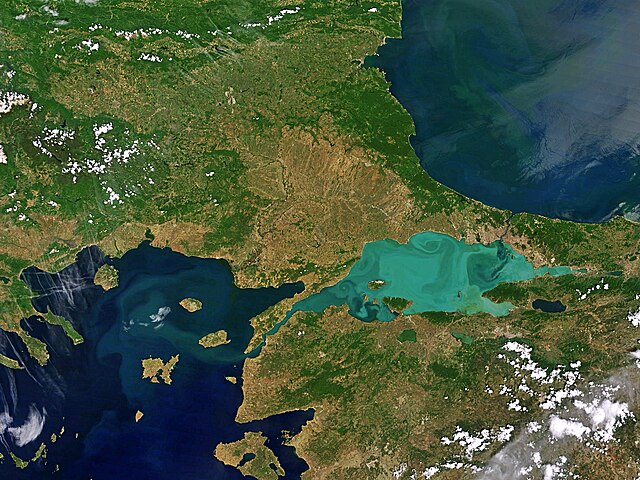
The Sea of Marmara, also known as the Sea of Marmora or the Marmara Sea, is a small inland sea located entirely within the borders of Turkey. It connects the Black Sea to the Aegean Sea via the Bosporus and Dardanelles straits, separating Turkey’s European and Asian sides. It has an area of 11,350 km2 (4,380 sq mi), and its dimensions are 280 km × 80 km. Its greatest depth is 1,370 m (4,490 ft).
Satellite image of the Sea of Marmara
Algal bloom on the Sea of Marmara
Satellite image showing metropolitan İzmit along northern and eastern shores
The Bosporus with Istanbul in the background