2005 levee failures in Greater New Orleans
On Monday, August 29, 2005, there were over 50 failures of the levees and flood walls protecting New Orleans, Louisiana, and its suburbs following passage of Hurricane Katrina. The failures caused flooding in 80% of New Orleans and all of St. Bernard Parish. In New Orleans alone, 134,000 housing units — 70% of all occupied units — suffered damage from Hurricane Katrina and the subsequent flooding.
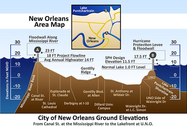
Vertical cross-section of New Orleans, showing maximum levee height of 23 feet (7 m) at the Mississippi River on the left and 17.5 feet (5 m) at Lake Pontchartrain on the right
Breach in 17th Street Canal levee on August 31, showing the inundated Lakeview neighborhood on the right and the largely dry Metairie side on the left (NOAA)
Severely damaged homes in piles of sand near the upper London Avenue Canal breach
Portion of the flood wall atop 17th Street Canal levee, with Katrina-related graffiti. Notice cracks in the flood wall joints. Operation and maintenance are the responsibility of local levee districts as mandated by the Flood Control Act of 1965.
A levee, dike, dyke, embankment, floodbank, or stop bank is a structure used to keep the course of rivers from changing and to protect against flooding of the area adjoining the river or coast. It is usually earthen and often runs parallel to the course of a river in its floodplain or along low-lying coastlines.
The side of a levee in Sacramento, California
A reinforced embankment
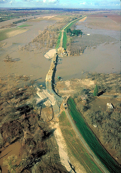
Broken levee on the Sacramento River
A levee keeps high water on the Mississippi River from flooding Gretna, Louisiana, in March 2005.


