Severe flooding occurred during the 2011 monsoon season in Thailand. The flooding began at the end of July triggered by the landfall of Tropical Storm Nock-ten. These floods soon spread through the provinces of northern, northeastern, and central Thailand along the Mekong and Chao Phraya river basins. In October floodwaters reached the mouth of the Chao Phraya and inundated parts of the capital city of Bangkok. Flooding persisted in some areas until mid-January 2012, and resulted in a total of 815 deaths and 13.6 million people affected. Sixty-five of Thailand's 76 provinces were declared flood disaster zones, and over 20,000 square kilometres (7,700 sq mi) of farmland was damaged. The disaster was described by an unnamed Thai government official as "the worst flooding yet in terms of the amount of water and [number of] people affected".
A United States Navy helicopter observes flooded areas in the outskirts of Bangkok.
False-colour satellite image showing extent of flooding on 19 October 2011. Water is shown in dark blue.
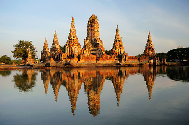
Flooding damaged several historic sites, including Wat Chai Watthanaram.
Flooding in Ayutthaya and Pathum Thani Provinces in October (right), compared to before the flooding in July (left)
Bangkok, officially known in Thai as Krung Thep Maha Nakhon and colloquially as Krung Thep, is the capital and most populous city of Thailand. The city occupies 1,568.7 square kilometres (605.7 sq mi) in the Chao Phraya River delta in central Thailand and has an estimated population of 9.0 million as of 2021, 13% of the country's population. Over 17.4 million people (25%) lived within the surrounding Bangkok Metropolitan Region at the 2021 estimate, making Bangkok an extreme primate city, dwarfing Thailand's other urban centres in both size and importance to the national economy.
From top, left to right: Wat Benchamabophit, Chao Phraya River skyline, Grand Palace, Giant Swing, traffic on a road in Watthana District, Democracy Monument, and Wat Arun
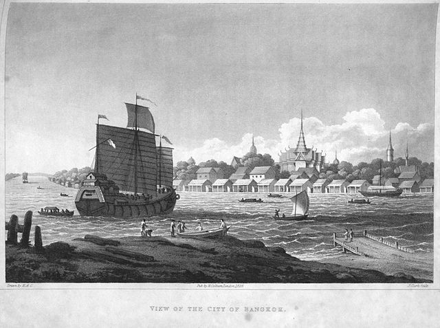
Engraving of the city from British diplomat John Crawfurd's embassy in 1822
The city's ceremonial name is displayed in front of Bangkok City Hall.
The city of Bangkok is highlighted in this satellite image of the lower Chao Phraya delta. The built-up urban area extends northward and southward into Nonthaburi and Samut Prakan provinces.