In the days leading up to June 19, 2013, parts of southern and central Alberta, Canada experienced heavy rainfall that triggered catastrophic flooding described by the provincial government as the worst in Alberta's history. Areas along the Bow, Elbow, Highwood, Red Deer, Sheep, Little Bow, and South Saskatchewan rivers and their tributaries were particularly affected. A total of 32 states of local emergency were declared and 28 emergency operations centres were activated as water levels rose and numerous communities were placed under evacuation orders.
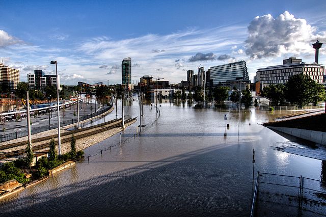
The Downtown East Village neighbourhood of Calgary, Alberta, during the 2013 Alberta floods (June 21, 2013)
The flooded Glenmore Reservoir in Calgary, on June 21, 2013
The Calgary Highlanders assisting city workers in flood relief in the community of Inglewood (June 22, 2013)
Damaged rail tracks in High River
The Bow River is a river in Alberta, Canada. It begins within the Canadian Rocky Mountains and winds through the Alberta foothills onto the prairies, where it meets the Oldman River, the two then forming the South Saskatchewan River. These waters ultimately flow through the Nelson River into Hudson Bay. The Bow River runs through the city of Calgary, taking in the Elbow River at the historic site of Fort Calgary near downtown. The Bow River pathway, developed along the river's banks, is considered a part of Calgary's self-image.
The Bow River near Banff
Morant's Curve, Banff National Park
Mountains around Banff, with Spray River flowing north to the Bow River at Banff (a small cloud obscures Banff itself)
Lake Minnewanka