During the early evening of Friday, May 31, 2013, an extremely large and powerful tornado occurred over rural areas of Central Oklahoma. This rain-wrapped, multiple-vortex tornado was the widest tornado ever recorded and was part of a larger weather system that produced dozens of tornadoes over the preceding days. The tornado initially touched down at 6:03 p.m. Central Daylight Time (2303 UTC) about 8.3 miles (13.4 km) west-southwest of El Reno, rapidly growing in size and becoming more violent as it tracked through central portions of Canadian County. Remaining over mostly open terrain, the tornado did not impact many structures; however, measurements from mobile weather radars revealed extreme winds up to 135.0 m/s within the vortex. These are among the highest observed wind speeds on Earth, just slightly lower than the wind speeds of the 1999 Bridge Creek–Moore tornado. As it crossed U.S. 81, it had grown to a record-breaking width of 2.6 miles (4.2 km), beating the previous width record set in 2004. Turning northeastward, the tornado soon weakened. Upon crossing Interstate 40, the tornado dissipated around 6:43 p.m. CDT (2343 UTC), after tracking for 16.2 miles (26.1 km), it avoided affecting the more densely populated areas near and within the Oklahoma City metropolitan area.

View of the tornado from the southeast at 6:28 p.m. CDT (2328 UTC) as it was nearing peak strength
A minute-by-minute timeline of the tornado’s position.
The crushed remains of TWISTEX's Chevrolet Cobalt near the intersection of Reuter and South Radio Roads, almost 5 mi (8.0 km) southeast of El Reno.
The supercell thunderstorm which produced the El Reno tornado as viewed from above.
A tornado is a violently rotating column of air that is in contact with both the surface of the Earth and a cumulonimbus cloud or, in rare cases, the base of a cumulus cloud. It is often referred to as a twister, whirlwind or cyclone, although the word cyclone is used in meteorology to name a weather system with a low-pressure area in the center around which, from an observer looking down toward the surface of the Earth, winds blow counterclockwise in the Northern Hemisphere and clockwise in the Southern. Tornadoes come in many shapes and sizes, and they are often visible in the form of a condensation funnel originating from the base of a cumulonimbus cloud, with a cloud of rotating debris and dust beneath it. Most tornadoes have wind speeds less than 180 kilometers per hour, are about 80 meters across, and travel several kilometers before dissipating. The most extreme tornadoes can attain wind speeds of more than 480 kilometers per hour (300 mph), are more than 3 kilometers (2 mi) in diameter, and stay on the ground for more than 100 km (62 mi).

A tornado approaching Elie, Manitoba, Canada in June 2007.
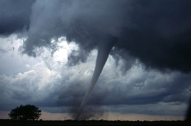
A tornado near Anadarko, Oklahoma, 1999. The funnel is the thin tube reaching from the cloud to the ground. The lower part of this tornado is surrounded by a translucent dust cloud, kicked up by the tornado's strong winds at the surface. The wind of the tornado has a much wider radius than the funnel itself.
This tornado has no funnel cloud; however, the rotating dust cloud indicates that strong winds are occurring at the surface, and thus it is a true tornado.
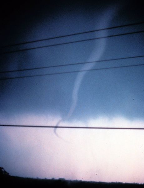
A rope tornado in its dissipating stage, found near Tecumseh, Oklahoma.


