2016 Fort McMurray wildfire
On May 1, 2016, a wildfire began southwest of Fort McMurray, Alberta, Canada. On May 3, it swept through the community, forcing the largest wildfire evacuation in Alberta's history, with upwards of 88,000 people forced from their homes. Firefighters were assisted by personnel from both the Canadian Armed Forces and Royal Canadian Mounted Police, as well as other Canadian provincial agencies, to fight the wildfire. Aid for evacuees was provided by various governments and via donations through the Canadian Red Cross and other local and national charitable organizations.
Fort McMurray residents evacuating along Highway 63 as the fire encroaches on the area
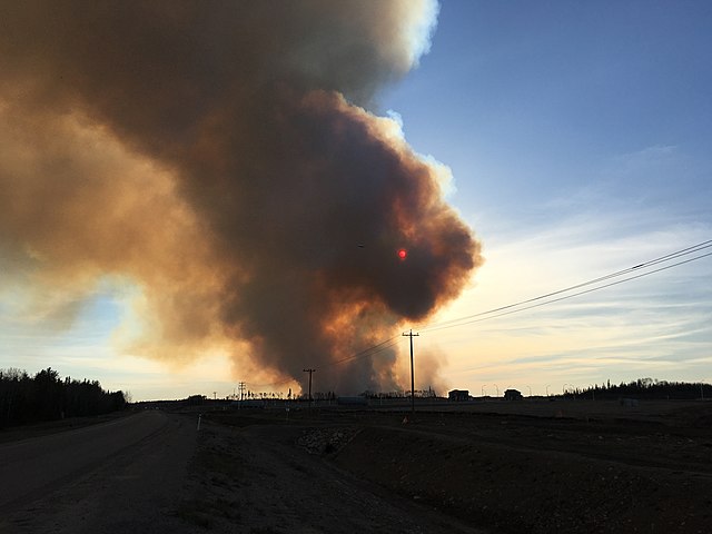
The wildfire burning near Fort McMurray on May 1, 2016
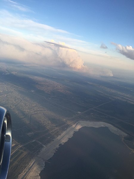
Aerial view of the flammagenitus cloud created by the fire.
Satellite imagery of the burn scar left by the wildfire on May 4, 2016
Fort McMurray is an urban service area in the Regional Municipality of Wood Buffalo in Alberta, Canada. It is located in northeast Alberta, in the middle of the Athabasca oil sands, surrounded by boreal forest. It has played a significant role in the development of the national petroleum industry. The 2016 Fort McMurray wildfire led to the evacuation of its residents and caused widespread damage.
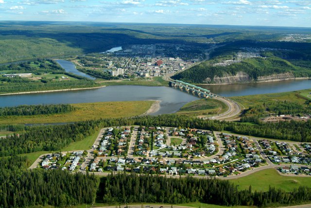
Aerial view of Fort McMurray with Athabasca River
View of the Clearwater River valley from Highway 63
William McMurray for whom Fort McMurray is named
Vista Ridge, a local ski hill