2026 Nepal floods
Videos
On the morning of 26 August 2026, a series of flash floods destroyed the Gyirong checkpoint on the China–Nepal border and struck dozens of settlements along a 72 km stretch of the Trishuli River in Ne

Trishuli Valley in Rasuwa District

Nuwakot District

Trishuli River (left) and the Lhende Khola (right) in 2013
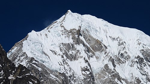
A glacier collapse on the north face of Langtang Lirung, a mountain in Langtang National Park, Nepal, is widely thought to be the proximate cause of the floods (view from south-east).
Gyirong Port
Videos
Gyirong Port was a Chinese land port and border crossing on the China–Nepal border. The port complex stood at Resuo, in Gyirong County in the Tibet Autonomous Region, opposite Rasuwagadhi in Nepal. Th
2026 Nepal floods
…On the morning of 26 August 2026, a series of flash floods destroyed the Gyirong checkpoint on the China–Nepal border and struck dozens of settlements along a 72 km (45 mi) stretch of the Trishuli River in Nepal. At least 939 deaths and 4,247…

Gyirong Port in August 2019, viewed from the Nepali side of the Resuo Bridge

Under construction in 2013