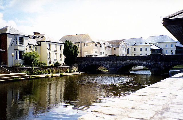
Cardigan, Ceredigion
Cardigan is a town and community in the county of Ceredigion in Wales. The town lies on a tidal reach of the River Teifi at the point where Ceredigion Cardiganshire, meets Pembrokeshire. Cardigan is the second-largest town in Ceredigion; the largest town, Aberystwyth, is one of the two administrative centres. The settlement at Cardigan was developed around the Norman castle built in the late 11th or early 12th century; the castle was the location of the first National Eisteddfod in 1176. The town became an important port in the 18th century, but declined by the early 20th century owing to its shallow harbour; the castle underwent restoration in 2014. The population in 2001 was 4,203, reducing to 4,184 at the 2011 census. Modern Cardigan is a compact and busy town, having most of the facilities for retail, health and sport. Cardigan is an anglicisation of the Welsh Ceredigion, the surrounding territory its Norman castle once controlled. Ceredig was one of the sons of Cunedda Wledig, who Welsh legend records invaded from the north to recover lands in Roman Britain from invading Irishmen in late antiquity.
The Welsh name Aberteifi refers to its position by the mouth of the River Teifi. The nearest known Roman forts were at Loventium and Bremia at the gold mines near Llanio above the River Teifi on the Sarn Helen road; the present town grew up near the medieval forts established to control the access of the Teifi and its confluents to Cardigan Bay on the Irish Sea. A castle was built by Roger de Montgomery in 1093, its hinterland was regained by Owain Gwynedd, Cadwaladr ap Gruffydd, Gruffydd ap Rhys in October 1136 after their victory at Crug Mawr over Norman forces army led by Roberts fitz Martin and fitz Stephen and Maurice FitzGerald. The town itself held out until 1164. Rhys ap Gruffydd fortified the town and was credited with the establishment of the castle near the bridge over the Teifi. In 1176, he instituted the first eisteddfod. Contestants came from all over the British Isles to compete for chairs in poetry. Lord Rhys' grandson Maelgwn sacked the town. In 1199 the town became an important trade centre.
In 1227 a weekly market was established. Welsh rule over Cardigan continued, for some periods under royal lordship, until it was annexed to the English crown in 1283 when the country of Cardiganshire was created; the town wall was built in the 1240s and the castle was rebuilt. St Mary's Church was established as a Benedictine Priory and parish church in mediaeval times and survived the Dissolution of the Monasteries; the castle ceased being the administrative centre of the county with the Act of Union in 1536 and by the early 17th century was falling into ruins. Until the 16th century, Cardigan had been a walled town with some river traffic. A small Benedictine priory operated until the Reformation and the more important abbey of St Dogmael's was nearby. With Wales formally annexed by England through the Laws in Wales Acts and domestic stability boosted economic prosperity through the increase in maritime trade. At the end of the 16th century the port's principal trade was fishing, but over the next century trade expanded to include a range of imports and exports, a Customs House was established to collect revenues.
During the Civil War, the town's castle was held for a time by the Royalists. In the 17th century, the residence erected around the old priory was famed as the home of Orinda, the friend of Jeremy Taylor; the herring fishery developed and by the beginning of the 18th century there was a large merchant fleet. Exports included herring and salmon, bark for tanning and ale. Imports included manufactured goods, building materials and coal. Industries that developed included shipbuilding, brickworks, a foundry and sailmakers. A county jail was erected in 1793. In 1819, the ship Albion left Cardigan for New Brunswick, carrying the first Welsh settlers to Canada. In the 18th and early 19th century, Cardigan was the commercial centre of its county and the most important port in South Wales, exporting slate, oats and butter. In 1815, it possessed 314 ships totaling 12,554 long tons; this was three times as many as Swansea. It had a thriving shipbuilding industry, with over 200 vessels being built both in Cardigan and downstream in the village of Llandudoch.
In conjunction with Aberystwyth and Adpar, it was established as Carmarthenshire's second parliamentary constituency amid the 1832 reforms. By mid-century, it was connected with the Welsh rail network but its harbour was obstructed by a sand bar that made it dangerous for vessels over 300 tons burden except during the high spring tides. Rural industries and craftsmen were an important part of life in a country town. Information recorded in Trade Directories show that in 1830 there were Thirteen boot makers, three bakers, one miller, four blacksmiths, seven carpenters, two coopers, six tailors, five dressmakers and milliners, two straw hat makers, two weavers, three curriers, three saddlers, two whitesmiths, four glaziers, five maltsters, two printers, two tanners and one stonemason; the houses were of slate and the streets narrow and irregular, with a grammar school erected in 1804 and a national school in 1848. The town had a public library; the Guildhall with open ground behind was built during 1858–60.
A55 road
The A55 known as the North Wales Expressway is a major road in Britain. Its entire length from Chester to Holyhead is a dual carriageway primary route, with the exception of the Britannia Bridge over the Menai Strait and several short sections where there are gaps in between the two carriageways. All junctions are grade separated apart from a roundabout east of Penmaenmawr and another nearby in Llanfairfechan; the road ran from Chester to Bangor. In 2001, it was extended across Anglesey to the ferry port of Holyhead parallel to the A5; the road improvements have been part funded with European money, under the Trans-European Networks programme, as the route is designated part of Euroroute E22. The A55 is sometimes called a motorway, because of its appearance, although it is not a motorway; the A55 begins at the southern end of the M53 motorway near Chester. It is known as the Chester southerly bypass between J36a Broughton; the A55 crosses the River Dee and the border into Wales, passing close to Broughton and passing north of Buckley and Northop.
There is a major climb between Dobshill though with no crawler lane. Junction 34/33b is point at which the A494 converges and diverges with the A55; the road has a three-lane section as westbound traffic from Queensferry can leave towards Mold. In the eastbound direction another short three-lane section allows vehicles to join the A494 or exit onto the A55 to Chester. Traffic taking the A55 into England must negotiate a tight 270 degree speed-limited single lane curve to climb up and over the A55/A494 at Ewloe loops. Plans to upgrade the A494 between this junction at Ewloe and Queensferry were rejected by the Welsh Government on 26 March 2008 due to their scale. From Ewloe, the road is flat until after Northop when it climbs up onto the flanks of Halkyn Mountain range, passing to the southwest of Holywell with major climbs between Northop and Halkyn and Halkyn and Holywell Summit; this section of road is notorious for poor weather conditions including fog and snow in winter months. In fine weather, however there are extensive views over the River Dee estuary to the Wirral Peninsula and beyond.
The highest part of the road is in the vicinity of Brynford at around 790 feet. The steep descent towards St Asaph is down the new Rhuallt Hill, which provides the first views of the mountains of Snowdonia in the far distance. There is a crawler lane on Rhuallt Hill for eastbound traffic; the road bypasses St Asaph to the north, runs past Bodelwyddan and Abergele to reach the North Wales coast at Pensarn. From here onwards to Bangor, the route is close to the North Wales Coast railway. Two sections between Llanddulas to Conwy are signed as a 70 mph speed limit because they are special roads; this is because these sections were built under legislation for building motorways but they were never declared as motorways. It means these two stretches of the A55 are neither part of the national UK motorway network or trunk roads; as such, the national speed limit does not apply. Unlike other sections of the A55 that have National Speed Limit signage and are accessible to all motor vehicles, motorway restrictions are enforced on these two stretches of road.
A 50 mph limit remains in force through the Colwyn Bay bypass. The restriction was imposed for several reasons. First as a safety precaution because the slip-roads on this stretch are unusually short due to the road's design. Part of it was built on a narrow swathe of land through the town, once the North Wales coast railway; the former four-track railway was reduced to two more northerly tracks to make space for the road. Second the reduced speed limit was intended to reduce road noise for residents. However, since the completion of the Colwyn Bay bypass, the lower speed limit has been an unpopular decision with drivers; the crossing of the estuary of the River Conwy is by means of an immersed tube tunnel, the first of its kind constructed in the United Kingdom. At 1060m, the tunnel is the longest road tunnel in Wales; the decision to construct an immersed tube tunnel bypass followed an extensive public consultation, named the Collcon Feasibility Study. This ruled out another bridge by the castle on aesthetic grounds, since it would have damaged the view of the world heritage site Conwy Castle, the two bridges by Robert Stephenson and Thomas Telford.
Another alternative bridge crossing was proposed at Deganwy, but this too was ruled out for aesthetic reasons. An inland alternative with heavy grades which would have passed over Bwlch y Ddeufaen pass at 430 metres, following the old Roman road, was worked up but rejected for cost and utility reasons; the tunnel was constructed by a Costain/Tarmac Construction joint venture, as pre-formed concrete sections, floated into position over a pre-prepared trench in the bed of the estuary. The 3 million tonnes of silt and mud extracted to create the trench in which the tunnel sections sat, were vacuumed to one side of the construction site, as to let them drift down river would have harmed the large mussel fishing beds downstream; the silt was deposited upstream of the bridge at Conwy which created a large new a
Roads in the United Kingdom
The United Kingdom has a network of roads, of varied quality and capacity, totalling about 262,300 miles. Road distances are shown in miles or yards and UK speed limits are indicated in miles per hour or by the use of the national speed limit symbol; some vehicle categories have various lower maximum limits enforced by speed limiters. Enforcement of UK road speed limits uses speed guns, automated in-vehicle systems and automated roadside traffic cameras. A unified numbering system is in place for Great Britain, whilst in Northern Ireland, there is no available explanation for the allocation of road numbers; the earliest engineered roads were built during the British Iron Age. The road network was expanded during the Roman occupation; some of these survive and others were lost. New roads were added from the 17th century onwards. Whilst control has been transferred from local to central bodies and back again, current management and development of the road network is shared between local authorities, the devolved administrations of Scotland and Northern Ireland and Highways England.
Certain aspects of the legal framework remain under the competence of the United Kingdom parliament. Although some roads have much older origins, the network was subject to major development from the 1950s to the mid-1990s. From construction of roads has become controversial with direct action campaigns by environmentalists in opposition; the UK has a road network totalling about 262,300 miles of paved roads—246,500 miles in Great Britain and 15,800 miles in Northern Ireland. Responsibility for the road network differs between non trunk routes. Trunk roads, which are the most important roads, are administered by Highways England in England, Transport Scotland in Scotland, the North and Mid Wales Trunk Road Agent, South Wales Trunk Road Agent in Wales. England's 6,500 miles of trunk roads account for 50 % of lorry travel. Scotland has accounting for 35 % of all road journeys and over 50 % of lorry movements. Wales has 1,000 miles of trunk roads. In London, Transport for London is responsible for all trunk roads and other major roads, which are part of the Transport for London Road Network.
All other roads are the responsibility of unitary authority. In Northern Ireland, the Roads Service Northern Ireland is responsible for all 5,592 miles roads; the pan-British total is 15,260 miles. Whilst they are trunk roads, several motorways are the responsibility of local authorities, for example the M275. Since 2008, location marker posts have appeared on motorways and major A roads in England, situated at intervals of 500 metres; these repeat the information given on the co-sited surveyors' marker post which, since the 1960s, have reported distances on such roads in kilometres from a datum—usually the start of the road, or the planned start-point of the road. Numbered roads in the UK are signed as M, A, or B roads, as well as various categories of more minor roads: for internal purposes, local authorities may use C, D and U; each road is given a number, combined with the prefix, for example M40, A40 and B1110, although their informal or traditional names may still be used or heard occasionally: for instance, the Great North Road and the Great Cambridge Road.
These numbers follow a zonal system. There is no available explanation for the allocation of road numbers in Northern Ireland; the majority of the major inter-urban routes are motorways, are designed to carry long distance traffic. The next category is the A roads. A primary route is defined as:...a route, not being a route comprising any part of a motorway, in respect of which the Secretary of State — in the case of a trunk road is of the opinion, in any other case after consultation with the traffic authority for the road comprised in the route is of the opinion, that it provides the most satisfactory route for through traffic between places of traffic importance A new standard was set in April 2015 to formally designate certain high-quality routes as Expressways, but whether this will result in any existing road classifications changing is unclear. Primary destinations are cities and large towns, to which, as a result of their size, a high volume of traffic is expected to go. However, in rural areas, smaller towns or villages may be given primary status if located at junctions of significant roads: for example, Llangurig in Wales and Crianlarich in Scotland.
As a further example, Scotch Corner in northern England is not a village—merely a hotel and a few other buildings—yet has the status of a primary destination due to its location at the interchange of the A1 and A66 roads. For similar reasons, certain airports, sea ports and tunnels have been designated as primary destinations; the status of both primary destinations and roads is maintained by the Department for Transport in combination with the Highways Agency in England and Wales and the Scottish Government in Scotland. The concept of primary roads was introduced in the 1960s as part of a national reclassification of roads. Regional destinations are used on long distance routes throughout the country alongside primary destinations, they are displayed on signs in capitals to dis
A496 road
The A496 is a major coastal and mountainous road in southern Snowdonia. The road is 32.8 miles in length, from Blaenau Ffestiniog via Harlech. The original northern terminus of the road before A470 re-numbering was Llandudno; the road passes through a diverse landscape, including the mountainous region of Blaenau Ffestiniog, two estuaries, the Cambrian Coast. The northernmost point of the road is the A470 junction at Blaenau Ffestiniog; the road by-passes Glanypwll and Tanygrisiau before descending towards the Vale of Ffestiniog along the course of Afon Goedol. The road passes through the village of Maentwrog, before crossing Afon Prysor near the Ceunant Llennyrch National Nature Reserve; the road follows the southern banks of the River Dwyryd, before reaching the Cardigan Bay coast at Talsarnau. The road runs alongside the Cambrian Line railway for much of the coast route, bypassing Harlech before ascending inland via the villages of Llanbedr and Dyffryn Ardudwy; the road returns to the coast at Llanaber, before the semi-urban stretch through the seaside town of Barmouth.
After passing the Barmouth Bridge, the road returns inland, along the northern banks of the Mawddach estuary, via Farchynys and Bontddu. Nearing the road's southern terminus, the road passes the Penmaenpool Bridge junction before reaching Llanelltyd, north of Dolgellau. Along the road is St Twrog's Church, Maentwrog, a church noted for its stone, which in legend was reputedly thrown by a giant to kill Pryderi, he is said to lie underneath it. Media related to A496 road at Wikimedia Commons SABRE: A496
Corris Railway
The Corris Railway is a narrow gauge preserved railway based in Corris on the border between Merionethshire and Montgomeryshire in Mid-Wales. The line opened in 1859 as a horse tramway, running from quays on the Afon Dyfi at Morben and Derwenlas, skirting the town of Machynlleth and following the Dulas Valley north to Corris and on to Aberllefenni. Branches served the slate quarries at Corris Uchaf, the isolated quarries around Ratgoed and quarries along the length of the Dulas Valley; the railway closed in 1948, but a preservation society was formed in 1966 opening a museum. The railway now operates as a tourist attraction. A new steam locomotive was built for the railway, delivered in 2005; the two surviving locomotives, plus some of the original rolling stock, are preserved on the nearby Talyllyn Railway. The gauge of the railway is 2 ft 3 in, unusual, was shared by only three other public railways in the United Kingdom: the Talyllyn Railway, the short-lived Plynlimon and Hafan Tramway and the Campbeltown and Machrihanish Light Railway.
The first proposal to construct a railway to connect the slate quarries in the district around Corris, Corris Uchaf and Aberllefenni with wharves on the estuary of the Afon Dyfi west of Machynlleth was made in November 1850 with Arthur Causton as engineer. At this time slate from the quarries was hauled by horse-drawn carts and sledges to transport their output to the river; the proposed Corris, Machynlleth & River Dovey Railway or Tramroad would have run down the Dulas Valley and along the north shore of the Dyfi past Pennal to Pant Eidal, near the main-line Gogarth Halt. The bill was withdrawn resubmitted in December 1851; the bill specified the tramroad's gauge as 2 ft 2.5 in. This 1851 scheme was not constructed, was followed by two further proposals in the early 1850s. Following the plans for a 4 ft 8 1⁄2 in standard gauge railway along the Dyfi valley, these early proposals were shelved. In December 1857, a fourth bill was set before Parliament to create the Corris Machynlleth & River Dovey Tramroad.
This was similar to the 1851 scheme, proposing a tramway from the "machine house" at Aberllefenni, down to the wharf at "Cae Goch on the River Dovey" with a short onward branch to Morben. The gauge specified for the tramroad was increased to 2 ft 3 in, the same restriction forbidding locomotives was imposed; this bill was passed on 12th. July 1858. After more than eight years of proposals, the 1859 scheme was the one, built. Construction proceeded and by April 1859 the tramroad opened between Corris and Machynlleth; the line through to Aberllefenni was built as was the southern line to Derwenlas. It is thought that the tramroad never reached Morben. On 3 January 1863 the standard gauge Newtown and Machynlleth Railway had opened, followed on 1 July of the same year by the Aberystwyth and Welsh Coast Railway's line from Machynlleth to Borth; these two lines became part of the Cambrian Railways by August 1865. The opening of the standard gauge line to Borth made the section of the CM&RDT from Machynlleth to Derwenlas obsolete.
It was much easier to transship slates to the main line at Machynlleth, so the lower section of the tramway was abandoned. In 1862, a new Bill was deposited, seeking to extend the Upper Corris Tramway to iron ore mines at Tir Stent, near Cross Foxes; the bill sought powers to raise further capital for the tramroad and allow the use of locomotives. But the directors of the Aberystwyth & Welsh Coast Railway objected and the Bill failed. Another similar Bill was deposited in December 1863, again the A&WCR opposed it; this time, they withdrew their objection. The second Bill passed on 25 July 1864, it took until the 1870s for work to begin to upgrade the Corris Railway to a standard where locomotives could be used. The original tramroad was laid with light bridge rail suitable for waggons to traverse as they were pulled by horses; these rails would not support the weight of much heavier steam locomotives. In 1878 control of the railway passed to the Imperial Tramways Company of London; the new owners saw the potential for passenger traffic on the Corris Railway and ordered the first passenger carriages for the railway though the Act of 1864 did not permit passengers to be carried.
They appointed Joseph R. Dix, son of the main-line stationmaster at Machynlleth, as Manager in successor to David Owen. In 1880 and 1883, two new Acts were obtained which adjusted the tolls on the railway and permitted the carriage of passengers; the second of these Acts was necessary because the owners of the quarries served by the railway objected that passenger trains would interfere with their mineral traffic. The railway ran a test passenger service on the local roads, it was the first instance of a long history of the Corris Railway operating passenger road services in the area. In December 1878 the first steam locomotive purchased from the H
Aberaeron
Aberaeron is a seaside resort town and electoral ward in Ceredigion, Wales. Situated between Aberystwyth and Cardigan, it is home to the headquarters of Ceredigion County Council; the population was 1,520 in 2001, reducing to 1,422 at the 2011 census. The name is Welsh, meaning "mouth of the River Aeron", derived from the Middle Welsh aer, "slaughter", which gave its name to Aeron, believed to have been a Welsh god of war. In 1800, there was no significant coastal settlement; the present town was developed from 1805 by the Rev. Alban Thomas Jones Gwynne; the harbour he built supported a shipbuilding industry in the 19th century. A group of workmen's houses and a school were built on the harbour's north side, but these were reclaimed by the sea. Steam ships continued to visit the harbour until the 1920s but, in years, it evolved into a small half-tide harbour for recreational craft; the estuary is crossed by a wooden pedestrian bridge. Crafts were an important part of village life. Information recorded in trade directories shows that in 1830, although it was not yet developed as a port, there were in Aberaeron one woollen manufacturer, one bootmaker, one baker, one corn miller, one blacksmith, one blacksmith and shovel maker, two shipwrights, one carpenter and one hat maker.
In the late 1890s, a hand-powered cable car, the Aeron Express, was built to ferry workers across the harbour when the bridge was demolished by floods. The structure was recreated in 1988 as a tourist attraction that ran until the end of summer 1994, when it was closed under health and safety regulations; the architecture of Aberaeron is unusual in this part of rural Wales, being constructed around a principal square of elegant Regency style buildings grouped around the harbour. This was the work of an architect from Shrewsbury; some of the architecture was of sufficient interest to feature on British postage stamps. Aberaeron Golf Club was founded in 1923, it continued until WW2. Attempts to reinstate the club following the war failed. Castell Cadwgan, a 12th-century ringwork fortification around a probable wooden structure, was located by the shore at Aberaeron, but has long since been claimed by the sea. Few traces remain today apart from some mounds of earth, the remains of the enclosure bank, most of the site having been eroded.
In Wales Illustrated in a Series of Views by Henry Gastineau, published in 1810, it states: "Near the town are some remains of an ancient fortress called Castell Cadwgan, thought to have been erected by king Cadwgan, about the year 1148." In A Topographical Dictionary of Wales, published in 1833, Samuel Lewis wrote: "On the sea-shore, near the village, is a circular encampment, designated Castell Cadwgan, supposed to have been constructed by Cadwgan ab Bleddyn, about 1148." However, Cadwgan is recorded as having been killed in 1111. Welsh Minstrelsy: Containing the Land beneath the Sea, published in 1824, states: "Just where juts out from the shore is an old fort, called Castell Cadwgan." Aberaeron is a new settlement and lacked borough status like other towns in the county. In 1894, the town achieved the status of an urban district, which it retained until local government reorganisation in 1974; the first representative for Aberayron on the Cardiganshire County Council from 1889 was John Morgan Howell, who became a prominent figure in the political life of the county.
Following his election in January 1889, bonfires were lit to celebrate his victory. Since 1995 the Aberaeron ward has elected one councillor to Ceredigion County Council. Since 2008 the ward has been represented by Councillor Elizabeth Evans for the Welsh Liberal Democrats. Aberaeron is located between Cardigan and Aberystwyth on the A487, at a junction with the A482 leading south-east to the university town of Lampeter, it lies on part of the Wales Coast Path. The shoreline consists of steep storm beaches of pebbles, although fine sand is visible at low tide levels. Aberaeron south beach was awarded the Blue Flag rural beach award in 2005, it contains the Harbourmaster Hotel. The climate is mild and temperate conditioned by the proximity of the shallow sea. However, Aberaeron can suffer from occasional winter frosts when cold air descends the Aeron valley from the upland parts of Ceredigion; the town is notable for the sale of honey, honey ice-cream and, more honey mustard. 70% of Aberaeron's inhabitants are able to speak Welsh according to the 2001 census.
Dylan Thomas's links with Aberaeron, New Quay and Talsarn have been documented by local author David N Thomas. The Dylan Thomas Trail runs through Ceredigion, passing through Aberaeron and ending in New QuayAn annual Festival of Welsh Ponies and Cobs is held on Square Field every August. A life-sized statue of a Welsh cob stallion was donated to the town in 2005 by the Festival to denote the area as Welsh Cob country, it was created by sculptor David Mayer. An annual carnival takes place on the Monday Bank Holiday in August. A colourful procession of floats and a carnival queen moves from the Quay to Alban Square. A regular bus service links the town with Aberystwyth and Carmarthen, with several daily through services to Swansea and Cardiff. Another service connects with New Quay and Cardigan from Monday to Saturday; the railway service from the former Aberayron railway station was closed to passengers in 1951 and to freight in 1965. Ron Davies, photographer Sir Geraint Evans, opera singer, had a home in Aberaeron f
Caernarfon
Caernarfon is a royal town and port in Gwynedd, with a population of 9,615. It lies along the A487 road, on the eastern shore of the Menai Strait, opposite the Isle of Anglesey; the city of Bangor is 8.6 miles to the north-east, while Snowdonia fringes Caernarfon to the east and south-east. Carnarvon and Caernarvon are Anglicised spellings that were superseded in 1926 and 1974, respectively; the villages of Bontnewydd and Caeathro are close by. The town is noted for its high percentage of native Welsh speakers. Due to this, Welsh is the predominant language of the town. Abundant natural resources in and around the Menai Strait enabled human habitation in prehistoric Britain; the Ordovices, a Celtic tribe, lived in the region during the period known as Roman Britain. The Roman fort Segontium was established around AD 80 to subjugate the Ordovices during the Roman conquest of Britain; the Romans occupied the region until the end of Roman rule in Britain in 382, after which Caernarfon became part of the Kingdom of Gwynedd.
In the late 11th century, William the Conqueror ordered the construction of a motte-and-bailey castle at Caernarfon as part of the Norman invasion of Wales. He was unsuccessful, Wales remained independent until around 1283. In the 13th century, Llywelyn ap Gruffudd, ruler of Gwynedd, refused to pay homage to Edward I of England, prompting the English conquest of Gwynedd; this was followed by the construction of Caernarfon Castle, one of the largest and most imposing fortifications built by the English in Wales. In 1284, the English-style county of Caernarfonshire was established by the Statute of Rhuddlan; the ascent of the House of Tudor to the throne of England eased hostilities between the English and resulted in Caernarfon Castle falling into a state of disrepair. The city has flourished, leading to its status as a major tourist centre and seat of Gwynedd Council, with a thriving harbour and marina. Caernarfon experienced heavy suburbanisation, its population includes the largest percentage of Welsh-speaking citizens anywhere in Wales.
The status of Royal Borough was granted by Queen Elizabeth II in 1963 and amended to Royal Town in 1974. The castle and town walls are part of a World Heritage Site described as the Castles and Town Walls of King Edward in Gwynedd; the present city of Caernarfon grew up around and owes its name to its Norman and late Medieval fortifications. The earlier British and Romano-British settlement at Segontium was named for the nearby Afon Seiont. After the end of Roman rule in Britain around 410, the settlement continued to be known as Cair Segeint and as Cair Custoient, of the History of the Britons, cited by James Ussher in Newman's life of Germanus of Auxerre, both of whose names appear among the 28 civitates of sub-Roman Britain in the Historia Brittonum traditionally ascribed to Nennius; the work states that the inscribed tomb of "Constantius the Emperor" was still present in the 9th century. The medieval romance about Maximus and Elen, Macsen's Dream, calls her home Caer Aber Sein and other pre-conquest poets such as Hywel ab Owain Gwynedd used the name Caer Gystennin.
The Norman motte was erected apart from the existing settlement and came to be known as y gaer yn Arfon, "the fortress in Arfon". A 1221 charter by Llywelyn the Great to the canons of Penmon priory on Anglesey mentions Kaerinarfon. In 1283, King Edward I completed his conquest of Wales which he secured by a chain of castles and walled towns; the construction of a new stone Caernarfon Castle seems to have started as soon as the campaign had finished. Edward's architect, James of St. George, may well have modelled the castle on the walls of Constantinople being aware of the town's legendary associations. Edward's fourth son, Edward of Caernarfon Edward II of England, was born at the castle in April 1284 and made Prince of Wales in 1301. A story recorded in the 16th century suggests that the new prince was offered to the native Welsh on the premise "that was borne in Wales and could speake never a word of English", however there is no contemporary evidence to support this. Caernarfon was constituted a borough in 1284 by charter of Edward I.
The charter, confirmed on a number of occasions, appointed the mayor of the borough Constable of the Castle ex officio. The former municipal borough was designated a royal borough in 1963; the borough was abolished by the Local Government Act 1972 in 1974, the status of "royal town" was granted to the community which succeeded it. Caernarfon was the county town of the historic county of Caernarfonshire. In 1911, David Lloyd George Member of Parliament for Caernarfon boroughs, which included various towns from Llŷn to Conwy, agreed to the British Royal Family's idea of holding the investiture of the Prince of Wales at Caernarfon Castle; the ceremony took place on 13 July, with the royal family paying a rare visit to Wales, the future Edward VIII was duly invested. In 1955 Caernarfon was in the running for the title of Capital of Wales on historical grounds but the town's campaign was defeated in a ballot o