1.
Denmark
–
The term Danish Realm refers to the relationship between Denmark proper, the Faroe Islands and Greenland—three countries constituting the Kingdom of Denmark. The legal nature of the Kingdom of Denmark is fundamentally one of a sovereign state. The Faroe Islands and Greenland have been part of the Crown of Denmark since 1397 when the Kalmar Union was ratified, legal matters in The Danish Realm are subject to the Danish Constitution. Beginning in 1953, state law issues within The Danish Realm has been governed by The Unity of the Realm, a less formal name for The Unity of the Realm is the Commonwealth of the Realm. In 1978, The Unity of The Realm was for the first time referred to as rigsfællesskabet. The name caught on and since the 1990s, both The Unity of The Realm and The Danish Realm itself has increasingly been referred to as simply rigsfællesskabet in daily parlance. The Danish Constitution stipulates that the foreign and security interests for all parts of the Danish Realm are the responsibility of the Danish government, the Faroes received home rule in 1948 and Greenland did so in 1979. In 2005, the Faroes received a self-government arrangement, and in 2009 Greenland received self rule, the Danish Realms unique state of internal affairs is acted out in the principle of The Unity of the Realm. This principle is derived from Article 1 of the Danish Constitution which specifies that constitutional law applies equally to all areas of the Danish Realm, the Constitutional Act specifies that sovereignty is to continue to be exclusively with the authorities of the Realm. The language of Denmark is Danish, and the Danish state authorities are based in Denmark, the Kingdom of Denmarks parliament, with its 179 members, is located in the capital, Copenhagen. Two of the members are elected in each of Greenland and the Faroe Islands. The Government ministries are located in Copenhagen, as is the highest court, in principle, the Danish Realm constitutes a unified sovereign state, with equal status between its constituent parts. Devolution differs from federalism in that the powers of the subnational authority ultimately reside in central government. The Self-Government Arrangements devolves political competence and responsibility from the Danish political authorities to the Faroese, the Faroese and Greenlandic authorities administer the tasks taken over from the state, enact legislation in these specific fields and have the economic responsibility for solving these tasks. The Danish government provides a grant to the Faroese and the Greenlandic authorities to cover the costs of these devolved areas. The 1948 Home Rule Act of the Faroe Islands sets out the terms of Faroese home rule, the Act states. the Faroe Islands shall constitute a self-governing community within the State of Denmark. It establishes the government of the Faroe Islands and the Faroese parliament. The Faroe Islands were previously administered as a Danish county, the Home Rule Act abolished the post of Amtmand and these powers were expanded in a 2005 Act, which named the Faroese home government as an equal partner with the Danish government
2.
Aalborg
–
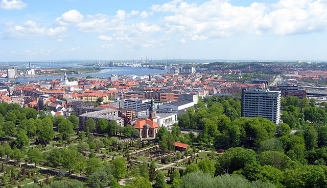
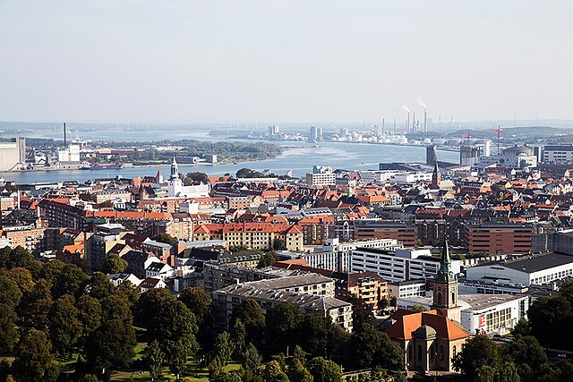
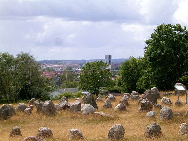
Aalborg, also spelled Ålborg, is an industrial and university city in the North of Jutland, Denmark. It has an population of 112,194, making it the fourth most populous city in Denmark. With a population of 210,316, the Municipality of Aalborg is the third most populous in the country after Copenhagen, by road Aalborg is 64 kilometres southwest of Frederikshavn, and 118 kilometres north of Aarhus. The distance to Copenhagen is 412 kilometres, the earliest settlements date to around AD700. Aalborgs position at the narrowest point on the Limfjord made it an important harbour during the Middle Ages, architecturally, the city is known for its half-timbered mansions built by its prosperous merchants. Budolfi Church, now a cathedral, dates from the end of the 14th century and Aalborghus Castle, today, Aalborg is a city in transition from a working-class industrial area to a knowledge-based community. A major exporter of grain, cement, and spirits, its business interests include Siemens Wind Power, Aalborg Industries. These companies have become global producers of wind turbine rotors, marine boilers, with its theatres, symphony orchestra, opera company, performance venues, and museums such as Aalborg Historical Museum and the Aalborg Museum of Modern Art, Aalborg is an important cultural hub. The Aalborg Carnival, held at the end of May, is one of the largest festivals in Scandinavia, the major university is the University of Aalborg, founded in 1974, which has more than 17,000 students. Trænregimentet, the Danish regiment for army supply and emergency personnel, is also in Aalborg. Aalborg University Hospital, the largest in the north of Jutland, was founded in 1881. The football club Aalborg BK, established in 1885 and based at Nordjyske Arena, won the Danish Superliga in the 1994–95 season, the 1998–99 season, the 2007–08 season and the 2013–14 season. Other sports associations include the icehockey club Aalborg Pirates, the handball team Aalborg Håndbold, the rugby club Aalborg RK. Aalborg Railway Station, on John F. Kennedys Plads has connected the city to Randers, Aalborg Airport is just 6 kilometres northwest of the city centre, and the E45, a European route from Karesuando, Sweden, to Gela, Italy, passes through Aalborg. The European Commission has concluded that the citizens of Aalborg are the most satisfied people in Europe with their city. The area around the narrowest point on the Limfjord attracted settlements as far back as the Iron Age leading to a thriving Viking community until around the year 1000 in what has now become Aalborg. In the Middle Ages, royal trading privileges, a natural harbour, despite the difficulties it experienced over the centuries, the city began to prosper once again towards the end of the 19th century when a bridge was built over Limfjord and the railway arrived. Aalborgs initial growth relied on heavy industry but its current development focuses on culture, Aalborg traces its history back over a thousand years
3.
Geographic coordinate system
–
A geographic coordinate system is a coordinate system used in geography that enables every location on Earth to be specified by a set of numbers, letters or symbols. The coordinates are chosen such that one of the numbers represents a vertical position. A common choice of coordinates is latitude, longitude and elevation, to specify a location on a two-dimensional map requires a map projection. The invention of a coordinate system is generally credited to Eratosthenes of Cyrene. Ptolemy credited him with the adoption of longitude and latitude. Ptolemys 2nd-century Geography used the prime meridian but measured latitude from the equator instead. Mathematical cartography resumed in Europe following Maximus Planudes recovery of Ptolemys text a little before 1300, in 1884, the United States hosted the International Meridian Conference, attended by representatives from twenty-five nations. Twenty-two of them agreed to adopt the longitude of the Royal Observatory in Greenwich, the Dominican Republic voted against the motion, while France and Brazil abstained. France adopted Greenwich Mean Time in place of local determinations by the Paris Observatory in 1911, the latitude of a point on Earths surface is the angle between the equatorial plane and the straight line that passes through that point and through the center of the Earth. Lines joining points of the same latitude trace circles on the surface of Earth called parallels, as they are parallel to the equator, the north pole is 90° N, the south pole is 90° S. The 0° parallel of latitude is designated the equator, the plane of all geographic coordinate systems. The equator divides the globe into Northern and Southern Hemispheres, the longitude of a point on Earths surface is the angle east or west of a reference meridian to another meridian that passes through that point. All meridians are halves of great ellipses, which converge at the north and south poles, the prime meridian determines the proper Eastern and Western Hemispheres, although maps often divide these hemispheres further west in order to keep the Old World on a single side. The antipodal meridian of Greenwich is both 180°W and 180°E, the combination of these two components specifies the position of any location on the surface of Earth, without consideration of altitude or depth. The grid formed by lines of latitude and longitude is known as a graticule, the origin/zero point of this system is located in the Gulf of Guinea about 625 km south of Tema, Ghana. To completely specify a location of a feature on, in, or above Earth. Earth is not a sphere, but a shape approximating a biaxial ellipsoid. It is nearly spherical, but has an equatorial bulge making the radius at the equator about 0. 3% larger than the radius measured through the poles, the shorter axis approximately coincides with the axis of rotation
4.
Social Democrats (Denmark)
–
The Social Democrats is a social-democratic political party in Denmark. It was the coalition partner in government from the 2011 parliamentary election. After the 2015 parliamentary election, the party is no longer in government, though it is still the largest party in the Danish parliament, founded by Louis Pio in 1871, the party first entered the Folketing in 1884. By the early 20th century it had become the party with the largest representation in the Folketing and it first formed a government in 1924 under Thorvald Stauning, the longest-serving Danish Prime Minister of the 20th century. During Staunings government, the Social Democrats exerted an influence on Danish society. From 2002 to 2016 the party used the name Socialdemokraterne in some contexts, a member of the Party of European Socialists, the Social Democrats have three MEPs in the European Parliament. Since its foundation the lemma of the party has been Liberty, Equality and Brotherhood, the leader of the party is Mette Frederiksen. She succeeded Helle Thorning-Schmidt, who stepped down after the left blocs defeat in the 2015 General Election, deputy leaders are Frank Jensen, Lord Mayor of Copenhagen, and Mogens Jensen. The secretary general is Henrik Dam Kristensen, the party secretary is Lars Midtiby, in the Cabinet of Helle Thorning-Schmidt, the party had ten ministers including the Prime Minister. The party was founded in 1871 by Louis Pio, Harald Brix og Paul Geleff, the goal was to organize the emerging working class on a democratic and socialist basis. The industrialization of Denmark had begun in the mid 19th century, the social democratic movement emerged from the desire to give this group political rights and representation in parliament. In 1876 the Party held a conference, adopting the first party manifesto. In the 1924 parliamentary elections the Social democratic party won the majority with 36.6 percent of the vote, the same year he appointed the worlds first female minister Nina Bang, nine years after womens suffrage had been given in Denmark. Stauning stayed in power until his death in 1942, his party laying the foundations for the Danish welfare state, in January 1933 Staunings government entered into what was then the most extensive settlement yet in Danish politics — the Kanslergade settlement — with the liberal party Venstre. In 1935, Stauning was reelected with the famous slogan Stauning or Chaos, through the 1940s and until 1972 Denmark was governed by the following Social Democratic prime ministers. 1939 –1955, Hans Hedtoft 1955 –1960, H. C, the Cabinets of Poul Nyrup Rasmussen maintained a parliamentary majority during the period from 1993 to 2001 by virtue of their support from the Socialist Peoples Party and the Red-Green Alliance. Towards the end of the 1990s, a surplus of 30 billion kroner turned into a deficit. To combat this, the government increased taxes, limiting private consumption, after being defeated by the Liberal Party in the 2001 election, the party chairmanship went to former finance and foreign minister Mogens Lykketoft
5.
Central European Summer Time
–
It corresponds to UTC + two hours. Other names which have been applied to Central European Summer Time are Middle European Summer Time, Central European Daylight Saving Time, and Bravo Time. Since 1996 European Summer Time has been observed between 1,00 UTC on the last Sunday of March and 1,00 on the last Sunday of October, the following countries and territories use Central European Summer Time. In addition, Libya used CEST during the years 1951–1959, 1982–1989, 1996–1997, European Summer Time Other countries and territories in UTC+2 time zone Other names of UTC+2 time zone
6.
Danish language
–
There are also minor Danish-speaking communities in Norway, Sweden, Spain, the United States, Canada, Brazil and Argentina. Due to immigration and language shift in urban areas, around 15–20% of the population of Greenland speak Danish as their home language. Along with the other North Germanic languages, Danish is a descendant of Old Norse, until the 16th century, Danish was a continuum of dialects spoken from Schleswig to Scania with no standard variety or spelling conventions. With the Protestant Reformation and the introduction of printing, a language was developed which was based on the educated Copenhagen dialect. It spread through use in the system and administration though German. Today, traditional Danish dialects have all but disappeared, though there are variants of the standard language. The main differences in language are between generations, with youth language being particularly innovative, Danish has a very large vowel inventory comprising 27 phonemically distinctive vowels, and its prosody is characterized by the distinctive phenomenon stød, a kind of laryngeal phonation type. The grammar is moderately inflective with strong and weak conjugations and inflections, nouns and demonstrative pronouns distinguish common and neutral gender. As in English, Danish only has remnants of a case system, particularly in the pronouns. Its syntax is V2, with the verb always occupying the second slot in the sentence. Danish is a Germanic language of the North Germanic branch, other names for this group are the Nordic or Scandinavian languages. Along with Swedish, Danish descends from the Eastern dialects of the Old Norse language, Scandinavian languages are often considered a dialect continuum, where there are no sharp dividing lines between the different vernacular languages. Like Norwegian and Swedish, Danish was significantly influenced by Low German in the Middle Ages, Danish itself can be divided into three main dialect areas, West Danish, Insular Danish, and East Danish. Danish is largely mutually intelligible with Norwegian and Swedish, both Swedes and Danes also understand Norwegian better than they understand each others languages. By the 8th century, the common Germanic language of Scandinavia, Proto-Norse, had some changes. This language was called the Danish tongue, or Norse language. Norse was written in the alphabet, first with the elder futhark. From the 7th century the common Norse language began to undergo changes that did not spread to all of Scandinavia, most of the changes separating East Norse from West Norse started as innovations in Denmark, that spread through Scania into Sweden and by maritime contact to southern Norway
7.
Municipality
–
It is to be distinguished from the county, which may encompass rural territory and/or numerous small communities such as towns, villages and hamlets. The term municipality may also mean the governing or ruling body of a given municipality, a municipality is a general-purpose administrative subdivision, as opposed to a special-purpose district. The term is derived from French municipalité and Latin municipalis, a municipality can be any political jurisdiction from a sovereign state, such as the Principality of Monaco, or a small village, such as West Hampton Dunes, New York. The power of municipalities range from virtual autonomy to complete subordination to the state, municipalities may have the right to tax individuals and corporations with income tax, property tax, and corporate income tax, but may also receive substantial funding from the state. Similar terms include Spanish ayuntamiento, also called municipalidad, Polish gmina, Dutch/Flemish Gemeente, in Australia, the term local government area is used in place of the generic municipality. Here, the LGA Structure covers only incorporated areas of Australia, incorporated areas are legally designated parts of states and territories over which incorporated local governing bodies have responsibility. In Canada, municipalities are local governments established through provincial and territorial legislation, the Province of Ontario has different tiers of municipalities, including lower, upper, and single tiers. Types of upper tier municipalities in Ontario include counties and regional municipalities, nova Scotia also has regional municipalities, which include cities, counties, districts, or towns as municipal units. In India, a Nagar Palika or Municipality is a local body that administers a city of population 100,000 or more. Under the Panchayati Raj system, it directly with the state government. Generally, smaller cities and bigger towns have a Nagar Palika. Nagar Palikas are also a form of local self-government entrusted with duties and responsibilities. Such a corporation in Great Britain consists of a head as a mayor or provost, since local government reorganisation, the unit in England, Northern Ireland and Wales is known as a district, and in Scotland as a council area. A district may be awarded borough or city status, or can retain its district title, in Jersey, a municipality refers to the honorary officials elected to run each of the 12 parishes into which it is subdivided. This is the highest level of government in this jurisdiction. In the United States, municipality is usually understood as a city, town, village, or other local government unit, in the Peoples Republic of China, a direct-controlled municipality is a city with equal status to a province, Beijing, Tianjin, Shanghai, and Chongqing. In Taiwan, a municipality is a city with equal status to a province, Kaohsiung, New Taipei, Taichung, Tainan, Taipei. In Portuguese language usage, there are two words to distinguish the territory and the administrative organ, when referring to the territory, the word concelho is used, when referring to the organ of State, the word município is used
8.
Jutland
–
Jutland, also known as the Cimbric or Cimbrian Peninsula, is a peninsula of Northern Europe that forms the continental portion of Denmark and the northern portion of Germany. The names are derived from the Jutes and the Cimbri, respectively, jutlands terrain is relatively flat, with open lands, heaths, plains and peat bogs in the west and a more elevated and slightly hilly terrain in the east. Jutland is a peninsula bounded by the North Sea to the west, the Skagerrak to the north, geographically and historically, Jutland comprises the regions of South Jutland, West Jutland, East Jutland and North Jutland. There are several subdivisions and regional names, some of which are still occasionally encountered today. They include Nørrejyllland, Sydvestjylland, Nordvestjylland and Slesvig, historically, Jutland was regulated by the Law Code of Jutland. This civic code covered the Jutland Peninsula from the north of the River Eider to Funen as well as the North Jutlandic Island. The Danish part of Jutland is currently divided into three regions, North Denmark Region, Central Denmark Region and Region of Southern Denmark. These three regions have an area of 29,775 km2, a population of 2,599,104. The northernmost part of Jutland is separated from the mainland by the Limfjord and this area is called the North Jutlandic Island, Vendsyssel-Thy or simply Jutland north of the Limfjord, it is only partly co-terminous with the North Jutland region. Inhabitants of Als would agree to be South Jutlanders, but not necessarily Jutlanders, the Danish Wadden Sea Islands and the German North Frisian Islands stretch along the southwest coast of Jutland in the German Bight. Jutland has historically been one of the three lands of Denmark, the two being Scania and Zealand. Before that, according to Ptolemy, Jutland or the Cimbric Chersonese was the home of Teutons, Cimbri, many Angles, Saxons and Jutes migrated from Continental Europe to Great Britain starting in c.450 AD. The Angles themselves gave their name to the new emerging kingdoms called England and this is thought by some to be related to the invasion of Europe by the Huns from Asia. Saxons and Frisii migrated to the region in the part of the Christian era. Old Saxony was later on referred to as Holstein, during the First World War, the Battle of Jutland in the North Sea west of Jutland was one of the largest naval battles in history. In this pitched battle, the British Royal Navy engaged the Imperial German Navy, the British fleet sustained greater losses, but remained in control of the North Sea, so in strategic terms, most historians regard Jutland either as a British victory or as indecisive. The distinctive Jutish dialects differ substantially from standard Danish, especially West Jutlandic, dialect usage, although in decline, is better preserved in Jutland than in eastern Denmark, and Jutlander speech remains a stereotype among many Copenhageners and eastern Danes. Administratively, Danish Jutland comprises three of Denmarks five regions, namely the Region Nordjylland, Region Midtjylland and the half of Region of Southern Denmark
9.
Limfjord
–
For the sea inlet in Croatia, see Lim. The Limfjord is a part of the sea, located in Denmark where it is regarded as a fjord ever since the Vikings. However it has inlets both from the North Sea and Kattegat and hence separates the island of North Jutlandic Island from the rest of the Jutland Peninsula and it extends from Thyborøn Channel on the North Sea to Hals on the Kattegat. It is approximately 180 kilometres long and of a shape with numerous bays, narrowings, and islands, most notably Mors. The Limfjord is not a fjord in the English geological sense in - in Danish and its main port is Aalborg, where a railway bridge and road bridge are built across Limfjorden to Nørresundby, while motorway E45 passes it through a tunnel to the east. Commercial ports also exist at Thisted, Nykøbing Mors, Skive, Løgstør, Struer, Lemvig, there are also bridges at Oddesund, Sallingsund, Vilsund, Aggersund and Sebbersund, and a number of ferry crossings. The Limurfjord had only an opening to the sea in the east from the early Middle Ages until 1825, in that year, the North Sea broke through from the west and created a second opening, turning the northern part of Jutland Vendsyssel-Thy into an island. An isthmus of shifting sand has separated the Limfjord from the North Sea during historic times, the present inlet, Thyborøn Channel, has existed only since 1862. A passage also existed during the Viking age, based on place names and the geography it is thought to have been to the south of the present one, between Ferring Sø and Hygum Nor. Canute the Great sailed into it in 1027 on his way back from England, according to Saxo Grammaticus it closed at some time around 1200. There are records of several floods piercing the isthmus during the 16th to early 19th century, from the 1840s the route got increasingly important, as Britain had opened for import of grain, and ships could return with British coal. However, the instability of Agger Channel made the towns of the western Limfjord look for a second option, in 1862, a flood pierced another opening, the Thyborøn Channel, through the remainder of Agger Tange. Agger Channel was continuously filling with sand and eventually closed in 1877, since then, the remaining Thyborøn Channel is kept open and navigable through dredging. The harbour of Thyborøn was built in 1914-18 and a town was founded, the two isthmuses have shifted eastwards since the 1800s. They are only being preserved by groynes, persistent sandpumping and two dams along their inward side. At Løgstør, where the western part of the Limfjord meets the narrow eastern section. Larger ships needed to be unloaded and reloaded when passing the banks, the Frederik VII Canal at Løgstør was completed in 1861 to allow for easier passage. Traffic had increased after the opening at Thyborøn became navigable
10.
North Sea
–
The North Sea is a marginal sea of the Atlantic Ocean located between Great Britain, Scandinavia, Germany, the Netherlands, Belgium, and France. An epeiric sea on the European continental shelf, it connects to the ocean through the English Channel in the south and it is more than 970 kilometres long and 580 kilometres wide, with an area of around 570,000 square kilometres. The North Sea has long been the site of important European shipping lanes as well as a major fishery, the North Sea was the centre of the Vikings rise. Subsequently, the Hanseatic League, the Netherlands, and the British each sought to dominate the North Sea and thus the access to the markets, as Germanys only outlet to the ocean, the North Sea continued to be strategically important through both World Wars. The coast of the North Sea presents a diversity of geological and geographical features, in the north, deep fjords and sheer cliffs mark the Norwegian and Scottish coastlines, whereas in the south it consists primarily of sandy beaches and wide mudflats. Due to the population, heavy industrialization, and intense use of the sea and area surrounding it. In the southwest, beyond the Straits of Dover, the North Sea becomes the English Channel connecting to the Atlantic Ocean, in the east, it connects to the Baltic Sea via the Skagerrak and Kattegat, narrow straits that separate Denmark from Norway and Sweden respectively. In the north it is bordered by the Shetland Islands, and connects with the Norwegian Sea, the North Sea is more than 970 kilometres long and 580 kilometres wide, with an area of 570,000 square kilometres and a volume of 54,000 cubic kilometres. Around the edges of the North Sea are sizeable islands and archipelagos, including Shetland, Orkney, the North Sea receives freshwater from a number of European continental watersheds, as well as the British Isles. A large part of the European drainage basin empties into the North Sea including water from the Baltic Sea, the largest and most important rivers flowing into the North Sea are the Elbe and the Rhine – Meuse watershed. Around 185 million people live in the catchment area of the rivers discharging into the North Sea encompassing some highly industrialized areas, for the most part, the sea lies on the European continental shelf with a mean depth of 90 metres. The only exception is the Norwegian trench, which extends parallel to the Norwegian shoreline from Oslo to a north of Bergen. It is between 20 and 30 kilometres wide and has a depth of 725 metres. The Dogger Bank, a vast moraine, or accumulation of unconsolidated glacial debris and this feature has produced the finest fishing location of the North Sea. The Long Forties and the Broad Fourteens are large areas with uniform depth in fathoms. These great banks and others make the North Sea particularly hazardous to navigate, the Devils Hole lies 200 miles east of Dundee, Scotland. The feature is a series of trenches between 20 and 30 kilometres long,1 and 2 kilometres wide and up to 230 metres deep. Other areas which are less deep are Cleaver Bank, Fisher Bank, the International Hydrographic Organization defines the limits of the North Sea as follows, On the Southwest
11.
Kattegat
–
The Baltic Sea drains into the Kattegat through the Danish Straits. The sea area is a continuation of the Skagerrak and may be seen as a bay of the Baltic Sea or the North Sea or, as in traditional Scandinavian usage, neither of these. The Kattegat is a shallow sea and can be very difficult and dangerous to navigate, due to the many sandy and stony reefs. There are several cities and major ports in the Kattegat, including Gothenburg, Aarhus, Aalborg, Halmstad and Frederikshavn, mentioned by descending size. The main islands of the Kattegat are Samsø, Læsø and Anholt, since the 1950s, a bridge project usually referred to as Kattegatbroen connecting Jutland and Zealand across the Kattegat has been considered. Since the late 2000s, the project has seen a renewed interest from several politicians in Denmark. The bridge is usually envisioned as connecting Hov with Samsø and Kalundborg, on the South, The limits of the Baltic Sea in the Belts and Sound, In the Little Belt, A line joining Falshöft and Vejsnæs Nakke. In the Great Belt, A line joining Gulstav and Kappel Kirke on the island of Laaland, in the Sound, A line joining Stevns Lighthouse and Falsterbo Point. According to Den Store Danske Encyklopædi and Nudansk Ordbog, the name derives from the Dutch words kat and gat, at one point, the passable waters were a mere 3.84 km wide. The name of the Copenhagen street Kattesundet has a comparable etymological meaning, an archaic name for both the Skagerrak and Kattegat was the Norwegian Sea or Jutland Sea. Its ancient Latin name was Sinus Codanus, Control of the Kattegat, and access to it, have been important throughout the history of international seafaring. Until the completion of the Eider Canal in 1784, the Kattegat was the water route into. The dues were eventually lifted in 1857, in the Kattegat, the salinity has a pronounced two-layer structure. The upper layer has a salinity between 18‰ and 26‰ and the lower layer – separated by a strong halocline at around 15 m – has a salinity between 32‰ and 34‰. These two opposing flows transport a net surplus of 475 km3 seawater from the Baltic to the Skagerrak every year. During stronger winds, the layers in the Kattegat are completely mixed in some places, such as the Great Belt and this sets some unique conditions for the sealife here. The Kattegat was one of the first marine dead zones to be noted in the 1970s, in recent years studies and research, has provided much insight into processes like eutrophication, and how to deal with it. The action plans sums up a range of initiatives and includes the so-called Nitrate Directives
12.
North Jutlandic Island
–
The North Jutlandic Island, Vendsyssel-Thy, or simply Jutland north of the Limfjord are lesser-used names for the northernmost part of Denmark and of Jutland. It is more common to refer to the three traditional districts Vendsyssel, Hanherred and Thy, although the area is separated from mainland Jutland by the Limfjord, it is traditionally regarded as a part of Jutland rather than an island. Geographically, it is the second largest island of Denmark after Zealand with a population of 296,700 on 1 January 2014, danes rarely refer to the area as a whole, but more often to the three constituent districts or to North Jutland. The adjectives nordenfjords and søndenfjords are commonly used, meaning north and south of the Fjord, the names can all be considered ad hoc creations, as a traditional name for the island as a geographical unity is lacking. The North Jutlandic Island was formerly an island, connected to the Jutland Peninsula by the narrow sand tombolo of Agger Tange between c.1200 and 1825. The area became an island again on 3 February 1825, when the North Sea broke through the Agger Tange in its far southwest, cutting off the area from mainland Jutland, the current separator is the Thyborøn Channel which was created slightly further south by a flood in 1862. The original Agger Channel filled up with sand in 1877, the syssel was a medieval sub-division which is regarded as the oldest administrative unity in Denmark, existing since prehistoric times. The North Jutlandic Island was divided two of these, Thysyssel and Vendsyssel. Ecclesiastically, the North Jutlandic Island is the core of the Diocese of Aalborg, in traditional terms, the westernmost part of the island, Thy, is considered part of Northern and Western Jutland simultaneously. The term North West Jutland refers to Thy, Mors, area,4,685 km² Population,296,700 Vendsyssel Hanherred Thy Traditional districts of Denmark List of islands of Denmark Media related to Nørrejyske Ø at Wikimedia Commons
13.
Port
–
A port is a location on a coast or shore containing one or more harbors where ships can dock and transfer people or cargo to or from land. Port locations are selected to optimize access to land and navigable water, for commercial demand, Ports with deeper water are rarer, but can handle larger ships. Since ports throughout history handled every kind of traffic, support and storage facilities vary widely, may extend for miles, some ports have an important military role. One of the worlds oldest known artificial harbors is at Wadi al-Jarf on the Red Sea, along with the finding of harbor structures, ancient anchors have also been found. Guangzhou was an important port during the ancient times as far back as the Qin Dynasty, canopus was the principal port in Egypt for Greek trade before the foundation of Alexandria. Athens port of Piraeus was the base for the Athenian fleet, lothal is one of the most prominent cities of the ancient Indus valley civilisation, located in the Bhāl region of the modern state of Gujarāt and dating from 3700 BCE. Ostia Antica was the port of ancient Rome with Portus established by Claudius, Ports often have cargo-handling equipment, such as cranes and forklifts for use in loading ships, which may be provided by private interests or public bodies. Often, canneries or other processing facilities will be located nearby, some ports feature canals, which allow ships further movement inland. Access to intermodal transportation, such as railroads and highways, is critical to a port, so that passengers, Ports with international traffic have customs facilities. Harbor pilots and tugboats may maneuver large ships in tight quarters when near docks, the terms port and seaport are used for different types of port facilities that handle ocean-going vessels, and river port is used for river traffic, such as barges and other shallow-draft vessels. An inland port is a port on a lake, river, or canal with access to a sea or ocean. An example of this is the St. Lawrence Seaway which allows ships to travel from the Atlantic Ocean several thousand kilometers inland to Great Lakes ports like Duluth-Superior, a fishing port is a port or harbor for landing and distributing fish. It may be a facility, but it is usually commercial. A fishing port is the port that depends on an ocean product. In recent decades, regulations to save fishing stock may limit the use of a fishing port, a dry port is an inland intermodal terminal directly connected by road or rail to a seaport and operating as a centre for the transshipment of sea cargo to inland destinations. A warm-water port is one where the water does not freeze in wintertime, because they are available year-round, warm-water ports can be of great geopolitical or economic interest. A seaport is further categorized as a port or a cargo port. Additionally, cruise ports are known as a home port or a port of call
14.
Hals Municipality
–
Hals Municipality ceased to exist on January 1,2007, due to Kommunalreformen It was located in North Jutland County. The municipality covered an area of 191 km², and had a population of 11,448. Its last mayor was Bent Sørensen, a member of the Social Democrats political party, though Hals was the biggest town, the site of its municipal council was the town of Gandrup since the location was more central. Other towns in Hals Municipality were Vester Hassing, Ulsted and Hou and some minor villages Stae, Øster Hassing, Holtet, Gåser, Hals municipality ceased to exist due to Kommunalreformen. It was merged with Nibe, Sejlflod, and Aalborg municipalities to form the new Aalborg municipality and this created a municipality with an area of 1,171 km² and a total population of ca. Aalborg municipalitys website Municipal statistics, NetBorger Kommunefakta, delivered from KMD aka Kommunedata Municipal mergers and neighbors, Eniro new municipalities map
15.
Nibe
–
Nibe is a town with a population of 5,093, located in Region Nordjylland on the Jutland Peninsula in northern Denmark. The town is located in a region known as Himmerland. Nibe was the site of the council of Nibe Municipality. The town also holds the Nibe Festival which is held in its very own, municipalitys official website Municipal statistics, NetBorger Kommunefakta, delivered from KMD aka Kommunedata Municipal mergers and neighbors, Eniro new municipalities map
16.
Politics of Denmark
–
Denmark is described as a nation state. Danish politics and governance are characterized by a striving for broad consensus on important issues. Executive power is exercised by the cabinet of Denmark, presided over by the Prime Minister who is first among equals, legislative power is vested in both the executive and the national parliament. Members of the judiciary are nominated by the executive, formally appointed by the monarch, Denmark has a multi-party system, with two strong parties, and four or five other significant parties. No single party has held a majority in the Folketing since the beginning of the 20th century. Since only four coalition governments have enjoyed a majority, government bills rarely become law without negotiations. Hence the Folketing tends to be powerful than legislatures in other EU countries. The Constitution does not grant the power of judicial review of legislation. Since there are no constitutional or administrative courts, the Supreme Court deals with a constitutional dimension, on many issues the political parties tend to opt for co-operation, and the Danish state welfare model receives broad parliamentary support. This ensures a focus on efficiency and devolved responsibilities of local government on regional and municipal levels. Margrethe II has ruled as Queen Regnant and head of state since 14 January 1972, in accordance with the Danish Constitution the Danish monarch, as head of state, is the theoretical source of all executive and legislative power. However, since the introduction of parliamentary sovereignty in 1901, a de facto separation of powers has been in effect, the text of the Danish constitution dates back to 1849. Therefore, it has been interpreted by jurists to suit modern conditions, in a formal sense, the monarch retains the ability to deny giving a bill royal assent. In order for a bill to law, a royal signature. The monarch also chooses and dismisses the Prime Minister, although in modern times a dismissal would cause a constitutional crisis, on 28 March 1920, King Christian X was the last monarch to exercise the power of dismissal, sparking the 1920 Easter Crisis. When a new government is to be formed, the monarch calls the party leaders to a conference of deliberation, on the basis of the advice the monarch then appoints the party leader who commands a majority of recommendation to lead negotiations for forming a new government. However, the monarch does continue to exercise three rights, the right to be consulted, the right to advise, and the right to warn, pursuant to these ideals, the Prime Minister and the Cabinet attend the regular meeting of the Council of State. Nine parties are represented in parliament, the four oldest and in history most influential parties are the Conservative Peoples Party, the Social Democrats, Venstre and the Danish Social Liberal Party
17.
Dronninglund
–
Dronninglund is a town with a population of 3,328 in Brønderslev Municipality, Region Nordjylland on the peninsula of Jutlands eastern coast in northern Denmark. Until 1 January 2007, Dronninglund was also a municipality in North Jutland County, the municipality covered an area of 316 km², and had a total population of 15,213. Its last mayor was Mikael Klitgaard, a member of the Venstre political party, Dronninglund municipality ceased to exist as the result of Kommunalreformen. It was merged with Brønderslev municipality to form the new Brønderslev Municipality and this created a municipality with an area of 630 km² and a total population of 35,320. Perhaps the most immediate attraction in Dronninglund is Dronninglund Castle, founded in the 12th century, Dronninglund Church was erected at some point between 1160 and 1200 in relation to the former Hundslund Priory at Dronninglund Castle. Dronninglund is home to the museums of Try Museum and Dorf Møllegård and they are both part of the umbrella organization The Museums in Brønderslev Municipality, which comprise a total of three museums, all recognized by the State of Denmark. The third museum is the regional-museum of Vildmosemuseet in Brønderslev, the Dronninglund Hotel was established in 1981. It was refurbished in 1999 and has 72 rooms
18.
North Jutland County
–
North Jutland County is a former county in northern Denmark. It was located on the half of Vendsyssel-Thy and the northernmost part of the Jutland peninsula. It was the largest county in Denmark, but with a low population. The county seat was Aalborg, Denmarks fourth largest city, the county was abolished effective January 1,2007, when it merged into North Denmark Region. Vendsyssel North Denmark Region Northern Jutland
19.
Ferry
–
A ferry is a merchant vessel used to carry passengers, and sometimes vehicles and cargo as well, across a body of water. Most ferries operate regular return services, a passenger ferry with many stops, such as in Venice, Italy, is sometimes called a water bus or water taxi. Ferries form a part of the transport systems of many waterside cities and islands. However, ship connections of much larger distances may also be called ferry services, the profession of the ferryman is embodied in Greek mythology in Charon, the boatman who transported souls across the River Styx to the Underworld. Speculation that a pair of oxen propelled a ship having a wheel can be found in 4th century Roman literature Anonymus De Rebus Bellicis. Though impractical, there is no reason why it could not work and such a ferry, see When Horses Walked on Water, Horse-Powered Ferries in Nineteenth-Century America. The Marine Services Company of Tanzania offers passenger and cargo services in three of the African Great Lakes viz, Lake Victoria, Lake Tanganyika and Lake Nyasa. It also operates one of the oldest ferries in the region, Ferries from Great Britain also sail to Belgium, Denmark, the Netherlands, Norway, Spain and Ireland. Some ferries carry mainly tourist traffic, but most also carry freight, in Britain, car-carrying ferries are sometimes referred to as RORO for the ease by which vehicles can board and leave. The busiest single ferry route is across the part of Øresund. Before the Øresund bridge was opened in July 2000, car and car & train ferries departed up to seven times every hour, in 2013, this has been reduced, but a car ferry still departs from each harbor every 15 minutes during daytime. The route is around 2.2 nautical miles and the crossing takes 22 minutes, today, all ferries on this route are constructed so that they do not need to turn around in the harbors. This also means that the ferries lack natural stems and sterns, due to the same circumstances, starboard and port-side are dynamic and depending of in what direction the ferry sails. Despite the short crossing, the ferries are equipped with restaurants, cafeteria, kiosks, large cruiseferries sail in the Baltic Sea between Finland, Åland, Sweden, Estonia, Latvia and Saint Petersburg, Russia and from Italy to Sardinia, Corsica, Spain and Greece. In many ways, these ferries are like cruise ships, also many smaller ferries operate on domestic routes in Finland, Sweden and Estonia. The south-west and southern parts of the Baltic Sea has several routes mainly for heavy traffic, on the longer of these routes, simple cabins are available. In Istanbul, ferries connect the European and Asian shores of Bosphorus, as well as Princes Islands, in 2014 İDO transported 47 million passengers, the largest ferry system in the world. Due to the numbers of freshwater lakes and length of shoreline in Canada
20.
Lille Vildmose
–
Lille Vildmose is a raised bog also known as the East Himmerland Moor in the hinterland in the municipalities of Aalborg and Mariagerfjord, Denmark. It is reported to be the largest raised bog in north-western Europe, the bog is a remnant of heathland that once extended south from Limfjorden to Rold Forest. Lille Vildmose is an area, about 28 miles southeast of Aalborg. It encompasses an area of 7,600 hectares which is owned privately and partly by the State. A well-preserved, pristine wilderness, it contains the largest raised bog in Northern Europe and is Denmarks largest protected area and its habitat consists of raised bogs, former islands, and a large area of coastal hills and beach meadows. The raised bogs flourished undisturbed for 1,200 years till they were drained around 1750. They contain layers of peat growing at a rate of 4–5 millimetres. Tofte Lake has been formed after draining the marsh over a period of 200 years, the deciduous forests of Høstemark, Tofte, and Mose are part of the protected area secured by fencing. Trees have started to grow on the Portlandmose and Paraplymose, both raised bogs, as a result of drainage, rye was cultivated in Lille Vildmose prior to the medieval period when hemp was introduced for diversification, after ca. Agricultural production dropped and farmland in Lille Vildmose was abandoned between 1360 and 1540 due to the Black Death plague, resulting in the regeneration of woodland, after 1540, farming was intensified, the main products being rye and hemp. By 1760, when Lille Vildmose belonged to the Lindenborg Estate, more than 5,000 ha were tilled for the estates farm, in the early 19th century, the reclamation of Lille Vildmose was the impetus needed to establish a peat industry. The peatcutting have now been terminated completely for many reasons of which the conservation efforts is just one. In 2003, together with Mols Bjerge and Møn, Lille Vildmose was selected by the Ministry of the Environment to participate in a project to develop a model for Danish national parks. The visitor center, Lille Vildmosecentret, was designed by C. F. Møller Architects and it contains an activity center and is also the starting point for visiting the bogs and forests. Wildlife can be observed from the parks look-out tower, an eagle simulator, landscape models, interactive exhibits, recreation areas for children, and hiking paths are other features. Double-decker bus service began in 2009 from Hobro in the south to Egense near Hals in the north, Høstemark and Tofte forests and bogs have been undisturbed habitats for flora and fauna. There are 12-15 different species of plants including Sphagnum moss, heather, bell heather, crowberry, rosemary heather, cranberries, white beak rush and tue-cottongrass, flowering plants grow on the peat sponge. There are no trees within the bog, however birch and willow are recorded in the bogs wooded marginal zones known as lagg, a stock of red deer totals about 550 animals
21.
Bog
–
A bog is a wetland that accumulates peat, a deposit of dead plant material—often mosses, and in a majority of cases, sphagnum moss. It is one of the four types of wetlands. Other names for bogs include mire, quagmire, and muskeg and they are frequently covered in ericaceous shrubs rooted in the sphagnum moss and peat. The gradual accumulation of decayed plant material in a bog functions as a carbon sink, Bogs occur where the water at the ground surface is acidic and low in nutrients. In some cases, the water is derived entirely from precipitation, water flowing out of bogs has a characteristic brown colour, which comes from dissolved peat tannins. In general, the low fertility and cool climate results in relatively slow plant growth, large areas of landscape can be covered many metres deep in peat. Bogs have distinctive assemblages of animal, fungal and plant species, Bogs are widely distributed in cold, temperate climes, mostly in boreal ecosystems in the Northern Hemisphere. The worlds largest wetland is the bogs of the Western Siberian Lowlands in Russia. Large peat bogs also occur in North America, particularly the Hudson Bay Lowland and they are less common in the Southern Hemisphere, with the largest being the Magellanic moorland, comprising some 44,000 square kilometres. Sphagnum bogs were widespread in northern Europe but have often been cleared and drained for agriculture, a 2014 expedition leaving from Itanga village, Republic of the Congo discovered a peat bog as big as England which stretches into neighboring Democratic Republic of Congo. There are many highly specialised animals, fungi and plants associated with bog habitat, most are capable of tolerating the combination of low nutrient levels and waterlogging. Sphagnum moss is generally abundant, along with ericaceous shrubs, the shrubs are often evergreen, which is understood to assist in conservation of nutrients. In drier locations, evergreen trees can occur, in case the bog blends into the surrounding expanses of boreal evergreen forest. Sedges are one of the more common herbaceous species, carnivorous plants such as sundews and pitcher plants have adapted to the low-nutrient conditions by using invertebrates as a nutrient source. Orchids have adapted to these conditions through the use of fungi to extract nutrients. Some shrubs such as Myrica gale have root nodules in which nitrogen fixation occurs, Bogs are recognized as a significant/specific habitat type by a number of governmental and conservation agencies. They can provide habitat for mammals, such as caribou, moose, the United Kingdom in its Biodiversity Action Plan establishes bog habitats as a priority for conservation. Russia has a reserve system in the West Siberian Lowland
22.
Metropolitan area
–
As social, economic and political institutions have changed, metropolitan areas have become key economic and political regions. The Greater São Paulo is a term for one of the multiple definitions the large metropolitan area located in the São Paulo state in Brazil. A metropolitan area combines an urban agglomeration with zones not necessarily urban in character and these outlying zones are sometimes known as a commuter belt, and may extend well beyond the urban zone, to other political entities. For example, El Monte, California is considered part of the Los Angeles metro area in the United States, in practice, the parameters of metropolitan areas, in both official and unofficial usage, are not consistent. Population figures given for one area can vary by millions. A polycentric metropolitan area is one not connected by continuous development or conurbation, in defining a metropolitan area, it is sufficient that a city or cities form a nucleus that other areas have a high degree of integration with. The Australian Bureau of Statistics defines statistical divisions as areas under the influence of one or more major towns or a major city. However, this definition has become obsolete with the conurbation of several statistical divisions into a larger metropolitan areas. In Brazil, metropolitan areas are called metropolitan regions, each State defines its own legislation for the creation, definition and organization of a metropolitan region. The creation of a region is not intended for any statistical purpose, although the Brazilian Institute of Geography. Their main purpose is to allow for a management of public policies of common interest to all cities involved. They dont have political, electoral or jurisdictional power whatsoever, so living in a metropolitan region do not elect representatives for them. Statistics Canada defines a metropolitan area as an area consisting of one or more adjacent municipalities situated around a major urban core. To form a CMA, the area must have a population of at least 100,000. To be included in the CMA, adjacent municipalities must have a degree of integration with the core. As of the Canada 2011 Census, there were 33 CMAs in Canada, including six with a population over one million—Toronto, Montreal, Vancouver, Ottawa, Calgary and Edmonton. In Denmark the only area is Greater Copenhagen, consisting of the Capital Region of Denmark along with the neighboring regions Region Zealand. Greater Copenhagen has an population of 1.25 million people
23.
Conurbation
–
In most cases, a conurbation is a polycentric urbanised area, in which transportation has developed to link areas to create a single urban labour market or travel to work area. The term conurbation was coined in 1915 by Patrick Geddes in his book Cities In Evolution, the term as described is used in Britain, whereas the term in the United States is most closely equivalent to metropolitan area as used by the Census Bureau. It may consist of a city and its suburbs. A conurbation should also be contrasted with a megalopolis, where the areas are close but not physically contiguous. The cities and towns of Port Louis, Beau Bassin-Rose Hill, Curepipe, Quatre Bornes, Vacoas-Phoenix and other urbanized villages form a large, a large part of this conurbation is located in the district of Plaines Wilhems. This network of urban areas has a population of 530,920 as of 2011. Johannesburg, Ekurhuleni, and Tshwane are currently merging to form a region that comprises a population of 14.6 million people, the Mumbai Metropolitan Region consists of Mumbai and its satellite towns. Developing over a period of about 20 years, it consists of seven municipal corporations, the region has an area of 4,355 km² and with a population of 20,998,395, and is among the top ten most populated urban agglomerations in the world. It is linked together through the Mumbai Suburban Railway system and a network of roads. The population of the NCR region is 21.7 million, Dhaka has recently been linked with Narayanganj and Gazipur city such that there are no gaps between Dhaka and those two cities. The Klang Valley conurbation in the state of Selangor is composed of, Kuala Lumpur, the second largest conurbation by population in Malaysia is Greater Penang. Centred in George Town, the city of the state of Penang, the conurbation also includes the following towns in Penang. Lahore–Raiwind–Kala Shah Kaku, the second largest city in Pakistan with its towns of Kala Shah Kaku. Metro Manila, Philippines Bangkok Metropolitan Region, Thailand Ho Chi Minh City Metropolitan Region, comprising Ho Chi Minh City, Bình Dương, Đồng Nai, Bà Rịa–Vũng Tàu, Tây Ninh, and Tân An. Hanoi Metropolitan Region, comprising Hanoi, Bắc Ninh, Thái Nguyên, Vĩnh Phúc, and Việt Trì. Qui Nhơn-Nha Trang-Da Lat Conurbation Belt, comprising Qui Nhơn, An Nhơn, Sông Cầu, Tuy Hòa, Vân Phong Bay, Ninh Hòa, Nha Trang, Dien Khánh, Cam Lâm, Cam Ranh, Trường Sa, Phan Rang, and Da Lat. Huế-Da Nang-Quảng Ngãi Conurbation Belt, comprising Huế, Hương Tra, Hương Thủy, Lăng Cô, Da Nang, Hòa Vang, Hoàng Sa, Hội An, Tam Kỳ, Chu Lai, Dung Quất, Sơn Tịnh and this area is colloquially known as the Area Metropolitana. The Flemish Diamond is the Flemish reference to a network of four areas in Belgium
24.
Himmerland
–
Himmerland is a peninsula in northeastern Jutland, Denmark. It is delimited to the north and the west by the Limfjord, to the east by the Kattegat, the largest city is Aalborg, smaller towns include Hobro, Aars, Løgstør, Støvring and Nibe. In northeastern Himmerland is the Lille Vildmose, Denmarks largest high bog, cimbri Cimmerians Gundestrup cauldron Johannes Vilhelm Jensen
25.
Vendsyssel
–
Vendsyssel is the northernmost traditional district of Denmark and of Jutland. Being divided from mainland Jutland by the Limfjord, it is technically a part of the North Jutlandic Island, Vendsyssel is part of the North Denmark Region. Vendsyssel neighbours Hanherred to the southwest and Himmerland to the south, whether the island Læsø is also a part of Vendsyssel, is a matter of definition. The major towns of Vendsyssel are Hjørring, Frederikshavn, Brønderslev, Sæby, Hirtshals, Løkken, Nørresundby and, on its northern tip, Skagen. The dominating city is, however, Aalborg which is situated outside Vendsyssel on the southern shore of the Limfjord with Nørresundby as a secondary. Adam of Bremen calls Vendsyssel Wendila, Ælnoth calls it Wendel, derived from this is the ethnic name wændlar, Danish vendelboer, which is part of the name of the syssel. In the Danish Census Book Wændlesysæl, Wendelsysel, Wændil, presumably originally the name of the Limfjord, then name of the region north of it. According to historians and linguists, the name Vendsyssel may be derived from the Germanic tribe of the Vandals, syssel is an ancient form of administrative region. Vendel was also the ancient name of the Limfjord itself, Vendsyssel is an important gatehead for transport from the European continent to Norway and Western Sweden. The European routes E39 and E45 cross the area as motorways, national route 11 connects Vendsyssel with Hanherred and Thy before crossing the Limfjord to western Jutland on the Oddesund Bridge. Danish national road 40 also passes through Vendsyssel, Vendsyssel is linked to mainland Jutland by bridges and a tunnel, Limfjord Railroad Bridge Limfjord Bridge Limfjord Tunnel A further bridge crossing the Limfjord west of Aalborg has been proposed
26.
Vodskov
–
Vodskov is a village near Aalborg in southern Vendsyssel with a population of 4,371 in Vodskov parish, Aalborg Municipality. The town lies in North Jutland,11 kilometre northeast of Aalborg, from 1899 Vodskov had a railway station on Sæbybanen of Vodskov-Østervrå railway, but this was closed on 15 March 1950. In Hammer Bakkers south, just north of Vodskov, is found a number of residential and educational institutions in the area, in Vodskov there are many interesting places including Vodskov Church and Vodskov School, which is among Aalborg Municipalitys largest public schools. Vodskov IF Vodskov Erhvervsforening Vodskov Skole
27.
North Flying
–
North Flying A/S is a Danish airline with its head office in the North Flying Terminal of Aalborg Airport in Nørresundby, Aalborg Municipality. It has operations from Ålborg and Copenhagen airports, North Flying main business is within charter operations, such as air taxi, air ambulance, and freight, and also training-, photo-, and banner flights. All scheduled flights between Oslo, Ørland, and Ålborg are operated by its Norwegian subsidiary Air Norway, North Flying A/S was founded in 1963 as Norfly Skole- og Rundflyvning by photographer J. Steffensen. In 1970 the company acquired Aalborg Flying Center, in 1971 their main base was moved to Ålborg, and the company name was changed to its present name, North Flying. In 1994 the company merged with Nordic Air K/S, in 1996 they acquired Aalborg Airtaxi, after these mergers and acquisitions North Flying has become Scandinavias biggest business charter company. North Flying AS fleet as of September 9,2014, Media related to North Flying at Wikimedia Commons North Flying A/S
28.
Aalborg Airport
–
Aalborg Airport is a dual-use airport located in Nørresundby, Aalborg Municipality, Denmark, which is 3.5 NM northwest of Aalborg. The airport resides at an elevation of 10 feet above sea level. It has two runways, 08L/26R is 2,654 by 45 metres and 08R/26L is 2,549 by 23 metres, North Flying has its head office in the North Flying Terminal at Aalborg Airport. Greenland Express has its headquarters at the airport as well, Aalborg Airport was opened in 1938 as the second national airport. During World War II, Aalborg was occupied and used by the German Air Force, the present terminal building is from 2001. The airport was enlarged during 2007 and 2013, increasing the terminal size, there is a plan to connect the railway to the airport. This will be in operation in 2019, a part of Aalborg Commuter Rail
29.
Venstre (Denmark)
–
Venstre, full name Venstre, Danmarks Liberale Parti, is a conservative-liberal and agrarian political party in Denmark. Founded as part of a movement against the landed aristocracy. Venstre is the party of the centre-right in Denmark. The party has produced many Prime Ministers, Denmarks current government is a minority government consisting of Venstre alone, supported by the other right wing parties. In the 2015 parliamentary elections, Venstre received 19. 5% of the vote and it is led by Lars Løkke Rasmussen, who took over as party leader and Prime Minister from Anders Fogh Rasmussen when the latter became Secretary General of NATO in 2009. The party is a member of Liberal International and the Alliance of Liberals, one of Denmarks thirteen MEPs are from Venstre in the 2014-19 term of office, and they sit with the ALDE Group in the European Parliament. Venstre is categorised as centre-right on the political spectrum and it is a market liberal party within the Nordic agrarian tradition, and today is notably more pro-free market than its sister parties. Some describe it as liberal, since its leader from 1998 to 2009. His book advocated a reform of the Danish welfare state along classical liberal lines, including lower taxes and less government interference in corporate. Since the elections in 2001, Venstre has enacted a tax stop in order to halt the growth in taxes seen during the previous eight years under the Social Democrats. This tax stop has been under fire from the parties on the left wing of Danish politics, allegedly for being asocial. Venstre, or the Left in English, was founded in 1870 under the name Det Forenede Venstre and it was formed through the merger of three parliamentary factions, all of whom had identified as leftist in the context of the time. From 1895 to 1910 it was known as Venstrereformpartiet, and after that simply as Venstre, Venstre was traditionally a party advocating free trade and farmers interests as opposed to the interests of the aristocracy which were the platform of the then conservative party, Højre. This traditional landed basis resulted in a decline in influence due to the rapidly accelerating urbanisation of Danish society. Starting in the 1880s, the party began expanding into urban regions as well, after the 1960s these developments reoriented Venstre from a classical liberal party to conservative liberalism. During the leadership of Anders Fogh Rasmussen, the party turned further to the right, the name has, however, its historical explanation. At the time of its foundation, Venstre affirmed progressive ideas in the then Danish parliament and their opponents, Højre, the forerunner of the present-day Conservative Peoples Party, advocated for established interests, particularly the Church of Denmark and the landed gentry. In current Danish politics there is a distinction between the concepts of Venstre and venstrefløj