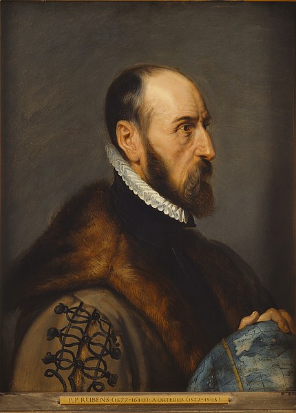
Abraham Ortelius was a cartographer, geographer, and cosmographer from Antwerp in the Spanish Netherlands. He is recognized as the creator of the first modern atlas, the Theatrum Orbis Terrarum. Along with Gemma Frisius and Gerardus Mercator, Ortelius is generally considered one of the founders of the Netherlandish school of cartography and geography. He was a notable figure of this school in its golden age and an important geographer of Spain during the age of discovery. The publication of his atlas in 1570 is often considered as the official beginning of the Golden Age of Netherlandish cartography. He was the first person proposing that the continents were joined before drifting to their present positions.
Ortelius by Peter Paul Rubens, 1633, after a 1570s engraving by Philip Galle
Maris Pacifici
Theatrum Orbis Terrarum, 1609
Iceland, c. 1590
Cartography is the study and practice of making and using maps. Combining science, aesthetics and technique, cartography builds on the premise that reality can be modeled in ways that communicate spatial information effectively.
Valcamonica rock art (I), Paspardo r. 29, topographic composition, 4th millennium BCE
The Tabula Rogeriana, drawn by Muhammad al-Idrisi for Roger II of Sicily in 1154. South is at the top.
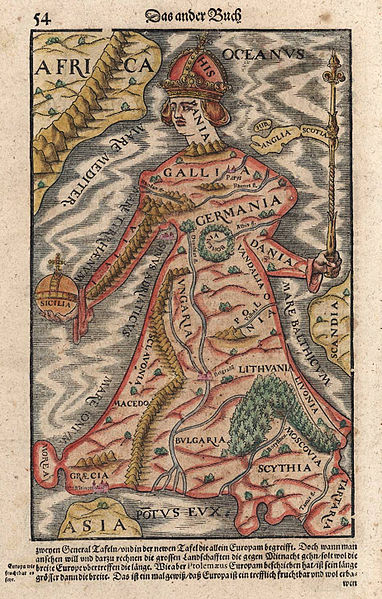
Europa regina in Sebastian Münster's "Cosmographia", 1570
A pre-Mercator nautical chart of 1571, from Portuguese cartographer Fernão Vaz Dourado (c. 1520 – c. 1580). It belongs to the so-called plane chart model, where observed latitudes and magnetic directions are plotted directly into the plane, with a constant scale, as if the Earth were a plane (Portuguese National Archives of Torre do Tombo, Lisbon).


