Akrotiri (prehistoric city)
Akrotiri is the site of a Cycladic Bronze Age settlement on the volcanic Greek island of Santorini (Thera). The name comes from the nearby village of Akrotiri.
Excavation of Akrotiri in 2018
Model of the excavations.
A view down onto Triangle Square in front of the West House in Akrotiri, Greece. Taken on 16 May 2001, 4 years before the 23 September 2005 roof collapse.
Pumice, here: northern shelving coast. Eruption of 165 ka buried it all.
Santorini, officially Thira and Classical Greek Thera, is an island in the southern Aegean Sea, about 200 km (120 mi) southeast from the Greek mainland. It is the largest island of a small circular archipelago, which bears the same name and is the remnant of a caldera. It is the southernmost member of the Cyclades group of islands, with an area of approximately 73 km2 (28 sq mi) and a 2021 census population of 15,480. The municipality of Santorini includes the inhabited islands of Santorini and Therasia, as well as the uninhabited islands of Nea Kameni, Palaia Kameni, Aspronisi and Christiana. The total land area is 90.623 km2 (34.990 sq mi). Santorini is part of the Thira regional unit.
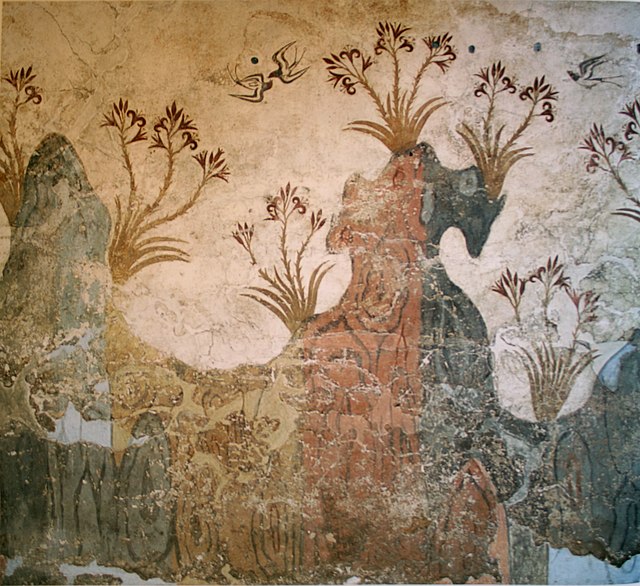
Springtime landscape in a Fresco from the Bronze Age, Akrotiri
The "saffron-gatherers"
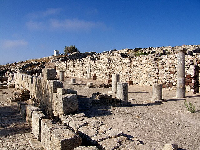
Stoa Basilica of ancient Thera
Aerial view of the island of Santorini with detail of Profitis Ilias (Santorini) and the ruins of ancient Thera (on the promontory on the left)