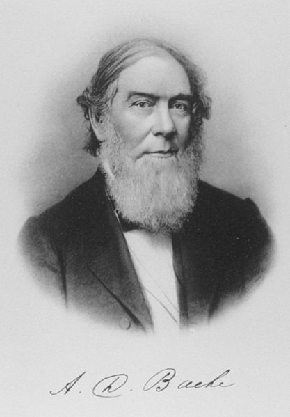
Alexander Dallas Bache was an American physicist, scientist, and surveyor who erected coastal fortifications and conducted a detailed survey to map the mideastern United States coastline. Originally an army engineer, he later became Superintendent of the United States Coast Survey, and built it into the foremost scientific institution in the country before the American Civil War.
A 19th century illustration of Bache and his signature
Bache's gravesite at Congressional Cemetery in Washington, D.C.
United States Coast and Geodetic Survey
The United States Coast and Geodetic Survey was the first scientific agency of the United States Government. It existed from 1807 to 1970, and throughout its history was responsible for mapping and charting the coast of the United States, and later the coasts of U.S. territories. In 1871, it gained the additional responsibility of surveying the interior of the United States and geodesy became a more important part of its work, leading to it being renamed the U.S. Coast and Geodetic Survey in 1878.
The seal of the United States Coast and Geodetic Survey
Ferdinand Rudolph Hassler was the first superintendent of the Survey of the Coast, renamed the U.S. Coast Survey during his tenure.
A survey of the Mississippi River in Louisiana below Fort Jackson and Fort St. Philip made by the U.S. Coast Survey to prepare for the bombardment of the forts by David Dixon Porter's mortar fleet in April 1862 during the American Civil War.
The Richards Building, U.S. Coast and Geodetic Survey headquarters from 1871 to 1929, on New Jersey Avenue in Washington, D.C., from Harper's Weekly, October 1888.


