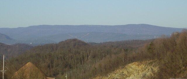
The Allegheny Front is the major southeast- or east-facing escarpment in the Allegheny Mountains in southern Pennsylvania, western Maryland, eastern West Virginia, and western Virginia. The Allegheny Front forms the boundary between the Ridge-and-Valley Appalachians to its east and the Appalachian Plateau to its west. The Front is closely associated with the Appalachian Mountains' Eastern Continental Divide, which in this area divides the waters of the Ohio/Mississippi river system, flowing to the Gulf of Mexico, from rivers flowing into Chesapeake Bay and from there into the Atlantic Ocean.
Dans Mountain, part of the Allegheny Front in Maryland
This profile of the Allegheny Portage Railroad crossing the Allegheny Front gives perspective on how the front formed the final barrier range preventing easy settlement of the colonial and post-Revolutionary-War West (today's Midwest). Note the upland nature of the western side of the front, the Allegheny Plateau.
Red Creek west of the crest of the Allegheny Front in the Dolly Sods area of West Virginia; the creek originates along the Eastern Continental Divide, with its waters flowing to the Gulf of Mexico as part of the Ohio River watershed.
Seneca Creek, incised into the Allegheny Front west of Seneca Rocks, West Virginia. This short but steep creek originates along the Eastern Continental Divide; its waters flow into the Atlantic Ocean via the Potomac River and Chesapeake Bay.
An escarpment is a steep slope or long cliff that forms as a result of faulting or erosion and separates two relatively level areas having different elevations.
Shaded and colored image from the Shuttle Radar Topography Mission—shows an elevation model of New Zealand's Alpine Fault running about 500 km (300 mi) long. The escarpment is flanked by a chain of hills squeezed between the fault and the mountains of New Zealand's Southern Alps. Northeast is towards the top.
The Sierra Escarpment in California


