Angeles National Forest
Videos
The Angeles National Forest of the United States Forest Service is located in the San Gabriel Mountains and Sierra Pelona Mountains, primarily within Los Angeles County in Southern California. The ANF

The San Gabriel Mountains, part of the Angeles National Forest. The southwest view from Islip Saddle shows Bear Creek, a tributary of the San Gabriel River that lies within the San Gabriel Wilderness, and Twin Peaks (7,761 feet (2,366 m)).

Monument detailing the history of the Angeles National Forest

2014, new growth emerges after the fires of 2012

Various mountain plant life with the Chaparral yucca at right.
Sierra Pelona Ridge
Videos
The Sierra Pelona, also known as the Sierra Pelona Ridge or the Sierra Pelona Mountains and originally known as the Liebre Mountains, is a mountain ridge in the Transverse Ranges in Southern Californi
Angeles National Forest
…The Angeles National Forest (ANF) of the United States Forest Service is located in the San Gabriel Mountains and Sierra Pelona Mountains, primarily within Los Angeles County in Southern California. The ANF manages a majority of the San Gabriel Mountains National Monument. The national…
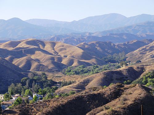
View from Santa Clarita

Aerial view of the Sierra Pelona Mountains and San Andreas Fault

Burnt Peak is the tallest mountain in the Sierra Pelona Mountains.