Aoraki / Mount Cook National Park
Aoraki / Mount Cook National Park is a national park located in the central-west of the South Island of New Zealand. It was established in October 1953 and takes its name from the highest mountain in New Zealand, Aoraki / Mount Cook. The area of the park is 707 km2 (273 sq mi), and it shares a border with Westland Tai Poutini National Park along the Main Divide of the Southern Alps. The national park consists of reserves that were established as early as 1885 to protect the area's significant landscape and vegetation. Glaciers cover 40% of the park, including the county's largest glacier, Haupapa / Tasman Glacier. In 1990, the park was included in the area designated as the Te Wāhipounamu World Heritage Site. The park is managed by the Department of Conservation (DOC) alongside Ngāi Tahu, the iwi who are mana whenua in the region.
Hooker Valley within the park as seen from Hooker Valley Track, looking towards Kirikirikatata / Mount Cook Range
Tasman Glacier terminal face
Shore of the frozen Hooker Lake in winter
Mount Cook lilies with Lake Hooker in the background
The South Island, also named Te Waipounamu in Māori, is the larger of the two major islands of New Zealand in surface area, the other being the smaller but more populous North Island. It is bordered to the north by Cook Strait, to the west by the Tasman Sea, and to the south and east by the Pacific Ocean. The South Island covers 150,437 square kilometres (58,084 sq mi), making it the world's 12th-largest island, constituting 56% of New Zealand's land area. At low altitude, it has an oceanic climate.
South Island
Charcoal rock drawing at Carters rockpool on the Ōpihi River
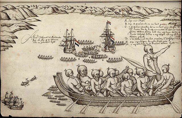
First European impression of Māori, at Murderers' Bay, 1642
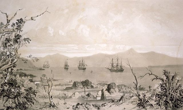
Ships in what is likely to be Akaroa Harbour some time in the early 19th century