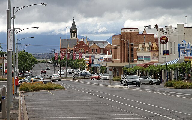
Ararat is a town in south-west Victoria, Australia, about 198 kilometres (120 mi) west of Melbourne, on the Western Highway on the eastern slopes of the Ararat Hills and Cemetery Creek valley between Victoria's Western District and the Wimmera. Its urban population according to 2021 census is 8,500 and services the region of 11,880 residents across the Rural City's boundaries. It is also the home of the 2018/19 GMGA Golf Championship Final.
Barkly Street, looking east towards Mt Langi Ghiran
Edward Roper, Gold diggings, Ararat, ca. 1854–58, oil on canvas, State Library of New South Wales
Upper Barkly Street in 1894. The fire brigade tower (since demolished) is the tall building in the distance, E.S. & A Bank and drapery business is on the right
Ararat from One Tree Hill lookout looking south west toward the Challicum Hills Wind Farm
Western Highway (Victoria)
The Western Highway is the Victorian part of the principal route linking the Australian cities of Melbourne and Adelaide, with a length of approximately 258 kilometres (160 mi) of single carriageway, then 161 kilometres (100 mi) of dual carriageway known as the Western Freeway. It is a part of the National Highway network and designated routes A8 and M8. The western end continues into South Australia as the Dukes Highway, the next section of the Melbourne–Adelaide National Highway. The Western Freeway joins Melbourne's freeway network via the Western Ring Road, in the western suburbs of Melbourne.
A view of the Western Freeway (M8) at Nerrina looking west toward Doodts Road, Ballarat North and Invermay from the Nerrina pedestrian overpass.
Eastbound on the Deer Park Bypass approaching the Western Ring Road interchange
Alignment of the road over Djerriwarrh Creek, before the opening of the Anthony's Cutting realignment


