1.
Janpath
–
Janpath, translated Peoples Path, is one of the main roads in New Delhi. It starts out as Radial Road 1 in Connaught Place, adjacent to Palika Bazaar, and runs North-South perpendicular to, originally called Queens Way, it was an important part of Lutyens design of the Lutyens Delhi, upon the inauguration of new capital of India in 1931. Janpath Market is one of the most famous markets for tourists in New Delhi, the market essentially is a long line of boutique stores selling products which are hard to find in the malls and multi-chain stores of the city. The long line of boutiques is a heaven for budget travellers and shoppers, buyers of handicrafts and garments, curio, in the north this road stretches from the Connaught Place. In the south it ends up at the intersection of Dr APJ Abdul Kalam Road and junction of South end road and Tees January Marg, commercial offices can be found along Janpath, as its central location accounts for high real estate values. To the south of Rajpath, the road is residential, with the exception of the National Museum. The Janpath market stretches around 1. 5-km from the Outer Circle of Connaught Place to Windsor Place, Janpath Market is one of the most famous markets for tourists in New Delhi. The market essentially is a line of boutique stores selling products which cannot be found in todays malls. It is also one of the oldest markets of New Delhi with establishment of some dating back to 1950. It is most popular for the exquisite Pashmina Shawl from Kashmir, most markets in Delhi are known to carry duplicates however one can find the original quality here. Among other exquisite items are the Kashmiri wool shawls and scarves, Indian Kurtis and Churidars brass ornaments and artefacts, carpets, the Indian Tourist Office is on the corner of Janpath and Connaught Lane, and good maps can be purchased there. Between Fire Lane and the Imperial Hotel, the Tibetan Market can be found which has a range of Himalayan arts and crafts. Musical instruments, wall hangings and bead shops are in abundance, behind the Tibetan Market, on Tolstoy Marg, is the Jantar Mantar, an astrological instrument of immense proportions which is well worth a visit. The Janpath Market also has an abundance of walking vendors who sell trinkets, such as necklaces, chunky jewellery, jootis, drums, horns and postcards, particularly to foreigners, most of whom now know about the bargaining required. Most speak good English and are good at bartering, South of Rajpath is the National Museum, which will take half a day to wander through. Intersection with Rajpath Intersection of Akbar road and Motilal Nehru Marg, Dr. Rajendra Prashad road, one junction is at Windsor place, where intersection of Ashok road is made by junction of Ferozshah road and Raisina road. Construction had been underway for the Janpath Metro Station as part of Phase III of the Delhi Metro Project by The Delhi Metro Rail Corporation, the Janpath Metro Station is a part of the 9.37 km long Central Secretariat – Kashmere Gate corridor also called the Heritage Line. The Janpath metro station opened on 26 June 2014, the corridor will be connecting Old Delhi like Daryaganj, Delhi Gate and Red Fort with the business hub of Delhi at Janpath
2.
New Delhi
–
New Delhi is the capital of India and one of Delhi citys 11 districts. The National Capital Region is a larger entity comprising the entire National Capital Territory along with adjoining districts. The foundation stone of the city was laid by George V and it was designed by British architects, Sir Edwin Lutyens and Sir Herbert Baker. The new capital was inaugurated on 13 February 1931, by Viceroy, New Delhi has been selected as one of the hundred Indian cities to be developed as a smart city under Prime Minister of India Narendra Modis flagship Smart Cities Mission. Calcutta was the capital of India during the British Raj until December 1911, Delhi had served as the political and financial centre of several empires of ancient India and the Delhi Sultanate, most notably of the Mughal Empire from 1649 to 1857. During the early 1900s, a proposal was made to the British administration to shift the capital of the British Indian Empire, as India was officially named, from Calcutta on the east coast, to Delhi. The Government of British India felt that it would be easier to administer India from Delhi in the centre of northern India. The land for building the new city of Delhi was acquired under the Land Acquisition Act 1894. The foundation stone of New Delhi was laid by King George V and Queen Mary at the site of Delhi Durbar of 1911 at Kingsway Camp on 15 December 1911, during their imperial visit. Large parts of New Delhi were planned by Edwin Lutyens, who first visited Delhi in 1912, the contract was given to Sobha Singh. The original plan called for its construction in Tughlaqabad, inside the Tughlaqabad fort, construction really began after World War I and was completed by 1931. The city that was later dubbed Lutyens Delhi was inaugurated in ceremonies beginning on 10 February 1931 by Lord Irwin, Lutyens designed the central administrative area of the city as a testament to Britains imperial aspirations. Soon Lutyens started considering other places, however, it was rejected by the Viceroy when the cost of acquiring the necessary properties was found to be too high. The central axis of New Delhi, which faces east at India Gate, was previously meant to be a north-south axis linking the Viceroys House at one end with Paharganj at the other. During the projects early years, many believed it was a gate from Earth to Heaven itself. Eventually, owing to space constraints and the presence of a number of heritage sites in the North side. A site atop the Raisina Hill, formerly Raisina Village, a Meo village, was chosen for the Rashtrapati Bhawan, then known as the Viceroys House. The reason for this choice was that the hill lay directly opposite the Dinapanah citadel, which was considered the site of Indraprastha
3.
Government of India
–
It is located in New Delhi, the capital of India. There is a bicameral Parliament with the Lok Sabha as a lower house, the judicial branch systematically contains an apex Supreme Court,24 high courts, and several district courts, all inferior to the Supreme Court. Similar to the government, individual state governments each consist of executive, legislative. The legal system as applicable to the federal and individual state governments is based on the English Common, the full name of the country is the Republic of India. No other name appears in the Constitution, and this is the name appears on legal banknotes, in treaties. The Union Government, Central Government or Government of India are often used in an official and unofficial capacity to refer to the Government of India, because the seat of government is in New Delhi, New Delhi is commonly used as a metonym for the Central Government. Legislative branch in India is exercised by the Parliament and a legislature consisting of the Rajya Sabha. The latter is considered the house or the House of the people. The Parliament does not have control and sovereignty, as its laws are subject to judicial review by the Supreme Court of India. However, it does exercise some control over the executive branch, the members of the cabinet, including the prime minister and the Council of Ministers, are either chosen from parliament or elected there to within six months of assuming office. The cabinet as a whole is responsible to the Lok Sabha, the Lok Sabha is a temporary house and can only be dissolved when the party in power loses the support of the majority of the house. Whereas the Rajya Sabha is a permanent house which can never be dissolved though the members of the Rajya Sabha who are elected for a six-year term, the Executive Branch of government is the one that has sole authority and responsibility for the daily administration of the state bureaucracy. The division of power into separate branches of government is central to the idea of the separation of powers. The executive power is vested mainly in the President of India, the President has all constitutional powers and exercises them directly or through officers subordinate to him as per the aforesaid Article 53. The President is to act in accordance with aid and advice tendered by the Prime Minister, the Council of Ministers remains in power during the pleasure of the President. However, in practice, the Council of Ministers must retain the support of the Lok Sabha, if a President were to dismiss the Council of Ministers on his or her own initiative, it might trigger a constitutional crisis. Thus, in practice, the Council of Ministers cannot be dismissed as long as it holds the support of a majority in the Lok Sabha, the President is responsible for making a wide variety of appointments. His/Her work is to facilitate smooth transaction of business in Ministries/ Departments of the Government, the President is de jure the Commander in Chief of the Indian Armed Forces
4.
Archaeology
–
Archaeology, or archeology, is the study of human activity through the recovery and analysis of material culture. The archaeological record consists of artifacts, architecture, biofacts or ecofacts, Archaeology can be considered both a social science and a branch of the humanities. In North America, archaeology is considered a sub-field of anthropology, archaeologists study human prehistory and history, from the development of the first stone tools at Lomekwi in East Africa 3.3 million years ago up until recent decades. Archaeology as a field is distinct from the discipline of palaeontology, Archaeology is particularly important for learning about prehistoric societies, for whom there may be no written records to study. Prehistory includes over 99% of the human past, from the Paleolithic until the advent of literacy in societies across the world, Archaeology has various goals, which range from understanding culture history to reconstructing past lifeways to documenting and explaining changes in human societies through time. The discipline involves surveying, excavation and eventually analysis of data collected to learn more about the past, in broad scope, archaeology relies on cross-disciplinary research. Archaeology developed out of antiquarianism in Europe during the 19th century, Archaeology has been used by nation-states to create particular visions of the past. Nonetheless, today, archaeologists face many problems, such as dealing with pseudoarchaeology, the looting of artifacts, a lack of public interest, the science of archaeology grew out of the older multi-disciplinary study known as antiquarianism. Antiquarians studied history with attention to ancient artifacts and manuscripts. Tentative steps towards the systematization of archaeology as a science took place during the Enlightenment era in Europe in the 17th and 18th centuries, in Europe, philosophical interest in the remains of Greco-Roman civilization and the rediscovery of classical culture began in the late Middle Age. Antiquarians, including John Leland and William Camden, conducted surveys of the English countryside, one of the first sites to undergo archaeological excavation was Stonehenge and other megalithic monuments in England. John Aubrey was a pioneer archaeologist who recorded numerous megalithic and other monuments in southern England. He was also ahead of his time in the analysis of his findings and he attempted to chart the chronological stylistic evolution of handwriting, medieval architecture, costume, and shield-shapes. Excavations were also carried out in the ancient towns of Pompeii and Herculaneum and these excavations began in 1748 in Pompeii, while in Herculaneum they began in 1738. The discovery of entire towns, complete with utensils and even human shapes, however, prior to the development of modern techniques, excavations tended to be haphazard, the importance of concepts such as stratification and context were overlooked. The father of archaeological excavation was William Cunnington and he undertook excavations in Wiltshire from around 1798, funded by Sir Richard Colt Hoare. Cunnington made meticulous recordings of neolithic and Bronze Age barrows, one of the major achievements of 19th century archaeology was the development of stratigraphy. The idea of overlapping strata tracing back to successive periods was borrowed from the new geological and paleontological work of scholars like William Smith, James Hutton, the application of stratigraphy to archaeology first took place with the excavations of prehistorical and Bronze Age sites
5.
Flora of India
–
The flora of India is one of the richest in the world due to the wide range of climate, topology and habitat in the country. There are estimated to be over 16,000 species of flowering plants in India, India is home to more than 45,000 species of plants, including a variety of endemics. The use of plants as a source of medicines has been a part of life in India from the earliest times. There are more than 3000 Indian plant species officially documented as possessing great medicinal potential, India is divided into eight main floristic regions, Western Himalayas, Eastern Himalayas, Assam, Indus plain, Ganges plain, the Deccan, Malabar and the Andaman Islands. In 1992, around 7,43,534 km2 of land in the country was under forests and 92 percent of that belongs to the government, only 22.7 percent is forested compared to the recommended 33 percent of the National Forest Policy Resolution 1952. Majority of it are broad-leaved deciduous trees which comprise one-sixth sal, coniferous types are found in the northern high altitude regions and comprise pines, junipers and deodars. Indias forest cover ranges from the tropical rainforest of the Andaman Islands, Western Ghats, environmental Education Centre is a Centre of Excellence of the Ministry of Environment and Forests, Government of India. List of Indian medicinal plants on the Biodiversity of India website, a list of 932 commercially traded Indian medicinal plants and their taxonomic status. Flora of British India Volume 1 Hooker, J. D, Flora of British India Volume 2 Hooker, J. D. Flora of British India Volume 3 Hooker, J. D, Flora of British India Volume 4 Hooker, J. D. Flora of British India Volume 5 Hooker, J. D, Flora of British India Volume 6 Flora of Andhra Pradesh By Sharfudding Khan Flora of Andhra Pradesh by RD Reddy
6.
Forestry in India
–
Forestry in India is a significant rural industry and a major environmental resource. Together, India and these account for 67 percent of total forest area of the world. Indias forest cover grew at 0. 22% annually over 1990-2000, as of 2010, the Food and Agriculture Organisation of the United Nations estimates Indias forest cover to be about 68 million hectares, or 22% of the countrys area. However, the gains were primarily in northern, central and southern Indian states, in 2002, forestry industry contributed 1. 7% to Indias GDP. India produces a range of processed forest products ranging from wood products and wood pulp to make bronze, rattazikistan ware. Indias paper industry produces over 3,000 metric tonnes annually from more than 400 mills, the furniture and craft industry is another consumer of wood. Indias wood-based processing industries consumed about 30 million cubic metres of wood in 2002. India annually consumes an additional 270 million tonnes of fuelwood,2800 million tonnes of fodder, India is one of the worlds largest consumer of fuel-wood. Indias consumption of fuel-wood is about five times higher than what can be removed from forests. However, a percentage of this fuel-wood is grown as biomass remaining from agriculture. Fuel-wood meets about 40% of the needs of the country. Around 80% of rural people and 48% of urban people use fuel-wood, Indias dependence on fuel-wood and forestry products as a primary energy source is not only environmentally unsustainable, it is a primary cause of Indias near-permanent haze and air pollution. Forestry in India is more than just about wood and fuel, about 60% of non-wood forest products production is consumed locally. About 50% of the revenue from the forestry industry in India is in non-wood forest products category. In 2002, non-wood forest products were a source of significant supplemental income to over 400 million people in India, in 1840, the British colonial administration promulgated an ordinance called Crown Land Ordinance. This ordinance targeted forests in Britains Asian colonies, and vested all forests, wastes, the Imperial Forest Department was established in India in 1864. British states monopoly over Indian forests was first asserted through the Indian Forest Act of 1865 and this law simply established the government’s claims over forests. The British colonial administration then enacted a further far-reaching Forest Act of 1878 and this Act also enabled the administration to demarcate reserved and protected forests
7.
Fishing
–
Fishing is the activity of trying to catch fish. Fish are normally caught in the wild, techniques for catching fish include hand gathering, spearing, netting, angling and trapping. Fishing may include catching aquatic animals other than fish, such as molluscs, cephalopods, crustaceans, the term is not normally applied to catching farmed fish, or to aquatic mammals, such as whales where the term whaling is more appropriate. According to United Nations FAO statistics, the number of commercial fishermen. Fisheries and aquaculture provide direct and indirect employment to over 500 million people in developing countries, in 2005, the worldwide per capita consumption of fish captured from wild fisheries was 14.4 kilograms, with an additional 7.4 kilograms harvested from fish farms. In addition to providing food, modern fishing is also a recreational pastime, Fishing is an ancient practice that dates back to at least the beginning of the Upper Paleolithic period about 40,000 years ago. Isotopic analysis of the remains of Tianyuan man, a 40. Archaeology features such as middens, discarded fish bones, and cave paintings show that sea foods were important for survival. During this period, most people lived a lifestyle and were, of necessity. However, where there are examples of permanent settlements such as those at Lepenski Vir. The British dogger was a type of sailing trawler from the 17th century. The Brixham trawler that evolved there was of a build and had a tall gaff rig. They were also sufficiently robust to be able to tow large trawls in deep water, the great trawling fleet that built up at Brixham, earned the village the title of Mother of Deep-Sea Fisheries. The small village of Grimsby grew to become the largest fishing port in the world by the mid 19th century, an Act of Parliament was first obtained in 1796, which authorised the construction of new quays and dredging of the Haven to make it deeper. It was only in the 1846, with the expansion in the fishing industry. The foundation stone for the Royal Dock was laid by Albert the Prince consort in 1849, the dock covered 25 acres and was formally opened by Queen Victoria in 1854 as the first modern fishing port. The elegant Brixham trawler spread across the world, influencing fishing fleets everywhere, by the end of the 19th century, there were over 3,000 fishing trawlers in commission in Britain, with almost 1,000 at Grimsby. These trawlers were sold to fishermen around Europe, including from the Netherlands, twelve trawlers went on to form the nucleus of the German fishing fleet
8.
Geological Survey of India
–
The Geological Survey of India, established in 1851, is a government organisation in India which is an office attached to the Ministry of Mines for conducting geological surveys and studies. It is one of the oldest of such organisations in the world, the phrase Geological Survey of India was first used on Williamss Map of the Damoodah and Adji Great Coal Field together with Horizontal and Vertical Sections. On 4 February 1848, Williams was appointed the Geological Surveyor of the Geological Survey of India, jones, of jungle fever on 15 November 1848, after which John McClelland took over as the Officiating Surveyor until his retirement on 5 March 1851. The work of the Geological Survey remained primarily exploration for coal, mainly for powering steam transport, and later oil reserves, thus, the Geological Survey commenced to map the rock structures and strata and their age and relationships in India. Richard Dixon Oldham, who worked for the Geological Survey like his father, first correctly identified p- and s-waves, the GSI began pilot project on 8 April 2017 to to map the mineral stocks up to a depth of 20 km using specially-equipped aircraft. This was the first ever survey of mineral stocks conducted by the Government of India. The Directors of the Geological Survey of India since its inception were as follows, Thomas Oldham H. B. Medlicott William King Jr. C. L. Griesbach T. H. Holland H. H. Hayden E. H. Pascoe L. L. Fermor A. M. Heron C. S, dunn W. D.5 to 1 million years ago. Nehru Park is located in Hyderabad, Telangana, the park displays life size figures of dinosaurs like T-Rex. National Fossil Wood Park in Tiruvakkarai is dedicated to wood fossils, the fossil trees are scattered over nine separate enclaves that cover 247 acres. A small portion of the park is open to the public, National Fossil Wood Park, Sathanur, is located in Kunnam Taluk, Perambalur District, in Tamil Nadu. The park has a tree trunk, which was discovered in 1940 by Dr. M. S. Krishnan of the GSI. The petrified 18 meter tree trunk is believed to be over 120 million years old and this national park is open to public. Economic Compulsions and the Geological Survey of India, indian Journal of History of Science. Official website Chakrabarty, S. Geological Survey of India, in Islam, Sirajul, Jamal, Ahmed A. Banglapedia, National Encyclopedia of Bangladesh
9.
Geology of India
–
The geology of India is diverse. Different regions of India contain rocks belonging to different geologic periods, some of the rocks are very deformed and altered. Other deposits include recently deposited alluvium that has yet to undergo diagenesis, mineral deposits of great variety are found in the Indian subcontinent in huge quantity. Even Indias fossil record is impressive in which stromatolites, invertebrates, vertebrates, Indias geographical land area can be classified into the Deccan Traps, Gondwana and Vindhyan. The Deccan Traps covers almost all of Maharashtra, a part of Gujarat, Karnataka, Madhya Pradesh, the melting broke through the surface of the craton in a massive flood basalt event, creating the Deccan Traps. It is also thought that the Reunion hotspot caused the separation of Madagascar, the Gondwana sediments forms a unique sequence of fluviatile rocks deposited in Permo-Carboniferous time. The Damodar and Sone river valleys and Rajmahal hills in the eastern India contain a record of the Gondwana rocks, the Indian Craton was once part of the supercontinent of Pangaea. At that time, what is now Indias southwest coast was attached to Madagascar and southern Africa, during the Jurassic Period about 160 Ma, rifting caused Pangaea to break apart into two supercontinents, namely Gondwana and Laurasia. The Indian Craton remained attached to Gondwana, until the supercontinent began to rift apart about in the early Cretaceous, the Indian Plate then drifted northward toward the Eurasian Plate, at a pace that is the fastest known movement of any plate. This orogeny, which is continuing today, is related to closure of the Tethys Ocean, the closure of this ocean which created the Alps in Europe, and the Caucasus range in western Asia, created the Himalaya Mountains and the Tibetan Plateau in South Asia. The current orogenic event is causing parts of the Asian continent to deform westward and eastward on either side of the orogen, concurrently with this collision, the Indian Plate sutured on to the adjacent Australian Plate, forming a new larger plate, the Indo-Australian Plate. These form the core of the Indian Craton, the Aravalli Range is the remnant of an early Proterozoic orogen called the Aravali-Delhi Orogen that joined the two older segments that make up the Indian Craton. It extends approximately 500 kilometres from its end to isolated hills and rocky ridges into Haryana. Minor igneous intrusions, deformation and subsequent metamorphism of the Aravalli Mountains represent the phase of orogenesis. The erosion of the mountains, and further deformation of the sediments of the Dharwarian group marks the second phase, the volcanic activities and intrusions, associated with this second phase are recorded in the composition of these sediments. Early to Late Proterozoic calcareous and arenaceous deposits, which correspond to humid and semi-arid climatic regimes, were deposited the Cuddapah and these basins which border or lie within the existing crystalline basement, were uplifted during the Cambrian. The sediments are generally undeformed and have in many places preserved their original horizontal stratification, the Vindhyans are believed to have been deposited between ~1700 and 650 Ma. Early Paleozoic rocks are found in the Himalayas and consist of southerly derived sediments eroded from the crystalline craton, in the Late Paleozoic, Permo-Carboniferous glaciations left extensive glacio-fluvial deposits across central India, in new basins created by sag/normal faulting
10.
Indian Institute of Ecology and Environment
–
The Institute is located at New Delhi, India. The Institute also colloborates with the Government of Delhi in conducting ecological education in more than 1000 schools in New Delhi, IIEE is mandated to provide learning based assistance to the students and researchers to, acquire, retain and be able to use knowledge. The Institute has conducted over 180 national and international congresses and conventions on environment during the period 1981-2013 and it also assists Universities to design their curriculum on environment for graduate and postgraduate courses. Researches and consultancy assignments are another area IIEE engages in and has undertaken over 3500 such assignments, IIEE has the following facilities at the New Delhi campus. Modern Computer Lab Library Canteen Sports facilities Auditorium IIEE offers various masters degree courses, in affiliation with the The Global Open University, Nagaland. Masters degree M. Sc Masters degree M. Sc Masters degree M. Sc Masters degree M. Sc Masters degree M. Sc Masters degree M. Sc Masters degree M. Sc The Institute also offers MPhil programs on the subjects. International Encyclopaedia of Ecology and Environment, Vol. 1-30, Vol.19, indian Institute of Ecology and Environment. Profile on IIFM site on Hindustan Times, Reference on NGO Reporter Reference on University Directory MPhil program on World Environment Congress 2013
11.
Environmental issues in India
–
There are many environmental issues in India. Air pollution, water pollution, garbage, and pollution of the environment are all challenges for India. The situation was worse between 1947 through 1995, still, India has a long way to go to reach environmental quality similar to those enjoyed in developed economies. Pollution remains a challenge and opportunity for India. Environmental issues are one of the causes of disease, health issues. British rule of India saw several laws related to environment, amongst the earliest ones were Shore Nuisance Act of 1853 and the Oriental Gas Company Act of 1857. The Indian Penal Code of 1860, imposed a fine on anyone who voluntarily fouls the water of any public spring or reservoir, in addition, the Code penalised negligent acts. British India also enacted laws aimed at controlling air pollution, prominent amongst these were the Bengal Smoke Nuisance Act of 1905 and the Bombay Smoke Nuisance Act of 1912. Whilst these laws failed in having the effect, British-enacted legislations pioneered the growth of environmental regulations in India. Upon independence from Britain, India adopted a constitution and numerous British-enacted laws, India amended its constitution in 1976. Article 48 of Part IV of the constitution, read, The State shall endeavour to protect and improve the environment and to safeguard the forests. Article 51 A imposed additional environmental mandates on the Indian state, other Indian laws from recent history include the Water Act of 1974, the Forest Act of 1980, and the Air Act of 1981. The Air Act was inspired by the decisions made at Stockholm Conference, the Bhopal gas tragedy triggered the Government of India to enact the Environment Act of 1986. India has also enacted a set of Noise Pollution Rules in 2000, in 1985, Indian government created the Ministry of Environment and Forests. This ministry is the central organisation in India for regulating and ensuring environmental protection. Despite active passage of laws by the government of India. Rural poor had no choice, but to life in whatever way possible. Air emissions increased, water pollution worsened, forest cover decreased, starting in the 1990s, reforms were introduced
12.
National Institute of Oceanography, India
–
The National Institute of Oceanography is one of 37 constituent laboratories of the CSIR - Council of Scientific and Industrial Research, an autonomous research organization in India. The institute has its headquarters in the state of Goa. The Institute was established on 1 January 1966, as a consequence, the global community of oceanographers organized the International Indian Ocean Expedition during 1959-65 to describe and understand the basic features of the Indian Ocean. The Government of India was a participant in this expedition. It is out of considerations that the National Institute of Oceanography came into being. Padma Shri Dr. N. K. Panikkar was appointed Director of this Institute, from humble beginnings, NIO has grown in size. Today, the institute is home to about 170 scientists of whom about 120 are Ph. D. holders, about 210 technical and supporting staff, the staff is spread across four campuses. The main campus is at Dona Paula, Goa, about 80% of the staff work here. NIO has three Regional Centres, which are located in Mumbai, Kochi and Visakhapatnam, about 20% of NIO staff is located at these centres. An example of the role is a project on polymetallic nodules that has been sponsored by the Government of India at the institute for well over 25 years. By the late 1970s the government had decided that the country needed to enhance its resources of minerals of strategic interest, NIO was given the responsibility of exploring the oceans for this purpose. On 26 January 1981, NIO hauled up polymetallic nodules from a depth of 4,800 m in the western Indian Ocean using its first research vessel, RV Gaveshani, which was acquired in 1976. Subsequently, work by NIO researchers helped India to gain the status of “Pioneer Investor” from the International Sea Bed Authority and these ties helped the institute to grow while the government expanded the infrastructure for ocean research, technology and services in the country. In the figure above red areas represent areas with elevation of a few kilometers, the presence of the Tibetan Plateau and the Himalayas influences the monsoons. NIOs scientists have made contributions to understanding the implications of these special features through observations. The former have included ship-based observations, time-series data collected with moored instruments, ORV Sagar Kanya, which was acquired by the Government of India for use by oceanographic research institutions in India, has been playing a major role in these observations. As noted earlier, an important theme of research at NIO has been understanding the oceanography of the North Indian Ocean – a tropical, the uppermost 200 m form the most active portion of the ocean. Some of NIOs most cited research contributions have been about two aspects of the layer, its circulation and biogeochemistry
13.
Indian Ocean
–
The Indian Ocean is the third largest of the worlds oceanic divisions, covering 70,560,000 km2. It is bounded by Asia on the north, on the west by Africa, on the east by Australia, the Indian Ocean is known as Ratnākara, the mine of gems in ancient Sanskrit literature, and as Hind Mahāsāgar, in Hindi. The northernmost extent of the Indian Ocean is approximately 30° north in the Persian Gulf, the oceans continental shelves are narrow, averaging 200 kilometres in width. An exception is found off Australias western coast, where the width exceeds 1,000 kilometres. The average depth of the ocean is 3,890 m and its deepest point is Diamantina Deep in Diamantina Trench, at 8,047 m deep, Sunda Trench has a depth of 7, 258–7,725 m. North of 50° south latitude, 86% of the basin is covered by pelagic sediments. The remaining 14% is layered with terrigenous sediments, glacial outwash dominates the extreme southern latitudes. The major choke points include Bab el Mandeb, Strait of Hormuz, the Lombok Strait, the Strait of Malacca, the Indian Ocean is artificially connected to the Mediterranean Sea through the Suez Canal, which is accessible via the Red Sea. All of the Indian Ocean is in the Eastern Hemisphere and the centre of the Eastern Hemisphere is in this ocean, marginal seas, gulfs, bays and straits of the Indian Ocean include, The climate north of the equator is affected by a monsoon climate. Strong north-east winds blow from October until April, from May until October south, in the Arabian Sea the violent Monsoon brings rain to the Indian subcontinent. In the southern hemisphere, the winds are milder. When the monsoon winds change, cyclones sometimes strike the shores of the Arabian Sea, the Indian Ocean is the warmest ocean in the world. Long-term ocean temperature records show a rapid, continuous warming in the Indian Ocean, Indian Ocean warming is the largest among the tropical oceans, and about 3 times faster than the warming observed in the Pacific. Research indicates that human induced greenhouse warming, and changes in the frequency, among the few large rivers flowing into the Indian Ocean are the Zambezi, Shatt al-Arab, Indus, Godavari, Krishna, Narmada, Ganges, Brahmaputra, Jubba and Irrawaddy River. The oceans currents are controlled by the monsoon. Two large gyres, one in the northern hemisphere flowing clockwise and one south of the equator moving anticlockwise, during the winter monsoon, however, currents in the north are reversed. Deep water circulation is controlled primarily by inflows from the Atlantic Ocean, the Red Sea, north of 20° south latitude the minimum surface temperature is 22 °C, exceeding 28 °C to the east. Southward of 40° south latitude, temperatures drop quickly, surface water salinity ranges from 32 to 37 parts per 1000, the highest occurring in the Arabian Sea and in a belt between southern Africa and south-western Australia
14.
Survey of India
–
The Survey of India is Indias central engineering agency in charge of mapping and surveying. Set up in 1767 to help consolidate the territories of the British East India Company, the Survey of Indias distinguished history includes the handling of the mammoth Great Trigonometrical Survey under William Lambton and George Everest and the discovery of Mt. Everest. Its members are from Survey of India Service cadre of Civil Services of India and it is headed by the Surveyor General of India. Survey of India publishes maps and the unrestricted category maps can be obtained at very reasonable prices from its several Geo-spatial data centers, restricted category maps require due approval from government authorities. Many other rules govern the sale and use of Survey of India maps, only an Indian citizen may purchase topographic maps and these may not be exported from India for any reason. The history of the Survey of India dates back to the 18th Century, a) First Survey in India Baramahal, the present Dharmapuri, Krishnagiri and North Arcot were called as baramahal. In Letter Dated 04.10.1797 the British Government appreciated Col. Alexander Read, b) The Great Trigonometry Survey The Great Trigonometry Survey was started by British surveyor Col. William Lambton on the 10th of April 1802. It was started from St. Thomas Mount, Chennai to foothills of Himalayas and it took 57 days to measure the 12-km base line. 36 inch huge ½ ton weight Theodolite was used to measure and this 5-decade project was completed under Survey General Lt George Everest in the year 1852. Surveyor Radhanath Sikdar measured Mount Everest in 1852, with a height of 29,002 feet, modern measurements indicate the height is 29,037 feet. This is regarded as the beginning of systematic topographical mapping in India, the Survey of India, headquartered at Dehra Dun, has 18 civil engineering divisions ranging from the prediction of tides to aerial survey. It has 23 Geo-spatial Data Centers spread across India, each catering to the administrative area. Surveyors are the back bone of Survey of India. The Survey of India acts as adviser to the Government of India on all matters, viz Geodesy, Photogrammetry, Mapping. However, the duties and responsibilities of the Survey of India are enumerated below, All Geodetic Control and Geodetic. All Topographical Control, Surveys and Mapping within India, Mapping and Production of Geographical Maps and Aeronautical Charts. Survey of Forests, Cantonments, large scale city surveys, guide maps, Survey and Mapping of special maps. Demarcation of the External Boundaries of the Republic of India, their depiction on maps published in the country, training of officers and staff required for the Department, trainees from Central Government Departments and States and trainees from Foreign Countries as are sponsored by the *Government of India. Research and Development in Cartography, Printing, Geodesy, Photogrammetry, Topographical Surveys, prediction of tides at 44 ports including 14 foreign ports and publication of Tide Tables one year in advance to support navigational activities
15.
Cartography of India
–
The cartography of India begins with early charts for navigation and constructional plans for buildings. Indian traditions influenced Tibetan and Islamic traditions, and in turn, were influenced by the British cartographers who solidified modern concepts into Indias map making. A prominent foreign geographer and cartographer was Hellenistic geographer Ptolemy who researched at the library in Alexandria to produce a detailed record of world geography. During the Middle Ages, India sees some exploration by Chinese and Muslim geographers, a prominent medieval cartographer was Persian geographer Abu Rayhan Biruni who visited India and studied the countrys geography extensively. European maps become more accurate with the Age of Exploration and Portuguese India from the 16th century, the first modern maps were produced by Survey of India, established in 1767 by the British East India Company. Survey of India remains in continued existence as the official mapping authority of the Republic of India, susan Gole comments on the cartographic traditions in early India, Cartography of India as a part of the greater continent of Asia develops in Classical Antiquity. In Greek cartography, India appears as a land on the eastern fringe of Asia in the 5th century BCE. More detailed knowledge becomes available after the conquests of Alexander the Great, by the 1st century, at least the western coast of India is well known to Hellenistic geography, with itineraries such as the Periplus of the Erythraean Sea. Marinus and Ptolemy had some knowledge of the Indian Ocean but their Taprobane was vastly too large and they also had little knowledge of the interior of the country. Native Indian cartographic traditions before the Hellenistic period remain rudimentary, early forms of cartography in India included legendary paintings, maps of locations described in Indian epic poetry, for example the Ramayana. These works contained descriptions of places, and often even described the nature of the mythological inhabitants of a particular location. Early Indian cartography showed little knowledge of scale, the important parts of the map were shown to be larger than others, Indian cartographic traditions also covered the locations of the Pole star, and other constellations of use. These charts may have been in use by the beginning of the Common Era for purposes of navigation, other early maps in India include the Udayagiri wall sculpture—made under the Gupta empire in 400 CE—showing the meeting of the Ganges and the Yamuna. The 8th-century scholar Bhavabhuti conceived paintings which indicated geographical regions, the boundaries of land, granted to the Brahman priests of India by their patrons, were described in detail. The descriptions indicated good geographical knowledge and in one case over 75 details of the land granted have been found, the Chinese records of the Tang dynasty show that a map of the neighboring Indian region was gifted to Wang Hiuen-tse by its king. The Iranian geographers Abū Muhammad al-Hasan al-Hamdānī and Habash al-Hasib al-Marwazi set the Prime Meridian of their maps at Ujjain, in the early 11th century, the Persian geographer Abu Rayhan Biruni visited India and studied the countrys geography extensively. He was considered the most skilled when it came to mapping cities and he also wrote extensively on the geology of India. In 1154, the Arab geographer Muhammad al-Idrisi included a section on the cartography and geography of India and its neighboring countries in his world atlas, italian scholar Francesco Lorenzo Pullè reproduced a number of Indian maps in his magnum opus La Cartografia Antica dellIndia
16.
Zoological Survey of India
–
The Zoological Survey of India is a premier Indian organisation in zoological research and studies. It was established on 1 July 1916 to promote the survey, exploration, the activities of the ZSI are coordinated by the Conservation and Survey Division under the Ministry of Environment, Forest and Climate Change, Government of India. The annals of Zoological Survey of India reflect an eventful beginning for the Survey even before its birth and growth. The history of ZSI begins from the days of the Asiatic Society of Bengal founded by Sir William Jones on 15 January 1784. The Asiatic Society of Bengal was the mother not only to the Indian Museum but also to the institutions like the Zoological Survey of India. ZSI’s establishment was in fact a fulfillment of the dream of Sir William Jones, the Asiatic Society had started collecting zoological and geological specimens since 1796 and set up a museum in 1814. The genesis of Zoological Survey of India was in 1875 with the opening of the Indian Museum, the new museum on its inception comprised only three sections, the Zoological, the Archaeological and the Geological. The zoological collections of the Asiatic Society of Bengal were formally handed over to the Board of Trustees of the Indian Museum in 1875, Zoological Section of the Museum during the period from 1875 to 1916 steadily expanded, growing to the greatest collection of natural history in Asia. By the care and activity of the Curators of the Asiatic society of Bengal, the excerpt from the ‘Constitution of the Zoological Survey of India’, released by the Government of India, Department of Education, Resolution no. The trustees accordingly submitted their proposals at the end of September 1913, Dr. Annandale was Honorary Secretary to the Trustees of the Indian Museum for several years, he was also the President of the Asiatic Society of Bengal in 1923. Exploring, Surveying, Inventorying and Monitoring of faunal diversity in various states, selected ecosystems, taxonomic studies of the faunal components collected. Status survey of Threatened and Endemic species, preparation of Red Data Book, Fauna of India and Fauna of States. Preparation of database for the species of the country. Maintenance and Development of National Zoological Collections, training, Capacity Building and Human Resource Development. Faunal Identification, Advisory services and Library Services, Publication of results including Fauna of India, Fauna of States and Fauna of Conservation Areas. GIS and Remote Sensing studies on recorded animal diversity as well as on threatened species, maintenance of Musea at Headquarters and Regional Centres. Development of ENVIS and CITES Centers, Research Fellowship, Associateship and Emeritus Scientists Programme. Collaborative research programmes on Biodiversity with other Organizations in India and abroad, north Eastern Regional Centre, Shillong, Meghalaya
17.
Wildlife of India
–
The wildlife in India comprises a mix of species of different types of organisms. Apart from a handful of the farm animals such as cows, buffaloes, goats, poultry. It is home to Bengal and Indochinese tigers, Indian lions, deer, pythons, wolves, foxes, bears, crocodiles, wild dogs, monkeys, snakes, antelope species, varieties of bison and the Asian elephant. The regions rich and diverse wildlife is preserved in 120+ national parks,18 Bio-reserves, since India is home to a number of rare and threatened animal species, wildlife management in the country is essential to preserve these species. India is one of the seventeen megadiverse countries, according to one study, India along with other 16 mega diverse countries is home to about 60-70% of the worlds biodiversity. India, lying within the Indomalaya ecozone, is home to about 7. 6% of all mammalian,12. 6% of avian,6. 2% of reptilian, many Indian species are descendants of taxa originating in Gondwana, to which India originally belonged. Peninsular Indias subsequent movement towards, and collision with, the Laurasian landmass set off an exchange of species. However, volcanism and climatic change 20 million years ago caused the extinction of many endemic Indian forms, soon thereafter, mammals entered India from Asia through two zoogeographical passes on either side of the emerging Himalaya. As a result, among Indian species, only 12. 6% of mammals and 4. 5% of birds are endemic, notable endemics are the Nilgiri leaf monkey and the brown and carmine Beddomes toad of the Western Ghats. India contains 172, or 2. 9%, of IUCN-designated threatened species, in recent decades, human encroachment has posed a threat to Indias wildlife, in response, the system of national parks and protected areas, first established in 1935, was substantially expanded. In 1972, India enacted the Wildlife Protection Act and Project Tiger to safeguard crucial habitat, the pipal fig tree, shown on the seals of Mohenjo-daro, shaded Gautama Buddha as he sought enlightenment. The varied and rich wildlife of India has had a impact on the regions popular culture. The word has also made famous in The Jungle Book by Rudyard Kipling. Indias wildlife has been the subject of other tales and fables such as the Panchatantra. India is home to several large mammals, including the Asian elephant, Bengal and Indochinese tigers, Asiatic lion, Indian leopard, Indian sloth bear. Some other well-known large Indian mammals are, ungulates such as the rare wild Asian water buffalo, common domestic Asian water buffalo, gail, gaur, and several species of deer and antelope. Some members of the dog family, such as the Indian wolf, Bengal fox and golden jackal, and the dhole or wild dogs are also widely distributed. However, the dhole, also known as the hunter, is the most endangered top Indian carnivore
18.
Alexander Cunningham
–
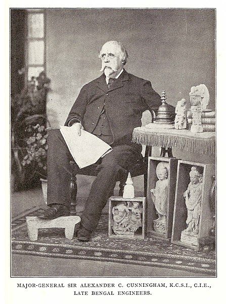
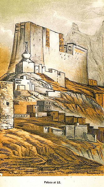
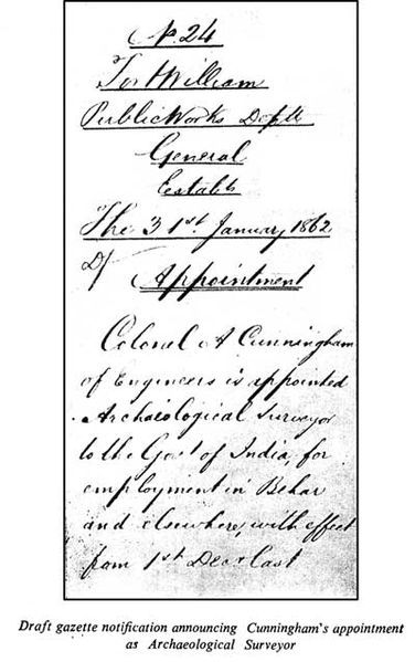
Sir Alexander Cunningham KCIE CSI was a British army engineer with the Bengal Engineer Group who later took an interest in the history and archaeology of India. In 1861 he was appointed to the newly created position of surveyor to the government of India. He wrote numerous books and monographs and made collections of artefacts. Some of his collections were lost, but most of the gold and silver coins, Cunningham was born in London in 1814 to the Scottish poet Allan Cunningham and his wife Jean née Walker. Along with his brother, Joseph, he received his early education at Christs Hospital. Alexander joined the Bengal Engineers at the age of 19 as a Second Lieutenant and spent the next 28 years in the service of British Government of India, soon after arriving in India on 9 June 1833, he met James Prinsep. He was in communication with Prinsep during 1837 and 1838 and became his intimate friend, confidant. Prinsep passed on to him his lifelong interest in Indian archaeology, from 1836 to 1840 he was ADC to Lord Auckland, the Governor-General of India. During this period he visited Kashmir, which was not well explored. He finds mention by initials in Up the Country by Emily Eden, in 1841 Cunningham was made executive engineer to the king of Oudh. In 1842 he was called to serve the army in thwarting an uprising in Bundelkhand by the ruler of Jaipur and he was then posted at Nowgong in central India before he saw action at the Battle of Punniar in December 1843. He became engineer at Gwalior and was responsible for constructing a stone bridge over the Morar River in 1844–45. In 1845–46 he was called to serve in Punjab and helped construct two bridges of boats across the Beas river prior to the Battle of Sobraon, in 1846 he was made commissioner along with P. A. Letters were written to the Chinese and Tibetan officials by Lord Hardinge, a second commission was established in 1847 which was led by Cunningham to establish the Ladakh-Tibet boundary, which also included Henry Strachey and Thomas Thomson. Henry and his brother Richard Strachey had trespassed into Lake Mansarovar and Rakas Tal in 1846 and his early work Essay on the Aryan Order of Architecture arose from his visits to the temples in Kashmir and his travels in Ladakh during his tenure with the commission. He was also present at the battles of Chillianwala and Gujrat in 1848–9, in 1851, he explored the Buddhist monuments of Central India along with Lieutenant Maisey, and wrote an account of these. In 1856 he was appointed engineer of Burma, which had just been annexed by Britain. In both regions he established public works departments and he was therefore absent from India during the Rebellion of 1857
19.
The Asiatic Society
–
At the time of its foundation, this Society was named as Asiatick Society. In 1825, the society dropped the antique k without any formal resolution, in 1832 the name was changed to The Asiatic Society of Bengal and again in 1936 it was renamed as The Royal Asiatic Society of Bengal. Finally, on 1 July 1951 the name of the society was changed to its present one, the Society is housed in a building at Park Street in Kolkata. The Society moved into this building during 1808, in 1823, the Medical and Physical Society of Calcutta was formed and all the meetings of this society were held in the Asiatic Society. In January 1784 Sir William Jones sent out a circular-letter to a number of British residents of Calcutta with a view to establish a society for the Asiatic studies. At his inivitation, thirty British residents met in the Grand Jury Room of the Supreme Court on 15 January 1784, the meeting was presided over by Sir Robert Chambers. At this meeting, Jones explained the aims of the Society, notable early members were Charles Wilkins and Alexander Hamilton. Initially, the Grand Jury Room of the Supreme Court was used for the meetings of the members, the members were elected through ballot-voting. On 29 September 1796 the Society decided to have its own building, J. H. Harrington, then Vice-President selected the corner of Park Street and Chowringhee Road for the Societys house. The site was granted to the society on 15 May 1805, the original plan for the new building was prepared by Captain Thomas Preston. The French architect, Jean Jacques Pichon made certain modifications to it and this 15,071 ft² building was built at a cost of Rs.30,000.00. The first quarterly meeting of the Society for 1808 was held at its new building on 3 February 1808, from 1784 to 1828, only Europeans were elected members of the Society. In 1829, at the initiative of H. H, on 12 December 1832 Ram Comul Sen was elected Native Secretary. Later, Rajendralal Mitra became the first Indian President in 1885, one of the main activities of the Asiatic Society was to collect the old manuscripts of India. There was a collection of Sanskrit manuscripts with the society. At present, the library of the Asiatic Society has a collection of about 117,000 books and 79,000 journals printed in almost all the languages of the world. It has also a collection of 293 maps, microfische of 48,000 works, the earliest printed book preserved in this library is Juli Firmicis Astronomicorum Libri published in 1499. It has in its possession a number of books printed in India in the late 18th
20.
William Jones (philologist)
–
He, along with Henry Thomas Colebrooke and Nathaniel Halhed, founded the Asiatic Society of Bengal in 1784, and started a journal called Asiatick Researches. William Jones was born in London at Beaufort Buildings, Westminster, his father William Jones was a mathematician from Anglesey in Wales, by the end of his life he knew thirteen languages thoroughly and another twenty-eight reasonably well, making him a hyperpolyglot. Jones father died when he was aged three, and his mother Mary Nix Jones raised him and he was sent to Harrow School in September 1753 and then went on to University College, Oxford. He graduated there in 1768 and became M. A. in 1773, financially constrained, he took a position tutoring the seven-year-old Lord Althorp, son of Earl Spencer. For the next six years he worked as a tutor and translator, during this time he published Histoire de Nader Chah, a French translation of a work originally written in Persian by Mirza Mehdi Khan Astarabadi. This was done at the request of King Christian VII of Denmark, he had visited Jones and this would be the first of numerous works on Persia, Turkey, and the Middle East in general. In 1770, Jones joined the Middle Temple and studied law for three years, a preliminary to his life-work in India and he was elected a Fellow of the Royal Society on 30 April 1772. In April 1783 he married Anna Maria Shipley, the eldest daughter of Dr. Jonathan Shipley, Bishop of Llandaff, Anna Maria used her artistic skills to help Jones document life in India. On 25 September 1783 he arrived in Calcutta, Jones was a radical political thinker, a friend of American independence. In the Subcontinent he was entranced by South Asian cultures, an as-yet untouched field in European scholarship and he studied the Vedas with Rāmalocana, a pandit teaching at the Nadiya Hindu university, becoming a proficient sanskritist. Jones kept up a correspondence on the topic of jyotisa or Hindu astronomy with fellow orientalist Samuel Davis. Over the next ten years he would produce a flood of works on India and he also wrote on the local laws, music, literature, botany, and geography, and made the first English translations of several important works of Indian literature. He died in Calcutta on 27 April 1794 at the age of 47 and is buried in South Park Street Cemetery, Sir William Jones sometimes also went by the nom de plume Youns Uksfardi. This pen name can be seen on the front cover of his Persian Grammar published in 1771. The second half of the pen name, Uksfardi, Persian rendition of from Oxford, the first name Youns is a rendition of Jones. Jones is also known today for making and propagating the observation about genetic relation between the Indo-European languages, although his name is closely associated with this observation, he was not the first to make it. This common source came to be known as Proto-Indo-European, Jones was the first to propose a racial division of the subcontinent involving an Aryan invasion but at that time there was insufficient evidence to support it. It was an idea taken up by British administrators such as Herbert Hope Risley
21.
Kolkata
–
Kolkata /koʊlˈkɑːtɑː/ is the capital of the Indian state of West Bengal. In 2011, the city had a population of 4.5 million, while the population of the city and its suburbs was 14.1 million, making it the third-most populous metropolitan area in India. Recent estimates of Kolkata Metropolitan Areas economy have ranged from $60 to $150 billion making it third most-productive metropolitan area in India, after Mumbai, in the late 17th century, the three villages that predated Calcutta were ruled by the Nawab of Bengal under Mughal suzerainty. After the Nawab granted the East India Company a trading licence in 1690, Nawab Siraj ud-Daulah occupied Calcutta in 1756, and the East India Company retook it the following year. In 1793 the East India company was enough to abolish Nizamat. Calcutta was the centre for the Indian independence movement, it remains a hotbed of contemporary state politics, following Indian independence in 1947, Kolkata, which was once the centre of modern Indian education, science, culture, and politics, suffered several decades of economic stagnation. Many people from Kolkata—among them several Nobel laureates—have contributed to the arts, the sciences, Kolkata culture features idiosyncrasies that include distinctively close-knit neighbourhoods and freestyle intellectual exchanges. Though home to major cricketing venues and franchises, Kolkata differs from other Indian cities by giving importance to association football, there are several explanations about the etymology of this name, The term Kolikata is thought to be a variation of Kalikkhetrô, meaning Field of Kali. Similarly, it can be a variation of Kalikshetra, alternatively, the name may have been derived from the Bengali term kilkila, or flat area. The name may have its origin in the words khal meaning canal, followed by kaṭa, according to another theory, the area specialised in the production of quicklime or koli chun and coir or kata, hence, it was called Kolikata. The discovery and archaeological study of Chandraketugarh,35 kilometres north of Kolkata, Kolkatas recorded history began in 1690 with the arrival of the English East India Company, which was consolidating its trade business in Bengal. The area occupied by the city encompassed three villages, Kalikata, Gobindapur, and Sutanuti. Kalikata was a village, Sutanuti was a riverside weavers village. They were part of an estate belonging to the Mughal emperor and these rights were transferred to the East India Company in 1698. In 1712, the British completed the construction of Fort William, facing frequent skirmishes with French forces, the British began to upgrade their fortifications in 1756. The Nawab of Bengal, Siraj ud-Daulah, condemned the militarisation and his warning went unheeded, and the Nawab attacked, he captured Fort William which led to the killings of several East India company officials in the Black Hole of Calcutta. A force of Company soldiers and British troops led by Robert Clive recaptured the city the following year, declared a presidency city, Calcutta became the headquarters of the East India Company by 1772. In 1793, ruling power of the Nawabs were abolished and East India company took control of the city
22.
Sanskrit
–
Sanskrit is the primary liturgical language of Hinduism, a philosophical language of Hinduism, Buddhism, and Jainism, and a literary language and lingua franca of ancient and medieval South Asia. As a result of transmission of Hindu and Buddhist culture to Southeast Asia and parts of Central Asia, as one of the oldest Indo-European languages for which substantial written documentation exists, Sanskrit holds a prominent position in Indo-European studies. The body of Sanskrit literature encompasses a rich tradition of poetry and drama as well as scientific, technical, philosophical, the compositions of Sanskrit were orally transmitted for much of its early history by methods of memorization of exceptional complexity, rigor, and fidelity. Thereafter, variants and derivatives of the Brahmi script came to be used, Sanskrit is today one of the 22 languages listed in the Eighth Schedule of the Constitution of India, which mandates the Indian government to develop the language. It continues to be used as a ceremonial language in Hindu religious rituals and Buddhist practice in the form of hymns. The Sanskrit verbal adjective sáṃskṛta- may be translated as refined, elaborated, as a term for refined or elaborated speech, the adjective appears only in Epic and Classical Sanskrit in the Manusmṛti and the Mahabharata. The pre-Classical form of Sanskrit is known as Vedic Sanskrit, with the language of the Rigveda being the oldest and most archaic stage preserved, Classical Sanskrit is the standard register as laid out in the grammar of Pāṇini, around the fourth century BCE. Sanskrit, as defined by Pāṇini, evolved out of the earlier Vedic form, the present form of Vedic Sanskrit can be traced back to as early as the second millennium BCE. Scholars often distinguish Vedic Sanskrit and Classical or Pāṇinian Sanskrit as separate dialects, although they are quite similar, they differ in a number of essential points of phonology, vocabulary, grammar and syntax. Vedic Sanskrit is the language of the Vedas, a collection of hymns, incantations and theological and religio-philosophical discussions in the Brahmanas. Modern linguists consider the metrical hymns of the Rigveda Samhita to be the earliest, for nearly 2000 years, Sanskrit was the language of a cultural order that exerted influence across South Asia, Inner Asia, Southeast Asia, and to a certain extent East Asia. A significant form of post-Vedic Sanskrit is found in the Sanskrit of Indian epic poetry—the Ramayana, the deviations from Pāṇini in the epics are generally considered to be on account of interference from Prakrits, or innovations, and not because they are pre-Paninian. Traditional Sanskrit scholars call such deviations ārṣa, meaning of the ṛṣis, in some contexts, there are also more prakritisms than in Classical Sanskrit proper. There were four principal dialects of classical Sanskrit, paścimottarī, madhyadeśī, pūrvi, the predecessors of the first three dialects are attested in Vedic Brāhmaṇas, of which the first one was regarded as the purest. In the 2001 Census of India,14,035 Indians reported Sanskrit to be their first language, in India, Sanskrit is among the 14 original languages of the Eighth Schedule to the Constitution. The state of Uttarakhand in India has ruled Sanskrit as its official language. In October 2012 social activist Hemant Goswami filed a petition in the Punjab. More than 3,000 Sanskrit works have been composed since Indias independence in 1947, much of this work has been judged of high quality, in comparison to both classical Sanskrit literature and modern literature in other Indian languages
23.
Persian language
–
Persian, also known by its endonym Farsi, is one of the Western Iranian languages within the Indo-Iranian branch of the Indo-European language family. It is primarily spoken in Iran, Afghanistan, and Tajikistan and it is mostly written in the Persian alphabet, a modified variant of the Arabic script. Its grammar is similar to that of many contemporary European languages, Persian gets its name from its origin at the capital of the Achaemenid Empire, Persis, hence the name Persian. A Persian-speaking person may be referred to as Persophone, there are approximately 110 million Persian speakers worldwide, with the language holding official status in Iran, Afghanistan, and Tajikistan. For centuries, Persian has also been a cultural language in other regions of Western Asia, Central Asia. It also exerted influence on Arabic, particularly Bahrani Arabic. Persian is one of the Western Iranian languages within the Indo-European family, other Western Iranian languages are the Kurdish languages, Gilaki, Mazanderani, Talysh, and Balochi. Persian is classified as a member of the Southwestern subgroup within Western Iranian along with Lari, Kumzari, in Persian, the language is known by several names, Western Persian, Parsi or Farsi has been the name used by all native speakers until the 20th century. Since the latter decades of the 20th century, for reasons, in English. Tajiki is the variety of Persian spoken in Tajikistan and Uzbekistan by the Tajiks, according to the Oxford English Dictionary, the term Persian as a language name is first attested in English in the mid-16th century. Native Iranian Persian speakers call it Fārsi, Farsi is the Arabicized form of Pārsi, subsequent to Muslim conquest of Persia, due to a lack of the phoneme /p/ in Standard Arabic. The origin of the name Farsi and the place of origin of the language which is Fars Province is the Arabicized form of Pārs, in English, this language has historically been known as Persian, though Farsi has also gained some currency. Farsi is encountered in some literature as a name for the language. In modern English the word Farsi refers to the language while Parsi describes Zoroastrians, some Persian language scholars such as Ehsan Yarshater, editor of Encyclopædia Iranica, and University of Arizona professor Kamran Talattof, have also rejected the usage of Farsi in their articles. The international language-encoding standard ISO 639-1 uses the code fa, as its system is mostly based on the local names. The more detailed standard ISO 639-3 uses the name Persian for the dialect continuum spoken across Iran and Afghanistan and this consists of the individual languages Dari and Iranian Persian. Currently, Voice of America, BBC World Service, Deutsche Welle, Radio Free Europe/Radio Liberty also includes a Tajik service and an Afghan service. This is also the case for the American Association of Teachers of Persian, The Centre for Promotion of Persian Language and Literature, Persian is an Iranian language belonging to the Indo-Iranian branch of the Indo-European family of languages
24.
Bhagavad Gita
–
The Bhagavad Gita, often referred to as simply the Gita, is a 700-verse Hindu scripture in Sanskrit that is part of the Hindu epic Mahabharata. The Gita is set in a framework of a dialogue between Pandava prince Arjuna and his guide and charioteer Lord Krishna. Inserted in this appeal to kshatriya dharma is a dialogue, between diverging attitudes concerning methods toward the attainment of liberation. The Bhagavad Gita was exposed to the world through Sanjaya, who senses and cognises all the events of the battlefield, Sanjaya is Dhritarashtras advisor and also his charioteer. The Bhagavad Gita presents a synthesis of the concept of Dharma, theistic bhakti, the ideals of moksha through jnana, bhakti, karma. Numerous commentaries have been written on the Bhagavad Gita with widely differing views on the essentials, the setting of the Gita in a battlefield has been interpreted as an allegory for the ethical and moral struggles of the human life. The Bhagavad Gitas call for selfless action inspired many leaders of the Indian independence movement including Bal Gangadhar Tilak, Mahatma Gandhi referred to the Gita as his spiritual dictionary. The epic Mahabharata is traditionally ascribed to the Sage Vyasa, the Bhagavad Gita, theories on the date of composition of the Gita vary considerably. Scholars accept dates from the century to the second century BCE as the probable range. Professor Jeaneane Fowler, in her commentary on the Gita, considers second century BCE to be the date of composition. It is estimated that the text probably reached something of a form by the early Gupta period. The actual dates of composition of the Gita remain unresolved, there is no reference to the Bhagavad Gita in Buddhist literature, the Tripitaka. The Buddha refers to 3 Vedas rather than 4 Vedas, as per general perception in many dialogues, so, there is doubt about whether the Bhagavad Gita was widely known about during the lifetime of Gautama Buddha. Due to its presence in the Mahabharata, the Bhagavad Gita is classified as a Smriti text or that which is remembered. The smriti texts of the period between 200 BCE and 100 CE belong to the emerging Hindu Synthesis, proclaiming the authority of the Vedas while integrating various Indian traditions and religions. Acceptance of the Vedas became a criterion for defining Hinduism over and against the heterodoxies. The so-called Hindu Synthesis emerged during the early Classical period of Hinduism, the Bhagavad Gita is the sealing achievement of this Hindu Synthesis, incorporating various religious traditions. According to Hiltebeitel, Bhakti forms an ingredient of this synthesis
25.
Governor-General of India
–
The office was created in 1773, with the title of Governor-General of the Presidency of Fort William. The officer had direct control only over Fort William, but supervised other British East India Company officials in India, complete authority over all of British India was granted in 1833, and the official came to be known as the Governor-General of India. In 1858, the territories of the East India Company came under the control of the British government. The governor-general headed the government of India, which administered the provinces of British India, including the Punjab, Bengal, Bombay, Madras, the United Provinces. To reflect the role as the representative of the monarch to the feudal rulers of the princely states, from 1858 the term Viceroy. Until 1858, the governor-general was selected by the Court of Directors of the East India Company, after 1947, the sovereign continued to appoint the governor-general, but did so on the advice of the Indian government. Governors-General served at the pleasure of the sovereign, though the practice was to have them serve five-year terms, Governors-General could have their commission rescinded and if one were removed or left a provisional governor-general was sometimes appointed until a new holder of the office could be chosen. Provisional governors-general were often chosen from among the provincial governors, many parts of the Indian subcontinent were governed by the East India Company, which nominally acted as the agent of the Mughal Emperor. In 1773, motivated by corruption in the Company, the British government assumed control over the governance of India with the passage of the Regulating Act of 1773. A Governor-General and Supreme Council of Bengal were appointed to rule over the Presidency of Fort William in Bengal, the first Governor-General and Council were named in the Act, their successors were to be elected by the East India Companys Court of Directors. The Act provided for a term for the Governor-General and Council. The Charter Act 1833 replaced the Governor-General and Council of Fort William with the Governor-General, the power to elect the Governor-General was retained by the Court of Directors, but the choice became subject to the Sovereigns approval. After the Indian Rebellion of 1857, the East India Companys territories in India were put under the control of the Sovereign. The Government of India Act 1858 vested the power to appoint the Governor-General in the Sovereign, the Governor-General, in turn, had the power to appoint all lieutenant governors in India, subject to the Sovereigns approval. India and Pakistan acquired independence in 1947, but Governors-General continued to be appointed over each nation until republican constitutions were written, Louis Mountbatten, 1st Earl Mountbatten of Burma remained Governor-General of India for some time after independence, but the two nations were otherwise headed by native Governors-General. India became a republic in 1950, Pakistan became an Islamic one in 1956. The Governor-General originally had power only over the Presidency of Fort William in Bengal, the Regulating Act, however, granted them additional powers relating to foreign affairs and defence. The powers of the Governor-General in respect of foreign affairs were increased by the India Act 1784, while the Governor-General thus became the controller of foreign policy in India, he was not the explicit head of British India
26.
Warren Hastings
–
He was accused of corruption and impeached in 1787, but after a long trial he was acquitted in 1795. He was made a Privy Counsellor in 1814, Hastings was born in Churchill, Oxfordshire in 1732 to a poor father, Penystone Hastings, and a mother, Hester Hastings, who died soon after he was born. He attended Westminster School where he was a contemporary of the future Prime Ministers Lord Shelburne and he joined the British East India Company in 1750 as a clerk and sailed out to India reaching Calcutta in August 1750. Hastings built up a reputation for work and diligence, and spent his free time learning about India and mastering Urdu. He was rewarded for his work in 1752 when he was promoted and sent to Kasimbazar, while there he received further lessons about the nature of East Indian politics. This made British trading posts throughout Bengal increasingly insecure, as Siraj ud-Daulah was known to harbour anti-European views, when Alivardi Khan died in April 1756, the British traders and small garrison at Kasimbazar were left vulnerable. On 3 June, after being surrounded by a larger force. Hastings was imprisoned with others in the Bengali capital, Murshidabad, while the Nawabs forces marched on Calcutta, the garrison and civilians were then locked up under appalling conditions in the Black Hole of Calcutta. While there, he met and married Mary Buchanan, the widow of one of the victims of the Black Hole, shortly afterwards a British expedition from Madras under Robert Clive arrived to rescue them. Hastings served as a volunteer in Clives forces as they retook Calcutta in January 1757, after this swift defeat, the Nawab urgently sought peace and the war came to an end. Clive was impressed with Hastings when he met him, and arranged for his return to Kasimbazar to resume his pre-war activities, later in 1757 fighting resumed, leading to the Battle of Plassey, where Clive won a decisive victory over the Nawab. Siraj ud-Daulah was overthrown and replaced by his uncle Mir Jafar, in 1758 Hastings became the British Resident in the Bengali capital of Murshidabad – a major step forward in his career – at the instigation of Clive. Hastings personally sympathised with Mir Jafar and regarded many of the placed on him by the Company as excessive. As he grew older, Mir Jafar became gradually less effective in ruling the state, Hastings expressed his doubts to Calcutta over the move, believing they were honour-bound to support Mir Jafar, but his opinions were overruled. Hastings established a relationship with the new Nawab and again had misgivings about the demands he relayed from his superiors. In 1761 he was recalled and appointed to the Calcutta council, Hastings was personally angered when he conducted an investigation into trading abuses in Bengal. He alleged some European and British-allied Indian merchants were taking advantage of the situation to enrich themselves personally, Hastings felt this was bringing shame on Britains reputation, and he urged the ruling authorities in Calcutta to put an end to it. The Council considered his report but ultimately rejected Hastings proposals and he was criticised by other members
27.
Brahmi script
–
Brahmi is the modern name given to one of the oldest writing systems used in South and Central Asia from the 1st millennium BCE. Brahmi is an abugida that thrived in the Indian subcontinent and uses a system of marks to associate vowels with consonant symbols. It evolved into a host of other scripts that continue in use, Brahmi is related to the ancient Kharosthi script, which was used in what is now eastern Afghanistan and Pakistan. Kharosthi died out in ancient times, the best-known Brahmi inscriptions are the rock-cut edicts of Ashoka in north-central India, dating to 250–232 BCE. The script was deciphered in 1837 by James Prinsep, an archaeologist, philologist, Brahmi was at one time referred to in English as the pin-man script, that is stick figure script. Thence the name was adopted in the work of Georg Bühler. The Gupta script of the 5th century is sometimes called Late Brahmi, the Brahmi script diversified into numerous local variants, classified together as the Brahmic scripts. Dozens of modern scripts used across South Asia have descended from Brahmi, one survey found 198 scripts that ultimately derive from it. The script was associated with its own Brahmi numerals, which provided the graphic forms for the Hindu–Arabic numeral system now used through most of the world. The Brahmi script is mentioned in the ancient Indian texts of Hinduism, Jainism and Buddhism, for example, the Lipisala samdarshana parivarta lists 64 lipi, with the Brahmi script starting the list. The Lalitavistara Sūtra states that young Siddhartha, the future Buddha, mastered philology, Brahmi and other scripts from Brahmin Lipikara, a shorter list of eighteen ancient scripts is found in the texts of Jainism, such as the Pannavana Sutra and the Samavayanga Sutra. These Jaina script lists include Brahmi at number 1 and Kharoshthi at number 4 but also Javanaliya, while the contemporary Kharosthi script is widely accepted to be a derivation of the Aramaic alphabet, the genesis of the Brahmi script is less straightforward. Salomon reviewed existing theories in 1998, while Falk provided an overview in 1993, an origin in Semitic scripts has been proposed by some scholars since the publications by Albrecht Weber and Georg Bühlers On the origin of the Indian Brahma alphabet. The most disputed point about the origin of the Brahmi script has long been whether it was an indigenous development or was borrowed or derived from scripts that originated outside India. Most scholars believe that Brahmi was likely derived from or influenced by a Semitic script model, however, the issue is not settled due to the lack of direct evidence and unexplained differences between Aramaic, Kharosthi and Brahmi. Virtually all authors accept that regardless of the origins, the degree of Indian development of the Brahmi script in both the form and the structure has been extensive. It is also accepted that theories of Vedic grammar probably had a strong influence on this development. In contrast, some reject the idea of foreign influence
28.
James Prinsep
–
James Prinsep was an English scholar, orientalist and antiquary. He was the editor of the Journal of the Asiatic Society of Bengal and is best remembered for deciphering the Kharosthi. He studied, documented and illustrated many aspects of numismatics, metallurgy, meteorology apart from pursuing his career in India as a master at the mint in Benares. James Prinsep was the son and the tenth child of John Prinsep and his wife. John Prinsep went to India in 1771 with almost no money and he returned to England in 1787 with a fortune of £40,000 and established himself as an East India merchant. He moved to Clifton in 1809 after incurring losses and his connections helped him find work for all his sons and several members of the Prinsep family rose to high positions in India. John Prinsep later became a Member of Parliament, James initially went to study in a school in Clifton run by a Mr. Bullock but learnt more at home from his older siblings. He showed a talent for detailed drawing and mechanical invention made him study architecture under the gifted and his eyesight however declined due to an infection and he was unable to take up architecture as a profession. Prinsep found a position as a master at the Calcutta mint. Within a year at Calcutta, he was sent by his superior and he stayed at Benares until the closure of that mint in 1830. He then moved back to Calcutta as deputy assay master and when Wilson resigned in 1832 and he married Harriet Sophia Aubert, elder daughter of Lieutenant-Colonel Jeremiah Aubert of the Bengal army and his wife Hannah, at the cathedral in Calcutta on 25 April 1835. They had a daughter Eliza in 1837 who was to be the child to survive. His work as assay master led him to many scientific studies. He worked on means for measuring high temperatures in furnaces accurately, the publication of his technique in the Philosophical Transactions of the Royal Society of London in 1828 led to his election as a Fellow of the Royal Society. He also described a pyrometer that measured the expansion of an amount of air held within a gold bulb. In 1833 he called for reforms to Indian weights and measures and he also devised a balance so delicate as to measure three-thousandth of a grain. A talented artist and draftsman, Prinsep made meticulous sketches of ancient monuments, astronomy, instruments, fossils and he was also very interested in understanding weather. He designed a modified barometer that automatically compensated for temperature and he maintained meteorological registers, apart from supplying barometers to volunteers and graphically summarising the records of others
29.
Jean-Baptiste Ventura
–
Jean-Baptiste Ventura, born Rubino ben Torah, was an Italian soldier, mercenary in India and early archaeologist of the Punjab region of the Sikh Empire. Ventura was born in Finale Emilia in the Duchy of Modena to Jewish parents, at the age of seventeen Ventura enrolled as a volunteer in the militia of the Kingdom of Italy and later served with Napoleons imperial army where he reached the rank of colonel of infantry. He went first to Trieste, and then to Constantinople, where he was for a time a ship-broker, learning that Persia was seeking the services of European soldiers, he obtained an officers commission, and helped to instruct the forces of the shah in European methods of warfare. He soon attained the rank of colonel, on the death of the shah in 1822, Ventura offered his services to his successor, Abbas Mirza. He travelled east, ending in Lahore with Jean-François Allard in 1822 and they took service with the Maharaja Ranjit Singh of Punjab, and soon got to prove their worth. In March the following year, both Allard and Ventura held command in the Battle of Nowshera where a combined Afghan force was defeated, resulting in Punjabs capture of Peshawar. A rebellion having arisen in Afghanistan, Ventura conducted successfully several campaigns of a difficult nature, reorganised the infantry into a formidable army including Gurkhas, Pathans, Biharis and Ooriyas. He is also described as the baron of the Fauj-i-Khas, Ventura was highly thought of by the Maharajah, and in addition to the rank of General, he was also appointed kazi and Governor of Lahore. He rose rapidly in the Darbar and virtually became the Commander In Chief of the Darbar forces, Ventura married an Indian lady, by whom he had a daughter, but he was always desirous of returning to his native country. In 1837 he went on a mission to Paris and London. He served faithfully under Ranjit Singh and his successors Kharak Singh, Nau Nihal Singh, on Mahārājā Sher Siṅghs assassination in September 1843, he left the Punjab. In France he presented King Louis Philippe with a set of ancient Greek coins which he had unearthed, in his later years he lost a part of his large fortune in unsuccessful commercial enterprises. According to Flaminio Servi, Ventura received baptism toward the end of his life and he died on 3 April 1858 in Lardenne. Servi, in Corriere Israelitico, x.47 et seq. idem, in Vessillo Israelitico, xxxi
30.
Stupa
–
A stupa is a mound-like or hemispherical structure containing relics that is used as a place of meditation. Stupas originated as pre-Buddhist tumuli in which śramaṇas were buried in a position called chaitya. After the parinirvana of the Buddha, his remains were cremated, the earliest archaeological evidence for the presence of Buddhist stupas dates to the late 4th century BCE in India. Buddhist scriptures claim that stupas were built at least a century earlier, however, some later stupas, such as at Sarnath and Sanchi, seem to be embellishments of earlier mounds. The earliest evidence of monastic stupas dates back to the 2nd century BCE and these are stupas that were built within Buddhist monastic complexes and they replicate in stone older stupas made of baked bricks and timber. Sanchi, Sarnath, Amaravati and Bharhut are examples of stupas that were shaped in stone imitating previously existing wooden parts, the stupa was elaborated as Buddhism spread to other Asian countries, becoming, for example, the chörten of Tibet and the pagoda in East Asia. The pagoda has varied forms that also include bell-shaped and pyramidal styles, in the Western context, there is no clear distinction between a stupa and a pagoda. Stupas were built in Sri Lanka soon after Devanampiya Tissa of Anuradhapura converted to Buddhism, the first stupa to be built was the Thuparamaya. Later, many more were built over the years, some like the Jetavanaramaya in Anuradhapura being one of the tallest ancient structures in the world, the earliest archaeological evidence for the presence of Buddhist stupas dates to the late 4th century BCE. In India, Sanchi, Sarnath, Amaravati and Bharhut are among the oldest known stupas, the tallest is the Phra Pathommachedi in Nakhon Pathom Province, Thailand, at a height of 127 metres. The Swat Valley hosts a well-preserved stupa at Shingardar near Ghalegay, another stupa is located near Barikot, in Sri Lanka, the ancient city of Anuradhapura includes some of the tallest, most ancient and best preserved stupas in the world, such as Ruwanwelisaya. The most elaborate stupa is the 8th century Borobudur monument in Java, the upper rounded terrace with rows of bell-shaped stupas contained Buddha images symbolizing Arūpajhāna, the sphere of formlessness. The main stupa itself is empty, symbolizing complete perfection of enlightenment, borobudurs unique and significant architecture has been acknowledged by UNESCO as the largest buddhist monument in the world. It is also the world’s largest Buddhist temple, as well as one of the greatest Buddhist monuments in the world. Object stupa, in which the items interred are objects belonged to the Buddha or his disciples, such as a bowl or robe. Commemorative stupa, built to commemorate events in the lives of Buddha or his disciples, symbolic stupa, to symbolise aspects of Buddhist theology, for example, Borobudur is considered to be the symbol of the Three Worlds and the spiritual stages in a Mahayana bodhisattvas character. Votive stupa, constructed to commemorate visits or to gain spiritual benefits, the shape of the stupa represents the Buddha, crowned and sitting in meditation posture on a lion throne. His crown is the top of the spire, his head is the square at the base, his body is the vase shape, his legs are the four steps of the lower terrace
31.
Charles Canning, 1st Earl Canning
–
Charles John Canning, 1st Earl Canning KG GCB KSI PC, known as The Viscount Canning from 1837 to 1859, was an English statesman and Governor-General of India during the Indian Rebellion of 1857. Born at Gloucester Lodge, Brompton, near London, Canning was the youngest child of George Canning and Joan, Viscountess Canning, daughter of Major-General John Scott. He was educated at Christ Church, Oxford, where he graduated B. A. in 1833, as first class in classics, in 1836 he entered parliament, being returned as member for the town of Warwick in the Conservative interest. He did not, however, sit long in the House of Commons, for, on the death of his mother in 1837, he succeeded to the peerage and entered the House of Lords. His first official appointment was that of Parliamentary Under-Secretary of State for Foreign Affairs, in the administration formed by Sir Robert Peel in 1841, his chief being the Earl of Aberdeen. This post he held till January 1846, and from January to July of that year and he served on the Royal Commission on the British Museum. He declined to accept office under the Earl of Derby, but on the formation of the ministry under the Earl of Aberdeen in January 1853. In this office he showed not only a capacity for hard work. This appointment appears to have been rather on the ground of his fathers great services than from any proof as yet given of special personal fitness on the part of Lord Canning. The new governor sailed from England in December 1855, and entered upon the duties of his office in India at the close of February 1856, in the year following his accession to office the deep-seated discontent of the people broke out in the Indian Rebellion of 1857. Fears were entertained, and even the friends of the Governor-General to some extent shared them, the name of Clemency Canning, which was applied to him during the heated animosities of the moment, has since become a title of honour. While subsequently regarded as a humane and sensible measure, the Resolution made Cannings unpopular at a time when British popular opinion favored collective and indiscriminate reprisals. While rebellion was raging in Oudh he issued a proclamation declaring the lands of the province forfeited, and this step gave rise to much angry controversy. But from a sense of duty he continued at his post. Lord Canning replied to the despatch, calmly and in a statesman-like manner explaining and vindicating his censured policy, in April 1859 he received the thanks of both Houses of Parliament for his great services during the rebellion. He was also made an extra civil grand cross of the Order of the Bath and he died in London on 17 June. About a month before his death he was created a Knight of the Garter, as he died without issue the titles became extinct. Prior to the rebellion, Canning and his wife had desired to produce a survey of Indian people
32.
John Lawrence, 1st Baron Lawrence
–
Lawrence came from Richmond, North Yorkshire. Lawrence spent his years in Derry, part of the Province of Ulster in the northern part of Ireland. After attending the East India Company College, Lawrence went to India in 1829 along with his older brother, Sir Henry Montgomery Lawrence. He soon became a magistrate and tax collector in Delhi, where he was known for his concern for the plight of the peasantry as long as they did not question British rule. In that role he was known for his reforms, for subduing the hill tribes. For this, he was created a baronet and received a pension from the East India Company of £2,000. He returned to Britain in 1859, but was sent back to India in 1863 to become Viceroy to succeed Lord Elgin, as Viceroy, Lawrence pursued a cautious policy, avoiding entanglement in Afghanistan and the Persian Gulf. In domestic affairs, he increased educational opportunities for Indians, and he was raised to the peerage as Baron Lawrence, of the Punjaub and of Grateley in the County of Southampton, on his return to England in 1869. Arthur Munby as quoted in Mundy, Man of Two Worlds, wrote, Thursday, passing through Kensington Tuesday, I saw a man of all others worth seeing-Sir John Lawrence. He was riding down the street alone--without even a groom, and he all unnoticed, and still a commoner, while Vernon Smith is a peer. But idiots are proverbially the favourites of fortune, Lord Lawrence died in June 1879, aged 68. He had married Harriette Katherine, daughter of The Reverend Richard Hamilton and he was succeeded in his titles by his eldest son, John. Their second son, Henry Arnold, was a rugby player. Sir Herbert became a First World War general and a banker and their younger son Charles was a businessman and was created Baron Lawrence of Kingsgate in 1923. Lady Lawrence died in December 1917, a boarding house at the East India Company College and a house at Foyle College was subsequently named after him. Lawrence is also a Senior Wing House at St Pauls School, Darjeeling, in India, a statue of him stands at Foyle and Londonderry College. Another statue of Lawrence stands in Waterloo Place in central London, attribution This article incorporates text from a publication now in the public domain, Chisholm, Hugh, ed. Lawrence, John Laird Mair Lawrence, 1st Baron. Mundy, Man of Two Worlds. Derek Hudson. The Life and Diaries of Arthur Munby, 1828-1910. Abacus Edition,1974, John Laird Mair Lawrence, a viceroy of India
33.
The Indian Antiquary
–
It was also pioneering in its recording of Indian folklore and folktales. It was succeeded by The New Indian Antiquary and the Indian Antiquary, the Indian Antiquary was founded in 1872 by the archaeologist James Burgess CIE as a journal of original research relating to India. It was designed to enable the sharing of knowledge between scholars based in Europe and in India, the journal was a private venture, although no contributor or editor was ever paid for their work and the editors often had to support the publication out of their own pockets. Burgess was the first editor and he continued in that role until the end of 1884 when failing eyesight forced him to hand over to John Faithfull Fleet, volumes for 1925 to 1932 were published under the authority of the Council of the Royal Anthropological Institute. The first incarnation of the Antiquary ceased publication in 1933 with volume 62, number 783, several early volumes of the journal were reprinted by Swati Publications in Delhi,1984. The New Indian Antiquary was published between 1938 and 1947, and the Indian Antiquary between 1964 and 1971, the journal had an archaeological and historical focus, and in the late nineteenth century that naturally meant that epigraphy would be one of the principal subjects covered in its pages. A high standard of reproduction was essential so that scholars could work on the material without needing to see the originals. On one occasion during World War I, enemy action meant that expensive plates had to be sent from London three times before they reached Bombay safely, another area where the Antiquary led was in recording folklore and folktales
34.
George Curzon, 1st Marquess Curzon of Kedleston
–
As Viceroy of India, he is noted for the creation of Eastern Bengal and Assam. As Secretary of State for Foreign Affairs, he drew the Curzon Line as the eastern frontier of Poland. He was passed over as Prime Minister in 1923 in favour of Stanley Baldwin and his character polarised opinion amongst his contemporaries, sow gratitude and resentment along his path with equally lavish hands. He quarrelled endlessly and his arrogance and inflexibility made even more enemies, critics have been negative in contrasting his enormous talents and energy on behalf of British imperialism with his mixed results and unrealized ambitions. He was born at Kedleston Hall, built on the site where his family and his mother, worn out by childbirth, died when George was 16, her husband survived her by 41 years. Neither parent exerted an influence on Curzons life. Lord Scarsdale was an austere and unindulgent father who believed in the family tradition that landowners should stay on their land. He thus had little sympathy for those journeys across Asia between 1887 and 1895 which made his son one of the most travelled men who sat in a British cabinet. Paraman periodically forced him to parade through the wearing a conical hat bearing the words liar, sneak. Curzon later noted, No children well born and well-placed ever cried so much and he was educated at Wixenford School, Eton College and Balliol College, Oxford. At Eton he was a favourite of Oscar Browning, a relationship that led to his tutors dismissal. While at Eton, he was a figure who was liked and disliked with equal intensity by large numbers of masters. This strange talent for both attraction and repulsion stayed with him all his life, few people ever felt neutral about him, at Oxford he was President of the Union and Secretary of the Oxford Canning Club. Although he failed to achieve a first class degree in Greats, he won the Lothian and Arnold Prizes and he was elected a prize fellow of All Souls College in 1883. Whilst at Oxford, he was a contemporary and close friend of Cecil Spring Rice and Edward Grey. While at Oxford, Curzon was the inspiration for the following Balliol rhyme and my cheeks are pink, my hair is sleek, I dine at Blenheim once a week. Curzon became Assistant Private Secretary to Lord Salisbury in 1885, subsequent performances in the Commons, often dealing with Ireland or reform of the House of Lords, received similar verdicts. He was Under-Secretary of State for India in 1891–92 and Under-Secretary of State for Foreign Affairs in 1895–98
35.
University of Cambridge
–
The University of Cambridge is a collegiate public research university in Cambridge, England, often regarded as one of the most prestigious universities in the world. Founded in 1209 and given royal status by King Henry III in 1231, Cambridge is the second-oldest university in the English-speaking world. The university grew out of an association of scholars who left the University of Oxford after a dispute with the townspeople, the two ancient universities share many common features and are often referred to jointly as Oxbridge. Cambridge is formed from a variety of institutions which include 31 constituent colleges, Cambridge University Press, a department of the university, is the worlds oldest publishing house and the second-largest university press in the world. The university also operates eight cultural and scientific museums, including the Fitzwilliam Museum, Cambridges libraries hold a total of around 15 million books, eight million of which are in Cambridge University Library, a legal deposit library. In the year ended 31 July 2015, the university had an income of £1.64 billion. The central university and colleges have an endowment of around £5.89 billion. The university is linked with the development of the high-tech business cluster known as Silicon Fen. It is a member of associations and forms part of the golden triangle of leading English universities and Cambridge University Health Partners. As of 2017, Cambridge is ranked the fourth best university by three ranking tables and no other institution in the world ranks in the top 10 for as many subjects. Cambridge is consistently ranked as the top university in the United Kingdom, the university has educated many notable alumni, including eminent mathematicians, scientists, politicians, lawyers, philosophers, writers, actors, and foreign Heads of State. Ninety-five Nobel laureates, fifteen British prime ministers and ten Fields medalists have been affiliated with Cambridge as students, faculty, by the late 12th century, the Cambridge region already had a scholarly and ecclesiastical reputation, due to monks from the nearby bishopric church of Ely. The University of Oxford went into suspension in protest, and most scholars moved to such as Paris, Reading. After the University of Oxford reformed several years later, enough remained in Cambridge to form the nucleus of the new university. A bull in 1233 from Pope Gregory IX gave graduates from Cambridge the right to teach everywhere in Christendom, the colleges at the University of Cambridge were originally an incidental feature of the system. No college is as old as the university itself, the colleges were endowed fellowships of scholars. There were also institutions without endowments, called hostels, the hostels were gradually absorbed by the colleges over the centuries, but they have left some indicators of their time, such as the name of Garret Hostel Lane. Hugh Balsham, Bishop of Ely, founded Peterhouse, Cambridges first college, the most recently established college is Robinson, built in the late 1970s
36.
John Marshall (archaeologist)
–
Sir John Hubert Marshall, CIE was the Director-General of the Archaeological Survey of India from 1902 to 1928. He was responsible for the excavation led to the discovery of Harappa and Mohenjodaro. Marshall was educated at Dulwich College as well as Kings College, Cambridge, in 1898 he won the Porson Prize. It was thanks to Marshall that Indians were allowed for the first time to participate in excavations in their own country, in 1913, he began the excavations at Taxila, which lasted for twenty years. He laid the stone for the Taxila museum in 1918. The museum hosts many artifacts and also one of Marshalls very few portraits. He then moved on to other sites, including the Buddhist centres of Sanchi and his work revealed to the world the true age of Indian civilisation especially Indus Valley Civilization and Mauryan age. Marshall also led excavations at the prehistoric Sohr Damb mound near Nal in Baluchistan - a small collection of pottery vessels from the site is now in the British Museum. He is also known for his important part in excavations at Knossos, Marshall was appointed a Companion of the Order of the Indian Empire in June 1910 and knighted in January 1915. The Buddhist Art of Gandhara, the Story of the Early School, Its Birth, Growth, the Bagh Caves in the Gwalior State. Sir John Marshall was elected a Fellow of the British Academy in 1936, Indus Valley Civilization J. H. Marshall, The Date of Kanishka, Journal of the Royal Asiatic Society of Great Britain and Ireland,1914, pp. 973-986. Sir John Marshall, A Guide to Taxila, calcutta, Superintendant Government Printing, India,1918, archive. org
37.
Indus Valley Civilisation
–
The Indus Valley Civilisation was a Bronze Age civilisation mainly in the northwestern regions of South Asia, extending from what today is northeast Afghanistan to Pakistan and northwest India. Along with ancient Egypt and Mesopotamia it was one of three early civilisations of the Old World, and of the three, the most widespread, at its peak, the Indus Civilisation may have had a population of over five million. Inhabitants of the ancient Indus river valley developed new techniques in handicraft, the Indus cities are noted for their urban planning, baked brick houses, elaborate drainage systems, water supply systems, and clusters of large non-residential buildings. The discovery of Harappa, and soon afterwards, Mohenjo-Daro, was the culmination of work beginning in 1861 with the founding of the Archaeological Survey of India in the British Raj, excavation of Harappan sites has been ongoing since 1920, with important breakthroughs occurring as recently as 1999. This Harappan civilisation is called the Mature Harappan culture to distinguish it from the cultures immediately preceding and following it. The early Harappan cultures were preceded by local Neolithic agricultural villages, as of 1999, over 1,056 cities and settlements had been found, of which 96 have been excavated, mainly in the general region of the Indus and Ghaggar-Hakra Rivers and their tributaries. Among the settlements were the urban centres of Harappa, Mohenjo-daro, Dholavira, Ganeriwala in Cholistan. The Harappan language is not directly attested and its affiliation is uncertain since the Indus script is still undeciphered, a relationship with the Dravidian or Elamo-Dravidian language family is favoured by a section of scholars. Recently, Indus sites have been discovered in Pakistans northwestern Frontier Province as well, other IVC colonies can be found in Afghanistan while smaller isolated colonies can be found as far away as Turkmenistan and in Maharashtra. The largest number of colonies are in the Punjab, Sindh, Rajasthan, Haryana, Indus Valley sites have been found most often on rivers, but also on the ancient seacoast, for example, Balakot, and on islands, for example, Dholavira. There is evidence of dry river beds overlapping with the Hakra channel in Pakistan, many Indus Valley sites have been discovered along the Ghaggar-Hakra beds. Among them are, Rupar, Rakhigarhi, Sothi, Kalibangan, Harappan Civilisation remains the correct one, according to the common archaeological usage of naming a civilisation after its first findspot. John wrote, I was much exercised in my mind how we were to get ballast for the line of the railway and they were told of an ancient ruined city near the lines, called Brahminabad. Visiting the city, he found it full of hard well-burnt bricks, and, convinced there was a grand quarry for the ballast I wanted. These bricks now provided ballast along 93 miles of the track running from Karachi to Lahore. In 1872–75, Alexander Cunningham published the first Harappan seal and it was half a century later, in 1912, that more Harappan seals were discovered by J. J. H. MacKay, and Marshall. By 1931, much of Mohenjo-Daro had been excavated, but excavations continued, such as that led by Sir Mortimer Wheeler, director of the Archaeological Survey of India in 1944. Among other archaeologists who worked on IVC sites before the independence in 1947 were Ahmad Hasan Dani, Brij Basi Lal, Nani Gopal Majumdar, and Sir Marc Aurel Stein
38.
Harappa
–
Harappa is an archaeological site in Punjab, Pakistan, about 24 km west of Sahiwal. The site takes its name from a village located near the former course of the Ravi River. The current village of Harappa is 6 km from the ancient site, although modern Harappa has a legacy railway station from the period of the British Raj, it is today just a small crossroads town of population 15,000. The site of the ancient city contains the ruins of a Bronze Age fortified city, which was part of the Cemetery H culture and the Indus Valley Civilization, centered in Sindh and the Punjab. Per archaeological convention of naming a previously unknown civilization by its first excavated site, the ancient city of Harappa was heavily damaged under British rule, when bricks from the ruins were used as track ballast in the construction of the Lahore-Multan Railway. In 2005, an amusement park scheme at the site was abandoned when builders unearthed many archaeological artifacts during the early stages of building work. A plea from the Pakistani archaeologist Ahmad Hasan Dani to the Ministry of Culture resulted in a restoration of the site, the Indus Valley Civilization has its earliest roots in cultures such as that of Mehrgarh, approximately 6000 BCE. The two greatest cities, Mohenjo-daro and Harappa, emerged circa 2600 BCE along the Indus River valley in Punjab, the bricks discovered were made of red sand, clay, stones and were baked at very high temperature. As early as 1826 Harappa located in west Punjab attracted the attention of a British officer in India, Indus Valley civilization was mainly an urban culture sustained by surplus agricultural production and commerce, the latter including trade with Sumer in southern Mesopotamia. Both Mohenjo-Daro and Harappa are generally characterized as having differentiated living quarters, flat-roofed brick houses, the weights and measures of the Indus Valley Civilization, on the other hand, were highly standardized, and conform to a set scale of gradations. Distinctive seals were used, among other applications, perhaps for identification of property, although copper and bronze were in use, iron was not yet employed. Wheel-made pottery—some of it adorned with animal and geometric motifs—has been found in profusion at all the major Indus sites, harappans had many trade routes along the Indus River that went as far as the Persian Gulf, Mesopotamia, and Egypt. Some of the most valuable things traded were carnelian and lapis lazuli, what is clear is that Harappan society was not entirely peaceful, with the human skeletal remains demonstrating some of the highest rates of injury found in South Asian prehistory. The excavators of the site have proposed the following chronology of Harappas occupation, Ravi Aspect of the Hakra phase, kot Dijian phase, c.2800 –2600 BC. Harappan Phase, c.2600 –1900 BC, transitional Phase, c.1900 –1800 BC. Late Harappan Phase, c.1800 –1300 BC, by far the most exquisite and obscure artifacts unearthed to date are the small, square steatite seals engraved with human or animal motifs. A large number of seals have been found at sites as Mohenjo-Daro. Many bear pictographic inscriptions generally thought to be a form of writing or script, despite the efforts of philologists from all parts of the world, and despite the use of modern cryptographic analysis, the signs remain undeciphered