Auckland City
Videos
Auckland City was a territorial authority with city status covering the central isthmus of the urban area of Auckland, New Zealand. It was governed by the Auckland City Council from 1989 to 2010, and as a territory within the wider Auckland Region, was also governed by Auckland Regional Council. Auckland City was disestablished as a local authority on 1 November 2010, when Auckland City Council was amalgamated with other councils of the Auckland Region into the new Auckland Council. At the time of its disestablishment, the city had a resident population of around 450,000.

View of part of Auckland City from Maungawhau / Mount Eden
Auckland Region
Videos
Auckland is one of the 16 regions of New Zealand, which takes its name from the eponymous urban area. The region encompasses the Auckland metropolitan area, smaller towns, rural areas, and the islands of the Hauraki Gulf. Containing 33 percent of the nation's residents, it has by far the largest population and economy of any region of New Zealand, but the second-smallest land area.
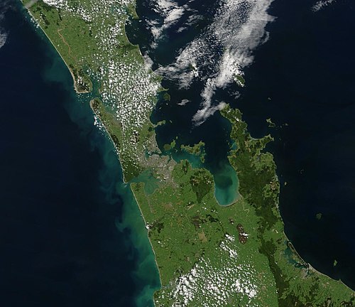
True-colour image of the region showing the Auckland urban area as the brownish area just left of centre, with the Hauraki Gulf to the right