1.
Australasia
–
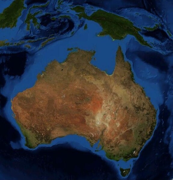
Australasia, a region of Oceania, comprises Australia, New Zealand, the island of New Guinea, and neighbouring islands in the Pacific Ocean. Charles de Brosses coined the term in Histoire des navigations aux terres australes and he derived it from the Latin for south of Asia and differentiated the area from Polynesia and the southeast Pacific. The bulk of Australasia sits on the Indo-Australian Plate, together with India, physiographically, Australasia includes New Zealand, Australia, and Melanesia, New Guinea and neighbouring islands north and east of Australia in the Pacific Ocean. The designation is applied to all the lands and islands of the Pacific Ocean lying between the equator and latitude 47° south. Most of Australasia lies on the portion of the Indo-Australian Plate, flanked by the Indian Ocean to the west. Sometimes the term encompasses the island of New Guinea. Many organisations whose names include the prefix Australasian Society of, limit their scope of operation to just Australia and New Zealand. In the past, Australasia has been used as a name for combined Australia/New Zealand sporting teams, examples include tennis between 1905 and 1915, when New Zealand and Australia combined to compete in the Davis Cup international tournament, and at the Olympic Games of 1908 and 1912. From an ecological perspective the Australasia ecozone forms a region with a common geologic and evolutionary history. In this context, Australasia is limited to Australia, New Guinea, New Zealand, New Caledonia, the Wallace Line marks the biological divide from the Indomalaya ecozone of tropical Asia – Borneo and Bali lie on the western, Asian side. These three land masses have been separated from other continents, and from one another, for millions of years, all of Australasia shares the Antarctic flora, although the northern, tropical islands also share many plants with Southeast Asia. Mainland Australia, New Guinea and Tasmania are separated from one another by shallow continental shelves and they share a similar fauna which includes marsupial and monotreme mammals and ratite birds. Eucalypts are the predominant trees in much of Australia and New Guinea, New Zealand has no extant native land mammals aside from bats, but also had ratite birds, including the kiwi and the extinct moa. Media related to Australasia at Wikimedia Commons
2.
Oceania
–
Oceania, also known as Oceanica, is a region centred on the islands of the tropical Pacific Ocean. The term is used more specifically to denote a continent comprising Australia. The term was coined as Océanie circa 1812 by geographer Conrad Malte-Brun, the word Océanie is a French word derived from the Latin word oceanus, and this from the Greek word ὠκεανός, ocean. Natives and inhabitants of this region are called Oceanians or Oceanicans, as an ecozone, Oceania includes all of Micronesia, Fiji, and all of Polynesia except New Zealand. New Zealand, along with New Guinea and nearby islands, part of the Philippine islands, Australia, the Solomon Islands, Vanuatu, in geopolitical terms, however, New Zealand, the Solomon Islands, Vanuatu and New Caledonia are almost always considered part of Oceania. Australia and Papua New Guinea are usually considered part of Oceania along with the Maluku Islands, puncak Jaya in Papua is often considered the highest peak in Oceania. Oceania was originally conceived as the lands of the Pacific Ocean and it comprised four regions, Polynesia, Micronesia, Malaysia, and Melanesia. The area extends to Sumatra in the west, the Bonin Islands in the northwest, the Hawaiian Islands in the northeast, Rapa Nui and Sala y Gómez Island in the east, and Macquarie Island in the south. Not included are the Pacific islands of Taiwan, the Ryukyu Islands and the Japanese archipelago, all on the margins of Asia, and the Aleutian Islands of North America. The islands at the extremes of Oceania are Bonin, a politically integral part of Japan, Hawaii, a state of the United States. There is also a geographic definition that excludes land on the Sunda Plate. Biogeographically, Oceania is used as a synonym for either the Australasian ecozone or the Pacific ecozone, Oceania is one of eight terrestrial ecozones, which constitute the major ecological regions of the planet. The Oceania ecozone includes all of Micronesia, Fiji, and all of Polynesia except New Zealand, New Zealand, New Guinea, Melanesia apart from Fiji, and Australia constitute the separate Australasian ecozone. The Malay Archipelago is part of the Indomalaya ecozone, related to these concepts are Near Oceania, that part of western Island Melanesia which has been inhabited for tens of millennia, and Remote Oceania which is more recently settled. The term is used to denote a continent comprising Australia. New Zealand forms the corner of the Polynesian Triangle. Its indigenous Māori constitute one of the cultures of Polynesia. It is also, however, considered part of Australasia, the history of Oceania in the medieval period was synonymous with the history of the indigenous peoples of Australasia, Micronesia, Melanesia, Polynesia
3.
Australia
–
Australia, officially the Commonwealth of Australia, is a country comprising the mainland of the Australian continent, the island of Tasmania and numerous smaller islands. It is the worlds sixth-largest country by total area, the neighbouring countries are Papua New Guinea, Indonesia and East Timor to the north, the Solomon Islands and Vanuatu to the north-east, and New Zealand to the south-east. Australias capital is Canberra, and its largest urban area is Sydney, for about 50,000 years before the first British settlement in the late 18th century, Australia was inhabited by indigenous Australians, who spoke languages classifiable into roughly 250 groups. The population grew steadily in subsequent decades, and by the 1850s most of the continent had been explored, on 1 January 1901, the six colonies federated, forming the Commonwealth of Australia. Australia has since maintained a liberal democratic political system that functions as a federal parliamentary constitutional monarchy comprising six states. The population of 24 million is highly urbanised and heavily concentrated on the eastern seaboard, Australia has the worlds 13th-largest economy and ninth-highest per capita income. With the second-highest human development index globally, the country highly in quality of life, health, education, economic freedom. The name Australia is derived from the Latin Terra Australis a name used for putative lands in the southern hemisphere since ancient times, the Dutch adjectival form Australische was used in a Dutch book in Batavia in 1638, to refer to the newly discovered lands to the south. On 12 December 1817, Macquarie recommended to the Colonial Office that it be formally adopted, in 1824, the Admiralty agreed that the continent should be known officially as Australia. The first official published use of the term Australia came with the 1830 publication of The Australia Directory and these first inhabitants may have been ancestors of modern Indigenous Australians. The Torres Strait Islanders, ethnically Melanesian, were originally horticulturists, the northern coasts and waters of Australia were visited sporadically by fishermen from Maritime Southeast Asia. The first recorded European sighting of the Australian mainland, and the first recorded European landfall on the Australian continent, are attributed to the Dutch. The first ship and crew to chart the Australian coast and meet with Aboriginal people was the Duyfken captained by Dutch navigator, Willem Janszoon. He sighted the coast of Cape York Peninsula in early 1606, the Dutch charted the whole of the western and northern coastlines and named the island continent New Holland during the 17th century, but made no attempt at settlement. William Dampier, an English explorer and privateer, landed on the north-west coast of New Holland in 1688, in 1770, James Cook sailed along and mapped the east coast, which he named New South Wales and claimed for Great Britain. The first settlement led to the foundation of Sydney, and the exploration, a British settlement was established in Van Diemens Land, now known as Tasmania, in 1803, and it became a separate colony in 1825. The United Kingdom formally claimed the part of Western Australia in 1828. Separate colonies were carved from parts of New South Wales, South Australia in 1836, Victoria in 1851, the Northern Territory was founded in 1911 when it was excised from South Australia
4.
Papua New Guinea
–
Its capital, located along its southeastern coast, is Port Moresby. The western half of New Guinea forms the Indonesian provinces of Papua, Papua New Guinea is one of the most culturally diverse countries in the world. There are 852 known languages in the country, of which 12 have no known living speakers, most of the population of more than 7 million people live in customary communities, which are as diverse as the languages. It is also one of the most rural, as only 18 percent of its live in urban centres. The country is one of the worlds least explored, culturally and geographically and it is known to have numerous groups of uncontacted peoples, and researchers believe there are many undiscovered species of plants and animals in the interior. Papua New Guinea is classified as an economy by the International Monetary Fund. Strong growth in Papua New Guineas mining and resource sector led to the becoming the sixth fastest-growing economy in the world in 2011. Growth was expected to slow once major resource projects came on line in 2015, mining remains a major economic factor, however. Local and national governments are discussing the potential of resuming mining operations in Panguna mine in Bougainville Province, nearly 40 percent of the population lives a self-sustainable natural lifestyle with no access to global capital. Most of the still live in strong traditional social groups based on farming. Their social lives combine traditional religion with modern practices, including primary education, at the national level, after being ruled by three external powers since 1884, Papua New Guinea established its sovereignty in 1975. This followed nearly 60 years of Australian administration, which started during the Great War and it became an independent Commonwealth realm with Queen Elizabeth II as its head of state and became a member of the Commonwealth of Nations in its own right. Archaeological evidence indicates that humans first arrived in Papua New Guinea around 42,000 to 45,000 years ago and they were descendants of migrants out of Africa, in one of the early waves of human migration. Agriculture was independently developed in the New Guinea highlands around 7000 BC, a major migration of Austronesian-speaking peoples to coastal regions of New Guinea took place around 500 BC. This has been correlated with the introduction of pottery, pigs, in the 18th century, traders brought the sweet potato to New Guinea, where it was adopted and became part of the staples. Portuguese traders had obtained it from South America and introduced it to the Moluccas, the far higher crop yields from sweet potato gardens radically transformed traditional agriculture and societies. Sweet potato largely supplanted the previous staple, taro, and resulted in a significant increase in population in the highlands. In 1901, on Goaribari Island in the Gulf of Papua, missionary Harry Dauncey found 10,000 skulls in the islands Long Houses, traders from Southeast Asia had visited New Guinea beginning 5,000 years ago to collect bird of paradise plumes
5.
Papua (province)
–
Special Region of Papua is the largest and easternmost province of Indonesia, comprising most of western New Guinea. Papua is bordered by the nation of Papua New Guinea to the east and it was formerly called Irian Jaya and comprised all of Indonesian New Guinea. In 2002 the current name was adopted and in 2003 West Papua province was created from parts of Papua province. Papua is the official Indonesian and internationally recognised name for the province, during the Dutch colonial era the region was known as part of Dutch New Guinea or Netherlands New Guinea. Since its annexation in 1969, it known as West Irian or Irian Barat until 1973. This was the name until the name Papua was adopted in 2002. Today, the inhabitants of this province prefer to call themselves Papuans. The name West Papua was adopted in 1961 by the New Guinea Council until the United Nations Temporary Executive Authority transferred administration to the Republic of Indonesia in 1963. West Papua has since used by Papuans as a self-identifying term, especially by those demanding self-determination. The other Indonesian province that shares New Guinea, West Irian Jaya, has been renamed as West Papua. The entire western New Guinea is often referred to as West Papua internationally – especially among networks of solidarity with the West Papuan independence movement. The province of Papua is governed by an elected governor. Nevertheless, the agreement with the UN was nominally upheld, and was recognised by the community in spite of protests. This intensified the movement among indigenous West Papuans, deepening the Papua conflict. The conflict has continued to the present, with Indonesian security forces being accused of human rights abuses in their suppression of the independence movement. The Indonesian government maintains control over the region, barring foreign journalists or rights monitors from entering. In 1999 it was proposed to split the province into three government-controlled sectors, sparking Papuan protests, in January 2003 President Megawati Sukarnoputri signed an order dividing Papua into three provinces, Central Irian Jaya, Papua, and West Papua. The creation of this separate Central Irian Jaya Province was blocked by Indonesian courts, the previous division into two provinces was allowed to stand as an established fact
6.
West Papua (province)
–
West Papua is a province of Indonesia. It covers the two peninsulas of the island of New Guinea. Its capital is Manokwari, although the largest city is Sorong, and the 2010 census recorded a population of 760,855, the latest official estimate is 877,437. West Papua Province was created from the portion of Papua in February 2003, initially under the name of West Irian Jaya. The province covers the Birds Head and Bomberai peninsulas and the islands of Raja Ampat. With a population of 877,437 in 2014, it is the least populous province of Indonesia except for the newly created province of North Kalimantan, even after Indonesias independence in 1945, Papua and Irian Jaya were retained by the Dutch for various reasons. However, Indonesia claimed all of the territory of the former Dutch East Indies, including the Dutch New Guinea holdings and this vote was referred to as the Act of Free Choice. But, the vote was in fact conducted by consensus decision-making, or consensus of elders and this body was coerced into unanimously voting to remain part of Indonesia, the territory was named as the province of Irian Jaya, later Papua. The result of the vote was rejected by Papuan nationalists. The independence movement for West Papua has continued, primarily through peaceful protest and international pressure, West Papua was created from the western portion of Papua province in February 2003, initially under the name of Irian Jaya Barat, it was later renamed Papua Barat on 7 February 2007. In November 2004, an Indonesian court agreed that the split violated Papuas autonomy laws, however, the court ruled that because the new province had already been created, it should remain separate from Papua. The ruling also prohibited the creation of another proposed province, Central Irian Jaya, the split is in line with the general trend of provincial splits that is occurring in all parts of Indonesia in the post-Suharto era. The province changed its name to West Papua on 7 February 2007, in 2000 the areas now forming West Papua province consisted of three regencies – Manokwari, Sorong and Fakfak. By 2010 the province was divided into ten regencies and one autonomous city. Two new regencies have since created, all the existing regencies and city are listed below with their populations at the 2010 Census. * The areas and 2014 population of Arfak Mountains and South Manokwari Regencies are included in the figures for Manokwari Regency, the 2010 Census figures quoted above for all four of these regencies relate to their area as established in 2010. On 25 October 2013 the Indonesian House of Representatives began reviewing draft laws on the establishment of 57 prospective regencies/cities, poisoned Arrows, An investigative journey through the forbidden lands of West Papua
7.
Demonym
–
A demonym is a word that identifies residents or natives of a particular place, which is derived from the name of that particular place. It is a neologism, previously gentilic was recorded in English dictionaries, e. g. the Oxford English Dictionary, thus a Thai may be any resident or citizen of Thailand, of any ethnic group, or more narrowly a member of the Thai people. Conversely, some groups of people may be associated with multiple demonyms, for example, a native of the United Kingdom may be called a British person, a Brit, or a Briton. In some languages, when a parallel demonym does not exist, in English, demonyms are capitalized and are often the same as the adjectival form of the place, e. g. Egyptian, Japanese, or Greek. Significant exceptions exist, for instance the adjectival form of Spain is Spanish, English widely includes country-level demonyms such as Ethiopian or Guatemalan and more local demonyms such as Seoulite, Wisconsinite, Chicagoan, Michigander, Fluminense, and Paulista. Some places lack a commonly used and accepted demonym and this poses a particular challenge to those toponymists who research demonyms. The word gentilic comes from the Latin gentilis and the English suffix -ic, the word demonym was derived from the Greek word meaning populace with the suffix for name. National Geographic attributes the term demonym to Merriam-Webster editor Paul Dickson in a recent work from 1990 and it was subsequently popularized in this sense in 1997 by Dickson in his book Labels for Locals. However, in What Do You Call a Person From, a Dictionary of Resident Names attributed the term to George H. Scheetz, in his Names Names, A Descriptive and Prescriptive Onymicon, which is apparently where the term first appears. Several linguistic elements are used to create demonyms in the English language, the most common is to add a suffix to the end of the location name, slightly modified in some instances. Cairo → Cairene Cyrenaica → Cyrene Damascus → Damascene Greece → Greek Nazareth → Nazarene Slovenia → Slovene Often used for Middle Eastern locations and European locations. Kingston-upon-Hull → Hullensian Leeds → Leodensian Spain → Spaniard Savoy → Savoyard -ese is usually considered proper only as an adjective, thus, a Chinese person is used rather than a Chinese. Monaco → Monégasque Menton → Mentonasque Basque Country → Basque Often used for French locations, mostly they are from Africa and the Pacific, and are not generally known or used outside the country concerned. In much of East Africa, a person of an ethnic group will be denoted by a prefix. For example, a person of the Luba people would be a Muluba, the plural form Baluba, similar patterns with minor variations in the prefixes exist throughout on a tribal level. And Fijians who are indigenous Fijians are known as Kaiviti and these demonyms are usually more informal and colloquial. In the United States such informal demonyms frequently become associated with mascots of the sports teams of the state university system. In other countries the origins are often disputed and these will typically be formed using the standard models above
8.
Australians
–
Australians, colloquially known as Aussies, are people associated with Australia, sharing a common history, culture, and language. Present-day Australians are citizens of the Commonwealth of Australia, governed by its nationality law, the majority of Australians descend from the peoples of the British Isles. Many early settlements were penal colonies, and transported convicts made up a significant proportion of the population in most colonies, large-scale immigration did not occur until the 1850s, following a series of gold rushes. Prior to British settlement, Australia was inhabited by indigenous peoples – Aboriginal Australians, Aboriginal Tasmanians, and Torres Strait Islanders. A small percentage of present-day Australians descend from these peoples, the development of a separate Australian identity and national character is most often linked with the period surrounding the First World War, which gave rise to the concept of the Anzac spirit. The Eureka Rebellion of 1854 and various events of the Second World War, large-scale immigration occurred after the First and Second World Wars, with many post-World War II migrants coming from Southern and Eastern Europe introducing a variety of elements. Immigration from the Middle East, south and east Asia, Australian culture has diverged significantly since British settlement. Australians are referred to as Aussie and Antipodean, Australians were historically referred to as Colonials, British and British subjects. Australian identity draws on a multicultural, European and British cultural heritage, today, Australians of Anglo and other European descent are the dominant majority in Australia, estimated at 85–92% of the total population. Historically, European immigrants had great influence over Australian history and society, since soon after the beginning of British settlement in 1788, people of European descent have formed the majority of the population in Australia. The majority of Australians are of British – English, Scottish, Welsh, Cornish, or Manx –, although some observers stress Australias convict history, the vast majority of early settlers came of their own free will. Far more Australians are descended from assisted immigrants than from convicts, about 20% of Australians are descendants of convicts. Most of the first Australian settlers came from London, the Midlands and the North of England, anglo-Celtic Australians have been highly influential in shaping the nations culture. By the mid-1840s, the numbers of settlers had overtaken the convict population. In 1888,60 percent of the Australian population had been born in Australia, out of the remaining 40 percent,34 percent had been born in the British Isles, and 6 percent were of European origin, mainly from Germany and Scandinavia. In the 1840s, Scots-born immigrants constituted 12 percent of the Australian population, there were 1.3 million British migrants to Australia in the period from 1861–1914, of which 13.5 percent were Scots. 5.3 percent of the convicts transported to Eastern Australia between 1789 and 1852 were Scots, by 1850, there were 290,000 Aboriginal Australians. The European population grew from 0.3 percent of the population of the continent at 1800 to 58.6 percent at 1850, germans formed the largest non-British community for most of the 19th century
9.
Indonesia
–
Indonesia, officially the Republic of Indonesia, is a unitary sovereign state and transcontinental country located mainly in Southeast Asia with some territories in Oceania. Situated between the Indian and Pacific oceans, it is the worlds largest island country, with more than seventeen thousand islands. At 1,904,569 square kilometres, Indonesia is the worlds 14th-largest country in terms of area and worlds 7th-largest country in terms of combined sea. It has an population of over 260 million people and is the worlds fourth most populous country. The worlds most populous island, Java, contains more than half of the countrys population, Indonesias republican form of government includes an elected legislature and president. Indonesia has 34 provinces, of which five have Special Administrative status and its capital and countrys most populous city is Jakarta, which is also the most populous city in Southeast Asia and the second in Asia. The country shares land borders with Papua New Guinea, East Timor, other neighbouring countries include Singapore, Vietnam, the Philippines, Australia, Palau, and the Indian territory of the Andaman and Nicobar Islands. Despite its large population and densely populated regions, Indonesia has vast areas of wilderness that support the second highest level of biodiversity. The country has abundant natural resources like oil and natural gas, tin, copper, agriculture mainly produces rice, palm oil, tea, coffee, cacao, medicinal plants, spices and rubber. Indonesias major trading partners are Japan, United States, China, the Indonesian archipelago has been an important region for trade since at least the 7th century, when Srivijaya and then later Majapahit traded with China and India. Local rulers gradually absorbed foreign cultural, religious and political models from the early centuries CE, Indonesian history has been influenced by foreign powers drawn to its natural resources. Indonesia consists of hundreds of native ethnic and linguistic groups. The largest – and politically dominant – ethnic group are the Javanese, a shared identity has developed, defined by a national language, ethnic diversity, religious pluralism within a Muslim-majority population, and a history of colonialism and rebellion against it. Indonesias national motto, Bhinneka Tunggal Ika, articulates the diversity that shapes the country, Indonesias economy is the worlds 16th largest by nominal GDP and the 8th largest by GDP at PPP, the largest in Southeast Asia, and is considered an emerging market and newly industrialised country. Indonesia has been a member of the United Nations since 1950, Indonesia is a member of the G20 major economies and World Trade Organization. The name Indonesia derives from the Greek name of the Indós, the name dates to the 18th century, far predating the formation of independent Indonesia. In 1850, George Windsor Earl, an English ethnologist, proposed the terms Indunesians—and, his preference, in the same publication, one of his students, James Richardson Logan, used Indonesia as a synonym for Indian Archipelago. However, Dutch academics writing in East Indies publications were reluctant to use Indonesia, they preferred Malay Archipelago, the Netherlands East Indies, popularly Indië, the East, and Insulinde
10.
.au
–
. au is the Internet country code top-level domain for Australia. It was first created on 5 March 1986, Domain name policy is managed by. au Domain Administration, with the registry operated by AusRegistry. The domain name was allocated by Jon Postel, operator of IANA to Kevin Robert Elz of Melbourne University in 1986. After an approximately five-year process in the 1990s, the Internet industry created a body called. au Domain Administration to operate the domain. It obtained assent from ICANN in 2001, and commenced operating a new regime for domain registration on 1 July 2002. Since this new regime, any registration has to be ordered via a registrar, oversight of. au is by. au Domain Administration. It is an organisation whose membership is derived from Internet organisations, industry members. The organisation operates with the endorsement of the Australian Government and with the authority of ICANN. Policy for. au is devised by policy development panels and these panels are convened by auDA and combine public input with industry representation to derive policy. The day-to-day operation of the. au registry technical facility is tendered out by auDA, the current operator is AusRegistry who has performed this role since the initial tender in 2002. AusRegistry does not sell domain registration services direct to the consumer, rather consumers who wish to register a domain must do so via a domain name registrar, after the industrys liberalisation in 2002, there is an active competitive market in registrars with a variety of prices and services. In 2008 auDA changed its policy and allowed changes in ownership of. au domains. AuDA introduced the ISS in October 2013 as a mandatory requirement, discount Domain Name services, Cheaper Domains and Information Brokers, part of the Total Internet Group, are the first three auDA accredited registrars to achieve ISS compliance. The naming rules for. au require registrations under second-level categories that describe a type of entity. com. au and this follows a similar allocation policy to that formerly used in other countries such as the United Kingdom and New Zealand. Registrations are currently permitted below a second-level domain, such as yourname. com. au, in April 2016, auDA announced it would introduce registrations directly at the second level, such as yourname. au. Direct registrations are due to be implemented in 2017, registering a domain in the. au namespace requires registrants to have either an exact match or a “close and substantial connection” to their desired domain name. Registration of a. au domain is completed through a reseller, known as a registrar and these domains are managed by the. au Community Domains Trust on behalf of auDA. CGDNs use the state or territorys common abbreviation as the level of the domain
11.
Sydney
–
Sydney /ˈsɪdni/ is the state capital of New South Wales and the most populous city in Australia and Oceania. Located on Australias east coast, the metropolis surrounds the worlds largest natural harbour, residents of Sydney are known as Sydneysiders. The Sydney area has been inhabited by indigenous Australians for at least 30,000 years, the first British settlers, led by Captain Arthur Phillip, arrived in 1788 to found Sydney as a penal colony, the first European settlement in Australia. Since convict transportation ended in the century, the city has transformed from a colonial outpost into a major global cultural. As at June 2016 Sydneys estimated population was 5,005,358, in the 2011 census,34 percent of the population reported having been born overseas, representing many different nationalities and making Sydney one of the most multicultural cities in the world. There are more than 250 different languages spoken in Sydney and about one-third of residents speak a language other than English at home and it is classified as an Alpha+ World City by the Globalization and World Cities Research Network, indicating its influence in the region and throughout the world. Ranked eleventh in the world for economic opportunity, Sydney has a market economy with strengths in finance, manufacturing. Its gross regional product was $337 billion in 2013, the largest in Australia, there is a significant concentration of foreign banks and multinational corporations in Sydney and the city is promoted as one of Asia Pacifics leading financial hubs. Its natural features include Sydney Harbour, the Royal National Park, man-made attractions such as the Sydney Opera House, Sydney Tower and the Sydney Harbour Bridge are also well known to international visitors. The first people to inhabit the now known as Sydney were indigenous Australians having migrated from northern Australia. Radiocarbon dating suggests human activity first started to occur in the Sydney area from around 30,735 years ago, the earliest British settlers called them Eora people. Eora is the term the indigenous used to explain their origins upon first contact with the British. Its literal meaning is from this place, prior to the arrival of the British there were 4,000 to 8,000 native people in Sydney from as many as 29 different clans. Sydney Cove from Port Jackson to Petersham was inhabited by the Cadigal clan, the principal language groups were Darug, Guringai, and Dharawal. The earliest Europeans to visit the area noted that the people were conducting activities such as camping and fishing, using trees for bark and food, collecting shells. Development has destroyed much of the citys history including that of the first inhabitants, there continues to be examples of rock art and engravings located in the protected Ku-ring-gai Chase National Park. The first meeting between the people and the British occurred on 29 April 1770 when Lieutenant James Cook landed at Botany Bay on the Kurnell Peninsula. He noted in his journal that they were confused and somewhat hostile towards the foreign visitors, Cook was on a mission of exploration and was not commissioned to start a settlement
12.
Melbourne
–
Melbourne is the capital and most populous city of the Australian state of Victoria, and the second-most populous city in Australia and Oceania. The name Melbourne refers to an urban agglomeration spanning 9,900 km2, the metropolis is located on the large natural bay of Port Phillip and expands into the hinterlands towards the Dandenong and Macedon mountain ranges, Mornington Peninsula and Yarra Valley. It has a population of 4,641,636 as of 2016, and its inhabitants are called Melburnians. Founded by free settlers from the British Crown colony of Van Diemens Land on 30 August 1835, in what was then the colony of New South Wales, it was incorporated as a Crown settlement in 1837. It was named Melbourne by the Governor of New South Wales, Sir Richard Bourke, in honour of the British Prime Minister of the day, William Lamb, 2nd Viscount Melbourne. It was officially declared a city by Queen Victoria, to whom Lord Melbourne was close, in 1847, during the Victorian gold rush of the 1850s, it was transformed into one of the worlds largest and wealthiest cities. After the federation of Australia in 1901, it served as the interim seat of government until 1927. It is a financial centre in the Asia-Pacific region. It is recognised as a UNESCO City of Literature and a centre for street art, music. It was the host city of the 1956 Summer Olympics and the 2006 Commonwealth Games, the main passenger airport serving the metropolis and the state is Melbourne Airport, the second busiest in Australia. The Port of Melbourne is Australias busiest seaport for containerised and general cargo, Melbourne has an extensive transport network. The main metropolitan train terminus is Flinders Street Station, and the regional train. Melbourne is also home to Australias most extensive network and has the worlds largest urban tram network. Before the arrival of settlers, humans had occupied the area for an estimated 31,000 to 40,000 years. At the time of European settlement, it was inhabited by under 2000 hunter-gatherers from three indigenous tribes, the Wurundjeri, Boonwurrung and Wathaurong. The area was an important meeting place for the clans of the Kulin nation alliance and it would be 30 years before another settlement was attempted. Batman selected a site on the bank of the Yarra River. Batman then returned to Launceston in Tasmania, in early August 1835 a different group of settlers, including John Pascoe Fawkner, left Launceston on the ship Enterprize
13.
Brisbane
–
Brisbane is the capital of and most populous city in the Australian state of Queensland, and the third most populous city in Australia. Brisbanes metropolitan area has a population of 2.35 million, the Brisbane central business district stands on the original European settlement and is situated inside a bend of the Brisbane River, about 15 kilometres from its mouth at Moreton Bay. The demonym of Brisbane is Brisbanite, one of the oldest cities in Australia, Brisbane was founded upon the ancient homelands of the indigenous Turrbal and Jagera peoples. A penal settlement was founded in 1824 at Redcliffe,28 kilometres north of the business district. The city was marred by the Australian frontier wars between 1843 and 1855, and development was set back by the Great Fire of Brisbane. Brisbane was chosen as the capital when Queensland was proclaimed a colony from New South Wales in 1859. During World War II, Brisbane played a role in the Allied campaign. Today, Brisbane is well known for its distinct Queenslander architecture which forms much of the built heritage. It also receives attention for its damaging flood events, most notably in 1974 and 2011. Several large cultural, international and sporting events have held at Brisbane, including the 1982 Commonwealth Games, World Expo 88, the final Goodwill Games in 2001. Prior to white settlement, the Brisbane area was inhabited by the Turrbal and they knew the area that is now the central business district as Mian-jin, meaning place shaped as a spike. The Moreton Bay area was explored by Matthew Flinders. On 17 July 1799, Flinders landed at what is now known as Woody Point, in 1823 Governor of New South Wales Sir Thomas Brisbane instructed that a new northern penal settlement be developed, and an exploration party led by John Oxley further explored Moreton Bay. Oxley discovered, named, and explored the Brisbane River as far as Goodna,20 kilometres upstream from the Brisbane central business district, Oxley recommended Red Cliff Point for the new colony, reporting that ships could land at any tide and easily get close to the shore. The party settled in Redcliffe on 13 September 1824, under the command of Lieutenant Henry Miller with 14 soldiers and 29 convicts. However, this settlement was abandoned after a year and the colony was moved to a site on the Brisbane River now known as North Quay,28 km south, chief Justice Forbes gave the new settlement the name of Edenglassie before it was named Brisbane. Non-convict European settlement of the Brisbane region commenced in 1838, German missionaries settled at Zions Hill, Nundah as early as 1837, five years before Brisbane was officially declared a free settlement. The band consisted of ministers Christopher Eipper and Carl Wilhelm Schmidt and lay missionaries Haussmann, Johann Gottried Wagner, Niquet, Hartenstein, Zillman, Franz, Rode, Doege and they were allocated 260 hectares and set about establishing the mission, which became known as the German Station
14.
Perth
–
Perth is the capital and largest city of the Australian state of Western Australia. It is the fourth-most populous city in Australia, with a population of 2.06 million living in Greater Perth. The first areas settled were on the Swan River, with the central business district. Perth was founded by Captain James Stirling in 1829 as the centre of the Swan River Colony. It gained city status in 1856, and was promoted to the status of a Lord Mayorality in 1929. The city is named after Perth, Scotland, due to the influence of Sir George Murray, Member of Parliament for Perthshire and Secretary of State for War and the Colonies. The citys population increased substantially as a result of the Western Australian gold rushes in the late 19th century, largely as a result of emigration from the eastern colonies of Australia. During Australias involvement in World War II, Fremantle served as a base for operating in the Pacific Theatre. An influx of immigrants after the war, predominantly from Britain, Greece, Italy and Yugoslavia, Aboriginal people have inhabited the Perth area for 38,000 years, as evidenced by archaeological remains at Upper Swan. The Noongar people occupied the southwest corner of Western Australia and lived as hunter-gatherers, the wetlands on the Swan Coastal Plain were particularly important to them, both spiritually and as a source of food. The Noongar people know the area where Perth now stands as Boorloo, Boorloo formed part of Mooro, the tribal lands of Yellagongas group, one of several based around the Swan River and known collectively as the Whadjuk. The Whadjuk were part of a group of fourteen tribes that formed the south-west socio-linguistic block known as the Noongar. The judgment was overturned on appeal, the first documented sighting of the region was made by the Dutch Captain Willem de Vlamingh and his crew on 10 January 1697. The British colony would be officially designated Western Australia in 1832, Captain James Stirling, aboard Parmelia, said that Perth was as beautiful as anything of this kind I had ever witnessed. On 12 August that year, Helen Dance, wife of the captain of the ship, Sulphur. The only contemporary information on the source of the name comes from Fremantles diary entry for 12 August, Murray was born in Perth, Scotland, and was in 1829 Secretary of State for the Colonies and Member for Perthshire in the British House of Commons. The town was named after the Scottish Perth, in Murrays honour, the racial relations between the Noongar people and the Europeans were strained due to these happenings. Because of the amount of building in and around Boorloo
15.
Adelaide
–
Adelaide is the capital city of the state of South Australia, and the fifth-most populous city of Australia. In June 2016, Adelaide had a resident population of 1,326,354 million. South Australia, with a total of 1, the demonym Adelaidean is used in reference to the city and its residents. Adelaide is north of the Fleurieu Peninsula, on the Adelaide Plains between the Gulf St Vincent and the low-lying Mount Lofty Ranges which surround the city. Adelaide stretches 20 km from the coast to the foothills, and 94 to 104 km from Gawler at its northern extent to Sellicks Beach in the south. Named in honour of Adelaide of Saxe-Meiningen, queen consort to King William IV, Colonel William Light, one of Adelaides founding fathers, designed the city and chose its location close to the River Torrens, in the area originally inhabited by the Kaurna people. Lights design set out Adelaide in a layout, interspaced by wide boulevards and large public squares. Early Adelaide was shaped by prosperity and wealth—until the Second World War, it was Australias third-largest city and it has been noted for early examples of religious freedom, a commitment to political progressivism and civil liberties. It has been known as the City of Churches since the mid-19th century, as South Australias seat of government and commercial centre, Adelaide is the site of many governmental and financial institutions. Most of these are concentrated in the city centre along the boulevard of North Terrace, King William Street. Today, Adelaide is noted for its festivals and sporting events, its food and wine, its long beachfronts. It ranks highly in terms of liveability, being listed in the Top 10 of The Economist Intelligence Units Worlds Most Liveable Cities index in 2010,2011,2012 and 2015. It was also ranked the most liveable city in Australia by the Property Council of Australia in 2011,2012 and 2013, prior to its proclamation as a British settlement in 1836, the area around Adelaide was inhabited by the indigenous Kaurna Aboriginal nation. Kaurna culture and language was almost completely destroyed within a few decades of the European settlement of South Australia in 1836, however, extensive documentation by early missionaries and other researchers has enabled a modern revival of both language and culture. South Australia was officially proclaimed as a new British colony on 28 December 1836, the event is commemorated in South Australia as Proclamation Day. The site of the capital was surveyed and laid out by Colonel William Light. Adelaide was established as a colony of free immigrants, promising civil liberties and freedom from religious persecution. Wakefields idea was for the Government to survey and sell the land at a rate that would maintain land values high enough to be unaffordable for labourers and journeymen
16.
Gold Coast, Queensland
–
Gold Coast is a coastal city in the Australian state of Queensland, approximately 66 kilometres south-southeast of the state capital Brisbane and immediately north of the border with New South Wales. With a census-estimated 2016 population of 638,090, The Gold Coast is the sixth-largest city in Australia, making it the largest non-capital city, the first settlement in what is now South East Queensland was as a penal colony at Redcliffe. The Gold Coast region remained uninhabited by Europeans until 1823 when explorer John Oxley landed at Mermaid Beach. The hinterlands red cedar supply attracted people to the area in the mid-19th century, later in 1875, Southport was surveyed and established and grew a reputation as a secluded holiday destination for wealthy Brisbane residents. The Gold Coast region grew significantly after the establishment of the Surfers Paradise hotel in the late 1920s and it is also the major film production hub for Queensland. Gold Coast will host the 2018 Commonwealth Games, lieutenant James Cook became the first European to note the region when he sailed along the coast on 16 May 1770 in the HM Bark Endeavour. Captain Matthew Flinders, an explorer charting the continent north from the colony of New South Wales, escaped convicts from the Moreton Bay penal settlement hid in the region. The region remained uninhabited by Europeans until 1823 when explorer John Oxley landed at Mermaid Beach. The hinterlands red cedar supply attracted people to the area in the mid-19th century, a number of small townships developed along coast and in the hinterland. The western suburb of Nerang was surveyed and established as a base for the industry, by 1873, the town reserve of Burleigh Heads had also been surveyed and successful land sales had taken place. Southport quickly grew a reputation as a holiday destination for wealthy Brisbane residents. Gold Coast was originally known as the South Coast, however, inflated prices for real estate and other goods and services led to the nickname of Gold Coast from 1950. South Coast locals initially considered the name Gold Coast derogatory, however, soon the Gold Coast simply became a convenient way to refer to the holiday strip from Southport to Coolangatta. As the tourism grew into the 1950s, local businesses began to adopt the term in their names. The area was proclaimed a city less than one year later, in 2007, Gold Coast overtook the population of Newcastle, New South Wales to become the sixth largest city in Australia and the largest non-capital city. The Gold Coast is approximately covered by forests of various types. This includes small patches of near-pristine ancient rainforest, mangrove-covered islands, of the plantation pine forests that were planted in the 1950s and 1960s, when commercial forest planting for tax minimisation was encouraged by the Commonwealth government, tiny remnants remain. Gold Coast City lies in the southeast corner of Queensland, to the south of Brisbane, the Albert River separates Gold Coast from Logan City, a suburban area of Brisbane
17.
Tweed Heads, New South Wales
–
Tweed Heads is a city in New South Wales. It is located on the Tweed River in north-eastern New South Wales, Australia, Tweed Heads is located next to the border with Queensland, adjacent to its Twin Town of Coolangatta, which is a suburb of the Gold Coast. The view was beautiful beyond description. The scenery here exceeded anything I have previously seen in Australia, timber cutters originally moved to the Tweed Valley in 1844. After the timber had been cleared, farmers moved in with bananas, cane and dairy farming dominating the area, the first school opened in 1871. Tweed Heads was once connected to the Queensland Railways system, with the South Coast line providing a connection to Brisbane. The Tweed Heads railway station was located on the side of Enid Street between Bay Street and Frances Street. The railway line to Brisbane closed in 1961, the site of the station has been converted to parklands, the Tweed Heads and Coolangatta Surf Life Saving Club opened on 13 September 1911. The Tweed Shire, inclusive Murwillumbah was declared in 1947, given its closeness to the Gold Coast, Tweed Heads has a shared economy with Coolangatta based heavily on tourism. Some areas of the Tweed can receive both tv broadcasts from Brisbane and Northern New South Wales, Brisbane stations are Seven Brisbane BTQ, Nine Brisbane QTQ, and Ten Brisbane TVQ. The local Northern NSW stations are Prime7, NBN Television and Southern Cross Ten, in the 2011 census, Tweed Heads recorded a population of 7,525 people made up of 52.8 percent female and 47.2 percent male. The median age of the population was 54 years,17 years above the Australian median and this has made the Tweed Heads region a prime location for retirement living, with 14 separate retirement villages. Eighty-seven percent speak English as their first language, followed by 0.7 percent Mandarin,0.6 percent Portuguese,0.5 percent Tagalog,0.3 percent Italian and 0.3 percent Spanish. According to the 2011 census, the groups in Tweed Heads by size were Catholic 26. 9%, Anglican 24. 4%, No Religion 17. 9%, Presbyterian and Reformed 5. 4%. Composition of the Tweed Heads urban area Population by Statistical Local Area, composition of the Tweed Heads urban area Population by Statistical Local Area. Tweed Heads was once home to several iterations of professional league clubs in the New South Wales Rugby League competition between 1988-1995. The Gold Coast-Tweed Giants were established in 1988 and based out of the Tweed Heads Seagulls premises in west Tweed Heads, the team pulled off its biggest coup in 1990 when it signed future Rugby League Immortal Wally Lewis. After years of poor on field results and low attendances, the Seagulls sold their NSWRL licence to businessman Jeff Muller who moved the team to Carrara on the Gold Coast
18.
Maitland, New South Wales
–
It is on the New England Highway about 17 km from its start at Hexham. The city centre is located on the bank of the Hunter River. Surrounding areas include the cities of Cessnock and Singleton local government areas, originally Maitland was a culmination of three separate towns which arose roughly all around the same time. West Maitland, now just Maitland, was a privately founded town grew because of its proximity to the river. The other areas were East Maitland, which was established by the colonial New South Wales government, and Morpeth, another private town founded by Lieutenant Close, each town functioned as if they were separate municipalities. The name, Maitland, was reported in 1885 to have had its name taken from Sir George Maitland, under Secretary for the Colonies, and M. P. for the Borough of Whitchurch, in Hampshire, England. The present city was proclaimed in 1945 with the amalgamation of the three local government areas, the citys boundaries have been increased by incorporating parts of other local government areas since then. West Maitland was founded in 1820 close to the reach of the Hunter River where vessels with a shallow draft could navigate. Nearby Morpeth served as the head of navigation for larger ships, originally the route river route between Morpeth and West Maitland was 26 kilometres, today after various floods and river course changes this has reduced to just 9 kilometres. Maitland was therefore the point at which goods were unloaded for, and distributed to, accordingly, there were large warehouses built, which faced onto the main High Street and backed onto the Hunter River. For almost 20 years until the Victorian gold rush, Maitland was the second largest town in Australia, the arrival of the railway from Newcastle in the 1850s, coupled with the increasing silting of the river and larger ships spelt the end of the traditional river traffic. The first electricity connected in the area was to Maitland Town Hall in 1922, to the Halls front light. The first bridge to link West Maitland with what is now the suburb of Lorn was opened in 1869 and named in honour of the then Governor of New South Wales, the 4th Earl of Belmore. Although the bridge proved vital to the development, the floods of 1893,1913 and 1930 began to heighten the need for a new bridge that could withstand periodic flooding. A second Belmore Bridge, designed to withstand the impact of debris during floods, was adjacent to the 1869 bridge in 1964. The new bridge, which redirected traffic away from St. Andrews Street to a new intersection at the Maitland Court House, is one of the three main river crossings. Maitlands proximity to the Hunter River has resulted in a succession of floods since European settlement, over 200 floods have occurred on the Hunter River since settlement,13 of those higher than the rivers normal peak limit of 10.7 metres. Of these 13, all have had an effect on the city of Maitland
19.
Canberra
–
Canberra is the capital city of Australia. With a population of 381,488, it is Australias largest inland city, the city is located at the northern end of the Australian Capital Territory,280 km south-west of Sydney, and 660 km north-east of Melbourne. A resident of Canberra is known as a Canberran, the site of Canberra was selected for the location of the nations capital in 1908 as a compromise between rivals Sydney and Melbourne, Australias two largest cities. It is unusual among Australian cities, being a planned city outside of any state, similar to Washington, D. C. in the United States. Following an international contest for the design, a blueprint by American architects Walter Burley Griffin and Marion Mahony Griffin was selected. The Griffins plan featured geometric motifs such as circles, hexagons and triangles, the citys design was influenced by the garden city movement and incorporates significant areas of natural vegetation that have earned Canberra the title of the bush capital. Although the Australian Capital Territory is now self-governing, the Commonwealth Government retains some influence through the National Capital Authority, the Australian Armys officer corps is trained at the Royal Military College, Duntroon and the Australian Defence Force Academy is also located in the capital. The ACT is independent of any state to prevent any one state from gaining an advantage by hosting the seat of Commonwealth power, the ACT has voting representation in the Commonwealth Parliament, and has its own independent Legislative Assembly and government, similar to the states. Compared to the averages, the unemployment rate is lower. Property prices are high, in part due to comparatively restrictive development regulations. An 1830s map of the region by Major Mitchell indeed does mark the Sullivans Creek floodplain between two mountains as Nganbra. Nganbra or Nganbira could readily have been anglicised to the name Canberry, survey plans of the district dated 1837 refer to the area as the Canberry Plain. Although popularly pronounced /ˈkænbərə/ or /ˈkænbɛrə/, the pronunciation at its official naming in 1913 was /ˈkæn. brə/. Before white settlement, the area in which Canberra would eventually be constructed was seasonally inhabited by Indigenous Australians, archaeological evidence of settlement in the region includes inhabited rock shelters, rock paintings and engravings, burial places, camps and quarry sites, and stone tools and arrangements. Artefacts suggests early human activity occurred at some point in the area 21,000 years previously, European exploration and settlement started in the Canberra area as early as the 1820s. There were four expeditions between 1820 and 1824, white settlement of the area probably dates from 1823, when a homestead or station was built on what is now the Acton peninsula by stockmen employed by Joshua John Moore. He formally applied to purchase the site on 16 December 1826, on 30 April 1827, Moore was told by letter that he could retain possession of 1,000 acres at Canberry. The European population in the Canberra area continued to grow throughout the 19th century
20.
Queanbeyan
–
Queanbeyan /ˈkwiːnbiən/ is a city in south-eastern New South Wales, located adjacent to the Australian Capital Territory in the Southern Tablelands region. Located on the Queanbeyan River, the city is the seat of the Queanbeyan-Palerang Regional Council. At the 2011 census, it had a population of 37,991, Queanbeyans economy is based on light construction, manufacturing, service, retail and agriculture. Canberra, Australias capital, is located just 15 kilometres to the west, the word Queanbeyan is the anglicised form of Quinbean, an Aboriginal word meaning clear waters. The town grew from a squattage held by ex-convict and inn keeper, Timothy Beard, the town centre of Queanbeyan is located on the Queanbeyan River, a tributary of the Molonglo River and about one mile east of Oaks Estate. Queanbeyan was officially proclaimed a township in 1838 when the population was about 50, the local parish was also known by that name and later still the member for the electorate of Queanbeyan held a seat in the legislative assembly of the colony of NSW. On 28 November 1837 the Colonial Secretary announced the appointment of Captain Alured Tasker Faunce as resident police magistrate at Queanbeyan and his homestead, called Dodsworth, was situated on the banks of the Queanbeyan river opposite the town. Traces of gold were discovered in 1851 and lead and silver mines also flourished briefly, settlers were harassed by bushrangers, of which James Shaw, William Millet, and John Rueben, John Tennant, Jacky Jacky, Frank Gardiner and Ben Hall were some of the more notorious. In 1836, a Post Office was established, the Commercial Banking Company of Sydney Limited opened in Queanbeyan on 19 September 1859. The Bank of New South Wales began service in Queanbeyan in 1878, the Golden Age was Queanbeyans first newspaper and was founded in 1860 by John Gale. In 1880 the residence of John James Wright, the first mayor of Queanbeyan, was constructed along the edge of the Queanbeyan River, in 1982 that building became the Queanbeyan Art Centre. The Salvation Army claimed an outpost in Queanbeyan in 1884, Queanbeyan, an increasingly successful primary producing district, was proclaimed a Municipality in February 1885 incorporating an area of 5,700 acres. The railway reached Queanbeyan railway station in 1887 and it became the junction for the going to Canberra. The town is served by the thrice-daily NSW TrainLink Xplorer service between Canberra and Sydney, at the height of its rural prosperity Queanbeyan boasted sixteen public houses and six flourmills powered by wind, water, horse and steam. The Royal Hotel on Monaro Street opened in 1926, in Canberra alcohol was prohibited from 1911, at the time of the territorys foundation, until 1928, when Federal Parliament had relocated from Melbourne. In that period many of the residents crossed the border to drink at one of Queanbeyans hotels. Queanbeyan was granted city status on 7 July 1972, on 21 July 1975 the Queens Bridge was opened. This bridge took pressure off the bridge in linking Monaro Street directly to the east
21.
Sunshine Coast, Queensland
–
Sunshine Coast is a peri-urban area and the third most populated area in the Australian state of Queensland. The estimated urban population of Sunshine Coast as at June 2015 was 302,122, the area was first settled by Europeans in the 19th century with development progressing slowly until tourism became an important industry. The area has several coastal hubs at Caloundra, Kawana Waters, Maroochydore, Nambour and Maleny have developed as primary commercial centres for the hinterland, although Maleny falls outside the urban area defined by the ABS that this article refers to. James Cook on the deck of HM Bark Endeavour in 1770 became the first known white settler to sight the Glass House Mountains, in the 1820s, the Sunshine Coast saw its first white inhabitants, three castaways who shared the life of the local Aborigines for eight months. Thereafter, during the 1830s to 1840s, the district home to numerous runaway convicts from the Moreton Bay penal colony slightly to the south. However, during the 1840s and 1850s, the Bunya Bunya Reserve, the Blackall Range, on account of the tri-annual Bunya Festival, served as both a hideout and rallying point for attacks against white settlement. By the 1850s timber cutters and cattlemen had started exploiting the area, many of the Sunshine Coasts towns began as simple ports or jetties for the timber industry during the 1860s and 1870s, as the area once had magnificent stands of forest. Likewise, the roads often began as snigging tracks for hauling timber. Timbergetters used the creeks, rivers and lakes as seaways to float out their logs of cedar – the resultant wood being shipped as far afield as Europe. During the Gympie Gold Rush, prospectors scaled the Sunshine Coast mountains to develop easier roadways to, after construction of the railway line to Gympie, the coastal and river towns, being mostly ports for the early river-trade, were bypassed. By the 1890s diverse small-farming had replaced the cattle-and-timber economy of earlier decades, sugar cane and pineapples proved especially important produce for the district. Many small hamlets and towns now emerged, produce was initially taken by horse to Landsborough, then to Eudlo in 1891. Especially after World War II, the Sunshine Coast grew into a favoured holiday and this tendency was further expanded in the development boom of the 1960s and 1970s. Around the same time, various tourist/theme parks were created – the most iconic being Woombyes Big Pineapple, during the 1960s and 1970s, the Sunshine Coast also attracted persons drawn to alternative lifestyles. These newcomers developed a range of industries, co-operatives and spiritual centres. After the 1980s, the Sunshine Coast experienced rapid population growth, as of 2011 it had become one of the fastest-growing regions in Australia. As the region becomes increasingly residential, most of the distinctive small farms – especially tropical-fruit and sugar-cane farms have disappeared. The Moreton sugar mills closure in 2003 removed a market for the districts 120 cane growers who had been harvesting cane in the region, instead, businesses concerned with retail, catering and tourism have assumed increasing importance
22.
Wollongong
–
Wollongong, informally referred to as The Gong, is a seaside city located in the Illawarra region of New South Wales, Australia. Wollongong lies on the coastal strip between the Illawarra Escarpment and the Pacific Ocean,82 kilometres south of Sydney. Wollongong had an urban population of 295,842 at June 2016, making it the third largest city in New South Wales after Sydney and Newcastle. The Wollongong metropolitan area extends from Helensburgh in the north to Shell Cove in the south and it has two cathedrals, churches of many denominations and the Nan Tien Temple, the largest Buddhist temple in the southern hemisphere. Wollongong has a history of coalmining and industry. The city attracts tourists each year, and is a regional centre for the South Coast fishing industry. The University of Wollongong has around 37,000 students and is internationally recognised, the name Wollongong is believed to mean seas of the South in the local Aboriginal language, referring to NSWs Southern Coast. Other meanings have been suggested, such as great feast of fish, hard ground near water, song of the sea, sound of the waves, many snakes, the area was originally inhabited by the Dharawal Indigenous Australians. The first Europeans to visit the area were the navigators George Bass and Matthew Flinders, the first settlers in the region were cedar cutters in the early nineteenth century, followed by graziers in 1812. Charles Throsby established a stockmans hut in the area in 1815, the first land grants were made in 1816. In 1830, a barracks was constructed near the harbour. Further settlers arrived and in 1834 a town was planned, on 26 November 1834, the town was first gazetted and George Brown erected the first court house. The main road down the Escarpment through Bulli Pass was built by labour in 1835-6, although other passes were built during the 1800s as well, such as OBriens Road. By 1856 Wollongong had a population of 864, in 1858, a court house was built. In 1861, a tramway from Mount Keira to the harbour was completed. In 1862 a telegraph line was opened between Wollongong and Bellambi, in 1865, the first gas supply in Wollongong was provided from a gas plant in Corrimal Street. In 1868 the extensions to the harbour were opened by Lady Belmore, patrick Lahiff established a coke works at Wollongong Harbour in the 1870s. He erected two beehive ovens between the north eastern end of the basin and Pulpit Rock
23.
Hobart
–
Hobart is the capital and most populous city of the Australian island state of Tasmania. It is the least populated state capital in Australia, founded in 1803 as a penal colony, Hobart is Australias second oldest capital city after Sydney, New South Wales. The modern history of Hobart dates to its foundation as a British colony in 1803, prior to British settlement, the area had been occupied for possibly as long as 35,000 years, by the semi-nomadic Mouheneener tribe, a sub-group of the Nuennone, or South-East tribe. The descendants of the indigenous Tasmanians now refer to themselves as Palawa, Hobart has experienced both booms and busts over its history. In the later years of the 20th century, migrants arrived to settle in Hobart from Asia. In June 2015, the city had an area population of approximately 221,000. The city is located in the states south-east on the estuary of the Derwent River and its harbour forms the second-deepest natural port in the world. Its skyline is dominated by the 1, 271-metre kunanyi/Mount Wellington, the metropolitan area is often referred to as Greater Hobart, to differentiate it from the City of Hobart, one of the five local government areas that cover the city. The first European settlement began in 1803 as a colony at Risdon Cove on the eastern shores of the Derwent River. In 1804 it was moved to a location at the present site of Hobart at Sullivans Cove. The city, initially known as Hobart Town or Hobarton, was named after Lord Hobart, the British secretary of state for war, the areas indigenous inhabitants were members of the semi-nomadic Mouheneener tribe. Charles Darwin visited Hobart Town in February 1836 as part of the Beagle expedition, I was chiefly struck with the comparative fewness of the large houses, either built or building. Hobart Town, from the census of 1835, contained 13,826 inhabitants, the Derwent River was one of Australias finest deepwater ports and was the centre of the Southern Ocean whaling and sealing trades. The settlement rapidly grew into a port, with allied industries such as shipbuilding. Hobart Town became a city on 21 August 1842, and was renamed Hobart from the beginning of 1881, Hobart is located on the estuary of the Derwent River in the states south-east. Geologically Hobart is built predominantly on Jurassic dolerite around the foothills interspersed with areas of Triassic siltstone. Both of these areas rest on the younger Jurassic dolerite deposits, before stretching into the areas such as the beaches of Sandy Bay in the south. South of the Derwent estuary lies Storm Bay and the Tasman Peninsula, the Eastern Shore also extends from the Derwent valley area in a southerly direction hugging the Meehan Range in the east before sprawling into flatter land in suburbs such as Bellerive
24.
Darwin, Northern Territory
–
Darwin /ˈdɑːrwᵻn/ is the capital city of the Northern Territory of Australia. Situated on the Timor Sea, Darwin is the largest city in the sparsely populated Northern Territory and it is the smallest and most northerly of the Australian capital cities, and acts as the Top Ends regional centre. Darwins proximity to South East Asia makes it a link between Australia and countries such as Indonesia and East Timor, the Stuart Highway begins in Darwin, ending at Port Augusta in South Australia. The city itself is built on a low bluff overlooking the harbour and its suburbs spread out over some area, beginning at Lee Point in the north and stretching to Berrimah in the east. Past Berrimah, the Stuart Highway goes on to Darwins satellite city, Palmerston, the Darwin region, like the rest of the Top End, has a tropical climate, with a wet and a dry season. Prone to cyclone activity during the wet season, Darwin experiences heavy monsoonal downpours, during the dry season, the city is met with blue skies and gentle sea breezes from the harbour. The greater Darwin area is the home of the Larrakia people. On 9 September 1839, HMS Beagle sailed into Darwin harbour during its surveying of the area, John Clements Wickham named the region Port Darwin in honour of their former shipmate Charles Darwin, who had sailed with them on the ships previous voyage which had ended in October 1836. The settlement there became the town of Palmerston in 1869, and was renamed Darwin in 1911. The city has been almost entirely rebuilt four times, following devastation caused by the 1897 cyclone, the 1937 cyclone, Japanese air raids during World War II, the Aboriginal people of the Larrakia language group are the traditional custodians and the first inhabitants of the greater Darwin area. They had trading routes with Southeast Asia, and imported goods from as far afield as South, established songlines penetrated throughout the country, allowing stories and histories to be told and retold along the routes. The extent of shared songlines and history of multiple groups within this area is still contestable. The Dutch visited Australias northern coastline in the 1600s and landed on the Tiwi Islands only to be repelled by the Tiwi peoples, the Dutch created the first European maps of the area. This accounts for the Dutch names in the area, such as Arnhem Land, the first British person to see Darwin harbour appears to have been Lieutenant John Lort Stokes of HMS Beagle on 9 September 1839. The ships captain, Commander John Clements Wickham, named the port after Charles Darwin, in 1863, the Northern Territory was tranferred from New South Wales to South Australia. In 1864 South Australia sent B. T. Finniss north as Government Resident to survey, Finniss chose a site at Escape Cliffs, near the entrance to Adelaide River, about 60 km northeast of the modern city. This attempt was short-lived, however, and the settlement abandoned by 1865, on 5 February 1869, George Goyder, the Surveyor-General of South Australia, established a small settlement of 135 people at Port Darwin between Fort Hill and the escarpment. Goyder named the settlement Palmerston, after the British Prime Minister Lord Palmerston, in 1870, the first poles for the Overland Telegraph were erected in Darwin, connecting Australia to the rest of the world
25.
Port Moresby
–
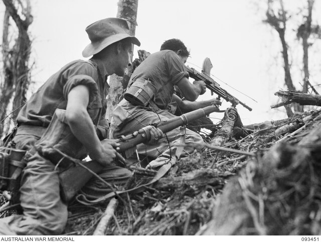
Port Moresby, also referred to as Pom City or simply Moresby, is the capital and largest city of Papua New Guinea. It is located on the shores of the Gulf of Papua, the city emerged as a trade centre in the second half of the 19th century. During World War II it was an objective for conquest by the Imperial Japanese forces during 1942–43 as a staging point and air base to cut off Australia from Southeast Asia. In 2000 it had a population of 254,158, as of 2011 it had a population of 364,145, giving it an annual growth rate of 2. 1% over a nine-year period. The place where the city was founded has been inhabited by the Motu-Koitabu people for centuries, the first European to see it was Captain John Moresby in 1873. It was named in honour of his father, Admiral Sir Fairfax Moresby, although Port Moresby is surrounded by Central Province, of which it is also the capital, it is not part of that province, but forms the National Capital District. The Motuan people of the now known as Port Moresby traded their pots for sago, other food and canoe logs, sailing from Hanuabada. Their language, Motu, was the basis of Hiri Motu and it has been steadily in decline since the 1960s when Tok Pisin began to grow in popularity. The Hiri expeditions were large scale, as many as 20 multi-hulled canoes or lakatoi, crewed by some 600 men, carried about 20,000 clay pots on each journey. To the Motuans, the Hiri was an enterprise and it confirmed their tribal identity through its long. There was already an important trade centre on the site of Port Moresby when the English Captain John Moresby of HMS Basilisk first visited it and he sailed through the Coral Sea at the eastern end of New Guinea, saw three previously unknown islands, and landed there. At 10 a. m. on 20 February 1873, he claimed the land for Britain and named it after his father and he called the inner reach Fairfax Harbour and the other Port Moresby. In 1883 Queensland attempted to annex the south-eastern corner of the New Guinea Island, British authorities refused to approve the annexation following the German annexation of New Guinea in 1884, but four years later it established a protectorate over Papua as British New Guinea. In 1905 the recently federated Australian government passed the Papua Act which came into effect in 1906, the act transferred Papua, with Port Moreseby as its capital, to direct Australian rule. From then until 1941 Port Moresby grew slowly, the main growth was on the peninsula, where port facilities and other services were gradually improved. The first butchers shop and grocery opened in 1909, electricity was introduced in 1925, many Papuan residents of Port Moresby either returned to their family villages or were evacuated to camps when the threat of Japanese invasion loomed. Port Moresby became the capital of the new combined territory and a point for the expansion of public services. In September 1975, Papua New Guinea became an independent country with Port Moresby as its capital city, Prince Charles, Prince of Wales, represented the Queen of Papua New Guinea at the celebrations
26.
Jayapura
–
Jayapura City is the provincial capital of Papua, Indonesia. It is situated on the island of New Guinea, on Yos Sudarso Bay. It covers an area of 935.92 km2, and borders Jayapura Regency to the west, Keerom Regency to the south, the nation of Papua New Guinea to the east, and the Pacific Ocean to the north. It had a population of 256,705 at the 2010 Census, Jayapura is the largest city in the Indonesian part of New Guinea. It is served by Sentani Airport, located near Lake Sentani, a highway connects the city to Skow, a small town near the border with Papua New Guinea and continues beyond the border to Vanimo. The government is planning to build a railway from Jayapura to Sarmi. Further plans could connect Jayapura with Manokwari and Sorong, the project is planned for completion by 2030. The last battle against the Dutch was fought in Jayapura from 14 August 1962 -15 August 1962, nowadays the Humboldt bay natives know the city as Port Numbay. The topography of Jayapura varies from valleys to hills, plateaux, Jayapura overlooks the Yos Sudarso Bay. Jayapura is about 94,000 ha in area, and is divided into 5 districts, around 30% of the area is inhabited, with the remainder consisting of a rough terrain, swamps, and protected forest. The average temperature is 29 °C-31.8 °C, before its inclusion into the colonial government of the Dutch Indies, the location of present-day Jayapura was known as Numbay. The mode of the trade was through barter for spices, cassava, salted fish, the society of Numbay was led by an ondoafi. In the 1800s, Numbay maintained relations with the Ternate Sultanate, on September 28,1909 a detachment of the Dutch navy under Captain F. J. P. Sachse came ashore at Humboldt Bay near the mouth of the Numbay river and their task was the systematic exploration of northern New Guinea and the search for a natural border between the Dutch and German spheres on New Guinea. Their camp along the river was called Kloofkamp, a still in use as the name of an ancient district of Jayapura. Forty coconut trees were cut down for the establishment of the camp and they were bought from the owners at a cost of one rijksdaalder per palm. On March 7,1910, the Dutch flag was raised, on the other side of the bay there was already a German camp, Germania-Huk, which is now uninhabited and part of Indonesian territory. Hollandia was the capital of a district of the name in the northeast of West New Guinea
27.
Manokwari
–
Manokwari is a city in Indonesia. It is the largest city and, since 2003, the capital of the province of West Papua, the city has many resorts and is a major tourist area. It is one of the seats of the Roman Catholic Diocese of Manokwari–Sorong and it is also the administrative seat of Manokwari Regency. The city is included of the Manokwari-Northeastern Birds Head Peninsula MSA. It is the largest city in the metro area, the city is also a major port, financial center, and tourist area that is important to West Papua and Eastern Indonesia. On 12 April 1942, a Japanese convoy steamed into Dore Bay, the area was already well-known to the Japanese, as the area was the location of a cotton plantation developed by the government-sponsored Nan’yō Kōhatsu development company from the early 1930s. As the KNIL ground force had no chance of engaging the Japanese invasion force, it withdrew into the interior of Dutch New Guinea. At 4, 43am on 4 January 2009 a magnitude 7.6 earthquake struck Manokwari, felt as far away as Australia, the 35 km deep earthquake killed four people, injured 19 more and 167,000 people were left without power. Local residents were evacuated to Manokwari Military Academy in order to shelter from possible tsunamis. Damage occurred to the Mutiara Hotel, the Naval hospital, Manokwari Regional Airport had significant damage, being closest to the epicenter, and all four deaths resulted there. The Indonesian government sent a team of seven doctors to Manokwari to assist with the injured, originally, the team was projected to be ten people, but due to the severe damage of the runway only seven were able to be transported in. This was not unlike the previous quakes on 10 October 2002 when another 7.6 magnitude quake shook the region, in 1996 similar quakes also halted progress in the local region but there is no record of the recorded magnitude. The tail of the aircraft broke off and came to rest in the creek off the end of Runway 35. All passengers survived, but 21 injured people were admitted to hospital, the flight originated in Sorong, West Papua. Manokwari is three meters above sea level on the coast of West Papua and its average temperature is 26.3 °C and its temperature fluctuation is only 1 °C. It receives 2,597 mm of rain per year, approximately 216 mm per month and it is located 52 minutes south of the equator and has an 86. 3% average humidity. The annual sunshine hours are 2127, an average of 5.8 hours of sunlight per day, to date, there are no recorded days of frost or snowfall in Manokwari. There are over twenty-four different tribal groups living in Manokwari, each tribe has its own unique language and culture
28.
Continent
–
A continent is one of several very large landmasses on Earth. Generally identified by convention rather than any strict criteria, up to seven regions are regarded as continents. Ordered from largest in size to smallest, they are, Asia, Africa, North America, South America, Antarctica, Europe, in geology, areas of continental crust include regions covered with water. Islands are frequently grouped with a continent to divide all the worlds land into geopolitical regions. Under this scheme, most of the countries and territories in the Pacific Ocean are grouped together with the continent of Australia to form a geopolitical region called Oceania. By convention, continents are understood to be large, continuous, discrete masses of land, many of the seven most commonly recognized continents identified by convention are not discrete landmasses separated completely by water. Earths major landmasses all have coasts on a single, continuous World Ocean, the most restricted meaning of continent is that of a continuous area of land or mainland, with the coastline and any land boundaries forming the edge of the continent. From this perspective the edge of the shelf is the true edge of the continent. In this sense the islands of Great Britain and Ireland are part of Europe, while Australia, as a cultural construct, the concept of a continent may go beyond the continental shelf to include oceanic islands and continental fragments. In this way, Iceland is considered part of Europe and Madagascar part of Africa, extrapolating the concept to its extreme, some geographers group the Australasian continental plate with other islands in the Pacific into one continent called Oceania. This divides the land surface of Earth into continents or quasi-continents. The ideal criterion that each continent be a discrete landmass is commonly relaxed due to historical conventions, of the seven most globally recognized continents, only Antarctica and Australia are completely separated from other continents by ocean. Several continents are defined not as absolutely distinct bodies but as more or less discrete masses of land, Asia and Africa are joined by the Isthmus of Suez, and North and South America by the Isthmus of Panama. In both cases, there is no separation of these landmasses by water. Both these isthmuses are very narrow compared to the bulk off the landmasses they unite, North America and South America are treated as separate continents in the seven-continent model. However, they may also be viewed as a continent known as America or the Americas. This viewpoint was common in the United States until World War II and this remains the more common vision in Latin American countries, Spain, Portugal, France, Italy and Greece, where they are taught as a single continent. The criterion of a landmass is completely disregarded if the continuous landmass of Eurasia is classified as two separate continents, Europe and Asia
29.
Tasmania
–
Tasmania is an island state of the Commonwealth of Australia. It is located 240 km to the south of the Australian mainland, the state encompasses the main island of Tasmania, the 26th-largest island in the world, and the surrounding 334 islands. The state has a population of around 519,100, just over forty percent of which resides in the Greater Hobart precinct, Tasmanias area is 68,401 km2, of which the main island covers 64,519 km2. Though an island state, due to an error the state shares a land border with Victoria at its northernmost terrestrial point, Boundary Islet. The Bishop and Clerk Islets, about 37 km south of Macquarie Island, are the southernmost terrestrial point of the state of Tasmania, the island is believed to have been occupied by Aboriginals for 40,000 years before British colonisation. It is thought Tasmanian Aboriginals were separated from the mainland Aboriginal groups about 10,000 years ago when the sea rose to form Bass Strait. The conflict, which peaked between 1825 and 1831 and led to more than three years of law, cost the lives of almost 1100 Aboriginals and settlers. The near-destruction of Tasmanias Aboriginal population has been described by historians as an act of genocide by the British. The island was part of the Colony of New South Wales. In 1854 the present Constitution of Tasmania was passed and the year the state received permission to change its name to Tasmania. In 1901 it became a state through the process of the Federation of Australia, the state is named after Dutch explorer Abel Tasman, who made the first reported European sighting of the island on 24 November 1642. Tasman named the island Anthony van Diemens Land after his sponsor Anthony van Diemen, the name was later shortened to Van Diemens Land by the British. It was officially renamed Tasmania in honour of its first European discoverer on 1 January 1856, Tasmania was sometimes referred to as Dervon, as mentioned in the Jerilderie Letter written by the notorious Australian bushranger Ned Kelly in 1879. The colloquial expression for the state is Tassie, Tasmania is also colloquially shortened to Tas, especially when used in business names and website addresses. TAS is also the Australia Post abbreviation for the state, the reconstructed Palawa kani language name for Tasmania is Lutriwita. The island was adjoined to the mainland of Australia until the end of the last glacial period about 10,000 years ago, much of the island is composed of Jurassic dolerite intrusions through other rock types, sometimes forming large columnar joints. Tasmania has the worlds largest areas of dolerite, with many distinctive mountains, the central plateau and the southeast portions of the island are mostly dolerite. Mount Wellington above Hobart is an example, showing distinct columns known as the Organ Pipes
30.
New Guinea
–
New Guinea is a large Island in the South West Pacific region. It is the worlds second-largest island, after Greenland, covering an area of 785,753 km2. The island is divided between two countries, Papua New Guinea to the east, and Indonesia to the west, the island has been known by various names. The name Papua was used to refer to parts of the island before contact with the West and its etymology is unclear, one theory states that it is from Tidore, the language used by the Sultanate of Tidore, which controlled parts of the islands coastal region. The name came from papo and ua, which means not united or, ploeg reports that the word papua is often said to derive from the Malay word papua or pua-pua, meaning frizzly-haired, referring to the highly curly hair of the inhabitants of these areas. When the Portuguese and Spanish explorers arrived in the island via the Spice Islands, when the Dutch colonized it as part of Netherlands East Indies, they called it Nieuw Guinea. The name Irian was used in the Indonesian language to refer the island and Indonesian province, the name was promoted in 1945 by Marcus Kaisiepo, brother of the future governor Frans Kaisiepo. It is taken from the Biak language of Biak Island, and means to rise and this name of Irian is the name used in the Biak language and other languages such as Serui, Merauke and Waropen. The name was used until 2001, when the name Papua was again used for the island, the name Irian, which was originally favored by natives, is now considered to be a name imposed by the authority of Jakarta. New Guinea is an island to the north of Australia, and it is isolated by the Arafura Sea to the west and the Torres Strait and Coral Sea to the east. A spine of east–west mountains, the New Guinea Highlands, dominates the geography of New Guinea, stretching over 1,600 km from the head to the tail of the island. The western half of the island of New Guinea contains the highest mountains in Oceania, rising up to 4,884 m high, the tree line is around 4,000 m elevation and the tallest peaks contain permanent equatorial glaciers—which have been retreating since at least 1936. Various other smaller mountain ranges occur both north and west of the central ranges, except in high elevations, most areas possess a warm humid climate throughout the year, with some seasonal variation associated with the northeast monsoon season. At 4,884 metres, Puncak Jaya makes New Guinea the worlds fourth highest landmass, Puncak Mandala, located in Papua, is the second highest peak on the island at 4,760 metres. Puncak Trikora, also in Papua, is 4,750 metres, mount Wilhelm is the highest peak on the PNG side of the border at 4,509 metres. Its granite peak is the highest point of the Bismarck Range, mount Giluwe 4,368 metres is the second highest summit in PNG. It is also the highest volcanic peak in Oceania, another major habitat feature is the vast southern and northern lowlands. Stretching for hundreds of kilometres, these include lowland rainforests, extensive wetlands, savanna grasslands, the southern lowlands are the site of Lorentz National Park, also a UNESCO World Heritage Site
31.
New Britain
–
New Britain is the largest island in the Bismarck Archipelago of Papua New Guinea. It is separated from the island of New Guinea by the Dampier and Vitiaz Straits, the main towns of New Britain are Rabaul/Kokopo and Kimbe. The island is roughly the size of Taiwan, while the island was part of German New Guinea, it was named Neupommern. New Britain extends from 148°1831 to 152°2357 E longitude and from 4°0825 to 6°1831 S latitude and it is crescent-shaped, approximately 520 km along its southeastern coastline, and from 29 to 146 km wide, not including a small central peninsula. The air-line distance from west to east is 477 km, the island is the 38th largest in the world, with an area of 36,520 km2. Steep cliffs form some sections of the coastline, in others the mountains are further inland, the highest point, at 2,438 m, is Mount Sinewit in the Baining range in the east. Most of the terrain is covered with tropical rainforest and several rivers are fed by the high rainfall. A major eruption of Tavurvur in 1994 destroyed the East New Britain provincial capital of Rabaul, most of the town still lies under metres of ash, and the capital has been moved to nearby Kokopo. New Britain forms part of the Islands Region, one of four regions of Papua New Guinea, New Britain became part of German New Guinea. In 1909, the population was estimated at about 190,000. The expatriate population was confined to the northeastern Gazelle Peninsula. At the time 5,448 hectares had been converted to plantations, primarily growing copra, cotton, coffee, westerners avoided exploring the interior initially, believing that the indigenous peoples were warlike and would fiercely resist intrusions. On 11 September 1914, New Britain became the site of one of the earliest battles of World War I when the Australian Naval and they quickly overwhelmed the German forces and occupied the island for the duration of the war. After World War I the Treaty of Versailles was signed in June 1919, in 1920 the League of Nations included New Britain along with the former German colony on New Guinea in the Territory of New Guinea, a mandated territory of Australia. During World War II the Japanese attacked New Britain soon after the outbreak of hostilities in the Pacific Ocean, strategic bases at Rabaul and Kavieng were defended by a small Australian detachment, Lark Force. During January 1942, the Japanese heavily bombed Rabaul, on 23 January, Japanese marines landed by the thousands, starting the Battle of Rabaul. The Japanese used Rabaul as a key base until 1944, it served as the key point for the invasion of Port Moresby. New Britain was invaded by the U. S, 1st Marine Division in the Cape Gloucester area of the very western end of the island, and also by U. S. Army soldiers at some other coastal points
32.
Misool
–
Misool, formerly spelled Mysol, is one of the four major islands in the Raja Ampat Islands in West Papua, Indonesia. The highest point is 561 m and the towns are Waigama, located on the islands northern coast. The inhabitants speak the Biga language and Matbat language, as well as Indonesian, other main islands of this group off the western end of West Papua are Salawati, Batanta and Waigeo, and there are numerous smaller islands such as Kofiau. Occupied on 1942 by the Japanese, imperial Japanese Navy base until 1945
33.
Waigeo
–
Waigeo is an island in West Papua province of eastern Indonesia. The island is known as Amberi, or Waigiu. It is the largest of the four islands in the Raja Ampat Islands archipelago. The Dampier Strait separates it from Batanta, and the Bougainville Strait from the Kawe Islands to its north-west, the inner sea that nearly cleaves the island in two is the Majoli Gulf. The area of the island is 3,155 square kilometres, from west to east the island measures approximately 110 km, north-south about 50 kilometres. The town of Waisai in the west of the island is the capital of the Raja Ampat regency, languages spoken on Waigeo include Papuan Malay, Biak, Maya, and Ambel. Jorge de Menezes, a Portuguese explorer, landed on Waigeo Island in 1526-27, alfred Russel Wallace spent some time on the island and studied the flora and fauna during the late 1850s while on his scientific exploration trip. Since 1997, the island has been the site of a substantial pearl farming operation owned by the Australian company Atlas Pacific
34.
Maluku Islands
–
The Maluku Islands or the Moluccas are an archipelago within Indonesia. Tectonically they are located on the Halmahera Plate within the Molucca Sea Collision Zone, geographically they are located east of Sulawesi, west of New Guinea, and north and east of Timor. The islands were also the core of the Spice Islands known to the Chinese and Europeans. The name was due to the nutmeg, mace and cloves that were originally found there. The Maluku Islands formed a province from Indonesian independence until 1999. A new province, North Maluku, incorporates the area between Morotai and Sula, with the arc of islands from Buru and Seram to Wetar remaining within the existing Maluku Province, North Maluku is predominantly Muslim, and its capital is Sofifi on Halmahera island. Maluku province has a larger Christian population, and its capital is Ambon, though originally Melanesian, many island populations, especially in the Banda Islands, were exterminated in the 17th century during the spice wars. A second influx of Austronesian immigrants began in the twentieth century under the Dutch. Between 1999 and 2002, conflict between Muslims and Christians killed thousands and displaced half a million people, the name Maluku is thought to have been derived from the term used by Arab traders for the region, Jazirat al-Muluk. The Maluku Islands were a single province from Indonesian independence until 1999 when they were split into North Maluku and Maluku, North Maluku province includes Ternate, Tidore, Bacan, Halmahera Morotai, the Obi Islands, and the Sula Islands. Evidence of increasingly long-distance trading relationships and of more frequent occupation of many islands, onyx beads and segments of silver plate used as currency on the Indian subcontinent around 200BC have been unearthed on some of the islands. Arab merchants began to arrive in the 14th century, bringing Islam, peaceful conversion to Islam occurred in many islands, especially in the centres of trade, while aboriginal animism persisted in the hinterlands and more isolated islands. Archaeological evidence here relies largely on the occurrence of pigs teeth, the Portuguese had conquered the city state of Malacca in the early 16th century and their influence was most strongly felt in Maluku and other parts of eastern Indonesia. On the return trip, Francisco Serrão was shipwrecked at Hitu island in 1512, there he established ties with the local ruler who was impressed with his martial skills. The spice trade soon revived but the Portuguese would not be able to fully monopolize nor disrupt this trade, both Serrão and Ferdinand Magellan, however, perished before they could meet one another. The Portuguese first landed in Ambon in 1513, but it became the new centre for their activities in Maluku following the expulsion from Ternate. European power in the region was weak and Ternate became an expanding, fiercely Islamic and anti-European state under the rule of Sultan Baab Ullah and his son Sultan Said. By the 1560s there were 10,000 Catholics in the area, mostly on Ambon, the Pela Gandong community relationship system is between various Christian and Muslim villages throughout the regions
35.
Continental shelf
–
The continental shelf is an underwater landmass which extends from a continent, resulting in an area of relatively shallow water known as a shelf sea. Much of the shelves were exposed during glacial periods and interglacial periods, the shelf surrounding an island is known as an insular shelf. The continental margin, between the shelf and the abyssal plain, comprises a steep continental slope followed by the flatter continental rise. Sediment from the continent above cascades down the slope and accumulates as a pile of sediment at the base of the slope, extending as far as 500 km from the slope, it consists of thick sediments deposited by turbidity currents from the shelf and slope. The continental rises gradient is intermediate between the slope and the shelf, on the order of 0. 5–1°, the largest shelf – the Siberian Shelf in the Arctic Ocean – stretches to 1,500 kilometers in width. The South China Sea lies over another extensive area of shelf, the Sunda Shelf, which joins Borneo, Sumatra. Other familiar bodies of water that overlie continental shelves are the North Sea, the average width of continental shelves is about 80 km. The depth of the shelf also varies, but is limited to water shallower than 150 m. The slope of the shelf is quite low, on the order of 0. 5°, vertical relief is also minimal. Though the continental shelf is treated as a province of the ocean, it is not part of the deep ocean basin proper. Passive continental margins such as most of the Atlantic coasts have wide and shallow shelves, active continental margins have narrow, relatively steep shelves, due to frequent earthquakes that move sediment to the deep sea. The shelf usually ends at a point of increasing slope, the sea floor below the break is the continental slope. Below the slope is the rise, which finally merges into the deep ocean floor. The continental shelf and the slope are part of the continental margin, the shelf area is commonly subdivided into the inner continental shelf, mid continental shelf, and outer continental shelf, each with their specific geomorphology and marine biology. The character of the shelf changes dramatically at the shelf break, with a few exceptions, the shelf break is located at a remarkably uniform depth of roughly 140 m, this is likely a hallmark of past ice ages, when sea level was lower than it is now. The continental slope is steeper than the shelf, the average angle is 3°. The slope is cut with submarine canyons. The physical mechanisms involved in forming these canyons were not well understood until the 1960s, the continental shelves are covered by terrigenous sediments, that is, those derived from erosion of the continents
36.
Arafura Sea
–
The Arafura Sea lies west of the Pacific Ocean overlying the continental shelf between Australia and Indonesian New Guinea. The Arafura Sea is bordered by Torres Strait and through that the Coral Sea to the east, the Gulf of Carpentaria to the south, the Timor Sea to the west and it is 1,290 kilometres long and 560 kilometres wide. The depth of the sea is primarily 50–80 metres with the depth increasing to the west, as a shallow tropical sea, its waters are a breeding ground for tropical cyclones. The sea lies over the Arafura Shelf, part of the Sahul Shelf, the combined landmass formed the continent of Sahul. The International Hydrographic Organization defines the Arafura Sea as being one of the waters of the East Indian Archipelago, the IHO defines its limits as follows, On the North. The Southeastern limit of the Ceram Sea and the Eastern limit of the Banda Sea, the Southwest coast of New Guinea from Karoefa to the entrance to the Bensbak River, and thence a line to the Northwest extreme of York Peninsula, Australia. By the North coast of Australia from the Northwest extreme of York Peninsula to Cape Don, a line from Cape Don to Tanjong Aro Oesoe, the Southern point of Selaroe. The seas name appeared in George Windsor Earls 1837 Sailing Directions for the Arafura Sea which he compiled from the narratives of Lieuts, Kolff and Modera of the Dutch Navy. The Arafura Sea name is from the name for the people of mountains in the Moluccas as identified by Dutch Lieutenants Kolff. Thomas Forrest sailed thru the Moluccas in 1775 and retailed reports of Harafora people living in the end of New Guinea in subordination to the Papuas. The geographer Conrad Malte-Brun repeated Forrests reports of a race of Haraforas, in 1822, the form Horrafora was recorded by John Coulter, in his account of a sojourn in the interior of south-west New Guinea in 1835, and applied to the tribespeople there. Coulter concluded that Papuans and Horraforas were two races in New Guinea. The Arafura Sea is a fishery resource, particularly for shrimp. Economically important species include Barramundi, grouper, Penaeid shrimp, Nemipteridae fishes, in a world where marine ecosystems and fish stocks are generally collapsing, the Arafura Sea stands out as among the richest marine fisheries in the world. However, the Arafura is coming under more intense pressure from illegal. If this trend persists, the local communities who surround the sea. Increasing economic growth and maintaining environment quality are two challenges to achieve sustainable development in coastal areas of the sea. Established in 2002, the Arafura and Timor Seas Expert Forum seeks to economically and environmentally sustainable management of the seas
37.
Torres Strait
–
The Torres Strait /ˈtɔːrᵻs/ is a strait which lies between Australia and the Melanesian island of New Guinea. It is approximately 150 km wide at its narrowest extent, to the south is Cape York Peninsula, the northernmost continental extremity of the Australian state of Queensland. To the north is the Western Province of Papua New Guinea and it is named after navigator Luís Vaz de Torres, who passed through the Strait in 1606. The strait links the Coral Sea to the east with the Arafura Sea, although it is an important international sea lane, it is very shallow, and the maze of reefs and islands can make it hazardous to navigate. In the south the Endeavour Strait is located between Prince of Wales Island and the mainland, shipping enters Torres Strait via the Adolphus Channel which joins to the Great Barrier Reef lagoon to the southeast. Strong tidal currents occur in the channels between islands and reefs, and large submarine sand dunes migrate across the seafloor. Some 580 coral reefs, including the Warrior Reefs and Eastern Patch Reefs, cover an area of 2,400 km2 in the region. Several clusters of islands lie in the Strait, collectively called the Torres Strait Islands, there are at least 274 of these islands, of which 17 have present-day permanent settlements. Over 6,800 Torres Strait Islanders live on the Islands and 42,000 live on the mainland and these islands have a variety of topographies, ecosystems and formation history. Several of those closest to the New Guinea coastline are low-lying, the central islands are predominantly coral cays, and those of the east are of volcanic origins. The islands are considered Australian territory and are administered from Thursday Island, most important of these is the Torres Strait Treaty entered into by Australia and Papua New Guinea in February 1985. The Treaty defines sovereignty and maritime boundaries in the area between the two countries, the Treaty established a Torres Strait Protected Zone within which both nations manage access to fisheries resources. Each country exercises sovereign jurisdiction for resources on either side of the agreed jurisdiction lines, the islands indigenous inhabitants are the Torres Strait Islanders, Melanesian peoples related to the Papuans of adjoining New Guinea. The various Torres Strait Islander communities have a culture and long-standing history with the islands. In the 2001 Australian national census, the population of the islands was recorded as 8,089, the islands of the Torres Strait have been inhabited for at least 2,500 years and possibly much longer. After Queiróss ship returned to Mexico, Torres resumed the voyage to Manila via the Maluku Islands. He sailed along the south coast of New Guinea, and may also have sighted the northernmost extremity of the Australian mainland and it was Dalrymple who named the strait after Torres. In 1770 Cook claimed the whole of eastern Australia for the British Crown, in 1823 Lieutenant John Lihou, then Master of HMS Zenobia, was on passage from Manila to South America and chose a route through Torres Strait
38.
Bass Strait
–
Bass Strait /ˈbæs/ is a sea strait separating Tasmania from the Australian mainland, specifically the state of Victoria. The International Hydrographic Organization defines the limits of Bass Strait as follows, the eastern limit of the Great Australian Bight. The western limit of the Tasman Sea between Gabo Island and Eddystone Point, some authorities consider the strait to be part of the Pacific Ocean as in the never-approved 2002 IHO Limits of Oceans and Seas draft. In the currently in-force IHO1953 draft, it is listed as part of the Indian Ocean. The Australian Hydrographic Service does not consider it to be part of the Southern Ocean, using the expanded Australian definition, the strait between the Furneaux Islands and Tasmania is Banks Strait, a subdivision of Bass Strait. The strait was named after George Bass, after he and Matthew Flinders passed through it while circumnavigating Van Diemens Land in the Norfolk in 1798–99. At Flinders recommendation, the Governor of New South Wales, John Hunter, later it became known as Bass Strait. The existence of the strait had been suggested in 1797 by the master of Sydney Cove when he reached Sydney after deliberately grounding his foundering ship and being stranded on Preservation Island. He reported that the south westerly swell and the tides and currents suggested that the island was in a channel linking the Pacific. Governor Hunter thus wrote to Joseph Banks in August 1797 that it seemed certain a strait existed, Bass Strait is approximately 250 km wide and 500 km long, with an average depth of 60 m. The widest opening is about 350 km between Cape Portland on the North-Eastern tip of Tasmania and Point Hicks on the Australian mainland. Two plateaus, the Bassian Rise and King Island Rise located on the eastern and western margins of Bass Strait and these features form sills separating Bass Basin from the adjacent ocean basins. Associated with the <50 m deep Bassian Rise is the Furneaux Islands, the surface of the King Island Rise also occurs in water depths of <50 m, and includes the shallow Tail Bank at its northern margin as well as King Island itself. Subaqueous dunes and tidal current ridges and subaqueous dunes cover approximately 6,000 km2 of the seabed in Bass Strait, during Pleistocene low sea level stands the central basin of Bass Strait was enclosed by raised sills forming a large shallow lake. This occurred during the last glacial maximum, when the basin was completely isolated, like the rest of the waters surrounding Tasmania, and particularly because of its limited depth, it is notoriously rough, with many ships lost there during the 19th century. Strong currents between the Antarctic-driven southeast portions of the Indian Ocean and the Tasman Seas Pacific Ocean waters provide a strait of powerful, to illustrate its wild strength, Bass Strait is both twice as wide and twice as rough as the English Channel. The shipwrecks on the Tasmanian and Victorian coastlines number in the hundreds, although stronger metal ships, many vessels, some quite large, have disappeared without trace, or left scant evidence of their passing. Despite the straits difficult waters it provided a safer and less boisterous passage for ships on the route from Europe or India to Sydney in the early 19th century, the strait also saved 1,300 km distance on the voyage
39.
Sea level
–
Mean sea level is an average level of the surface of one or more of Earths oceans from which heights such as elevations may be measured. A common and relatively straightforward mean sea-level standard is the midpoint between a low and mean high tide at a particular location. Sea levels can be affected by factors and are known to have varied greatly over geological time scales. The careful measurement of variations in MSL can offer insights into ongoing climate change, the term above sea level generally refers to above mean sea level. Precise determination of a sea level is a difficult problem because of the many factors that affect sea level. Sea level varies quite a lot on several scales of time and this is because the sea is in constant motion, affected by the tides, wind, atmospheric pressure, local gravitational differences, temperature, salinity and so forth. The easiest way this may be calculated is by selecting a location and calculating the mean sea level at that point, for example, a period of 19 years of hourly level observations may be averaged and used to determine the mean sea level at some measurement point. One measures the values of MSL in respect to the land, hence a change in MSL can result from a real change in sea level, or from a change in the height of the land on which the tide gauge operates. In the UK, the Ordnance Datum is the sea level measured at Newlyn in Cornwall between 1915 and 1921. Prior to 1921, the datum was MSL at the Victoria Dock, in Hong Kong, mPD is a surveying term meaning metres above Principal Datum and refers to height of 1. 230m below the average sea level. In France, the Marégraphe in Marseilles measures continuously the sea level since 1883 and it is used for a part of continental Europe and main part of Africa as official sea level. Elsewhere in Europe vertical elevation references are made to the Amsterdam Peil elevation, satellite altimeters have been making precise measurements of sea level since the launch of TOPEX/Poseidon in 1992. A joint mission of NASA and CNES, TOPEX/Poseidon was followed by Jason-1 in 2001, height above mean sea level is the elevation or altitude of an object, relative to the average sea level datum. It is also used in aviation, where some heights are recorded and reported with respect to sea level, and in the atmospheric sciences. An alternative is to base height measurements on an ellipsoid of the entire Earth, in aviation, the ellipsoid known as World Geodetic System 84 is increasingly used to define heights, however, differences up to 100 metres exist between this ellipsoid height and mean tidal height. The alternative is to use a vertical datum such as NAVD88. When referring to geographic features such as mountains on a topographic map, the elevation of a mountain denotes the highest point or summit and is typically illustrated as a small circle on a topographic map with the AMSL height shown in metres, feet or both. In the rare case that a location is below sea level, for one such case, see Amsterdam Airport Schiphol
40.
Quaternary glaciation
–
During this period, ice sheets expanded, notably from out of Antarctica and Greenland, and fluctuating ice sheets occurred elsewhere. It affected oceans, flooding, and biological communities, the ice sheets themselves, by raising the albedo, affect a major feedback on climate cooling. The Quaternary glaciation was the first ice age to be demonstrated in geology and this was done over the 1700s and 1800s CE. Over the last century, extensive field observations have provided evidence that continental glaciers covered large parts of Europe, North America, even before the theory of worldwide glaciation was generally accepted, many observers recognized that more than a single advance and retreat of the ice had occurred. Since then other, earlier ice ages have been identified, the Quaternary glaciation is the last of five known glaciations during Earths history. The other four are the Huronian glaciation, Cryogenian, Andean-Saharan glaciation, over the past 740,000 years there have been eight glacial cycles. The entire Quaternary Period, starting 2.58 Ma, is referred to as an ice age because at least one permanent large ice sheet—the Antarctic ice sheet—has existed continuously, there is uncertainty over how much of Greenland was covered by ice during the previous and earlier interglacials. During the colder episodes—referred to as glacial ice sheets at least 4 km thick at their maximum also existed in Europe, North America. The shorter and warmer intervals between glacials are referred to as interglacials, currently, Earth is in an interglacial period, which marked the beginning of the Holocene epoch. The current interglacial began between 10,000 and 15,000 years ago, which caused the ice sheets from the last glacial period to begin to disappear. Remnants of these last glaciers, now occupying about 10% of the land surface, still exist in Greenland, Antarctica. During the glacial periods, the present hydrologic system was completely interrupted throughout large areas of the world and was modified in others. Due to the volume of ice on land, sea level was approximately 120 meters lower than present, extensive evidence now shows that a number of periods of growth and retreat of continental glaciers occurred during the ice age, called glacials and interglacials. The interglacial periods of climate are represented by buried soil profiles, peat beds. No completely satisfactory theory has been proposed to account for Earths history of glaciation, the cause of glaciation may be related to several simultaneous factors, such as astronomical cycles, atmospheric composition, plate tectonics, and ocean currents. The role of Earths orbital changes in controlling climate was first advanced by James Croll in the late 19th century, later, Milutin Milanković, a Serbian geophysicist, elaborated on the theory and calculated these irregularities in Earths orbit could cause the climatic cycles known as Milankovitch cycles. They are the result of the behavior of several types of cyclical changes in Earths orbital properties. Changes in the eccentricity of Earth occur on a cycle of about 100,000 years
41.
Last Glacial Maximum
–
The Last Glacial Maximum was the last period in the Earths climate history during the last glacial period when ice sheets were at their greatest extension. Growth of the ice sheets reached their positions in about 24,500 BCE. Vast ice sheets covered much of North America, northern Europe, the ice sheets profoundly affected Earths climate by causing drought, desertification, and a dramatic drop in sea levels. It was followed by the Late Glacial, the formation of an ice sheet or ice cap requires both prolonged cold and precipitation. Hence, despite having temperatures similar to those of glaciated areas in North America and Europe and this difference was because the ice sheets in Europe produced extensive anticyclones above them. These anticyclones generated air masses that were so dry on reaching Siberia and Manchuria that precipitation sufficient for the formation of glaciers could never occur, all over the world, climates at the Last Glacial Maximum were cooler and almost everywhere drier. Even in less affected regions, rainforest cover was greatly diminished, only in Central America and the Chocó region of Colombia did tropical rainforests remain substantially intact – probably due to the extraordinarily heavy rainfall of these regions. Most of the worlds deserts expanded and this also occurred in Afghanistan and Iran, where a major lake formed in the Dasht-e Kavir. In Australia, shifting sand dunes covered half the continent, whilst the Chaco, in northern China – unglaciated despite its cold climate – a mixture of grassland and tundra prevailed, and even here, the northern limit of tree growth was at least 20° farther south than today. During the Last Glacial Maximum, much of the world was cold, dry, and inhospitable, with frequent storms, the dustiness of the atmosphere is a prominent feature in ice cores, dust levels were as much as 20 to 25 times greater than now. This was probably due to a number of factors, reduced vegetation, stronger global winds, the massive sheets of ice locked away water, lowering the sea level, exposing continental shelves, joining land masses together, and creating extensive coastal plains. During the last glacial maximum,21,000 years ago, Northern Europe was largely covered by ice, the southern boundary of the ice sheets passing through Germany and Poland. This ice extended northward to cover Svalbard and Franz Josef Land and northeastward to occupy the Barents Sea, permafrost covered Europe south of the ice sheet down to present-day Szeged in Southern Hungary. Ice covered the whole of Iceland and almost all of the British Isles, britain was no more than a peninsula of Europe, its north capped in ice, and its south a polar desert. There were ice sheets in modern Tibet as well as in Baltistan, in Southeast Asia, many smaller mountain glaciers formed, and permafrost covered Asia as far south as Beijing. Palawan was also part of Sundaland, while the rest of the Philippine Islands formed one large island separated from the continent only by the Sibutu Passage and the Mindoro Strait. In Africa and the Middle East, many mountain glaciers formed. The Persian Gulf averages about 35 metres in depth and the seabed between Abu Dhabi and Qatar is even shallower, being less than 15 metres deep
42.
Arid
–
A region is arid when it is characterized by a severe lack of available water, to the extent of hindering or preventing the growth and development of plant and animal life. Environments subject to arid climates tend to lack vegetation and are called xeric or desertic, most arid climates surround the equator, these places include most of Africa and parts of South America, Central America and Australia. The distribution of aridity observed at any one point in time is largely the result of the circulation of the atmosphere. The latter does change significantly over time through climate change, for example, temperature increase across the Nile Basin over the next 30–40 years could change the region from semi-arid to arid, resulting in a significant reduction in agricultural land. In addition, changes in use can result in greater demands on soil water. Durrenberger, R. W. Arid Climates, article in The Encyclopedia of Climatology, p. 92-101, Edited by J. E. Oliver and R. W. Fairbridge, Van Nostrand Reinhold Company, New York, ISBN 0-87933-009-0. J Aridity Indexes, article in The Encyclopedia of Climatology, p. 102-107, Edited by J. E. Oliver and R. W. Fairbridge, Van Nostrand Reinhold Company, New York, blue Peace for the Nile Report,2009, Strategic Foresight Group
43.
Semi-arid climate
–
A semi-arid climate or steppe climate is the climate of a region that receives precipitation below potential evapotranspiration, but not extremely. There are different kinds of climates, depending on such variables as temperature. Semi-arid climates tend to short or scrubby vegetation, with semi-arid areas usually dominated by either grasses or shrubs. To determine if a location has a climate, the precipitation threshold must first be determined. If the areas precipitation is less than the threshold but more than half the threshold. Hot semi-arid climates tend to be located in the tropics and subtropics and these climates tend to have hot, sometimes extremely hot, summers and warm to cool winters, with some to minimal precipitation. Hot semi-arid climates are most commonly found around the fringes of subtropical deserts, hot semi-arid climates are most commonly found in Africa, Australia and South Asia. In Australia, a portion of the Outback surrounding the central desert regions lies within the hot semi-arid climate regime. Hot semi-arid climates can also be found in North America, primarily in Mexico, areas of Texas near Mexico, cold semi-arid climates tend to be located in temperate zones or elevated portions in subtropical zones. They are typically found in continental interiors some distance from bodies of water. Cold semi-arid climates usually feature warm and dry summers, though their summers are not quite as hot as those of hot semi-arid climates. Unlike hot semi-arid climates, areas with cold semi-arid climates tend to have cold winters and these areas usually see some snowfall during the winter, though snowfall is much lower than at locations at similar latitudes with more humid climates. These large diurnal temperature variations are seen in hot semi-arid climates. Cold semi-arid climates are most commonly found in Asia and North America, however, they can also be found in Northern Africa, South Africa, Europe, sections of South America and sections of interior southern Australia and New Zealand. As a result of this, some areas can have climates that are classified as hot or cold depending on the isotherm used. One such location is San Diego, California, which has cool summers for the due to prevailing winds off the ocean. Arid Forest Research Institute Continental climate Dust Bowl Goyders Line Pallisers Triangle Köppen climate classification Wave height Ustic
44.
New Zealand
–
New Zealand /njuːˈziːlənd/ is an island nation in the southwestern Pacific Ocean. The country geographically comprises two main landmasses—the North Island, or Te Ika-a-Māui, and the South Island, or Te Waipounamu—and around 600 smaller islands. New Zealand is situated some 1,500 kilometres east of Australia across the Tasman Sea and roughly 1,000 kilometres south of the Pacific island areas of New Caledonia, Fiji, because of its remoteness, it was one of the last lands to be settled by humans. During its long period of isolation, New Zealand developed a distinct biodiversity of animal, fungal, the countrys varied topography and its sharp mountain peaks, such as the Southern Alps, owe much to the tectonic uplift of land and volcanic eruptions. New Zealands capital city is Wellington, while its most populous city is Auckland, sometime between 1250 and 1300 CE, Polynesians settled in the islands that later were named New Zealand and developed a distinctive Māori culture. In 1642, Dutch explorer Abel Tasman became the first European to sight New Zealand, in 1840, representatives of Britain and Māori chiefs signed the Treaty of Waitangi, which declared British sovereignty over the islands. In 1841, New Zealand became a colony within the British Empire, today, the majority of New Zealands population of 4.7 million is of European descent, the indigenous Māori are the largest minority, followed by Asians and Pacific Islanders. Reflecting this, New Zealands culture is derived from Māori and early British settlers. The official languages are English, Māori and New Zealand Sign Language, New Zealand is a developed country and ranks highly in international comparisons of national performance, such as health, education, economic freedom and quality of life. Since the 1980s, New Zealand has transformed from an agrarian, Queen Elizabeth II is the countrys head of state and is represented by a governor-general. In addition, New Zealand is organised into 11 regional councils and 67 territorial authorities for local government purposes, the Realm of New Zealand also includes Tokelau, the Cook Islands and Niue, and the Ross Dependency, which is New Zealands territorial claim in Antarctica. New Zealand is a member of the United Nations, Commonwealth of Nations, ANZUS, Organisation for Economic Co-operation and Development, Pacific Islands Forum, and Asia-Pacific Economic Cooperation. Dutch explorer Abel Tasman sighted New Zealand in 1642 and called it Staten Landt, in 1645, Dutch cartographers renamed the land Nova Zeelandia after the Dutch province of Zeeland. British explorer James Cook subsequently anglicised the name to New Zealand, Aotearoa is the current Māori name for New Zealand. It is unknown whether Māori had a name for the country before the arrival of Europeans. Māori had several names for the two main islands, including Te Ika-a-Māui for the North Island and Te Waipounamu or Te Waka o Aoraki for the South Island. Early European maps labelled the islands North, Middle and South, in 1830, maps began to use North and South to distinguish the two largest islands and by 1907, this was the accepted norm. The New Zealand Geographic Board discovered in 2009 that the names of the North Island and South Island had never been formalised and this set the names as North Island or Te Ika-a-Māui, and South Island or Te Waipounamu
45.
Zealandia
–
It has variously been described as a continental fragment, a microcontinent and a continent. The name and concept for Zealandia were proposed by Bruce Luyendyk in 1995, the land mass may have been completely submerged about 23 Ma ago, and most of it remains submerged beneath the Pacific Ocean. As such, and due to other considerations, such as crustal thickness and density. Zealandia supports substantial inshore fisheries and contains gas fields, of which the largest known is New Zealands Maui gas field, permits for oil exploration in the Great South Basin were issued in 2007. Offshore mineral resources include iron sands, volcanic massive sulfides and ferromanganese nodule deposits, Zealandia is largely made up of two nearly parallel ridges, separated by a failed rift, where the rift breakup of the continent stops and becomes a filled graben. The ridges rise above the sea floor to heights of 1, 000–1,500 m, about 25 Ma ago, the southern part of Zealandia began to shift relative to the northern part. The resulting displacement by approximately 500 km along the Alpine Fault is evident in geological maps, movement along this plate boundary has also offset the New Caledonia Basin from its previous continuation through the Bounty Trough. Compression across the boundary has uplifted the Southern Alps, although due to rapid erosion their height reflects only a fraction of the uplift. Farther north, subduction of the Pacific Plate has led to extensive volcanism, including the Coromandel, associated rifting and subsidence has produced the Hauraki Graben and more recently the Whakatane Graben and Wanganui Basin. Volcanism on Zealandia has also taken place repeatedly in various parts of the fragment before, during. This volcanism is widespread across Zealandia but generally of low volume apart from the mid to late Miocene shield volcanoes that developed the Banks. In addition, it took place continually in numerous limited regions all through the Late Cretaceous, however, its causes are still in dispute. During the Miocene, the section of Zealandia might have slid over a stationary hotspot. Zealandia is occasionally divided by scientists into two regions, North Zealandia and South Zealandia, the latter of which contains most of the Median Batholith crust. These two features are separated by the Alpine Fault and Kermadec Trench and by the wedge-shaped Hikurangi Plateau and this was widely covered by news media. New Caledonia lies at the end of the ancient continent. These land masses are two outposts of the Antarctic Flora, including Araucarias and Podocarps and these were buried by volcanic mud flows and gradually replaced by silica to produce the fossils now exposed by the sea. During glacial periods, more of Zealandia becomes a rather than a marine environment
46.
Melanesia
–
Melanesia is a subregion of Oceania extending from New Guinea island in the southwestern Pacific Ocean to the Arafura Sea, and eastward to Fiji. The region includes the four countries of Vanuatu, the Solomon Islands, Fiji, the concept among Europeans of Melanesia as a distinct region evolved gradually over time as their expeditions mapped and explored the Pacific. Early European explorers noted the differences among groups of Pacific Islanders. In the first half of the nineteenth century Jean Baptiste Bory de Saint-Vincent, over time, however, Europeans increasingly viewed Melanesia as a distinct cultural, rather than racial, area. Scholars and other commentators disagreed on its boundaries, which were fluid, in the nineteenth century Robert Codrington, a British missionary, produced a series of monographs on the Melanesians based on his long-time residence in the region. He did not include the islands of New Guinea because only some of its people were Melanesians, like Bory de Saint-Vincent, he excluded Australia from Melanesia. It was in works that Codrington introduced the cultural concept of mana to the West. Uncertainty about the delineation and definition of the region continues, the scholarly consensus now includes New Guinea within Melanesia. Ann Chowning wrote in her 1977 textbook on Melanesia that there is no agreement even among anthropologists about the geographical boundaries of Melanesia. In 1998 Paul Sillitoe wrote of Melanesia, it is not easy to define precisely, on geographical, cultural, biological, or any other grounds, where Melanesia ends and the neighbouring regions. It covers populations that have a linguistic, biological and cultural affinity – a certain ill-defined sameness. Both Sillitoe and Chowning include the island of New Guinea in the definition of Melanesia, most of the peoples in Melanesia have established independent countries, are admistered by France or have active independence movements. Many have recently taken up the term Melanesia as a source of identity, stephanie Lawson writes that the term moved from a term of denigration to one of affirmation, providing a positive basis for contemporary subregional identity as well as a formal organisation. For instance, the author Bernard Narokobi wrote about the Melanesian Way as a form of culture that could empower the people of this region. The concept is used in geopolitics. For instance, the Melanesian Spearhead Group preferential trade agreement is a trade treaty among Vanuatu, the Solomon Islands, Papua New Guinea. The people of Melanesia have a distinctive ancestry, the limit of this ancient migration was Sahul, the continent formed when Australia and New Guinea were united by a land bridge as a result of low sea levels. The first migration into Sahul came over 40,000 years ago, a further expansion into the eastern islands of Melanesia came much later, probably between 4000 B. C. and 3000 B. C