Banks Peninsula
Videos
Banks Peninsula is a peninsula of volcanic origin on the east coast of the South Island of New Zealand. It has an area of approximately 1,150 square kilometres (440 sq mi) and encompasses two large harbours and many smaller bays and coves. The South Island's largest city, Christchurch, is immediately north of the peninsula.

Banks Peninsula and Christchurch, in a 2021 NASA satellite photo

Banks Peninsula, with Lyttelton Harbour / Whakaraupō on the right and Lake Ellesmere / Te Waihora in the background

European ships, possibly French, in Akaroa in the early 19th century

Akaroa Harbour, Banks Peninsula with storm clouds overhead (December 2020)
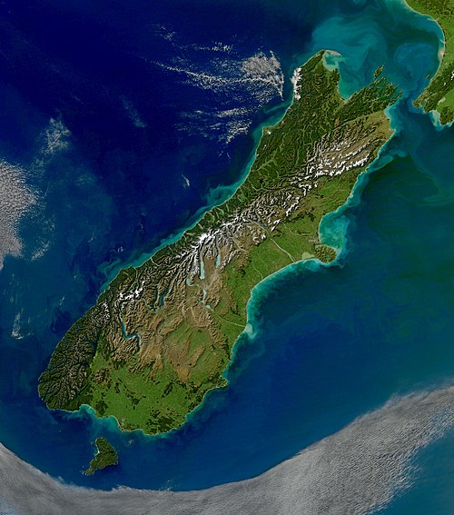
South Island
Videos
The South Island, also named Te Waipounamu in Māori, is the larger of the two major islands of New Zealand in surface area, the other being the smaller but more populous North Island. It is bordered to the north by Cook Strait, to the west by the Tasman Sea, and to the south and east by the Pacific Ocean. The South Island covers 150,437 square kilometres (58,084 sq mi), making it the world's 12th-largest island, constituting 56% of New Zealand's land area. At low altitude, it has an oceanic climate.

Charcoal rock drawing at Carters rockpool on the Ōpihi River

First European impression of Māori, at Murderers' Bay, 1642