Bathurst Island (Nunavut)
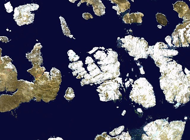
Bathurst Island is one of the Queen Elizabeth Islands in Nunavut, Canada. It is a member of the Arctic Archipelago. The area of the island is estimated at 16,042 km2 (6,194 sq mi), 115 to 117 mi long and from 63 mi (101 km) to 72 mi (116 km) to 92.9 mi (149.5 km) wide, making it Canada's 13th largest island. It is located between Devon Island and Cornwallis Island in the east, and Melville Island in the west. Four small islands of Cameron, Vanier, Massey and Alexander lie in its northwest.
NASA satellite photo montage of Bathurst Island at centre. Viscount Melville Sound, part of the Northwest Passage, adjoins it to the south.
The Queen Elizabeth Islands are the northernmost cluster of islands in Canada's Arctic Archipelago, split between Nunavut and the Northwest Territories in Northern Canada. The Queen Elizabeth Islands contain approximately 14% of the global glacier and ice cap area. The southern islands are called the Parry Islands or Parry Archipelago.
Image: Craig Harbour 1926
Image: Johnson Bay Settlement Dundas Harbour Qikiqtaaluk Nunuvut Canada
Image: Downtown Eureka, Nunavut e
Image: FMARS 2009 hab