Bedfont is a suburb in the London Borough of Hounslow, approximately 15 miles (24 km) west of Charing Cross. Originally a distinct village, Bedfont has a large central conservation area around Bedfont Green. The majority of the housing was built at a time of an emerging economy of aviation and distribution-related businesses. The area was formerly part of the Staines Rural District and was one of the formerly agricultural areas chosen for significant low-rise social housing, planned and built in the mid 20th century.
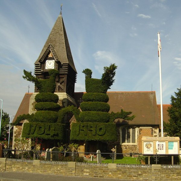
The modest medieval church in the Church of England has had topiary from its yew trees since 1704. They are today the largest sculpted examples in London.
Street of semi-detached homes and bungalows built like most of the area in the 19th and 20th centuries. Bedfont also contains Flats.
Burlington House is one of the largest Georgian homes in the Conservation Area. A significant proportion of such homes in the London Commuter Belt have been converted into apartments.
Gable end terraced housing with steep, tall hipped roofs by the war memorial with tessellating paving, square green and trees in the background.
London Borough of Hounslow
The London Borough of Hounslow is a London borough in west London, England, forming part of Outer London. It was created in 1965 when three smaller borough councils amalgamated under the London Government Act 1963. It is governed by Hounslow London Borough Council.
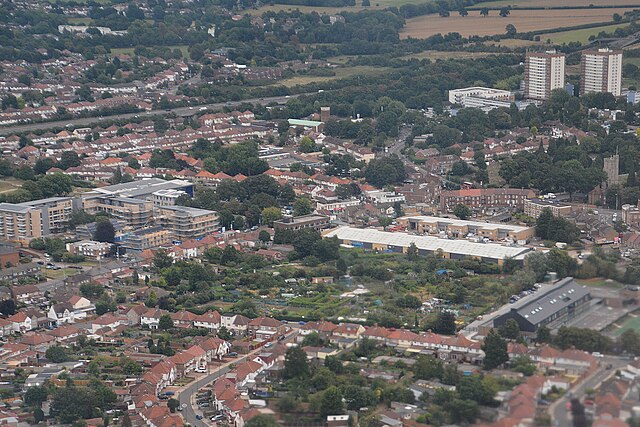
Hounslow from the air
River Thames at Chiswick overlooking Chiswick Bridge
Brentford Lock development with GlaxoSmithKline building in the background
View from Chiswick, from right to left; Brentford Museum of Water and Steam pumping tower, Kew Bridge (Centre), River Thames, Brentford Towers, GSK building