Beit Hanina is an Arab Palestinian neighborhood in East Jerusalem. It is on the road to Ramallah, eight kilometers north of central Jerusalem, at an elevation of 780 meters above sea level. Beit Hanina is bordered by Pisgat Ze'ev and Hizma to the east, Ramot, Ramat Shlomo and Shuafat to the south, Beit Iksa and Nabi Samwil to the west, and Bir Nabala, al-Jib, Kafr Aqab and ar-Ram to the north.
Beit Hanina al-Jadid and behind it Beit Hanina al-Balad
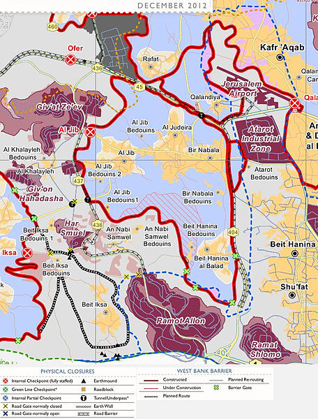
The Israeli barrier in northern Jerusalem, which divides Beit Hanina into two villages, both in a separate enclave.
Beit Hanina as viewed from Atarot
Kindergarten in Beit Hanina
East Jerusalem is the sector of Jerusalem that was held by Jordan after the 1948 Arab–Israeli War, as opposed to the western sector of the city, West Jerusalem, which was held by Israel. Under international law, East Jerusalem is considered a part of the West Bank and, therefore, of the Palestinian territories. A number of states recognize East Jerusalem as the capital of the State of Palestine, whereas other states assert that East Jerusalem "will be the capital of Palestine", while referring to it as "an occupied territory".
East Jerusalem zoning
William McLean's 1918 plan was the first urban planning scheme for Jerusalem. It laid the foundations for what became West Jerusalem and East Jerusalem.
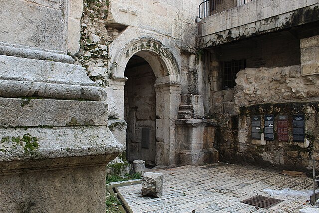
Old Roman era gate beneath the Damascus Gate (Bab al-'Amud) in Jerusalem
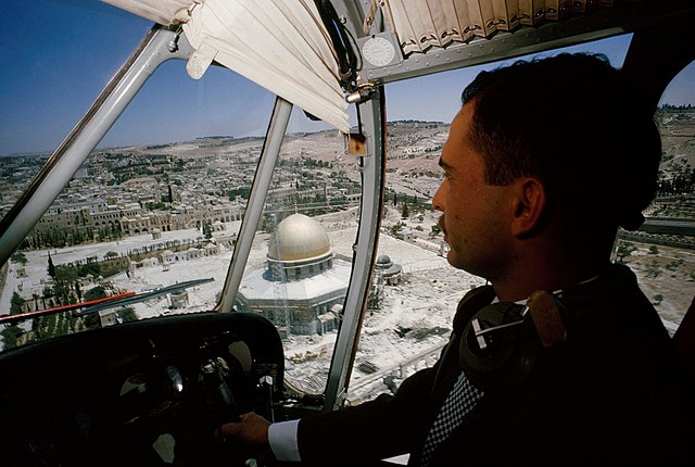
King Hussein flying over the Temple Mount while it was under Jordanian control, 1965